Boosting 4D project management with drone mapping
| First published | October 25, 2018 |
| Updated | June 11, 2020 |
Helsinki is booming. As the population of Finland’s capital city increases, so does demand for services and amenities. The Kauppakeskus Lippulaiva shopping center in Espoo, a community in the Helsinki metropolitan area, is undergoing a complete redevelopment that will nearly double its available leasable space. Lehto Group, a Finnish general contractor, is charged with completing the project, from the demolition and the blasting of 200,000 cubic meters of rock to earthworks and new construction.
To facilitate demolition and site preparation, Lehto Group teamed with Rakennuslordi Oy, a BIM, scheduling, production control and site management consulting company, to keep the project on track with help from commercial drones to facilitate a real-time integrated 4D project schedule.
| Location | Espoo, Helsinki |
| Project members | Lehto Group, Rakennuslordi Oy |
| Hardware | DJI Mavic Pro |
| Software | PIX4Dcapture, former PIX4Dbim - Now PIX4Dcloud Advanced integrated with Synchro PRO Software |
| Project size | 8.5 hectares |
| Number of images per flight | 1,300 images |
4D scheduling for better collaboration and communication
As a progressive technology adopter, Lehto Group has selected a number of advanced tools to streamline construction processes.
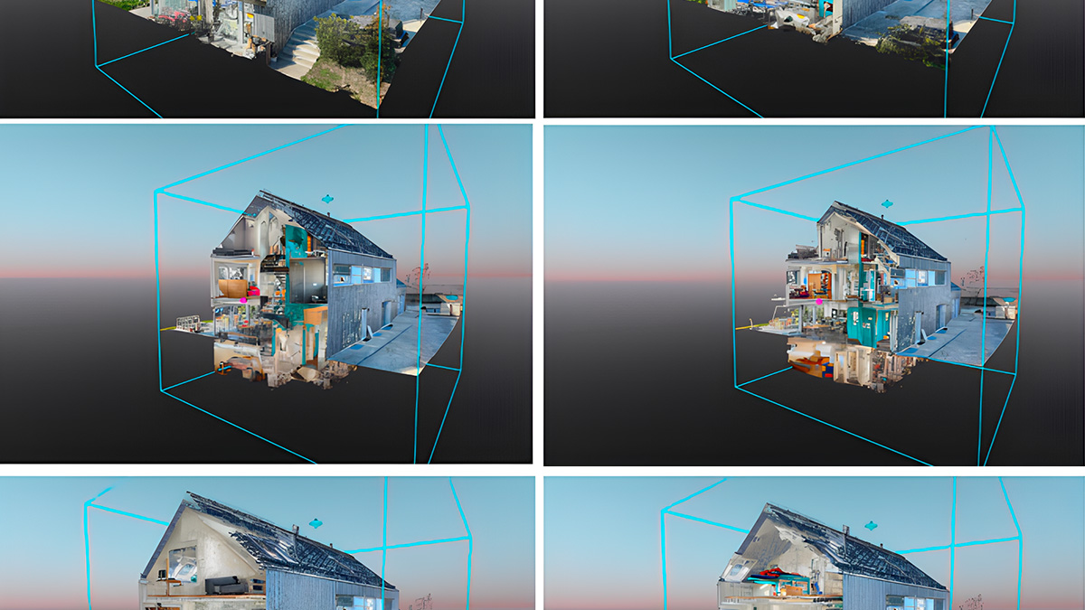
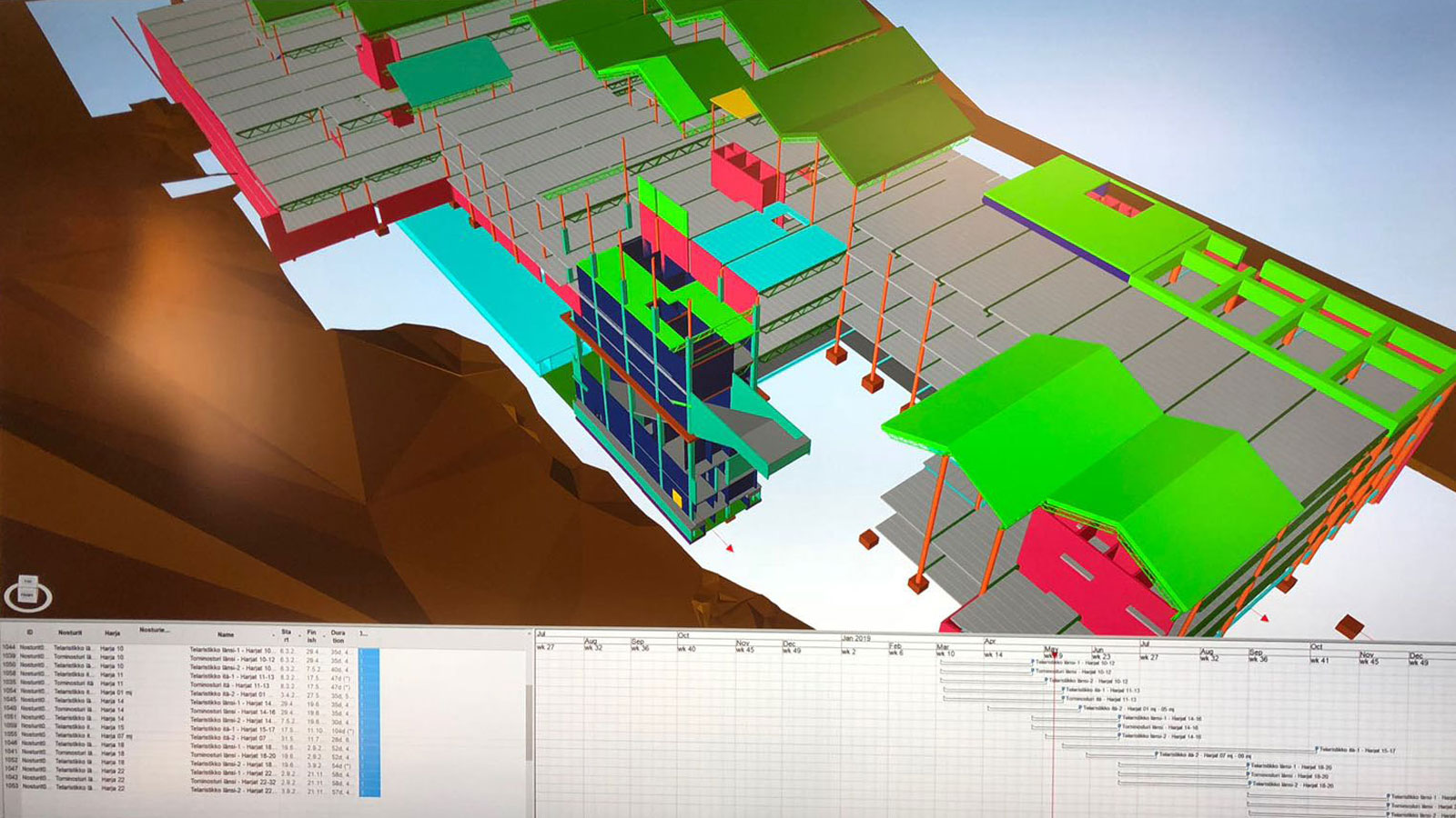
For example, Lehto relies on Synchro PRO Software, a 4D (3D modeling plus scheduling) visual planning and virtual design and construction (VDC) project management solution, helping deliver precise and timely construction project information for teams.
With Synchro PRO Software, the contractor manages the entire project plan from the 3D model, including simulations, instead of conventional methods of Gantt charts for planning and 3D modeling for simulations. The 4D solution lets the team better track real-time progress with simulated expectations, keeping pace with changes as they happen.
Integration is key
With help from Rakennuslordi Oy, the Lehto Group looked to add another dimension to their 4D workflow by extending the value of drone-captured images to gain greater insight, analysis opportunities and more value from the models.
Jouni Ojala, founder and owner of Rakennuslordi Oy, explains that his job was to facilitate a tighter integration between 3D models, schedules and field activities. He adds, “Normally there is a gap between the schedule and the reality in the field, the two are rarely connected. Now we have tools and possibilities to make that connection happen.”
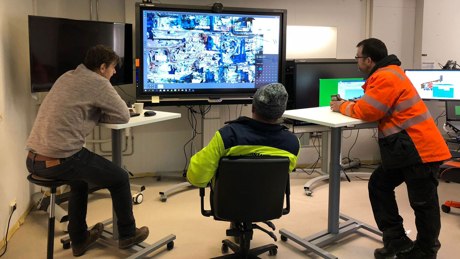
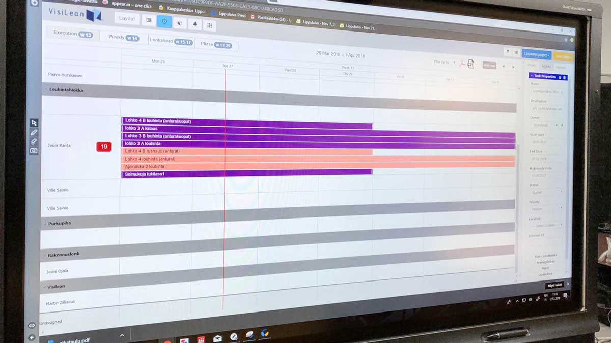
Specifically, Ojala points to camera-equipped drones, Pix4D and Smart Board touch screens. The combination of these three technologies are key to informing the team during weekly meetings and keeping the project on track.
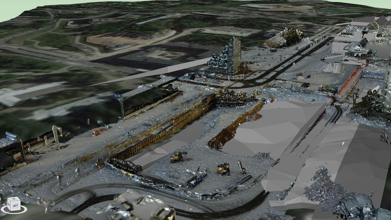
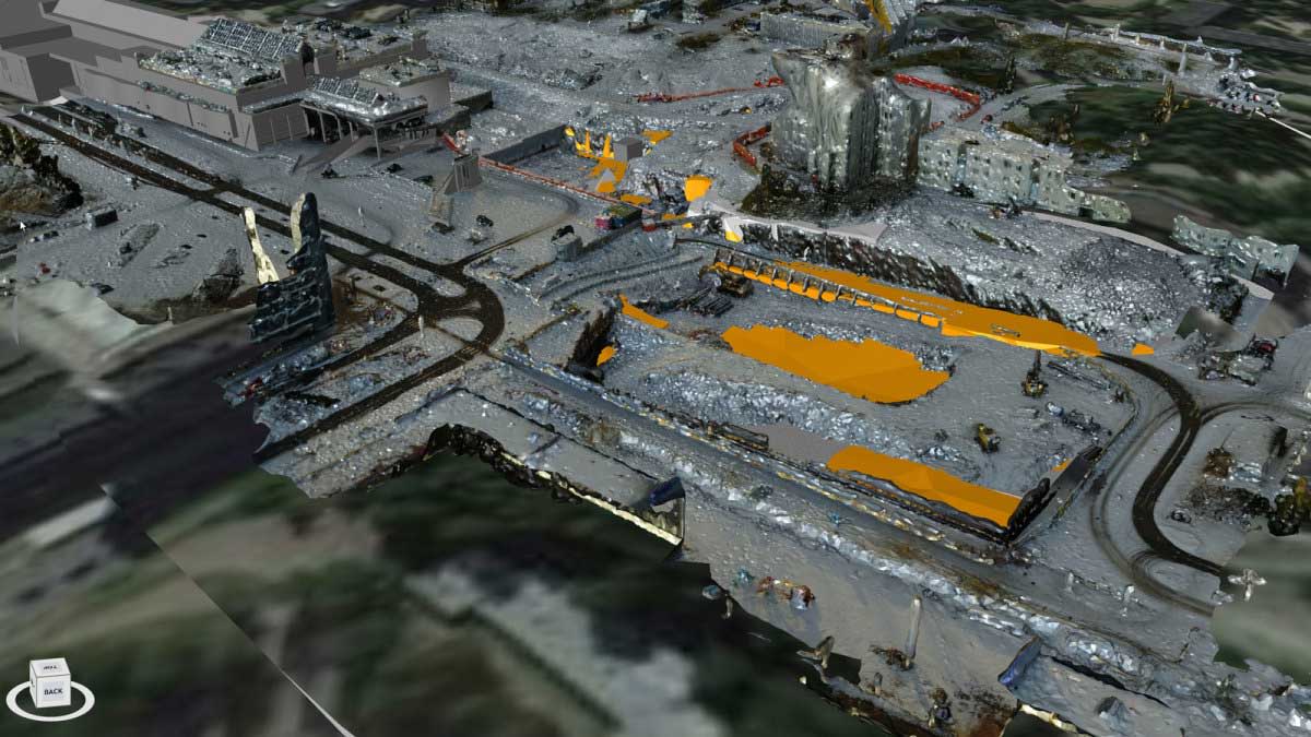
He adds, “Pix4D allows us to create point clouds and orthomaps from hundreds of photos. These point clouds can be used to quickly and easily compare the as-designed model to the as-built orthophotos. The drone data and Pix4D combination is an affordable way to monitor site progress against project schedules and for virtual site planning and design.”
In this case, the DJI Mavic Pro equipped with a 4K camera costs around 1,000 euros, compared to a professional drone capable of carrying a scanner that costs more than 20,000 euros.
“Drone mapping is one way of tracking progress on the job — without the need to visit the site. We simply use the web interface to access the 2D map and 3D model-views,” he adds. “And we can push the results to Synchro Pro in order to show current work progress versus scheduled activities.”
Drone mapping in demolition - how does it work?
Once a week, typically on Monday, a drone-qualified pilot like Ojala, flies the site using the PIX4Dcapture application on their smartphone. This allows the creation of a flight path that takes photos at optimal locations for the best results from the Pix4D software. The application is also a flight controller, so the operation is hands-free. That way information is current for regular Tuesday project meetings.
The flight altitude is typically around 30 meters above the ground for easy visibility of site conditions and equipment, from the highest point of construction down to the cabling and rebar. The images are then turned into 2D orthophotos which are used for better planning and improved site safety. The area to map is around 8.5 hectares - mapping it with the DJI Mavic Pro takes around one hour and about four batteries.
Ojala explains, “The time the flight takes is pretty much inversely proportional to the flight altitude. Double the flight altitude, halve the flight time. For just schedule meeting purposes, it would be enough to fly at the legal maximum flight altitude of 150 meters but we have seen that more precise data is worth the time invested and thus do the routine flight at 30 meters.”
The drone flies autonomously and takes pictures at predefined points. Flying at 30 meters results in around 1,300 images that are uploaded to the cloud for processing. Once processed on PIX4Dcloud Advanced, the data is available to visualize, measure and verify the as-built status of a site.
Streamline project planning
Ojala continues, “During our weekly scheduled meetings with the demolition contractor and earthworks contractor, we use the Pix4D 3D model to show where they are now and what needs to get done in the next few days.”
When needed, Ojala imports the Pix4D high-resolution point clouds into Synchro PRO Software, where it is easy to compare the 4D scheduling models to the Pix4D up-to-date point clouds. He says, “From this point, it’s easy to see where we should be per the schedule and where we are at the moment and make decisions accordingly.”
A Lehto spokesperson said, “By leveraging the Pix4D data throughout demolition and construction, we were able to spot issues very early in the process, before they impact later stages of the build. Alternatively, schedule diagrams derived from the BIM application can be imported and compared to ensure the project is on-track.”
Building best practices
In one case, the technology-driven scheduling process has become an integral part of the earthworks contractor’s quantity calculation process. Ojala adds, “It is fast and accurate enough for measuring distances, areas, elevation differences and slope degrees.” The contractor is excited as well. Lehto now has camera-equipped drones working at multiple sites.
While the demolition of the old structure and the earthwork preparation for the new build is now complete, the Lehto Group and Rakennuslordi Oy are preparing to use a similar workflow with Pix4D and Smart Boards to facilitate on-time scheduling during the construction process.When ready, the new shopping center will span 42,000 square meters of leasable space, house approximately 550 new apartments and incorporate a fully integrated feeder bus terminal.