Precision farming for remote sugarcane plantations
Réunion Island is a French overseas department in the Indian Ocean. It has white sand beaches, a humid tropical climate, and from October to May is battered by winds and cyclones. Réunion has an extremely varied weather profile and geography: the dormant Piton des Neiges (‘Snow Peak’) volcano rises to a height of 3,070 meters.
Sugarcane is the central pillar of the island’s agriculture. 46% of the farms produce sugarcane over a total of 24,300 hectares. An average sugarcane farm would have 90% of its surface planted with sugarcane, the remaining 10% being used for other productions such as fruit, vegetables or grazing pastures.
| Company | GeoDrone Solutions |
| Location | Réunion Island |
| Project size | Scientific phase: 19 hectares Field testing phase: 15 farms (from 2 ha - 35 ha) |
| Hardware | Parrot Bluegrass |
| Software | Pix4Dfields, ParrotFields |
| GSD | 2 cm |
GeoDrone Solutions was initially born in the interests of continuity of local policy towards quality agriculture. Réunion Island's desire to transition to renewable energy is also a cause as local sugarcane will eventually be used less for agri-food and more for "green" fuels.
The multispectral farm analysis project is one year old, which is how long it took GeoDrone Solutions to convince local farmers of the benefits of switching to precision farming.
The multispectral farm analysis project
The multispectral analysis of Réunion Island’s major crop of approximately 23,000 ha of sugarcanes is not the current practice nor agriculture culture of Réunion.
Because the process is new, upstream work was needed to calibrate the Parrot Bluegrass drone with the 11 varieties of sugarcane on the island. While the varietals of sugarcane were standard, the climate differences and very varied operating altitudes required careful work. The project is therefore in the experimental phase for six months, before moving to a truly commercial exploitation of the service, and consists of a scientific and field testing phase.
This calibration is carried out with the help of public scientific organizations specialized in local agriculture and with the farmers themselves.
The scientific and field testing phases have the same objectives:
- To bring the cultivation of sugarcane from Réunion Island into a modern era
- To use tools which support growers in making decisions
- To have a better knowledge of their crops to ensure a refined follow-up
- To modulate input requirements (economy and ecological trend) while allowing them to aim for a yield target of 80 tonnes of canes per hectare
- In the event of a natural disaster (mainly cyclones), be able to estimate with more precision the damage and losses in order to obtain the right compensation from insurance companies
Scientific phase of the UAV project
The scientific phase is done on a total plot of 19 hectares (including 2 hectares of plots dedicated to local weeds for testing the crop resilience) of clear and flat land. The team collected about 1,900 multispectral images at an altitude of 20 meters, with an average ground sampling distance of 2 centimeters per pixel.
The aerial images are correlated with layers of information obtained from the plant indices to map the composition of the soil and its chemical composition (Nitrogen, Phosphorus, Potassium, acidity...).
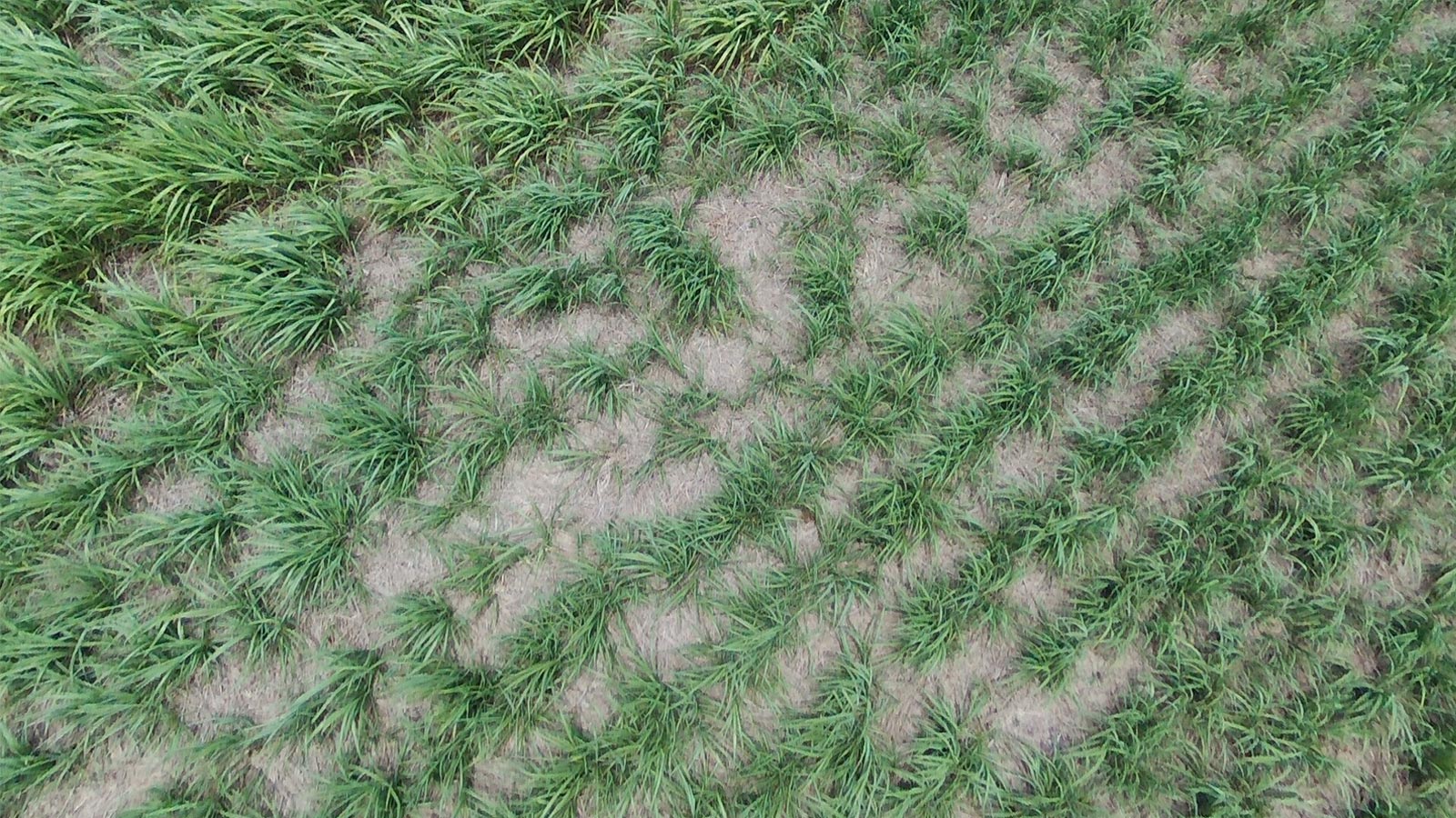
But the reality of agriculture is different from what can take place in an experimental field. That’s why GeoDrone Solutions is conducting parallel experiments on various fields looking at the overdose of fertilizers or pesticides, rugged and/or difficult to access terrain.
Field testing phase with ParrotFields
These phases of field tests are more complicated to carry out due to sloping terrain and gullies, as well as the presence of high-voltage lines and trees. They also require adapting flight plans in order to collect usable data, without wasting time. 15 farms are tracked and have an average size of 10 ha (minimum 2 ha - maximum 35 ha).
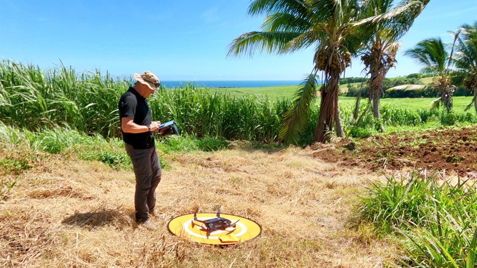
Three mornings per week are required for the acquisition of multispectral images on all of these plots. The data collected is variable, both in the acquisition altitudes, the GSD, and in the number of flights per parcel, depending on their topographical profiles.
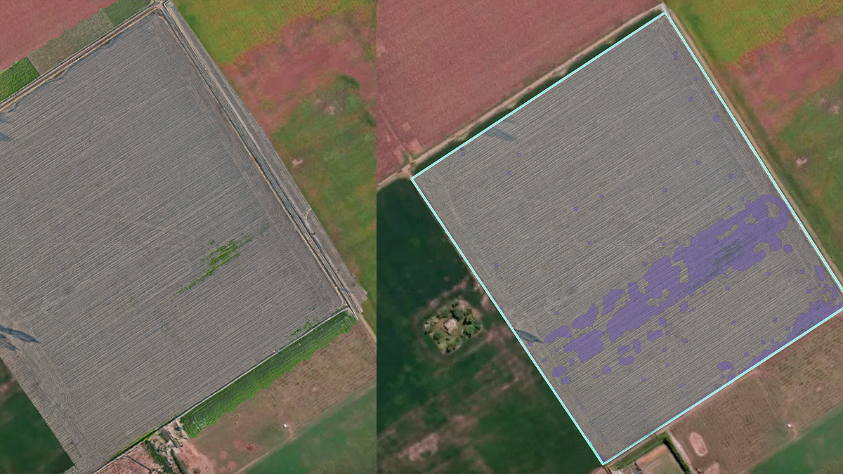
The immediate NDVI rendering of the parcel (showing variations in vegetation conditions) allows further flights to inspect areas that potentially have problems.
This can be overlaid with the RGB photos to enhance the at-a-glance view of the field, giving more context. The first analysis is usually done with a grower or an agronomist.
Advanced and finer analysis with Pix4Dfields
The Pix4Dfields software is used for further inspection: it allows more advanced and finer analysis of drone images. “This software offers very fast processing and the analysis can be done “in situ,” at the very end of drone flights,” says Mr. François, CEO at GeoDrone Solutions.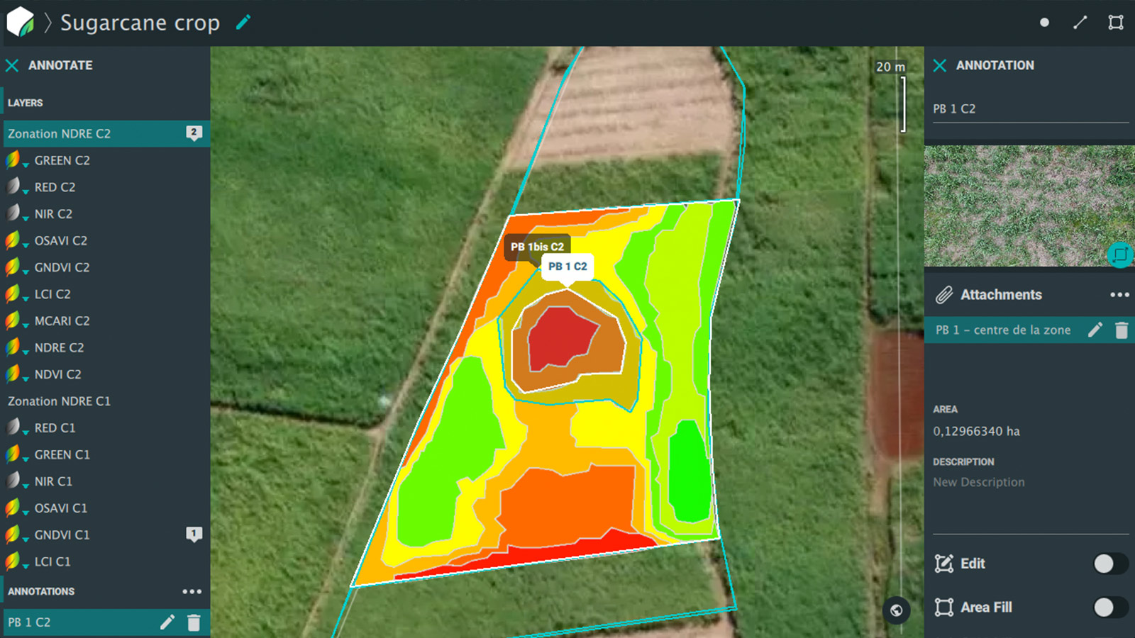
Access to various vegetation indices, precise zoning, tools to compare the different layers, combined with knowledge of farm data allow the farmer to have a clearer idea of the state of sugarcane fields.
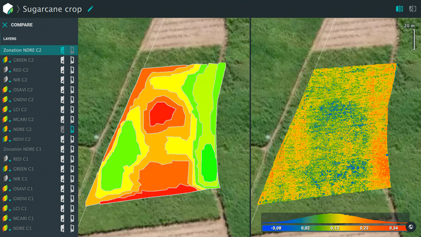
Analysis at key times throughout the season helps to anticipate potential problems and offers decision-making support to remedy them. This analysis data can be exported for the benefit of the operator for action and reused to be compared over time or to verify the impacts of the adjustments made.
Boots on the ground vs. multispectral data
Drones and multispectral data are not here to replace the “boots on the ground” but rather give an extra level of certainty. “With the help of Pix4Dfields software, indicators of their proven correlations with certain problems may avoid wasting time, better targeting these problems and acting as soon as possible, before the potential loss of a significant portion of a crop,” concludes Mr. François.
| We would like to thank Laurencin François for sharing this story with us. If you are interested in learning more about Parrot Bluegrass Fields bundle, you can reach out to the Parrot team. |


