
PIX4Dsurvey 1.35: profiles, sections and essential exports!
PIX4Dsurvey aims to bridge the gap between photogrammetry and CAD or GIS and it is constantly evolving as we add new vectorizing tools for surveying and mapping professionals. The software has automated capabilities and tools such as object detection, stockpile detection, and road marking, all of which save time and effort. Keep reading to learn more about the new features of the latest release.
Profiles and sections
A section is a valuable surveying tool that shows how an area or an object looks from a side view and provides accurate information on elevation changes. While working with PIX4Dsurvey you can use the shortcut, draw the profile in the area of your interest and see the section appear in its own viewport, where you can also modify its visualization settings. Mark what is important to your project: the top of a roof, the front, back, and bottom of a curb, the edge of a stockpile. But there is more! In the profile section you can digitize directly, leveraging this tool not only to vectorize but also as a refinement tool for vectorization already done in the project, working together with the images for more accuracy.
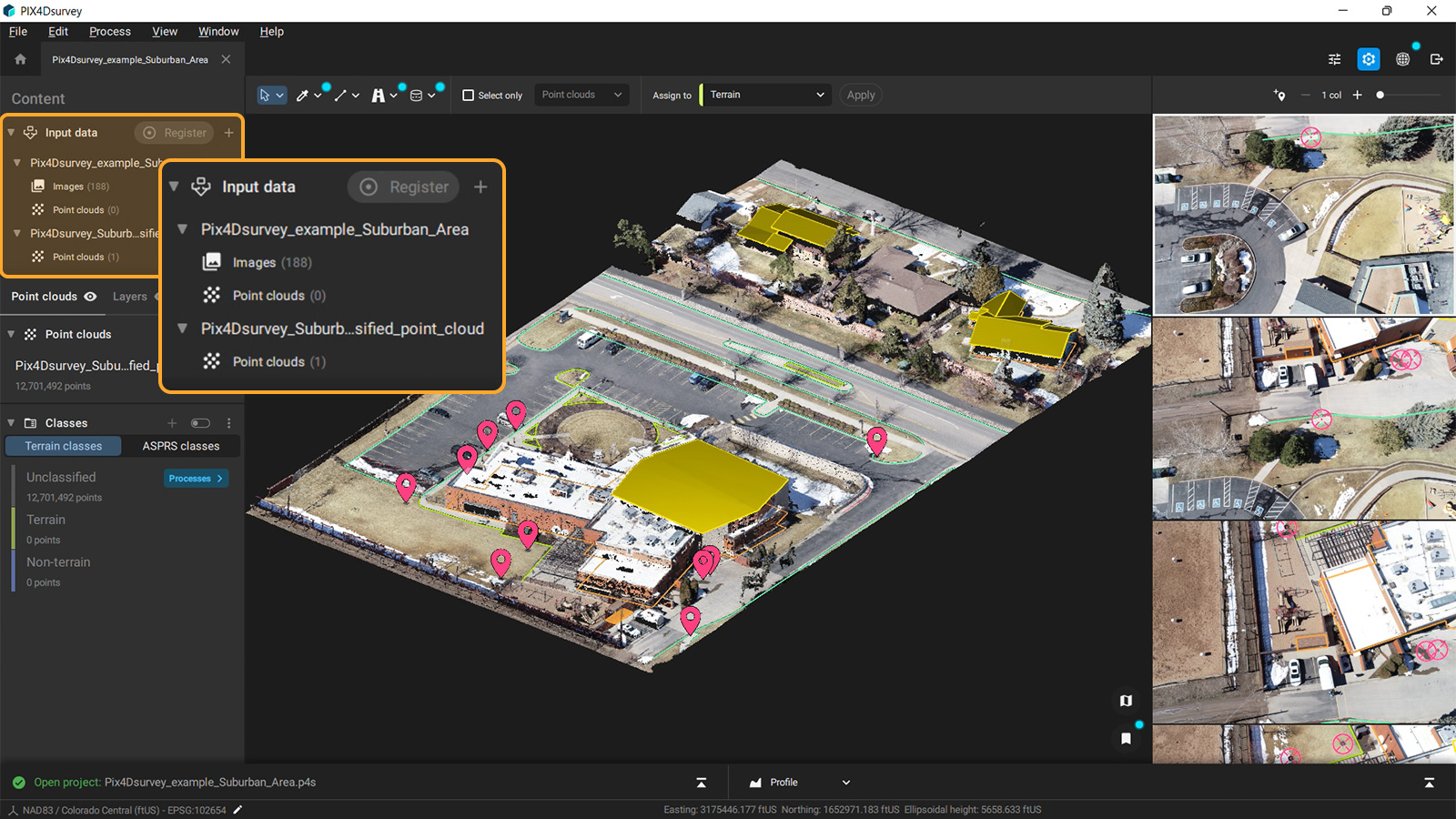
Efficient and clear project management
We are very proud of the intuitive interface of PIX4Dsurvey and we keep improving it in order to make the workflow faster, simpler, and easier. With this principle and by following feedback from our users, in the new update, you can see the project management in the content panel on the left. All input data, like photogrammetry projects and point clouds, are now visible and you can toggle on and off the visibility of the project or components, so you can efficiently display and work with the right images and point clouds at the right time.
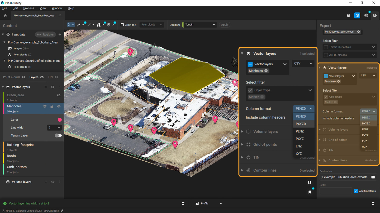
Essential exports and new geoids
The latest PIX4Dsurvey update allows users to export the data of the markers in the most common file type used by surveyors, the .csv file. And this new option comes with extra flexibility as the user has total control of the column format of the file and also can choose whether headers will be included or not. Along with this, in PIX4Dsurvey you can already timestamp and suffix your export files for more control over your files. One more great addition in the processing options of the software, is the creation of TIN from exactly what makes sense for your project: single or multiple grid files, grids and terrain layers, or just from terrain layers. This way you have full flexibility to get the right detail in your TIN in the areas you need it most
In addition, PIX4Dsurvey supports new geoids: the RAF18b and RAF20 geoid models of France and the hBG18 geoid model for Belgium, expanding the list of supported geoids and the surveying applications that can be done by surveyors all over the world.
Download PIX4Dsurvey now and try the new features and improvements for yourself! Visit our product page and the Pix4D support site to learn more or check out our available training courses. You can learn more about how PIX4Dsurvey can extend the combined aerial and terrestrial workflow with fast vectorization and automatic feature extraction by watching our free webinar!


