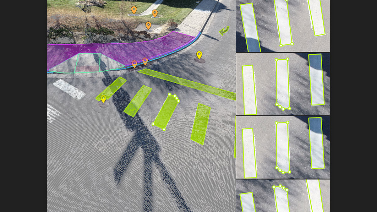
キャプチャー
ドローンやレーザースキャナーを使用して、画像や点群をキャプチャーします。
ドローンを使用する場合には、無料のPIX4Dcaptureモバイルアプリを使ってフライトを自動化・最適化させることができます。
Join us for a discussion on why combining aerial and terrestrial data for mapping is the ideal solution for the creation of comprehensive, accurate 3D models.
Watch now