Digital cadastral surveys with drones and photogrammetry
A cadastral survey is one of the most important parts of land management documentation. If accurate and up to date, it can help plan new construction projects based on land permissions and boundaries, inform the community about terrain history, and define ownership. Inaccurate or nonexistent cadastral surveys can cause conflicts and confusion through misinformation. As a result, local authorities often need to update their cadastral survey records with the latest developments.
Orselina, a beautiful municipality near Lake Maggiore in Switzerland, is located in the canton of Ticino. The local authorities wanted a new cadastral survey to define land cover, including green areas, open spaces, and building control measurements. To do this, they contracted the Ticino-based surveying company, Studio Calastri.
Studio Calastri works across the Ticino region on land registry and surveying projects. They often complete projects on building surveys using a combination of drones and laser scanners. For this digital survey with drones, they decided to process their data with PIX4Dmatic and PIX4Dsurvey.
Project details
| Location | Ticino, Switzerland |
| User | Studio Calastri |
| Area surveyed | 3.5 km2 |
| Images captured | 6,500 |
| Software used | PIX4Dmatic PIX4Dsurvey |
| Hardware used | Matrice 300 RTK |
| GSD | 1.7 cm |
Cadastre surveys with drones
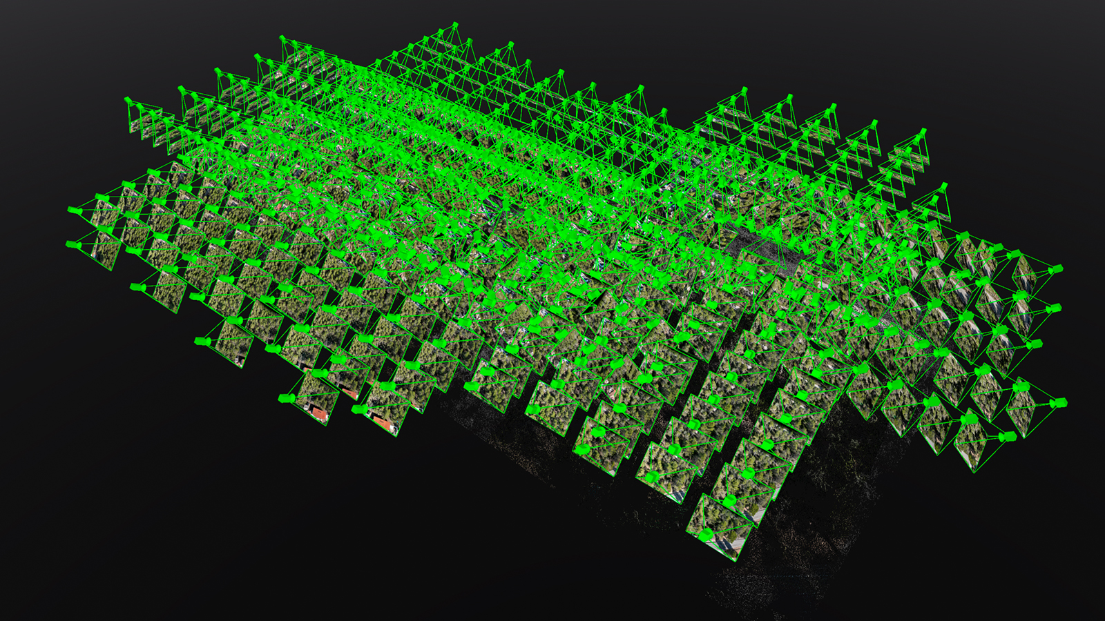
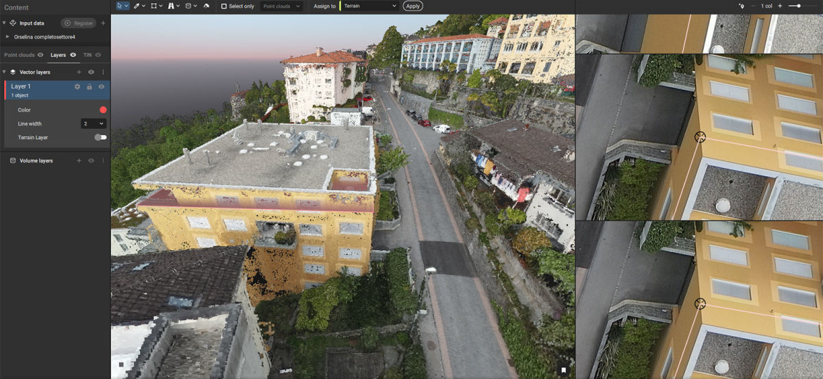
The team from Studio Calastri set out a Matrice 300 RTK drone with a Zenmuse P1 camera attached. This multicopter drone helped the team to capture 6,500 images throughout the 3.5 square kilometers being surveyed. The RTK results would be generated with the Swiss coordinate system (CH1903 + LV95). In total, the aerial data collection was completed after 7 flights. The team only had to lay 3 GCPs and one checkpoint to help calibrate their project thanks to the RTK drone.
However, Orselina is located on quite a steep slope, with an elevation difference of 300 meters across the area. In order to ensure their results, the Studio Calastri team performed a flight that followed the terrain gait, with another flight that used the 5 different axes of the P1 camera. This would help to ensure complete data collection and prevent problems during processing caused by not having complete data on the elevation changes.
Finally, in order to ensure the results were consistent across the final maps, Studio Calastri waited to have similar light conditions for each flight to ensure the quality of all their results.
Digital surveying with drones
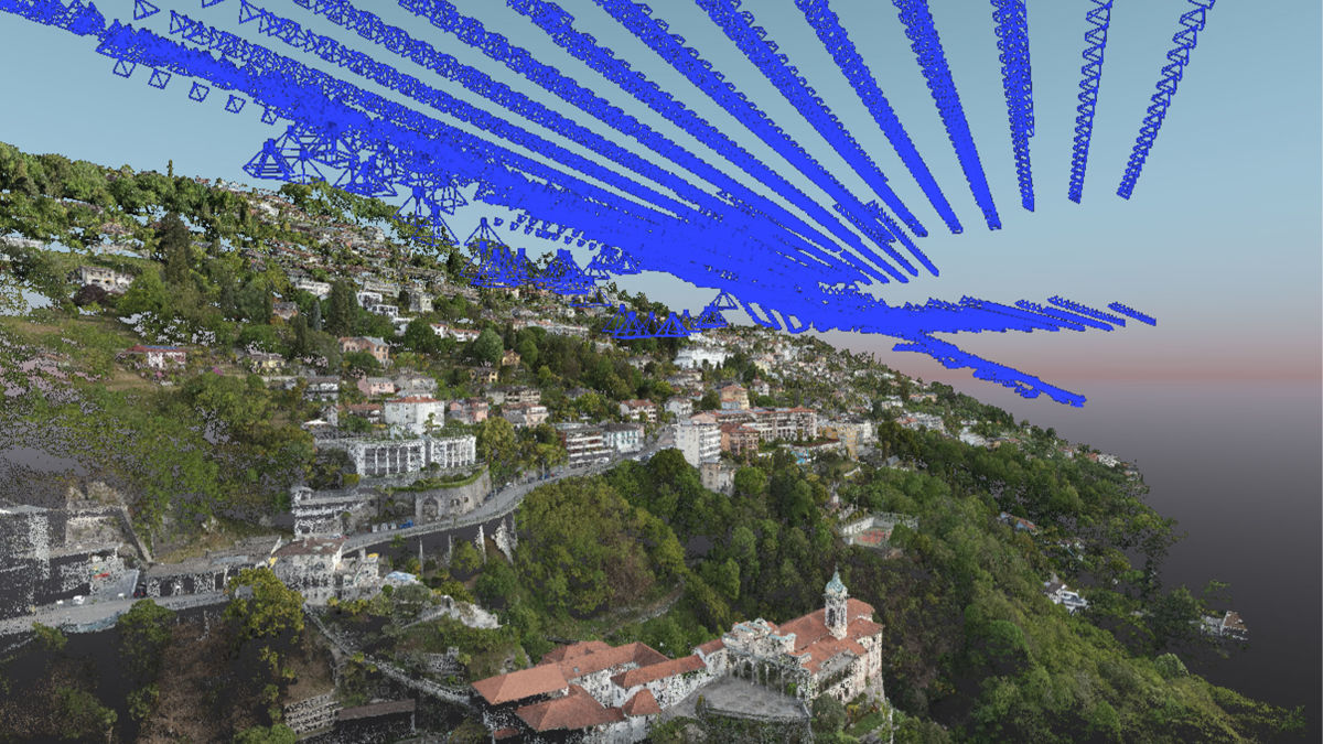
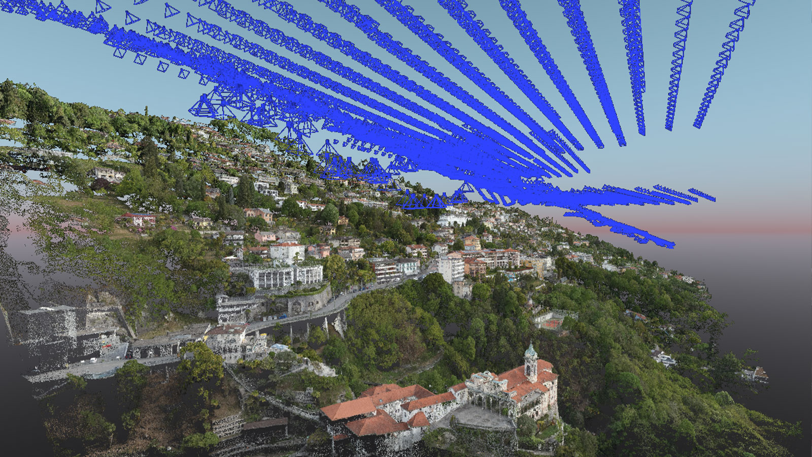
After data collection, the images and geolocation information was imported to PIX4Dmatic to begin processing. Despite the quantity of data, processing was quickly completed and the point cloud was exported to PIX4Dsurvey for digital survey analysis.
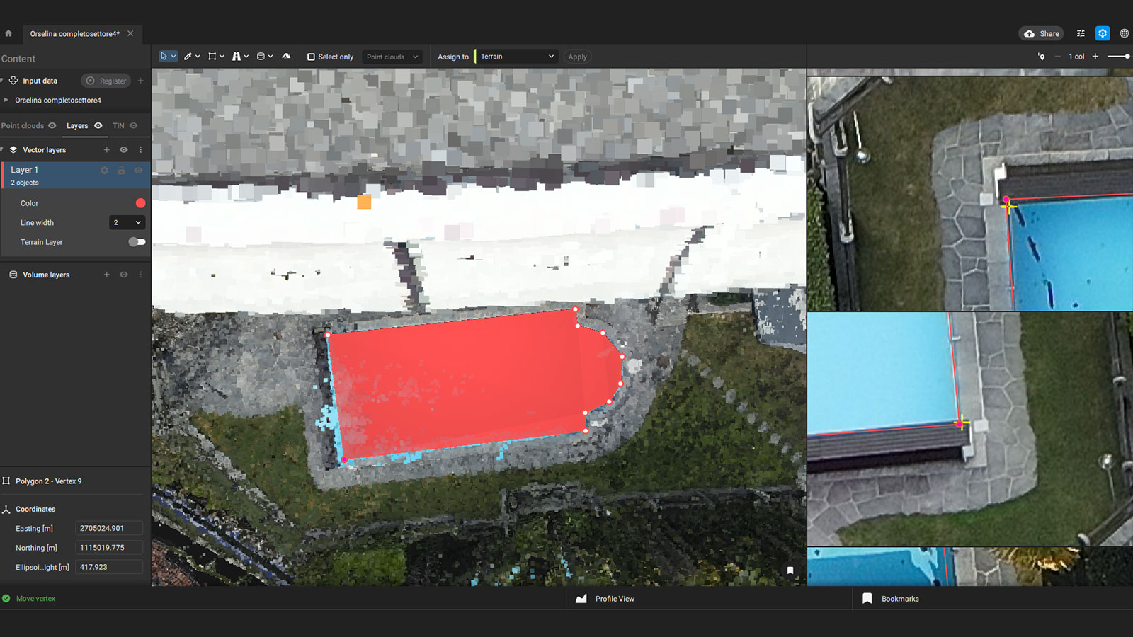
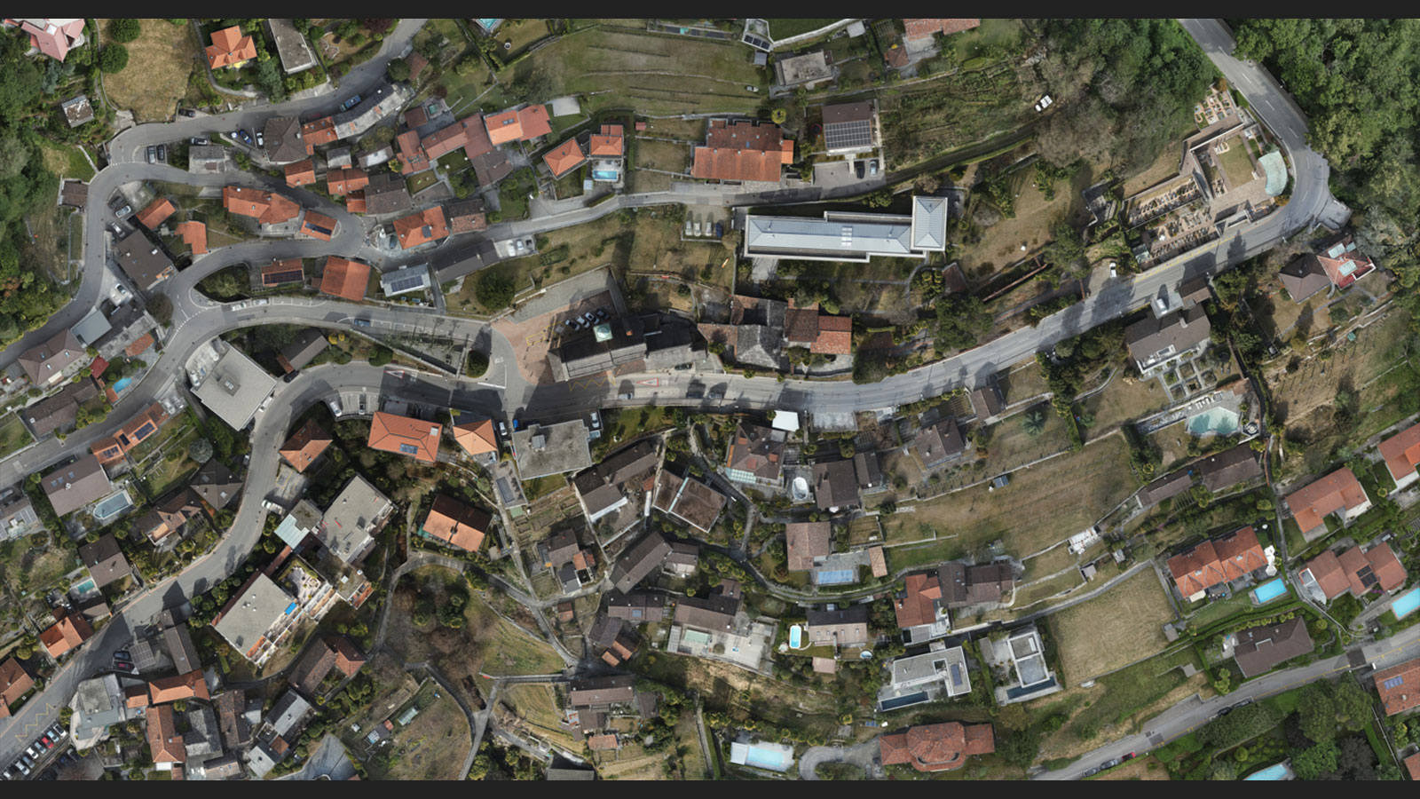
In PIX4Dsurvey, the surveying team extracted elements including building measurements, roads, open spaces, and any objects they believed would be useful for the local authorities. This saved them lots of time by doing it digitally rather than in person, saving excess fieldwork.
Relying on drones for digital surveying
Thanks to the aerial survey, the Studio Calastri team was able to share a successful cadastre survey with the Orselina municipality that will be used to update records and better maintain the town’s infrastructure.
"The integration system of PIX4Dmatic and PIX4Dsurvey is ideal for handling projects of this size, they bring you excellent quality results." Giacomo Cariboni, Studio d’Ingegneria Riccardo Calastri SA
Studio Calastri now has this project as part of their portfolio which they can use to advertise the merits of digital surveying with drones to future clients.