
Usability meets accuracy with PIX4Dcatch mobile scanning
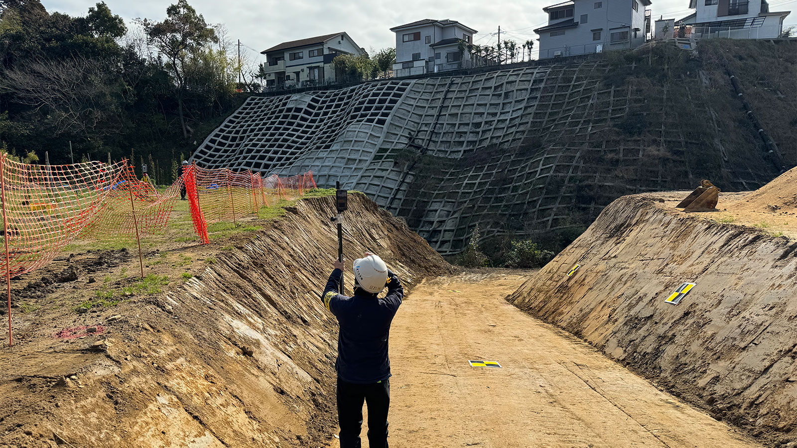
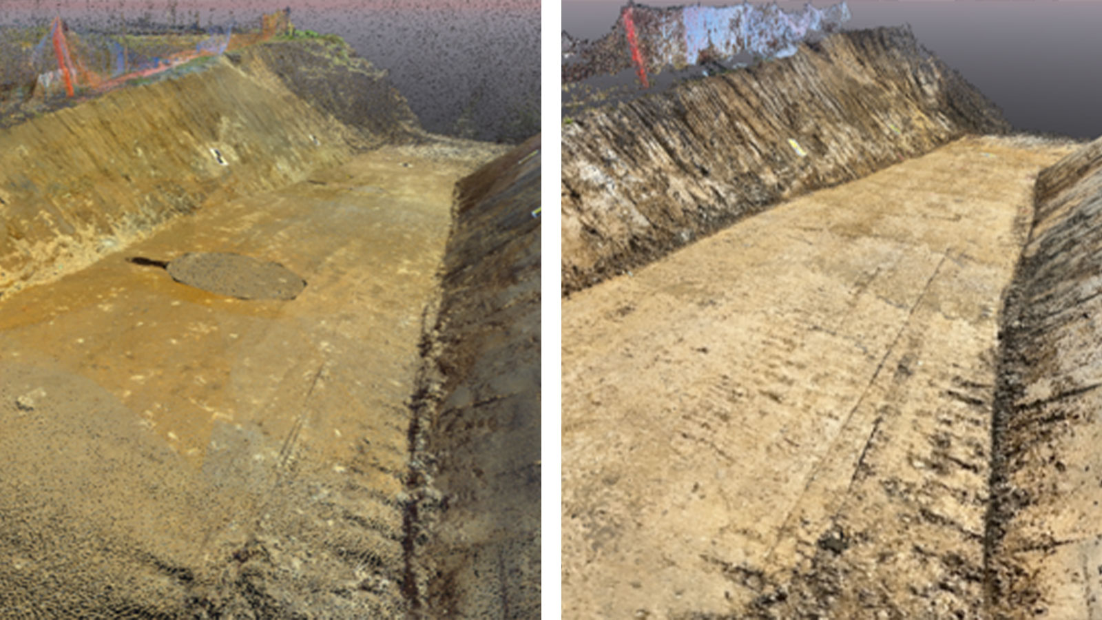
Kanemoto Gumi Co., Ltd., a Japanese civil engineering and construction firm who specializes in various private and public works projects, embarked on an accuracy test to evaluate if PIX4Dcatch can be used for job site management at actual earthworks sites.
PIX4Dcatch is a photogrammetry app that transforms your smartphone into a professional 3D scanner, offering ease of use as well as accuracy. They conducted the test in February 2024. To ensure a comprehensive test, they compared PIX4Dcatch with more conventional methods—a laser scanner and a drone. They discuss the demonstration results and the differences in usability of each method.
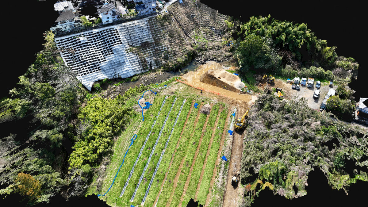
Demonstration conditions
| Place | Miyazaki Prefecture, Japan |
| Object | Temporary road for heavy machinary used in bank protection construction |
| Shooting range | Length 30m x Width 5m x Height 6m |
| Equipment and software used | |
| Pix4D products | PIX4Dcatch (with RTK device), PIX4Dcloud |
| Laser scanner | Trimble SX12 |
| Drone | Mavic 3 Enterprise |
| Others | Third-party software for performance management measurement |
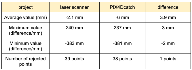
Demonstration results
The values obtained with PIX4Dcatch were compared with the blueprints, and the results between the laser scanner (Trimble SX12) and PIX4Dcatch were very similar.
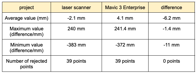
The results compared with the Mavic 3 drone were as follows (even when compared with the drone, PIX4Dcatch produced values closer to the laser scanner).
PIX4Dcatch and usability
Kanemoto Gumi confirmed the high accuracy of PIX4Dcatch and noted its remarkable ease of use when compared to both the laser scanner and drone. Unlike drones, with PIX4Dcatch, there is no concern of losing sight, and it is possible to capture pinpoint details on the ground that cannot be captured from the air. Additionally, you don't have to carry heavy equipment around in the mountains, and if you upload to the cloud, the data won't weigh down your PC.
Laser scanners may be highly accurate, but they also require time and effort to set up reference points and prepare equipment, and especially when it comes to small-scale sites, the results may not be worth the effort. Kanemoto Gumi found PIX4Dcatch very useful for easy scanning while maintaining a high level of accuracy.
Time management with PIX4Dcatch
During the demonstration, even though some of the staff were using PIX4Dcatch for the first time, they were able to start scanning immediately. Learning how to use a laser scanner controller usually takes several hours, and becoming a licensed drone pilot can take up to a month, including lectures and flights.
Since PIX4Dcatch is on your smartphone and can be used as soon as the app is installed, training costs are significantly lower than more conventional products. Kanemoto Gumi concluded that if they can reliably obtain high-quality data no matter who goes to the site and regardless of their experience level, then this will help to ensure consistent quality at their job sites and for future work projects.
*CRAFTCOM Co., Ltd. assisted in creating this case study.


