Fighting soil erosion in Malawi with drone mapping
Soil erosion is a problem across the entire globe. It happens when the topmost layer of soil is removed, either by wind, human activity, water, or other factors. That uppermost layer, however, is the most important part with the most nutrients for growth. After it has been eroded away, it can take as long as 100 years to replace just 2.5 centimeters. Even worse, soil erosion can cause gullies and degradation across the land which makes farming impossible and recovery difficult.
Deforestation exacerbates this problem as tree and plant roots that hold the soil together are removed. This is just part of why the protection of rainforests and wildlands is so important. Wells for Zoë is a charity that has already been working on reforestation projects across Malawi. With the support of Pix4D, they have been using drone mapping to monitor and plan responsible reforestation in Malawi. Now, their work is expanding to fighting soil erosion as well.
Fighting soil erosion
Wells for Zoë, an Irish non-profit, has been working since 2005 on a range of positive projects. Their work began with providing access to safe, clean water for rural communities through the installation of wells, bringing water access to around 750,000 people. They work with local teams as well as volunteers on a range of projects and have grown to include a team of around 1,000 people.
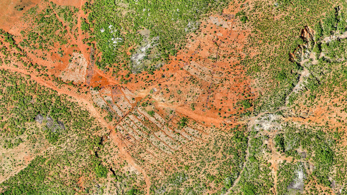
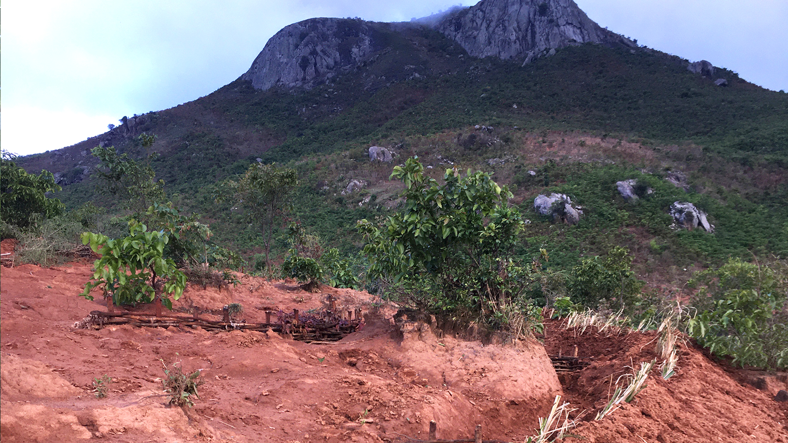
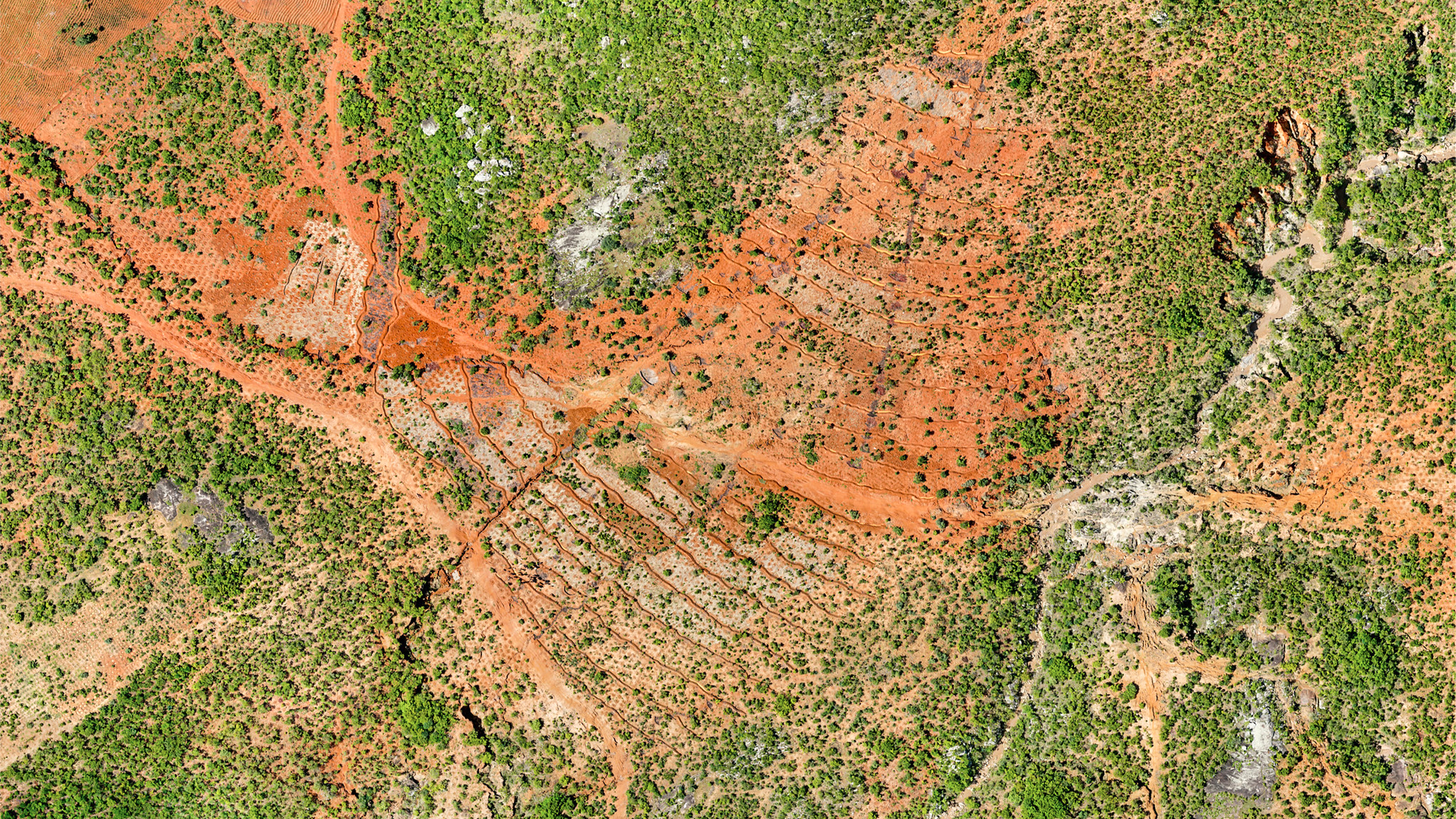
In order to fight soil erosion in the Enyezini region of Malawi, the team has been looking for natural solutions. One is to dig contour berms, which are specially shaped ditches around planted trees or farms. These berms will trap rainwater, silt, and soil when there is heavy rain, as well as stop seeds from washing away if they are uprooted/dug up.
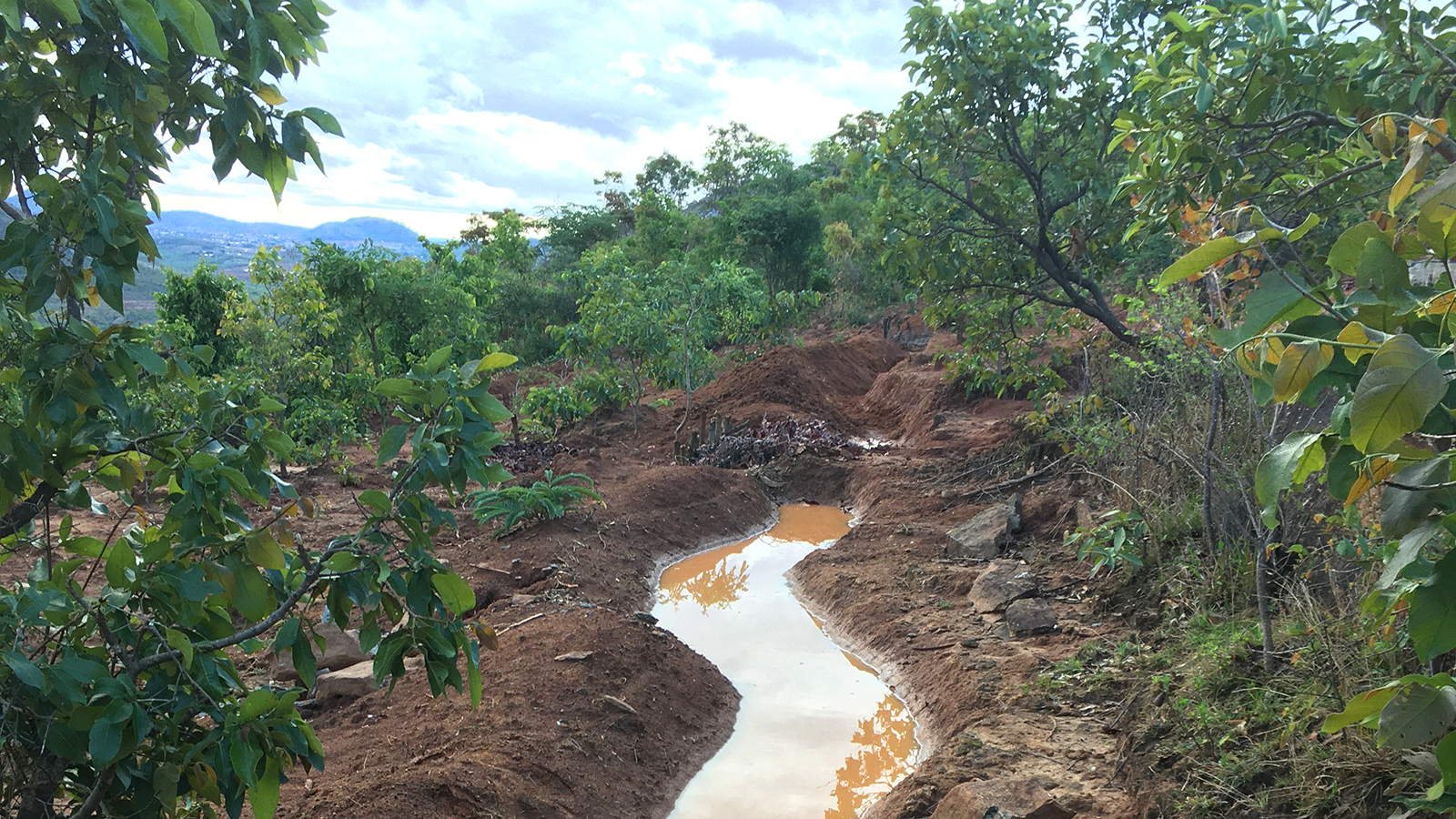
Thus, Wells for Zoë needed to complete contour mapping in order to plan and improve existing contour berms. They decided to use PIX4Dmatic and PIX4Dsurvey to do this: PIX4Dmatic can provide fast results of drone mapping whilst PIX4Dsurvey would enable them to complete contour analysis and overlay digital elevation models (DEM) over the target areas.
Project details
| Location | Enyezini, Malawi |
| User | Wells for Zoë |
| Software | PIX4Dmatic PIX4Dsurvey |
| Hardware | Wingtra One Gen II |
| Photos collected | 8759 |
| GSD | 4 |
Planning a drone mapping workflow
The aim of this drone mapping project was to quickly assess the quality of work that has already been implemented as well as plan new contour berms. The aerial maps and analysis could enable quick intervention to identify and fix problems, saving time - and precious soil.
Wells for Zoë’s team planned for data collection to be done during a field visit with several experts, including support from AfricanDrone, the World Resources Institute, and Restor.
The challenges of drone mapping for soil erosion
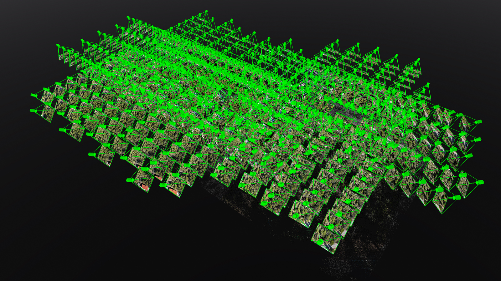
The area being surveyed measured 3273 hectares, which meant that even using a fixed-wing drone such as the Wingtra One Gen II would be challenging. The mapping missions were broken up into multiple flights to ensure complete data collection. Once this had been completed, the data was imported to PIX4Dmatic.
PIX4Dmatic is tailored for large projects, and as a result, processing was incredibly quick on an Apple M1 processor. The team appreciated the ease of use: they could simply “throw in the data after a day of mapping and see the results in the morning before going to the field again,” explains Kevin Dalferth, the Technical Advisor at Wells for Zoë. This ease of use enabled a fast turnaround of results and action for managing the contour berms and monitoring of the planting of indigenous trees
Once the data was processed in PIX4Dmatic, it was exported to the digital surveying software PIX4Dsurvey, where Kevin could generate the DEM. This allowed them to accurately visualize the contours of the land and thus see exactly where contour berms needed to be - and where they had to be reshaped.
Protecting the land from the sky
Through the detailed drone monitoring that Wells for Zoë completed, they have been able to not only successfully implement this project’s vision but also leverage more funding through their transparent operations and visualization of work. The project was smooth and easy to implement, which is all the more useful when working in the field.
“PIX4Dmatic and PIX4Dsurvey are freakishly fast and run smoothly on our hardware - we haven’t had a single crash during processing, which makes life significantly easier for our work,” Kevin Dalferth - Technical Advisor Wells for Zoë
Wells for Zoë is hard at work using a mix of local resources and external support to make a difference for communities, empowering them with the tools, technology, and knowledge to fight the environmental hazards they face. With improved soil care, the local community can improve farming yields and the overall health of the ecosystem.