Precision agriculture on-demand with drone mapping
What is precision agriculture?
Precision agriculture, also known as precision ag or precision farming, is the use of new technologies to increase production and crop yields, improve farming management and profitability, save costs and eliminate risks whilst lowering the amount of inputs needed to grow and protect the crops (water, fertilizers, herbicides, insecticides etc).
In other words, farmers utilizing precision agriculture techniques are using less to produce more. For instance, Global Positioning System (GPS) devices on tractors allow farmers to plant crops more efficiently and move from point A to point B with more precision, saving fuel and time.
Vegetation indices can be created and utilized in real time, in order to apply water and inputs more efficiently and with less effort. The improved results are a big advantage for farmers and hold great potential for making agriculture more sustainable and increasing food availability.
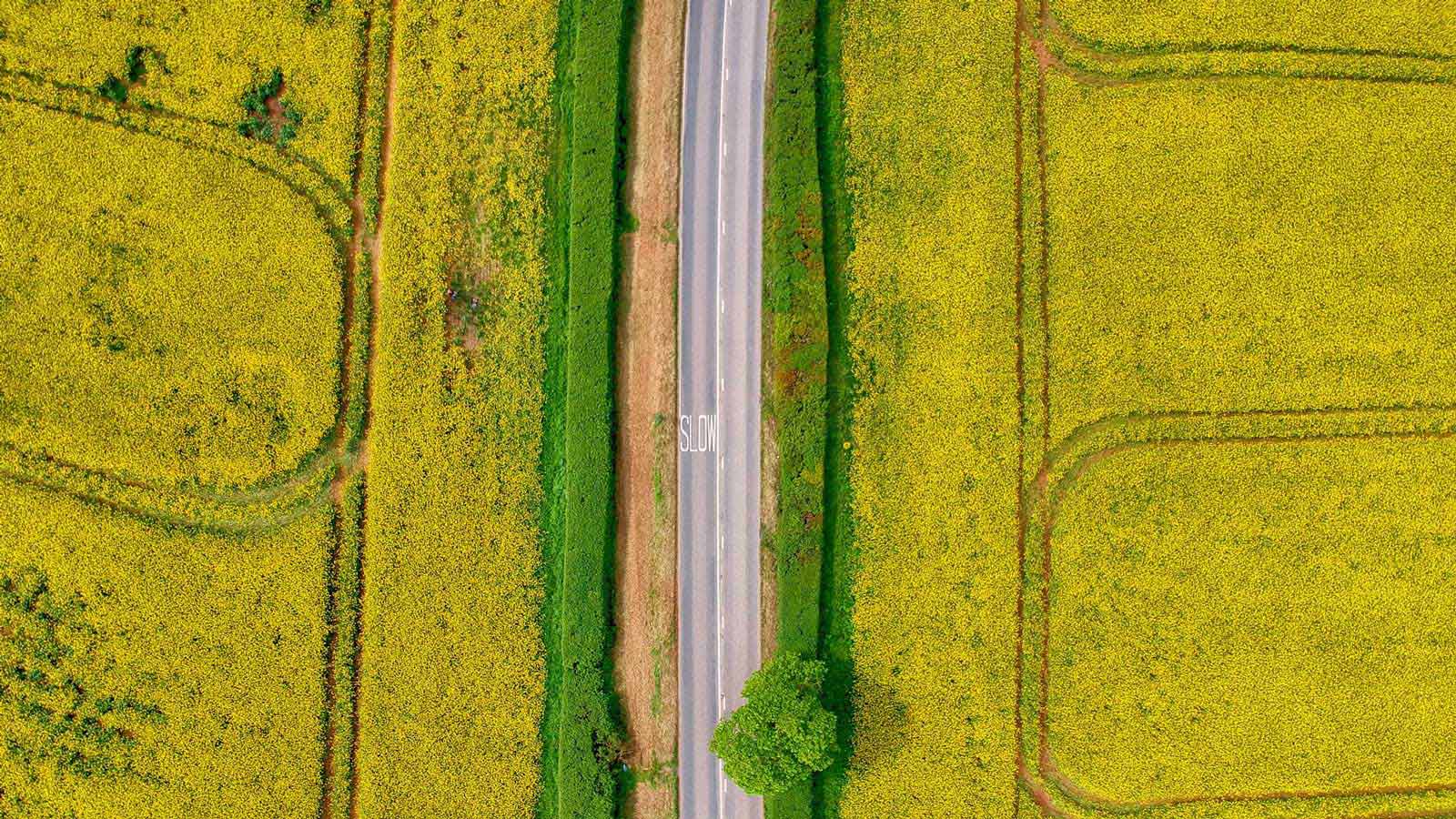
Rapeseed: England's valuable, yet vulnerable crop
England’s ‘green and pleasant land’ is dappled with brilliant yellow rapeseed fields. The crop (also called rape, oilseed rape, and canola) is known for its characteristic bright-yellow flower and is cultivated for its oil-rich seed.
Rapeseed is one of the highest yield oils - its dark black seeds are 45% oil - and the other 55% is high protein animal feed.¹ It’s one of the world’s major oil crops, and of the 70 million tonnes produced annually, 2.2 million tonnes are produced in the UK. Rapeseed is one of the most common break crops in the country. Break crops are generally a pulse or oilseed crop grown instead of cereals. Introducing a break crop typically improves productivity and economic value.²
As a high input, high output break crop, oilseed rape has become increasingly important over the last decade for intensive arable farmers. It can provide good income and goes well in a crop rotation with wheat, which is often the most profitable cereal.³
However, rapeseed is extremely vulnerable to a large number of pests, diseases and animals such as wild game - particularly pheasants and partridges. In addition, this year the major pest has been cabbage stem flea beetle (CSFB) which, although it has been a problem in the east, is now a major problem further west. This issue does not only occur in the UK - rapeseed farmers in the Czech Republic face huge damage by wild animals.
To make this crop more viable, farmers and service providers across the UK are exploring new technologies such as drone mapping and precision agriculture to scout and assess the fields for any potential issues.
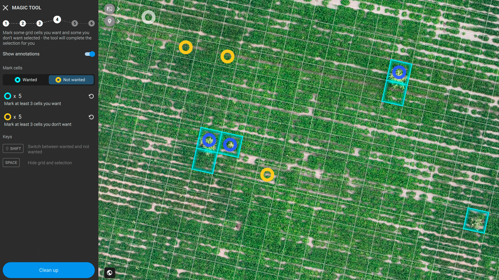
A digital agriculture workflow for precision farming
A drone, camera, and software, as part of a digital agriculture workflow, can be major factors in increasing agricultural precision, crop productivity or enabling more focused crop protection. Data gathered by drone maps and Geographic Information Systems (GIS) greatly contributes to management decisions and variable rate applications.
One of our Pix4D Ambassadors, Chris Eglington, CEO of Crop Angel, has been using drone mapping in agriculture for years now and believes that drone usage and remote sensing are both becoming more common and their use is likely to increase.
Crop Angel specializes in the delivery of agricultural services using UAV technology. They were one of the first companies to offer crop spraying drones within the UK. They also work closely with YEN (yield enhancement network) on their momentum project which involves farmers trying out different treatments and timings of various applications onto various crops to optimize agricultural workflows and crop yields.
Project details
| Company | Crop Angel |
| Location | Norfolk, England |
| Project description | Field assessment of pheasant/wild bird damage to rapeseed crop |
| Project size | 6.1 ha/15 ac |
| Data capture | 432 images totalling 3,118 MB |
| Processing time | 6 minutes |
| Hardware | DJI Phantom 4 Pro + DJI RGB camera |
| Software | Pix4Dfields |
| Outputs | Orthomosaic, index map |
A rapeseed farmer was concerned about the damage caused by pheasants, and needed an accurate damage assessment of his field. The farmer asked the Crop Angel team if drone mapping could help.
Crop damage estimation with drone mapping
Chris performed one flight using a DJI Phantom 4 Pro mounted with a DJI RGB camera. Once the data was collected, the 432 images were uploaded and processed in Pix4Dfields.
“With Pix4Dfields software, which I have used before - I know I can just process my images directly in the field without needing an internet connection. Plus I can show the damaged areas to my client immediately” Chris states.
The total processing time for this project was just six minutes.
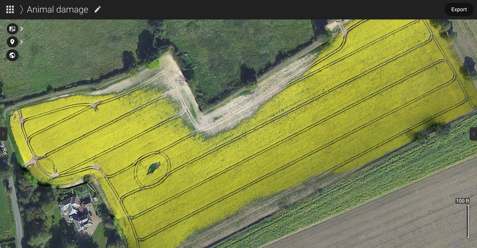
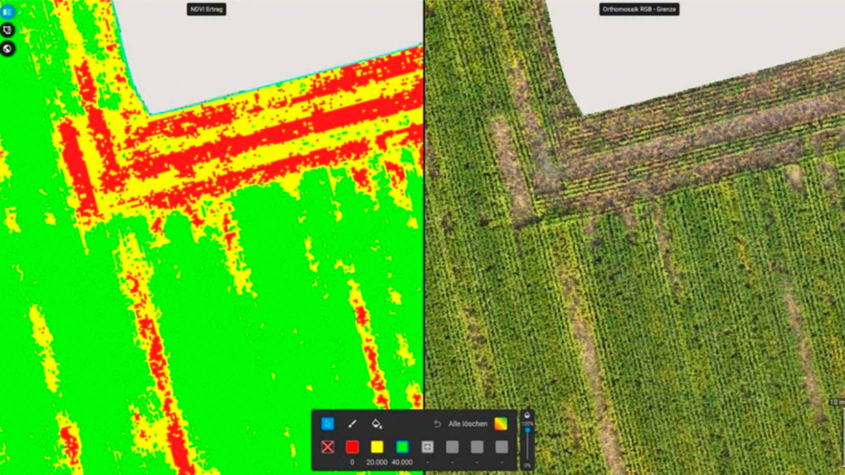
The initial overview showed two main damaged areas which the index map supported even further.
“With an index map you get another level of certainty. In this case, it is pretty obvious even just from the orthomosaic, but there are cases - like pest damage where an index map will show more information than the orthomosaic,” Chris points out.
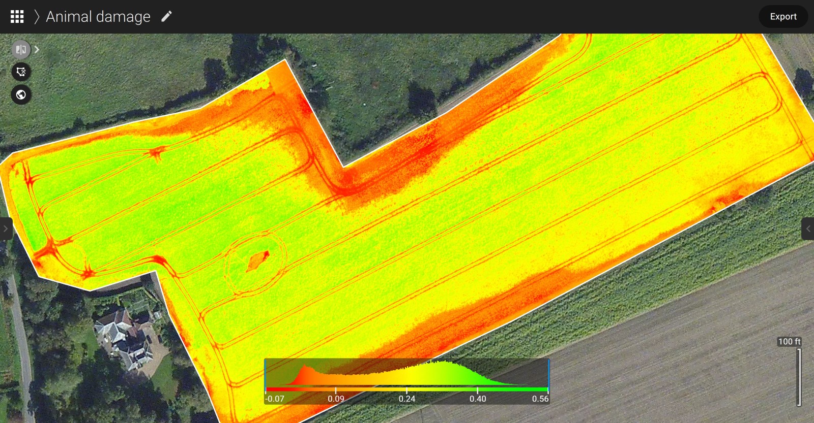
With the PDF report tool, Chris created an overview of different software outputs his client requested and then continued working on the area damage assessment. Once the orthomosaic was generated, Chris uploaded it to Pix4Dfields, and using the measure tool, calculated the size of the damaged area.
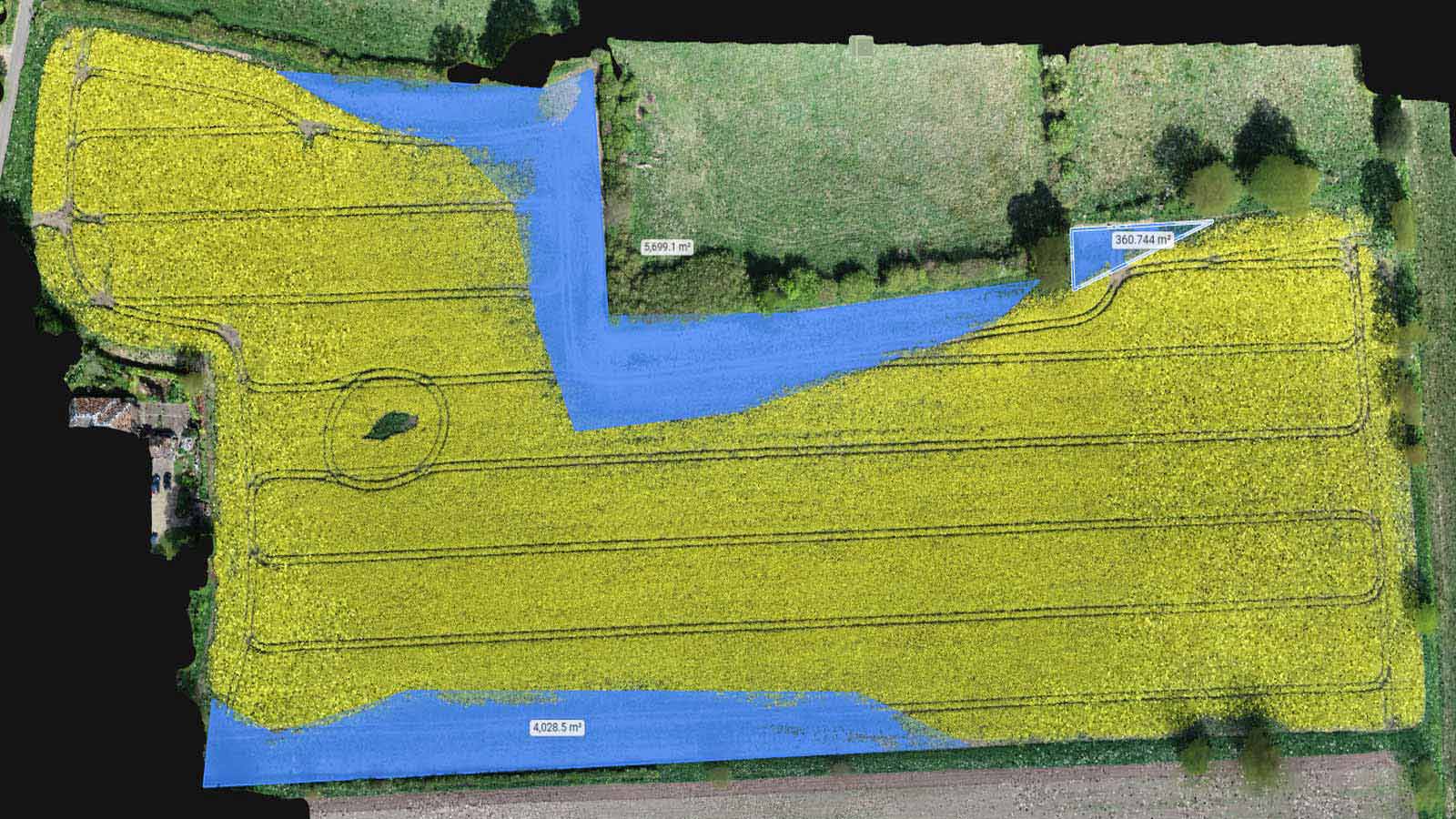
“I think it’s important to have tools to support your work because in situations like these it becomes essential to have a way to prove and provide context fast and accurately in order to negotiate compensation,” Chris concludes.
Why is precision agriculture important?
As Chris concluded, it is important to have tools to support your work. Precision agriculture techniques help growers know how much and when to apply crop inputs, reducing the risk of misapplication and increasing farm efficiency and yield production. Large fields can be managed as groups of small fields, which greatly improves management decisions and decreases costs.
Additionaly, precision agriculture results in a stable and environmentally-friendly food supply which has a huge impact on the reduction of greenhouse gas emissions and therefore on climate change. Our goal is not to produce more now; our goal is for future generations to continue to produce more!
References
| ¹ "Break Crop Benefits - West", Grain Research and Development Corporation, 3 March 2011 Back to top ² "Who what why: Why is there more oilseed rape being grown?" BBC News, 29 May 2012 Back to top ³ "The supply chain of fats: Rapeseed oil", Sustainable Food Trust, 26 July 2018 Back to top History of Grupo Industrial Lala, S.A. de C.V. |