Pix4Dsurvey 1.3: A smoother workflow and TIN generation
Pix4Dsurvey, released earlier in 2020, aims at bridging the gap between photogrammetry and CAD or GIS. The point clouds generated with LiDAR or with photogrammetry software such as Pix4Dmapper, Pix4Dcloud, or Pix4Dmatic are often too large to be easily handled in CAD, so professionals have to go through some form of data reduction in third party software or tools - and often in multiple programmes! Today, this workflow can all be pulled into Pix4Dsurvey, so there is no need to face additional challenges, training, or delays due to researching and adapting to other software or moving between tools. It converts point cloud data into CAD-ready formats.
Import a variety of files
Pix4Dsurvey works by taking imported files, such as from Pix4Dmatic or Pix4Dmapper as well as .las and .laz files from any source, including LiDAR, and extracts key elements for use as CAD files. This simplified but accurate data can then be opened in CAD or GIS software with custom layers and properties which suit your project, massively simplifying the surveying workflow and removing the need for third-party software. When LiDAR and photogrammetry are combined they bring more detail to a project that may not have been achieved by either individually.
Terrain filtering for more accurate and easier surveys
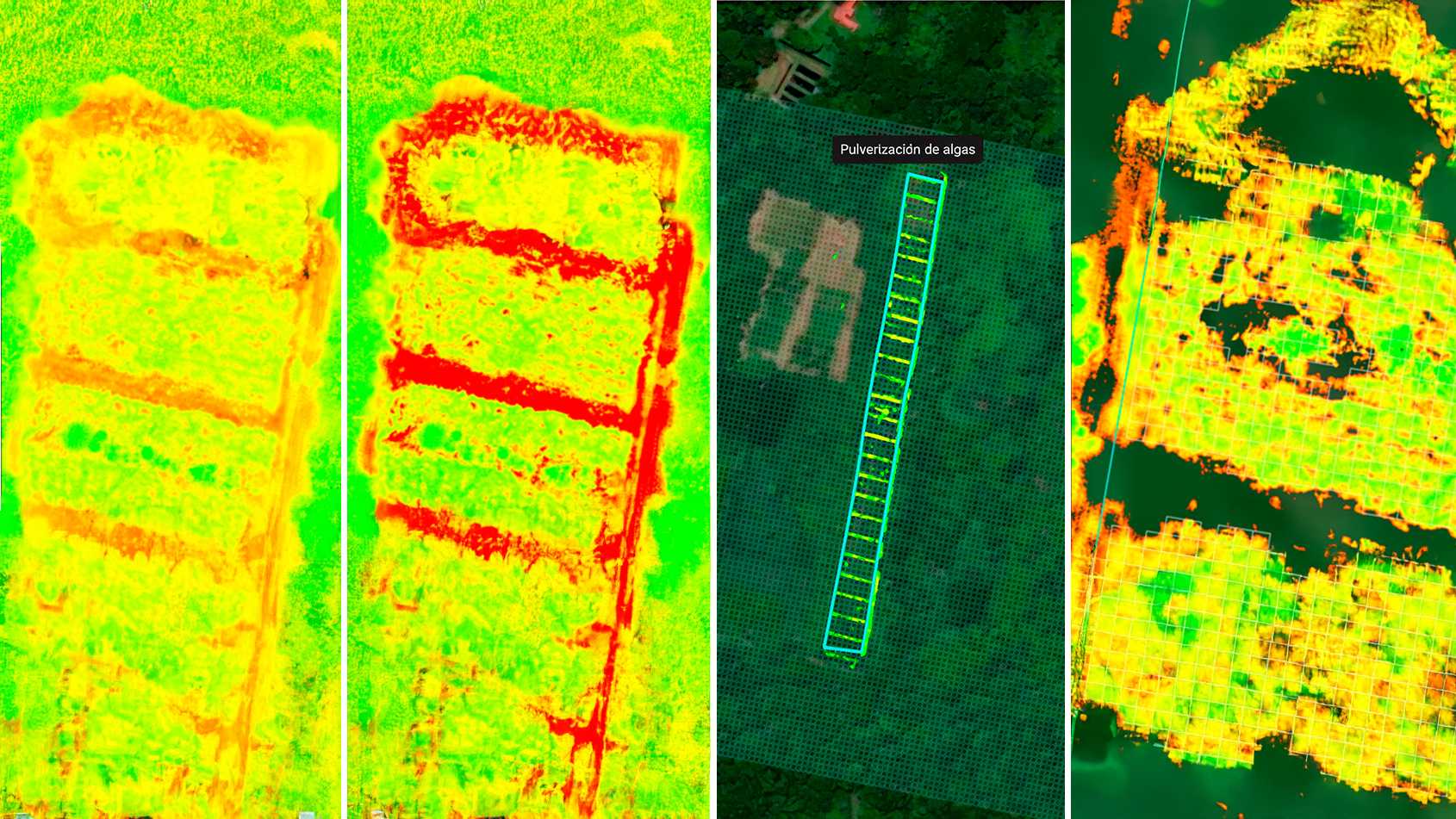
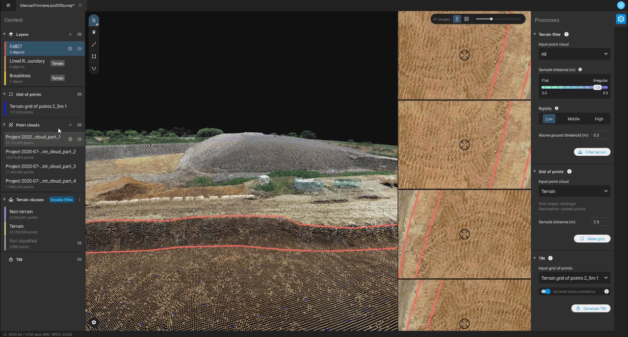
The terrain filter process gives professionals the opportunity to classify specific input point clouds as terrain or non-terrain. They can later be used to create a grid of points only from the specified terrain class. Pix4Dsurvey classifies the point cloud into three categories: terrain (green), non-terrain (blue) and Never Classified points, whilst the user can tweak and adjust the parameters to get the best possible result for their work. It can then be shown with colour or in monochrome to provide a clear, visual representation of how the terrain looks across the surveyed space, with breaks in the selected terrain clearly shown through the contrasting colours or shades.

Digitize surfaces with a TIN
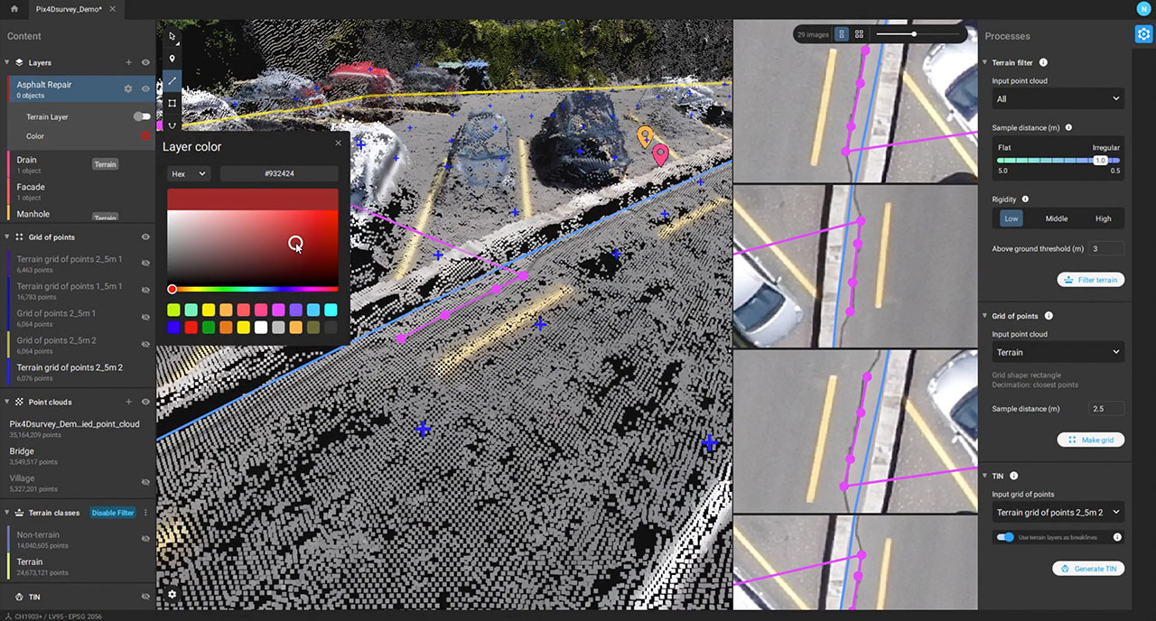
Pix4Dsurvey now generates a triangular irregular network (TIN): a seamless set of triangles representing the surface of the digitized space. The TIN in Pix4Dsurvey is used to model the ground from points and breaklines, taking the grid of points which was generated by a user into account for the process. The user can then select which vectorized objects, or layers, should be considered part of the terrain and which should be used for the TIN generation. This combines both the grid of points and breaklines to provide an accurate but simplified representation of the ground. Whether it is the difference between a road surface and manhole cover, or the bottom of a steep wall, the TIN helps represent these features better than before.
The new ability to tag vector layers as Terrain Layers means that not only does Pix4Dsurvey introduce the concept of breaklines to Pix4D products for the first time, but also the ability to create points that are going to be treated as part of the terrain. Those features will all be part of the TIN when its created, in addition to the grid of points. This strict respect for the terrain layers as part of the TIN means that you can control and be confident in the surface you are creating.
This analysis using breaklines and TIN is vital to measuring and maintaining the accuracy of elevation points, as small variations can have a big impact in planning and construction. This is particularly useful in cases like planning water drainage systems, where differences in terrain can significantly affect how overflowing water may move. The TIN is multi-functional, which means users get more freedom than solely using DSM and DTMs.
Change color of lines and points to suit your project
The color of the lines and points featured on the map can now be customized, enhances the ease of use. This seemingly simple change means the range of environments that can be easily analyzed in Pix4Dsurvey increases - surveying an urban area is difficult if grid points are grey and blend in with the landscape.
More information and support regarding technical features is available on our Pix4Dsurvey FAQ page.