
PIX4Dfields 2.3: edit polygons, holes, and work faster!
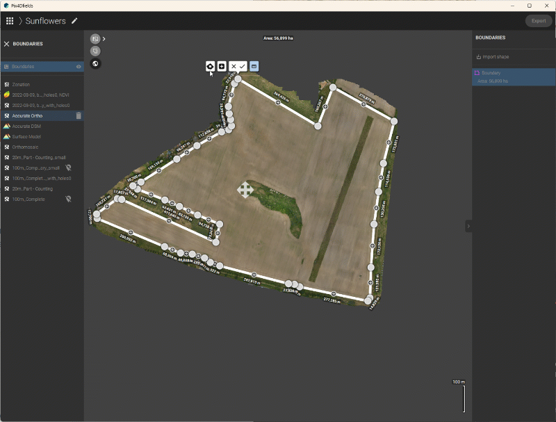
Mark your subfield boundaries
Every field is different and so are its boundaries. PIX4Dfields now offers the possibility of creating inner and outer boundaries as well as support for in-field obstacles.
With this update, you can mark and create fields as well as subfields on the software. Use highly accurate geolocation data (such as RTK) from your drone to ensure the right field boundaries are identified
Learn more on our PIX4Dfields support article.
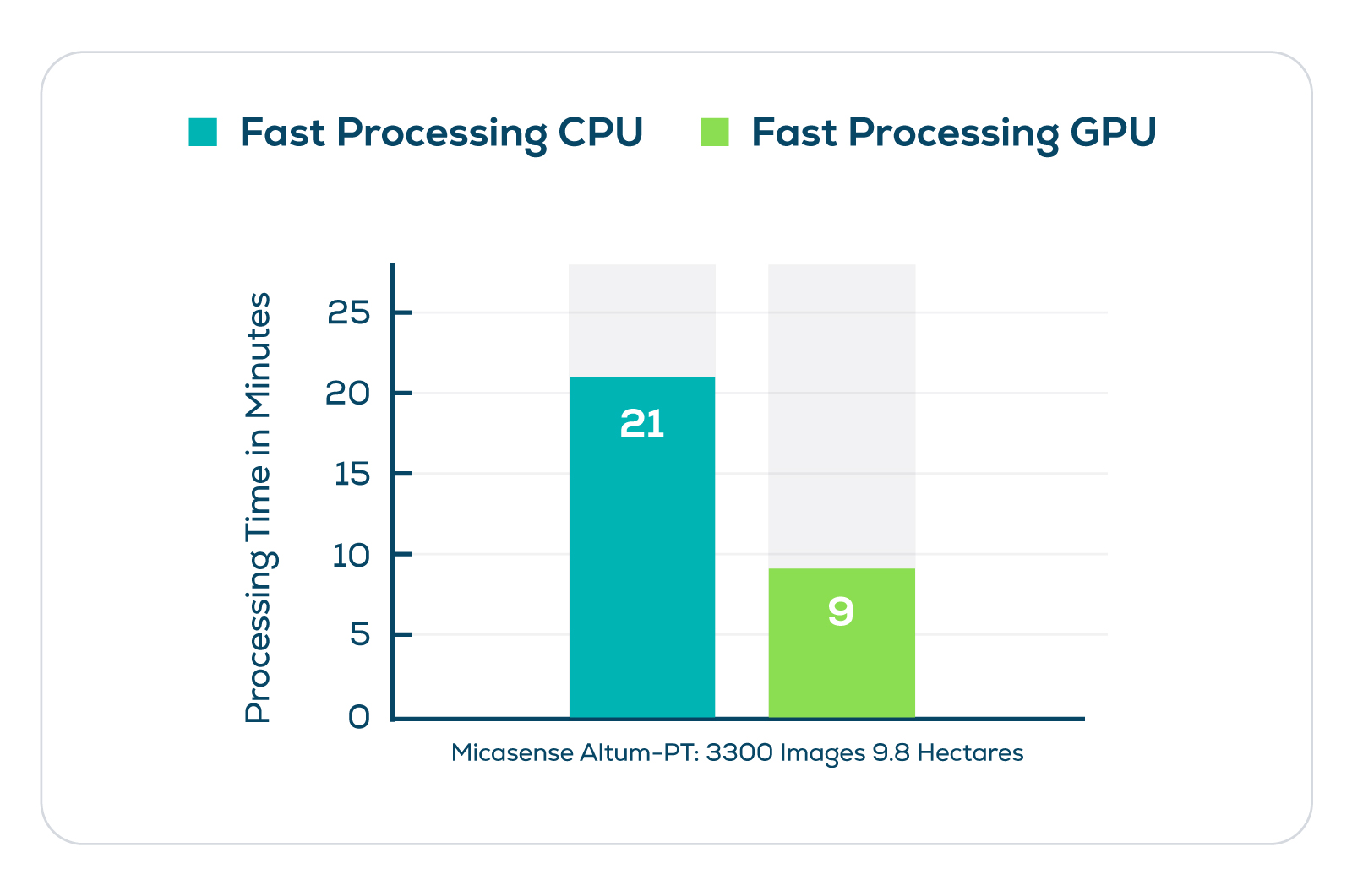
Enhanced processing using GPU acceleration for multispectral datasets
PIX4Dfields is the ideal hybrid drone and satellite mapping solution for precision agriculture as it processes maps in minutes. With the latest release, the software has been enhanced with new processing speeds. Computers equipped with a supported graphic processing unit (GPU) now have increased processing performance for multispectral datasets by up to 50%!
These multispectral datasets are used by researchers and growers around the world to learn more about their crops. The vegetation indices generated with PIX4Dfields are being used for crops around the world to improve yields and help catch problems early in the field.
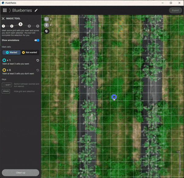
More improvements: Magic Tool & PDF reports
Labeling on PDF reports plays an important role in keeping track of damaged areas or areas of interest in your field. With PIX4Dfields 2.3, you can create and export PDF reports that are ready to be used for insurance claims or in circumstances where further investigation and a record of a field or crop is needed.
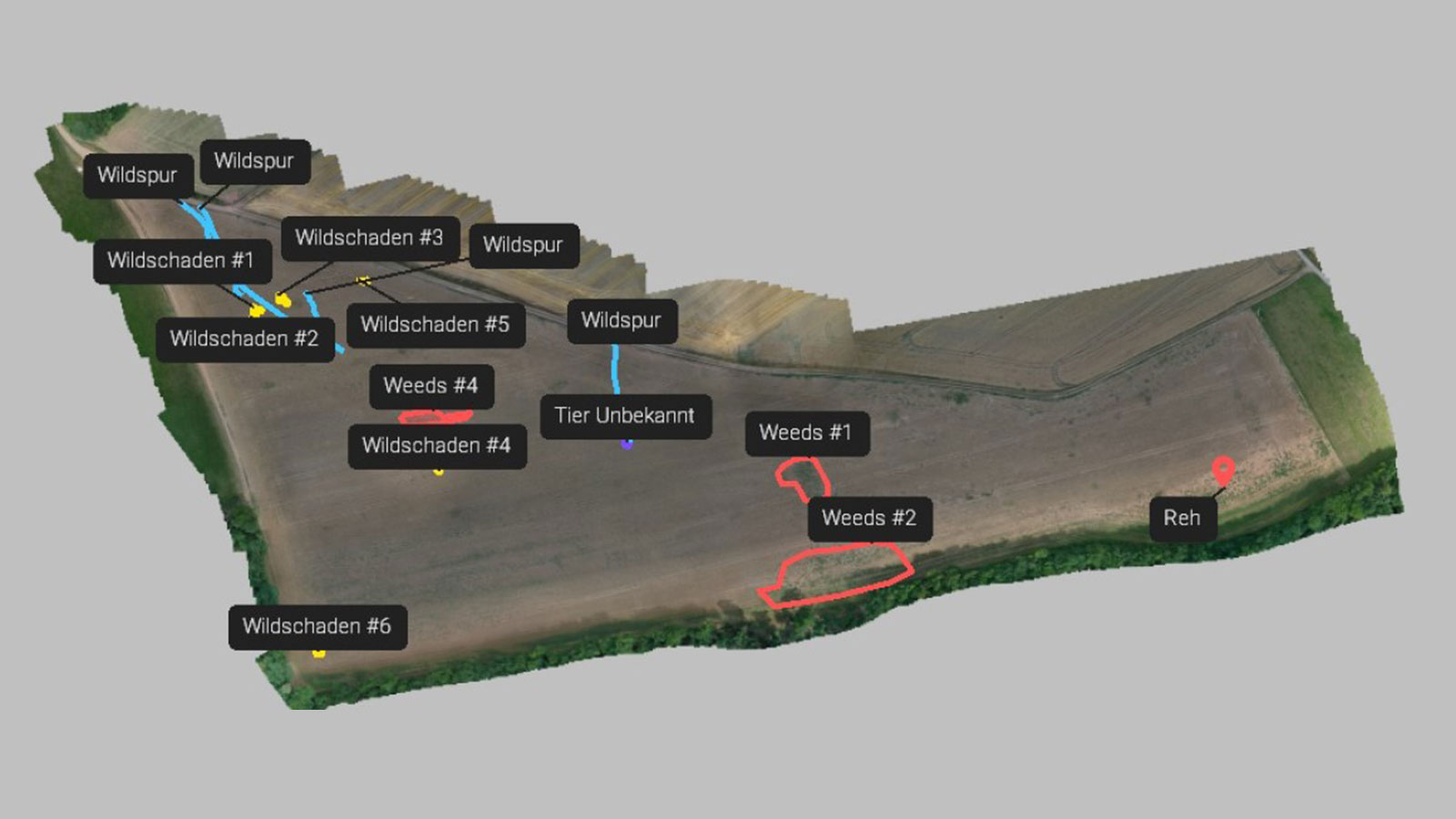
The Magic Tool can now automatically spot areas that the user defines as areas of interest on their crop or field and separate these from the rest. In addition, you can now hide the grid by pressing the spacebar button. This makes the area selection and classification easier so that you can have a clear view of the field or crop when adding labels with the Magic Tool.
PIX4Dfields is continuously improving to help growers save time and resources. Further improvements in this release include the automatic naming of exported Zonations & Boundary files after the project’s name. This facilitates users that create and export more and different boundaries and zonations to keep better track of these files.
If you want to learn more, download the newest version of PIX4Dfields to try it for yourself, visit our support site to watch our new video tutorials, and get inspired by the way people from around the world use PIX4Dfields.


