PIX4Dcatch: the Community Challenge winners!
Last year, we released PIX4Dcatch, a mobile app for terrestrial 3D scanning. Available on both iPhones and Android devices, this app can gather data from your phone and generate precise, accurate 3D models in combination with Pix4D’s processions solutions on the cloud (PIX4Dcloud) or desktop (PIX4Dmapper).
For the PIX4Dcatch Community Challenge, we wanted to see 3D models from phones or tablets made by our Community. The data was collected with PIX4Dcatch, and processed in PIX4Dcloud or PIX4Dcloud Advanced. The idea was to get models of construction sites, including earthworks, underground utilities, infrastructure, and buildings-in-progress. The 3D models were rendered with less than 1,000 images. Our users shared their results and the story behind their work while the Pix4D jury decided on the winners. The top prize was a year’s license for PIX4Dcloud Advanced.
Here are the top projects, and their results!
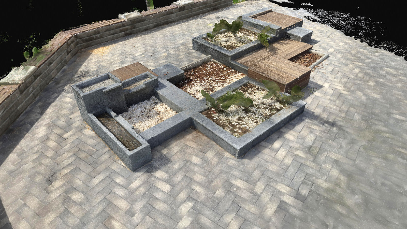
First prize: 3D model of a residential project
This model, submitted by Adam Taylor, shows the footings that were dug out and placed for a residential construction project. He used PIX4Dcatch and PIX4Dcloud Advanced to capture and process his imagery, and got a detailed model as a result. He believes this model can be consolidated with drone models he already has, which will strengthen the range of outputs he can provide to stakeholders and clients.
Taylor measured the distance between the form boards, which is meant to be 5.75 feet (175 cm) apart. His model gave results between 5.7 and 6 feet (173 - 182 cm), which is the range expected, showing the accuracy of the 3D model.
Second prize: terrestrial scan of underground piping
The second place prize went to Jimmy Urfer, who works in surveying. He used an iPad Pro to gather data with PIX4Dcatch and processed the data in PIX4Dcloud. Urfer is working on this project to optimize how the pipes were placed and organized. This model is very useful for managing this pipework system as it is a record of their current status and can be used to plan further expansions.
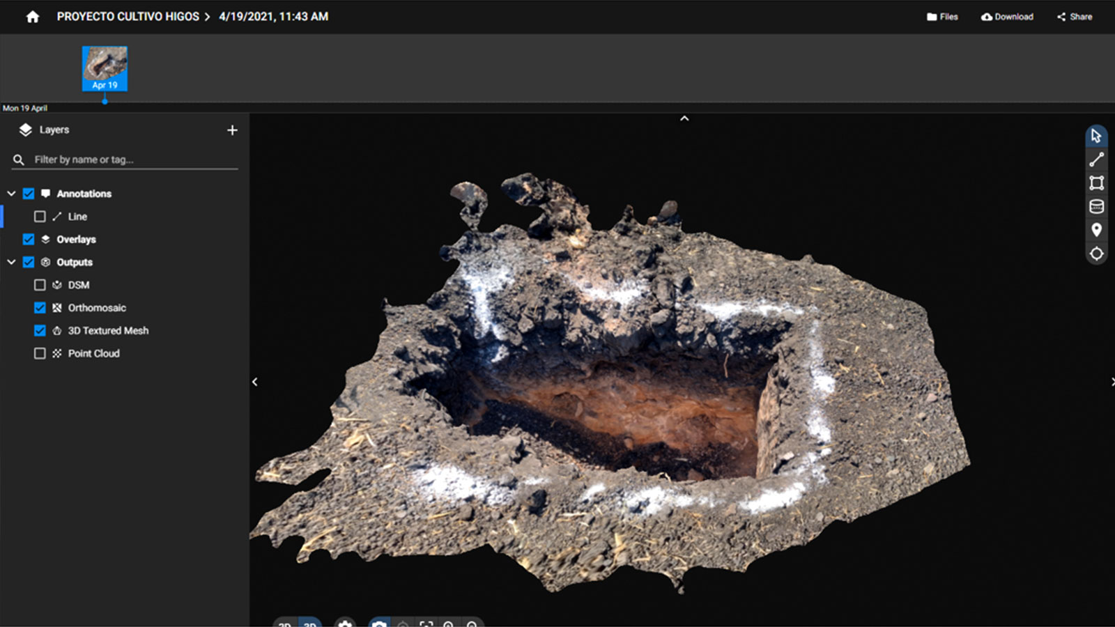
Third prize: surveying a stormwater sewer junction
Our third place Community Challenge winner is Thomas Reinsel, who submitted this model of a stormwater junction. It’s tricky to gather data for these underground sites, but Reinsel found it easy enough with PIX4Dcatch. He took just 3 minutes with an iPhone 12 scanning the inside of the area to look for the status of the junction and the material that was stuck. The model helped determine the connectivity of the system and the size, material, and structure of the pipes. They connected the model to high accuracy GPS invert measurements in GIS.
Other prizes: accurate models captured with mobile devices
There were loads of great submissions, so we decided to give prizes to more participants than just top 5 to include a top 7.
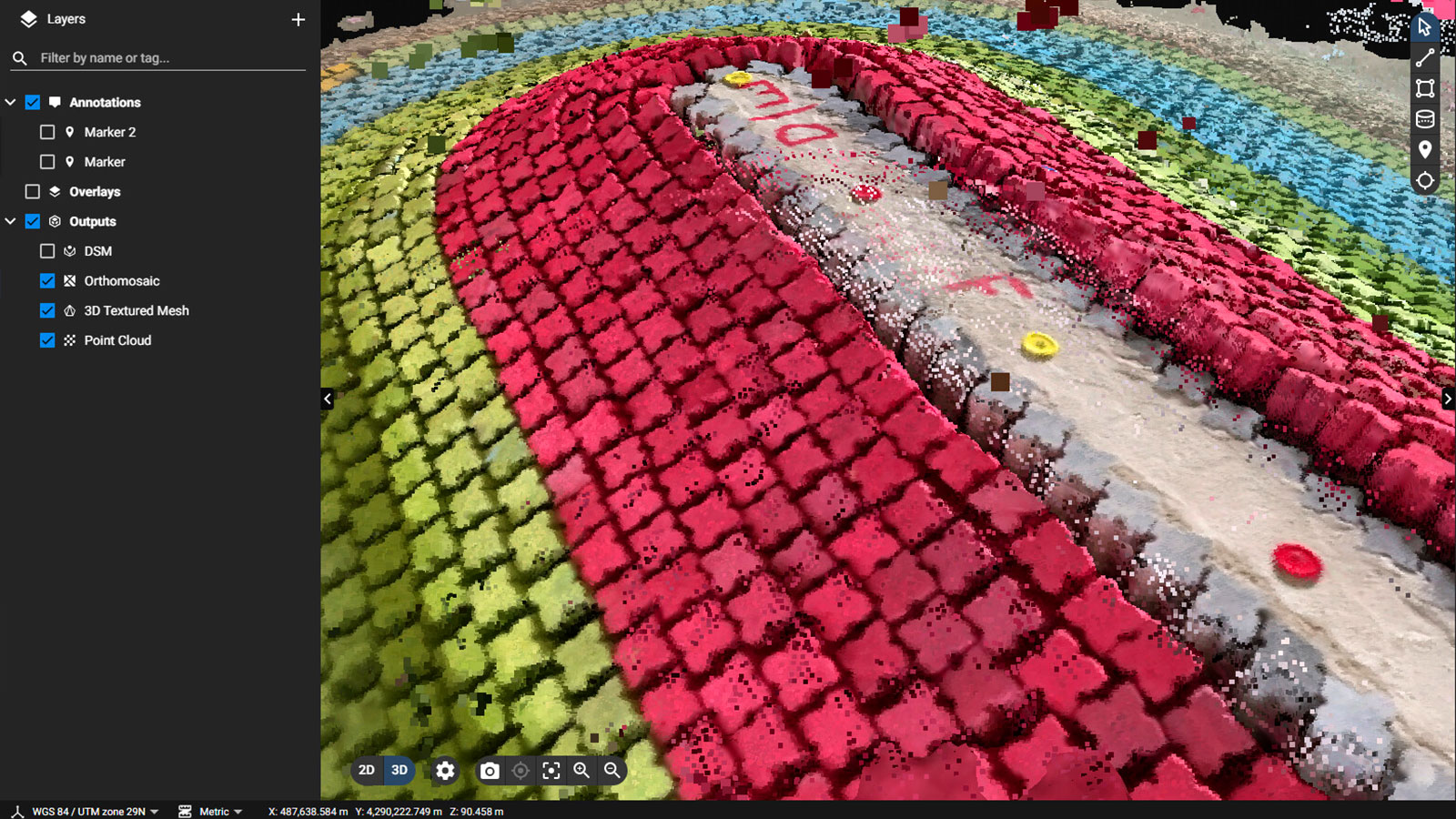
Javier Sanchez submitted this awesome model of an open pit that was excavated to study soil stratigraphy. He lives and works in Querétaro, Mexico, where the soil has a high clay content. The soil is affected by water levels, as it expands or contracts according to the level of saturation which can be difficult for construction. His PIX4Dcatch model clearly shows the different densities of soil at the top layer compared to the bottom. The data was processed with PIX4Dcloud Advanced. The results clearly show the differing soil levels that their clients can plan for as they move ahead with construction.
3D model wave simulations
Rui Capitão shared this colourful model of a water breaker that is being used at a research and development center to verify the structural integrity and stability of a pathway extended out into water. The physical model works like a wave tank and can have water movement simulated around it to picture how the real-world structure is affected by coastal storms and weather. The team used PIX4Dcatch on an iPhone 12 Pro, with the LiDAR sensor, to obtain a 3D model on their computers with PIX4Dcloud processing the data they collected. The results are promising for helping analyze wave patterns with better accuracy and detail than the physical model, and the results are clear without any editing necessary.
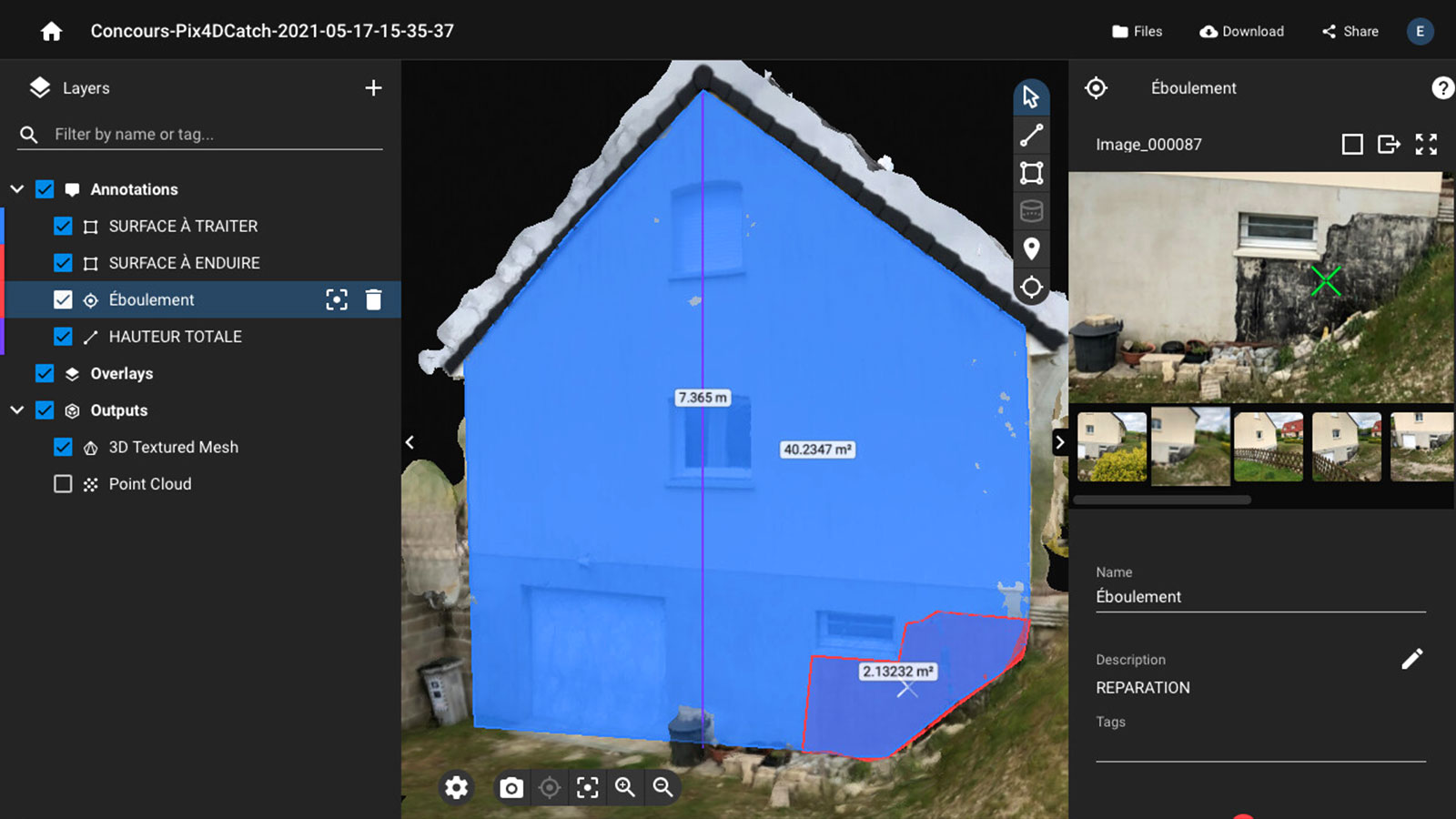
3D scanning for building maintenance
Steeve Empereur is working in maintenance, and was looking at a building where he wanted to measure the area of the gable, height, and areas needing repair. He got the ideal measurements with PIX4Dcatch, streamlining his workflow. The results are being used to help select the best equipment for repairs, sharing the site details with colleagues, and have a record of what work was required and what was done at the end.
New urban features modeled in 3D
Finally, our user Alex Bond made a model of a fountain in an urban area that he is working on. This model is being used to analyze how to prepare and install lighting around the fountain as a decorative monument.
Pix4D Community Challenges are a great way for our users to share how they are using drone surveying in their work. Depending on the product, we can see a huge range of applications of drone mapping and terrestrial 3D scanning.
Thank you to all of our Community Challenge participants, and congratulations to our winners! Follow our Pix4D Community to keep up to date with the latest challenges as well as find out how other users are pushing the limits of photogrammetry technology.