Unlocking the sky: meet PIX4Dcapture Pro & Mission Planner
Pix4D is excited to share the release of our brand new flight planning app, PIX4Dcapture Pro. It is accompanied by a new software extension, Mission Planner, to assist Pix4D users in planning flights online from a web browser.
PIX4Dcapture Pro has been carefully designed by our team to enable optimal data collection for 3D modeling and 2D mapping. As a result, the features and tools within the app are customized for professionals looking to capture data for aerial mapping.
Discover PIX4Dcapture Pro
Here are some highlights to PIX4Dcapture Pro’s features that will enable drone pilots to complete successful flights.
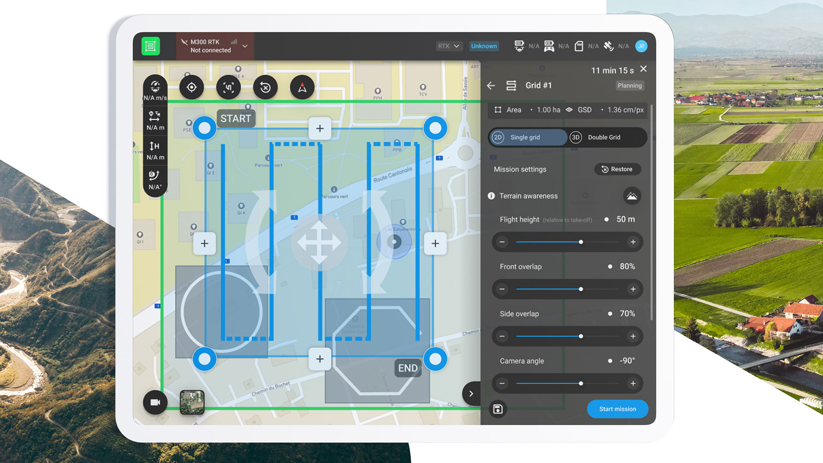
Achieving consistent data collection with Terrain awareness
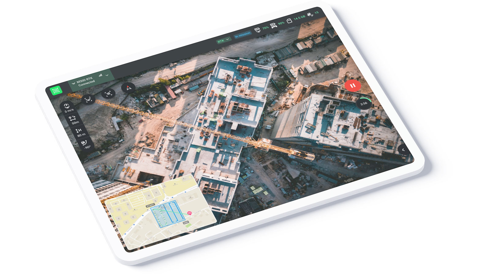
The drone flight app will help you achieve a constant overlap of images during the flight regardless of the terrain. Using geolocation data, the drone’s flight path will be adapted according to the elevation of the land beneath it to ensure a consistent distance from the ground and thus consistent data.
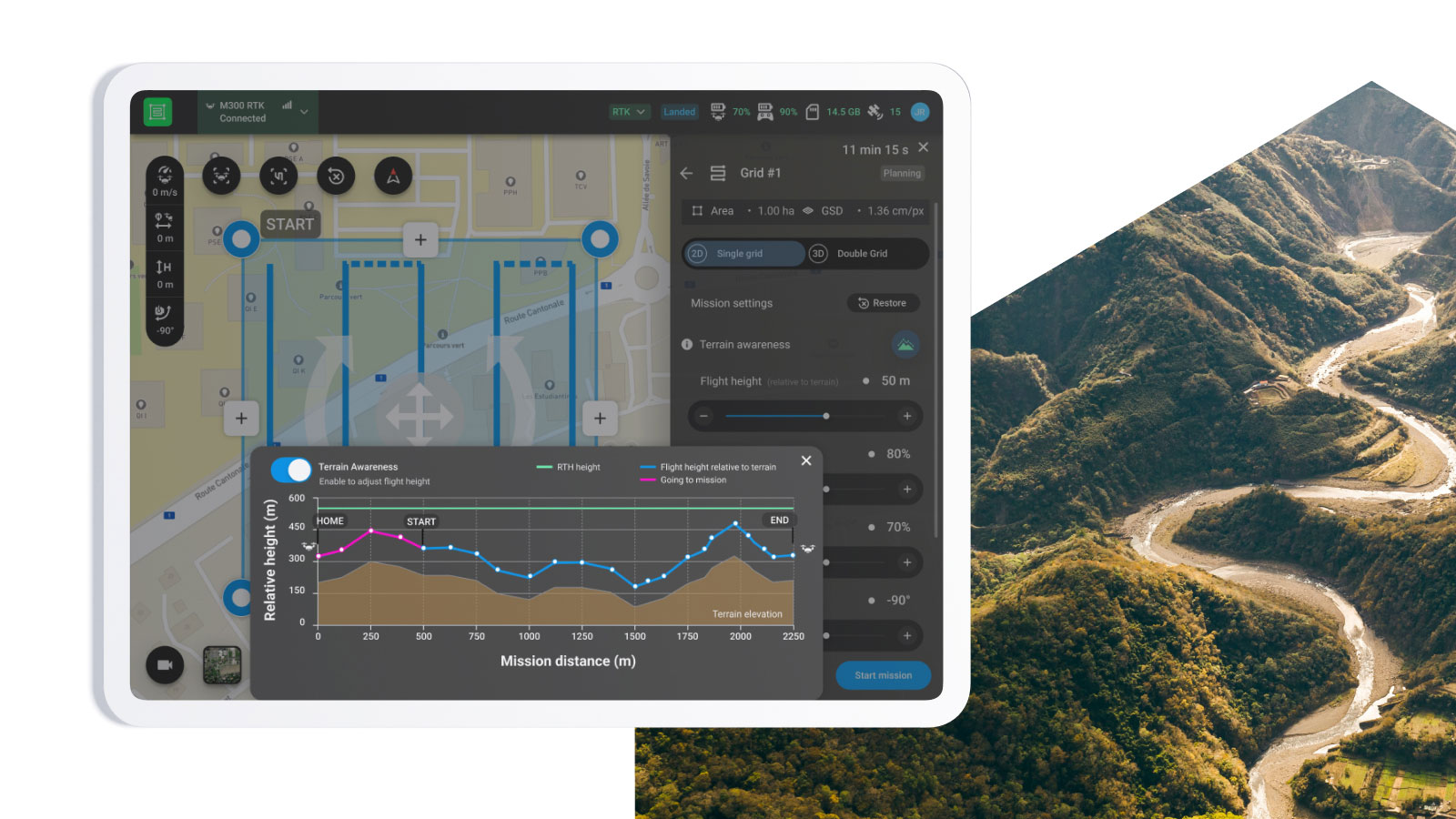
The result of this terrain awareness and adaptivity is that when processing the image data you can achieve a constant GSD and avoid any gaps in your 2D or 3D model.
Effortlessly plan drone flights with Offline maps
If you know you’re going to fly in a remote location, or even just want to be careful about having a pre-planned flight regardless of Internet connection, you can use the offline maps feature. Plan your missions in advance using downloaded basemaps (street or satellite views) to get a visual reference when flying in the field.
The app will also automatically download a Digital Elevation Model (DEM) to enable the terrain awareness feature. For more information about this feature, you can check out our support documentation.
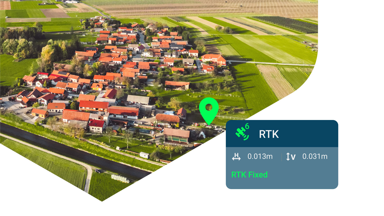
PIX4Dcapture Pro enables RTK for precise measurements
PIX4Dcapture Pro is compatible with the latest drone models, including drones from the Parrot range as well as both RTK and non-RTK DJI drones. Some of the compatible drone models are DJI Matrice 300 RTK, DJI Mavic 3E and DJI Mavic 3T. For more information about the drone compatibility, you can read our support documentation.
RTK drones offer a high level of accuracy in data collection, making them an ideal tool for industries that require precise measurements such as surveying and construction.
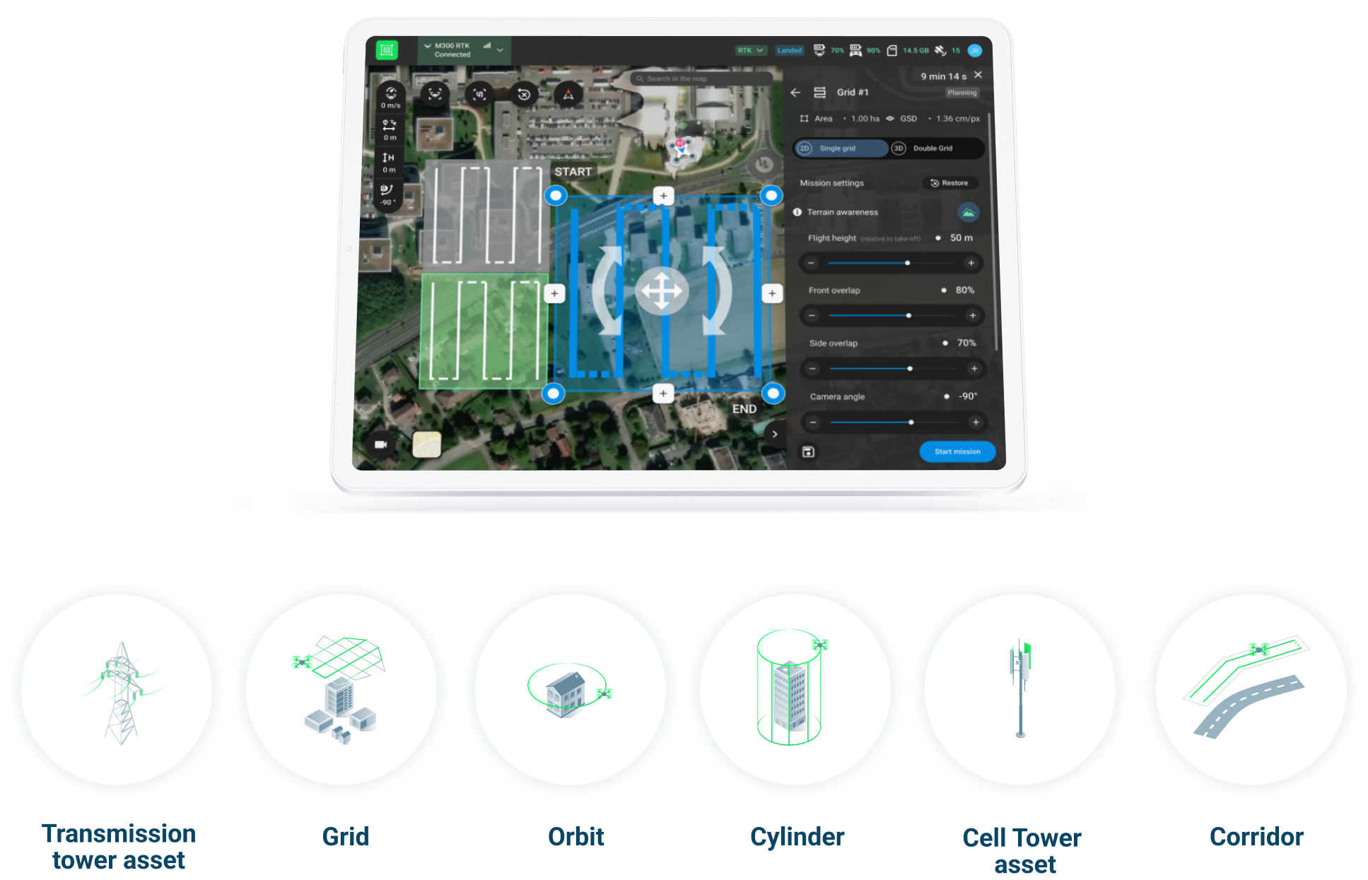
Custom flight plans
PIX4Dcapture Pro has specialized flight plans for data collection for specific assets including cell towers and transmission towers, in addition to grid layouts for wider land surveys, orbit and cylinder missions.
Alternatively, you can fly manually if you need to survey a particular object or focus on a specific asset. With this, you have complete control of how your drone flight planning works.
Streamline project efficiency
With PIX4Dcapture Pro you can effortlessly duplicate and delete both plans and missions, as well as create new plans and add missions. Our app streamlines project management so you can efficiently manage your flights and elevate your drone operations.
Meet Pix4D’s Mission Planner: simple, scalable, reliable
In addition to PIX4Dcapture Pro, we are releasing Mission Planner. This new tool is accessed from PIX4Dcloud and enables you to plan drone flights from a laptop rather than on a mobile device. These missions can then be downloaded to PIX4Dcapture Pro for use.
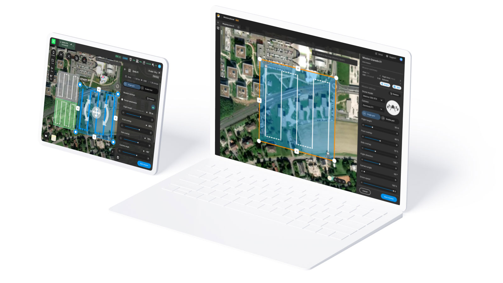
The Mission Planner tool supports the same models of drones as PIX4Dcapture Pro which allows pilots to plan their missions on the web and execute them on mobile devices, providing a smooth transition from planning to execution. For more information about the supported drone models, check out our support documentation.
Easy drone flight planning
Our web-based drone mission planning tool offers a comprehensive solution for planning and managing drone flights. With a user-friendly interface, this tool offers a variety of mission types including grid missions for surveying large areas, cylinder missions for assets like tall buildings, and orbit missions for small buildings. This ensures that pilots have access to the necessary tools to successfully complete any mission.
Reduce planning time with the Mission Split functionality
With the Mission Planner, you can easily import .kml and .csv files, which can be downloaded from various publicly available sources of geospatial data such as the National Institute of Geography of each country. Once uploaded, the Mission Split feature automatically calculates the number of missions required to cover the area and creates them for the pilot in seconds. Please note that the Mission Split feature also works with manually created missions.
This significantly reduces the planning time and helps streamline the overall flight process. Plus, if you are working on maintenance projects, this means that the plans can be easily saved and repeated with the “Duplicate” function of the tool.
Maximizing efficiency and scalability
With Mission Planner, projects can be planned in the office and centralized, meaning that major decisions can be made before flights are carried out. This enables high scalability through repeating drone flights, either at the same sight or across projects.
Take control of the sky
With the PIX4Dcapture Pro App and the Mission Planner, drone pilots can now focus on creating mission plans to efficiently streamline data collection.