
Monitoring a volcanic eruption with drones and PIX4Dcloud
The Cumbre Vieja volcanic area is located in La Palma island, one of the smallest islands in the Canaries. Its eruption in 2021 was the first in 50 years, when the last event was in 1971. Since then, the volcano has occasionally caused mild tectonic activity, such as tremors, but had not erupted.
The National Geographic Institute of Spain (IGN) is responsible for monitoring volcanoes across Spain and its territories. They carefully map, measure, and analyze volcanoes to detect shifts. The Institute is headquartered in Madrid with a volcano monitoring group and another significant office in Tenerife. They have several methods for monitoring volcanoes which include measuring seismic activity, INSAR images, GNSS, geochemistry, and geology.
Predicting the Cumbre Vieja eruption with photogrammetry
Prior to the eruption, a team of IGN volcanologists and specialists traveled to La Palma, arriving on the 14th of September - a week before the eruption. They arrived on the island, and after 3 days, began preparing for an imminent eruption.
Predicting volcanic eruptions is incredibly difficult. No two eruptions are the same, and for volcanoes with long periods of being dormant, careful monitoring is required to pick up on any signs of a change in the volcano’s status.
The team use drones to monitor changes in the terrain, its topography and gather high-resolution imagery. The outputs from this can be used before, during, and after an eruption to maintain records and plan emergency response or rescue efforts. Working with drones to map a volcano is safer than manually visiting the site on foot, and allows for scientists to balance safety with the need for data.
Project details
| Location | Canary Islands, Spain |
| User | IGN |
| Hardware | Phantom 4 |
| Software | PIX4Dcloud |
| Total images collected | 428 (volcano) 625 (coastline) |
How can you map a volcano with drones?
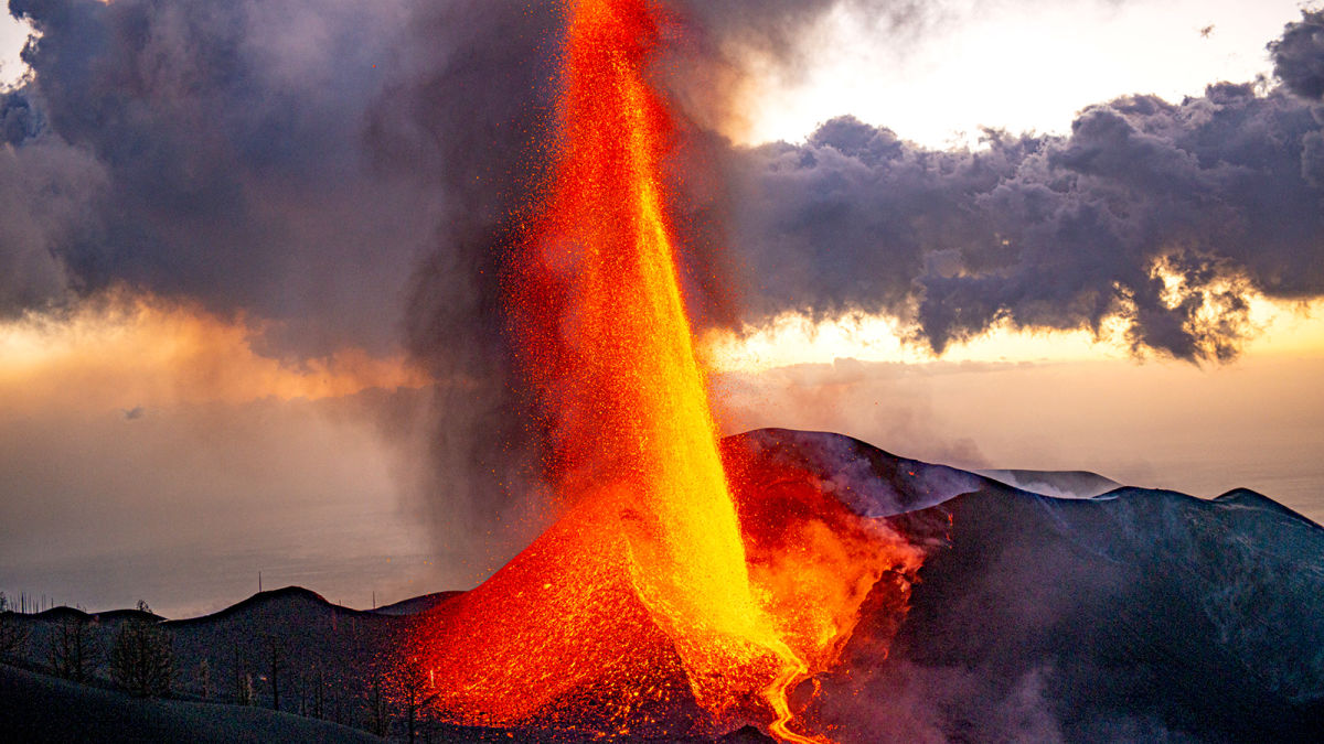
The La Palma eruption was dramatic, spewing lava as high as 500 meters into the sky and the eruptive column reached 5-7km above sea level. Lava flow from the volcano traversed the island, destroying buildings and plantations, forcing thousands of residents to evacuate their homes, leave behind most of their belongings, and for many, their livelihoods. The IGN team was on-site for the eruption and followed the entire process from the start until the eruption was declared over 85 days later. They had several missions:
- During the eruption, the team mapped the lava flows and the coast to see the extension of lava flows and terrain creation.
- IGN needed to estimate volumes and surface areas of the new land.
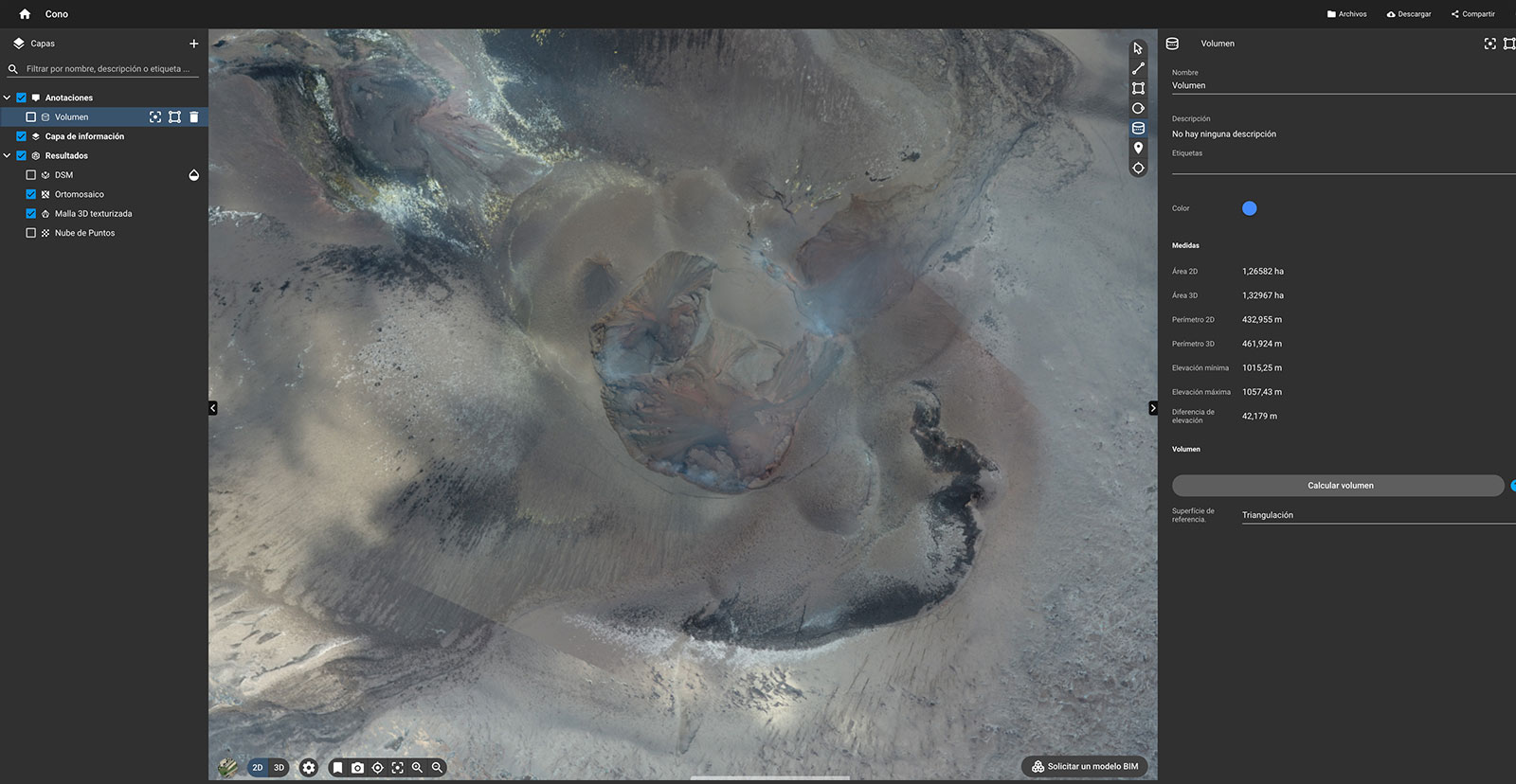
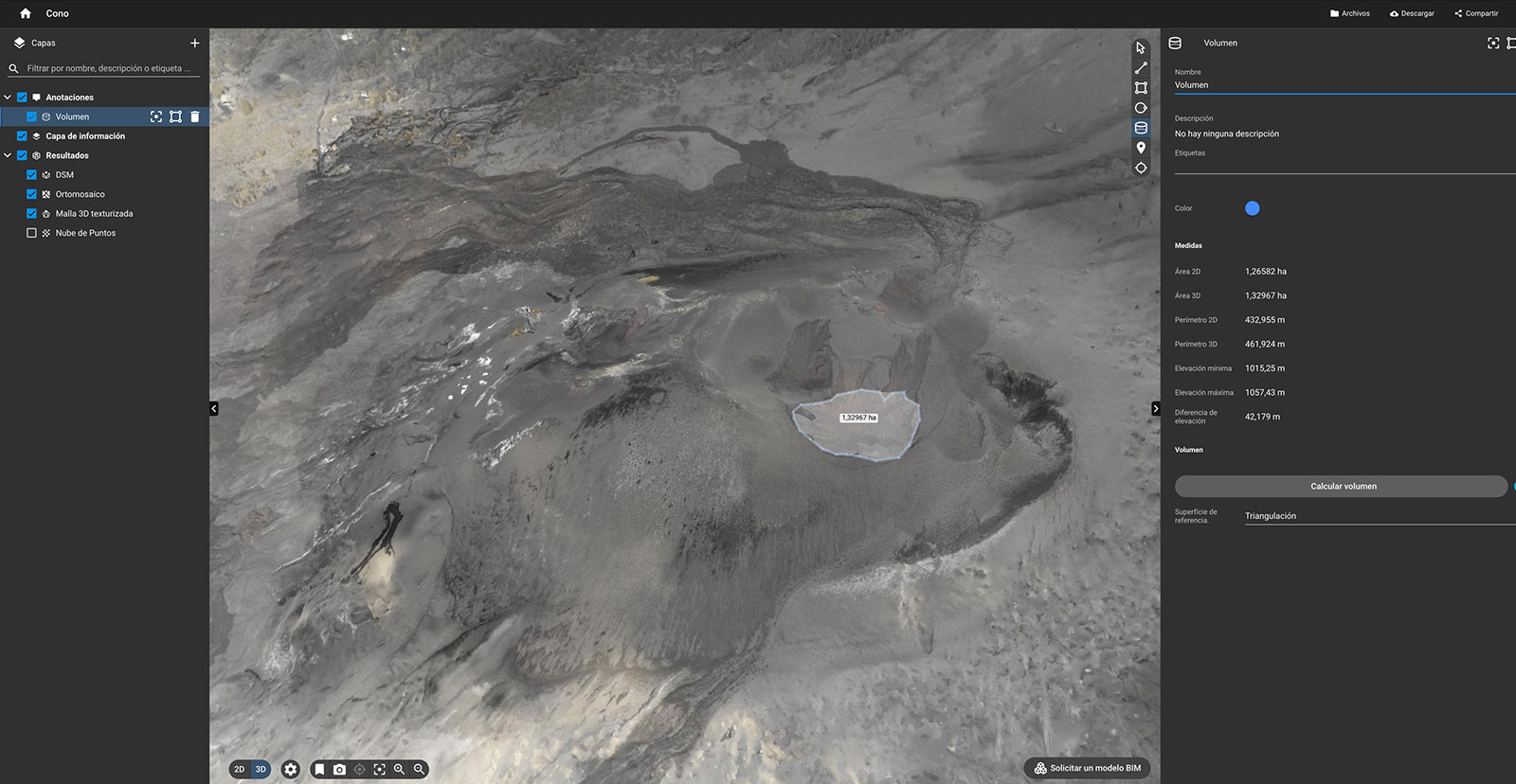
- Finally, the volcanologists planned to get a 3D model of the volcanic cone. This would be used to analyze the volcano, to understand its evolution and be a final model for the end of the eruption.
There are many risks to mapping a volcano with drones, as the lava is fast moving and can trap the pilots if they are not attentive. Another issue is that volcanoes do not just produce lava, but also pyroclastic flows and toxic gases. Plumes of a substance that look like gas may in fact be vaporized rock or terrain matter, which is a combination of solid and gaseous materials - similar to what happened to the town of Pompeii near the Vesuviius volcano in Italy. When mapping the volcano with drones, the team had to carefully avoid any gaseous outlets by the volcano or lava streams as they could lose it.
Measuring a volcanic eruption with photogrammetry
The IGN is partnered with Copernicus who assists in GNSS, tectonic, monitoring magnetic changes, and earthquake monitoring across Spain. In this use case, the IGN used PIX4Dcloud to get fast, accurate results that could easily be shared with the team in Madrid and with Copernicus.
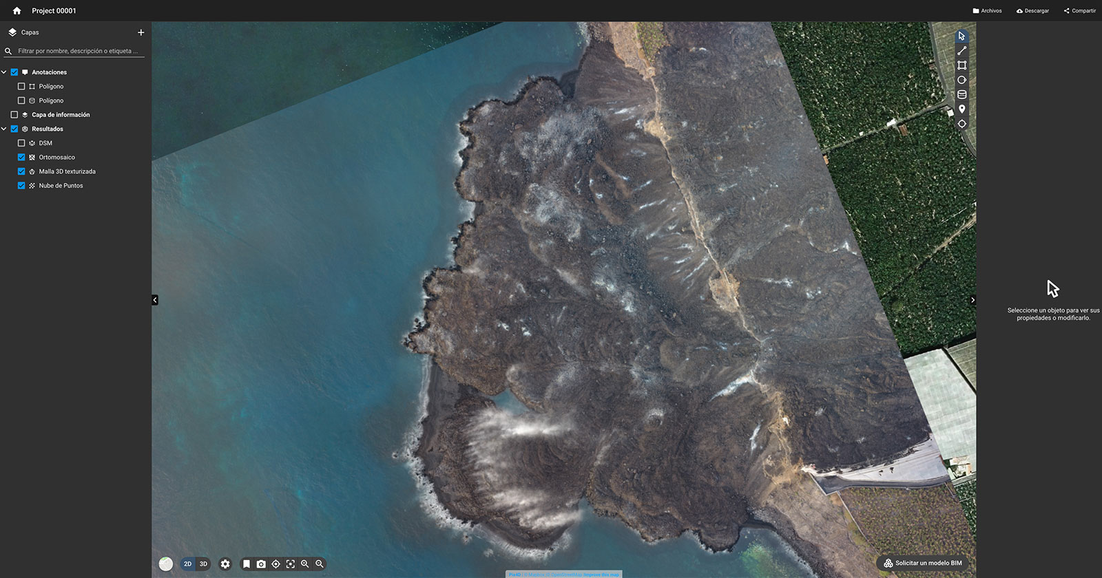
PIX4Dcloud, as the name suggests, is a cloud-based photogrammetry platform that enables the creation of 2D and 3D outputs from images. The team used drones to map the lava flow, which measured 1200 hectares and uploaded the images to PIX4Dcloud. From there they could create 2D orthomosaics and a 3D point cloud that accurately represented the lava flow. The eruption destroyed 1500 houses, and the outputs from PIX4Dcloud could be compared with previous maps to check the impact of the eruption using the 2D Comparison feature.
The volcanic cone itself was measured on PIX4Dcloud and confirmed as 200 meters high. This is where the gas columns were highest and most difficult to avoid, so they only completed one flight during the eruption to minimize the risk of losing the drone. Then, after the eruption was over, they measured it again to have a final record.
Advantages of photogrammetry in emergency response
PIX4Dcloud was an ideal solution for this project because of the ease of shareability. The processing was fast and the final project can be accessed from anywhere - especially for coordinating with Copernicus or the IGN headquarters in Madrid.
“Working with Pix4D was the key to obtaining maps and 3D models fast enough and without the necessity to have a powerful PC processing all day on-site. In addition, using the cloud helped us to share info with other scientific groups and the emergency managers.” - Meletlidis Stavros, Volcanologist at IGN
The automated processing also saved the team time as they could simply upload the images and be notified about the results being ready. The flight effort could easily be showcased with photogrammetry outputs. The high resolution images were valuable resources for coordinating the local response to the volcano, and helped gather data that could not be seen with satellite imagery. The eruption created its own weather system that the drone was able to move around and adapt to. Thanks to working with drones and photogrammetry, IGN could get accurate data and results whilst prioritising their own safety.


