Surveying Lake Vogorno: mapping challenges with Pix4D
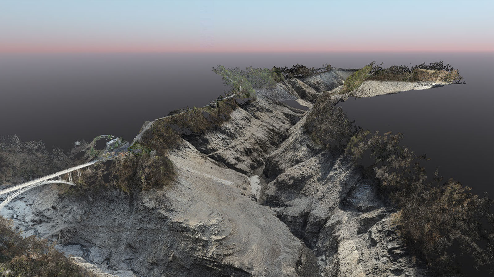
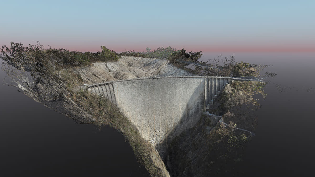
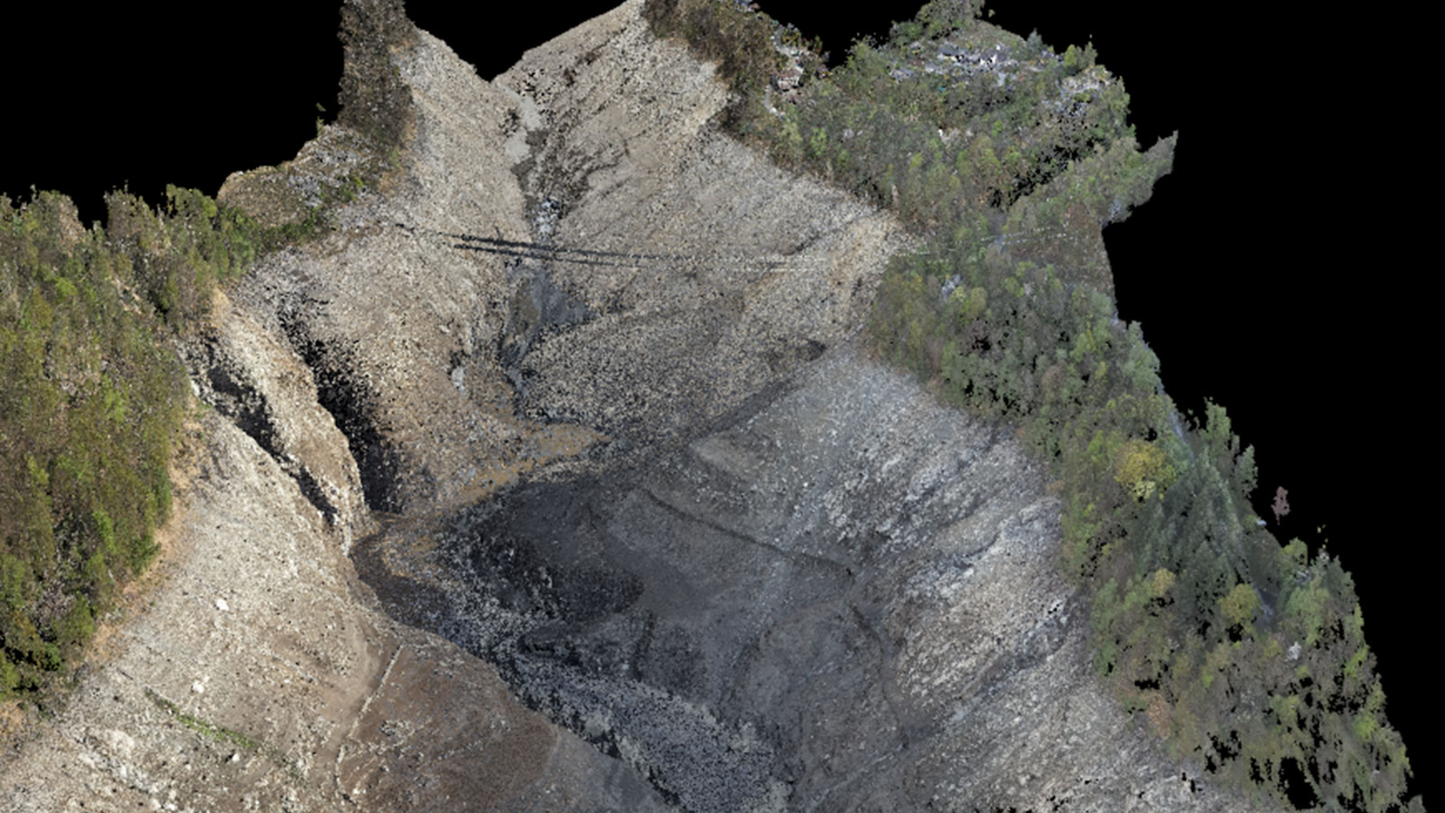
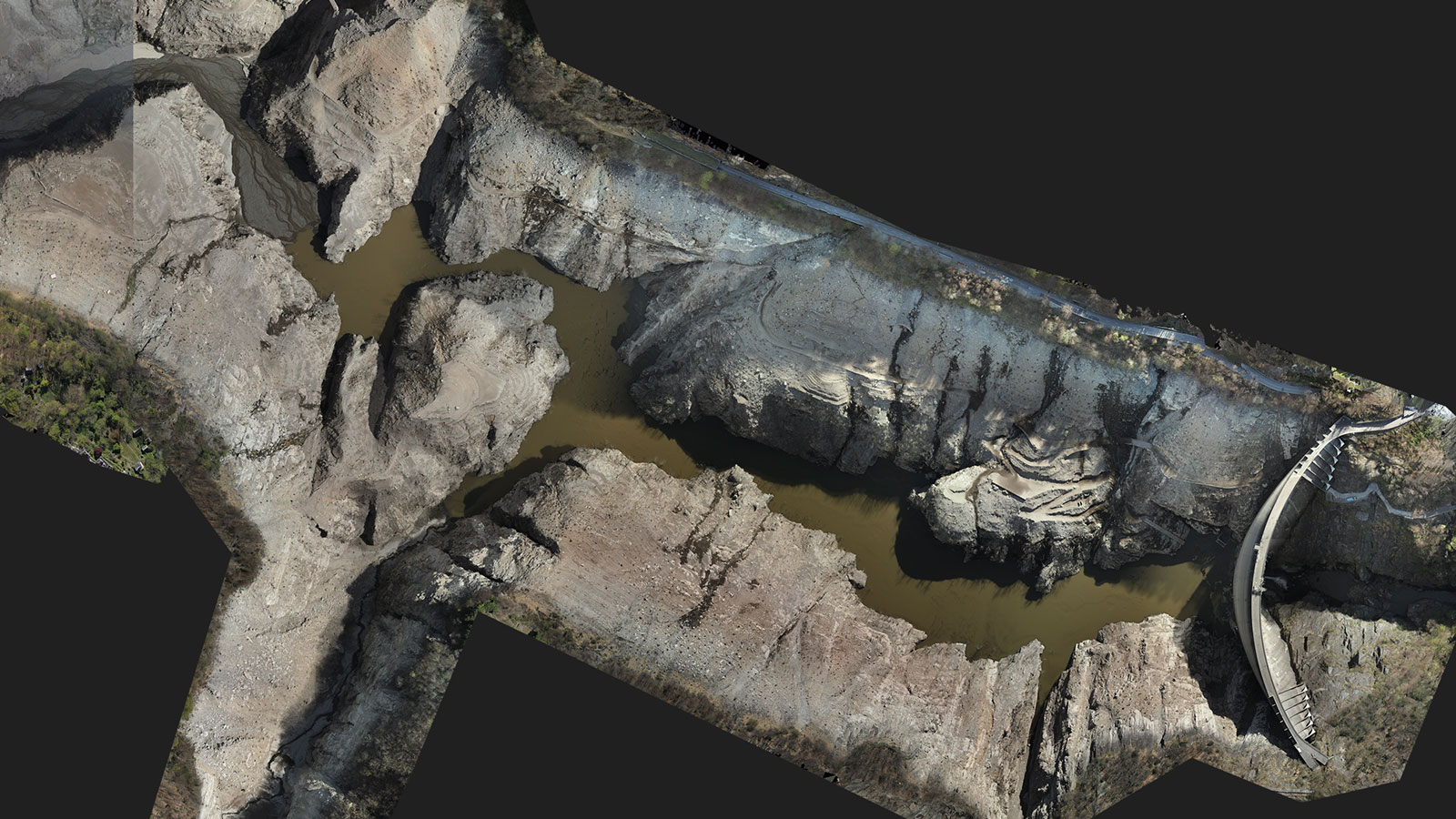
In May 2022 Studio Calastri conducted a photogrammetric survey of Lago di Vogorno in Sementina, Ticino, Switzerland. Studio Calastri is a small engineering studio of around 20 people, that specializes in cadastral surveys, land registry, and surveying projects. This particular project was requested by the Verzasca Dam's management company, to obtain a rare and comprehensive view of the basin’s interior as it was empty due to undergoing maintenance at the time.
Surveying challenges: overcoming obstacles
Because the reservoir falls within a 5km radius of the Magadino airport, the Studio Calastri team had to secure permission from Magadino airport’s traffic control in order to fly over it. Once permission was granted, they began the survey. They used the Swiss coordinate system (Swiss CH1903+ / LV95) for georeferencing. As there was RTK on the drone, Studio Calastri only needed eight ground control points (GCPs) across the entire survey area.
For the photogrammetric surveys, a DJI Matrice 300 RTK equipped with the Zenmuse P1 camera was used. The main challenge they encountered was the basin's structure – a U-shaped valley. The presence of rocky walls and numerous high-tension cables crossing the valley made navigation difficult, especially since the drone's safety system couldn't always detect these obstacles.
Also, in order to have a ground sampling distance (GSD) between unique flights they had to find takeoff areas that were high enough to meet the various drone flight regulations. The fact that they were in a valley in the mountains made this extremely difficult.
The team overcame these challenges by using the “smart oblique” system, with a 38-degree angle to capture the walls with steeper slopes. With RTK, they managed to achieve accuracy of approximately 2.7 cm. Because the lighting needed to be consistent, they flew at a similar time each day to avoid shadows, resulting in this phase of the project lasting several days.
Project results using PIX4Dmapper
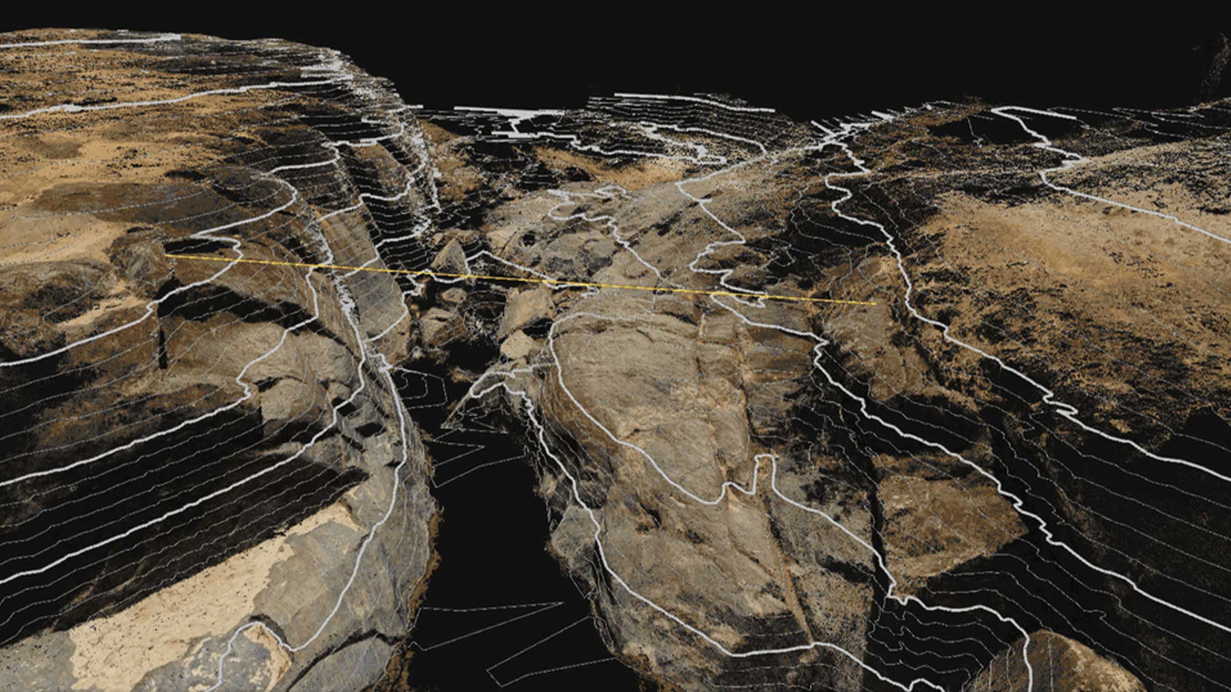
Studio Calastri used PIX4Dmapper to process the data. As this was a large-scale project with over 9000 images, the project had to be divided into three sub-projects. Out of the eight placed GCPs, they converted three into checkpoints for additional control. This phase also took several days to complete. They reduced the point cloud so that the clients could manage it without any issues. The orthophotos were left as they were generated during the data acquisition.
Re-processing with PIX4Dmatic
After Studio Calastri completed the photogrammetric survey of the lake with PIX4Dmapper, Giacomo Cariboni, a team member who worked on the project, decided to re-process the project using Pix4D's next generation software, PIX4Dmatic. PIX4Dmatic is better suited for a project of this scale, and Cariboni wanted to see the comparative results. Using PIX4Dmapper they had had to divide the project into three sub-projects, each project containing around 3000 images. The division was necessary as PIX4Dmapper has a limited capacity to handle a large number of images.
The challenge with PIX4Dmapper was to ensure that the three sub-projects overlapped correctly without georeferencing issues. Traditional ground control points and checkpoint points were added to continue the data registration. With PIX4Dmatic the data registration process was entirely different. Cariboni created a single project with the 9200 images, eliminating the problem of project overlap and simplifying the georeferencing. He calibrated the project with GCP and verified the accuracy with checkpoints.
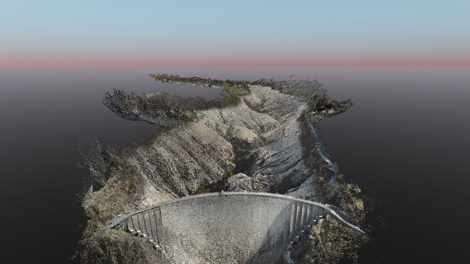
PIX4Dmatic enabled him to obtain a more comprehensive project. The data registration only took 32 hours - so PIX4Dmatic reduced the project time by half, and the generated data had significantly smaller file sizes. He found PIX4Dmatic’s noise filter invaluable for removing the noise that affected the lake background.

(Re-processed) Project Details
| Location | Valle Verzasca, Switzerland |
| User | Studio Calastri |
| Software used | PIX4Dmatic |
| Hardware used | Matrice 300 RTK with Zenmuse P1 |
| Processing hardware | CDell PC, i7-10700KF, CPU 23.80 GHz, 64 GB RAM |
| Area covered | circa 2.40 km² |
| Processing time | 32 hours |
| Total number of images | 9,200 |
| GCP | 8 cm/px |
| Checkpoint | 2 |
| GSD | 2,4 cm/px |
The project at Vogorno Lake showcased the potential of photogrammetry for modern surveying. Using entirely Pix4D software resulted in a faster and more dynamic data flow for the team. In the window that the reservoir was empty, the team successfully managed to survey the area and get a detailed analysis of the terrain. Finally, after reprocessing the project in PIX4Dmatic, Cariboni noted how PIX4Dmatic saved time, and improved the final quality of the results, making it the perfect software for a project of this size. However, he did note that, with the right precautions, PIX4Dmapper can also handle a similar project.
“Through this project, we have shown that with a simple drone and Pix4D it is possible to achieve results that until a few years ago were only achievable with an airplane or helicopter, while maintaining precision and accuracy. PIX4Dmatic is the ideal tool for projects of this scale." - Giacomo Cariboni, Geomatics, Digital Models Department, Studio d’ingegneria Riccardo Calastri SA