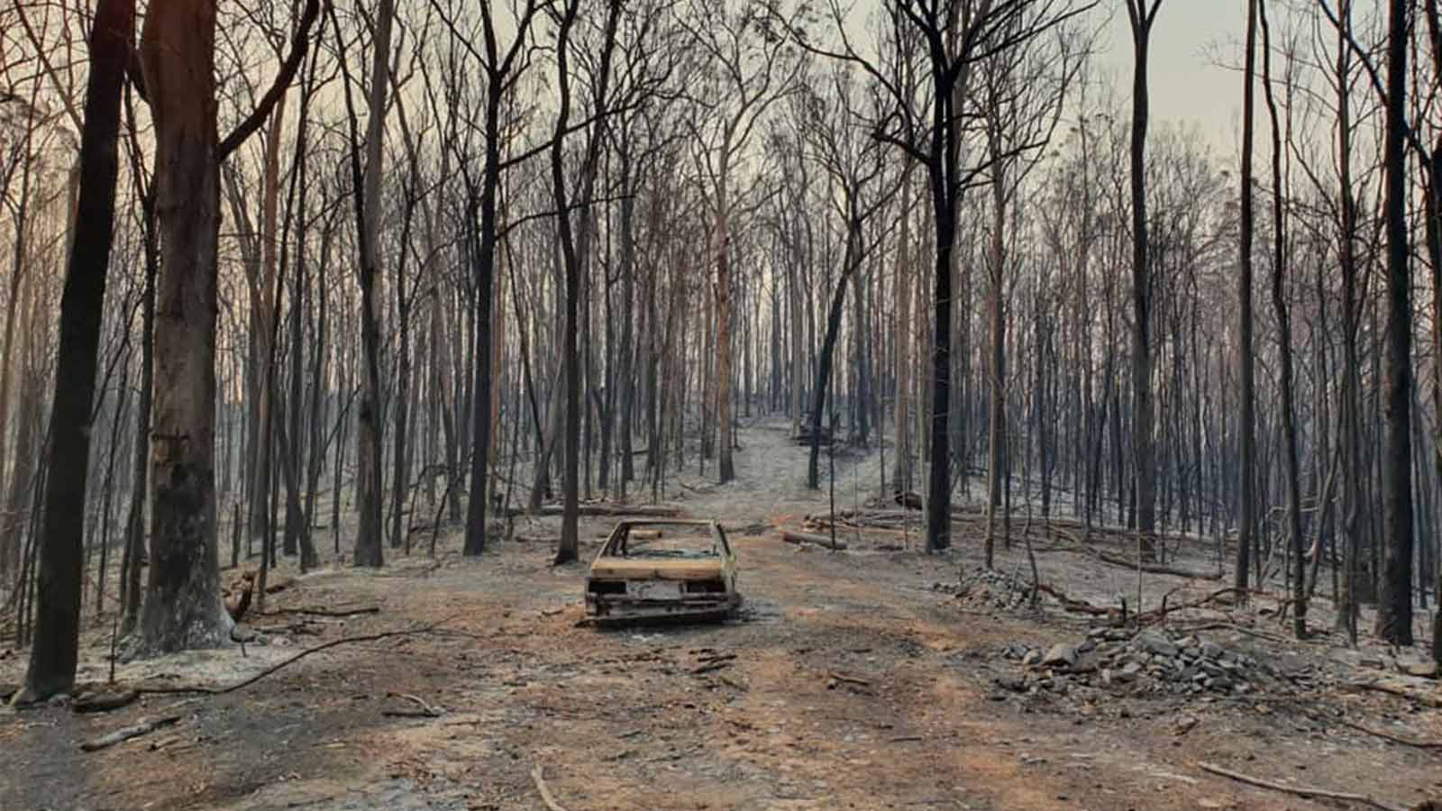
How drones are used in search and rescue
For over a decade, Gene Robinson1 has been a leading expert in drones for search and rescue. Robinson sat down with Pix4D’s Angad Singh, to discuss all things aerial.
- What is search and rescue?
- How does search and rescue work?
- Who is the most important person in a search and rescue operation?
- Which data are the most important to collect?
- What is imagery used for?
- How are drones used in search and rescue?
- How does PIX4Dreact helps in finding a target faster?
- What is one feature of PIX4Dreact you find very useful?
- Do you have any hardware tips for flying drones in adverse conditions?
- How useful do you find the produced map?
- Which other useful features does PIX4Dreact have?
Pix4D: Thank you for agreeing to talk to us today, Gene! Let’s begin at the beginning: What is search and rescue?
Robinson: Search and Rescue - SAR - is a service that is provided across Public Safety agencies. It has historically been the purview of fire departments, but now a team can be made up of specialists within a municipal police department, or a county sheriff’s department or even an Office of Emergency Management, or OEM, at the county level.
The emergence of private SAR teams such as TEXSAR2 and Texas Equusearch3 in the United States, has bolstered the capabilities of any local agency requiring that skill set or expertise they may not have. Additionally, because private SAR organizations are operated on donations, they may specialize in a certain field such as drones, boats, dogs, or foot searchers that utilize the latest of technologies to perform searches.
Pix4D: How does search and rescue work? What is the search structure?
Robinson: Search and Rescue has a very well defined structure - even if to an outside observer it may appear chaotic. Almost all searches in the United States are conducted under National Incident Management System (NIMS) protocols that have a formal structure and has training standards that are available for free for those interested.4
What is NIMS?
The National Incident Management System5 is a comprehensive, national approach to incident response and management. Regardless of the incident’s size, scope or cause, NIMS is a common standard for incident management. As well as giving responders a guideline on how best to move forwards, the NIMS framework improves public communication and cooperation.
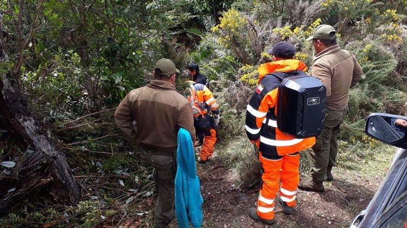
Who is the most important person during a search and rescue operation?
Robinson: The most important person in a search and rescue effort is the Incident Commander or the Search Coordinator. This is true whether the NIMS standard is utilized or a small search is executed by a band of civic minded folks. The Search Coordinator manages available resources and acts as “field general” coordinating all movements and making sure the search is conducted in the most effective way possible.
What sort of data is the most important to collect in a search and rescue effort?
Robinson: With the advent of lightweight drones and high resolution cameras the natural tendency is to think that video would be the best data to collect in a search.
While it is useful to provide a situational awareness video has several disadvantages that make it the least desirable to obtain. The biggest one is that even 4K video when compared to still imagery is equal to an 8 megapixel image. Most cameras these days are capable of producing a still image in the 20 megapixel range - or even higher. Why would you want to give up that much resolution? That extra resolution can make the difference between identifying a solid clue that could be key in a recovery, or missing it all together!
So still imagery is the most useful thing to capture in search and rescue? What is it used for?
Robinson: Still imagery is the “bread and butter” of what drones for SAR can be utilized for. These high resolution “snapshots” provide a wealth of information to not only the Search Coordinator, but also down to the “boots on the ground” person trying to do their best to find this poor unfortunate soul who has gone missing. Many times the imagery all by itself is enough to execute a successful search by identifying where an individual is while the drone is still in flight!
How are drones used in search and rescue?
Robinson: Think of resource management and advanced decision making processes. UAVs in search and rescue missions can provide so much detailed data quickly and efficiently that they directly impact the decision making process that any IC or Search Coordinator goes through to conduct the search. With drone imagery, all parties involved know there is a stream, fence, cliff, hill, obstacle or something that will require special equipment or skill. This precludes sending a team out blind and having them encounter said obstacle unprepared. All this can impact the time to find when minutes matter!How does PIX4Dreact enable you to find your target faster?
Robinson: PIX4Dreact is a blessing, bringing that full situational awareness and confidence by quickly providing what I call a “minute time” view of the area to be searched.
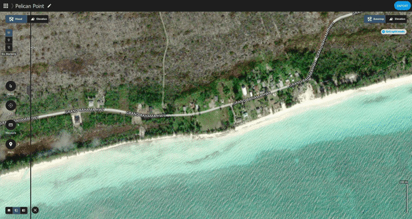
PIX4Dreact: photogrammetry software for search and rescue
An overall picture built by PIX4Dreact utilizing imagery that was taken just minutes ago is invaluable. Not only does it provide data of the area covered by high resolution imagery, it allows each and every participant to view what is ahead of them. Forewarned is forearmed as the saying goes. No false starts, no delays in deploying, and no missing equipment because “we just didn’t know.”
In the early days we attempted to do this by utilizing Google Earth and the image overlay function to produce something that would give coordinates and directions, which was time consuming and prone to errors.
What is one feature of PIX4Dreact you find very useful?
Robinson: Search and rescue operations rely heavily on individual orienteering skills by foot searchers. Any search coordinator would like them to have as much data as possible to reduce the amount of time it takes them to get to their subject. One of the key factors in this equation is distance. “Just how far away from this point is our subject?” With PIX4Dreact that distance is accurately calculated with the stretch of a line across the image! The free companion ground control software (GCS) in PIX4Dcapture also makes absolutely sure that you will get 100% coverage from your flight before you even start the process with PIX4Dreact.
Do you have any hardware tips for flying drones in adverse conditions?
Robinson: Since it is winter time, one of the most often questions I get is how to keep your equipment warm. Since cold saps our batteries the quickest and we can typically expect winter winds, flight duration is the most affected. Do your best to keep your batteries in a warm place, even if you have to wear them inside your jacket and use your own body heat to keep them at an optimal temperature range.When the map is produced, how useful do you find it?
Robinson: Luckily we are seeing more and more search and rescue operations teams upgrade their ground equipment and data processing equipment. Since PIX4Dreact will run on just about any normal laptop, that piece of data processing can now serve a dual purpose as a display. And as flat screen TVs have gotten cheaper they are finding their way into “mobile command units” that may be an SUV with an inverter to provide the electricity required. Combine these two and you have a “mini IT” field solution that can process the PIX4Dreact data, display the resulting maps on a big screen in a size that all can view and make decisions from, and finally send that data out to all that need it!
Are there other features of PIX4Dreact that are useful in a SAR situation?
Robinson: This is a “where do I begin?” question. After the map has been produced by PIX4Dreact, the tools it contains pretty much as much orienteering information the search and rescue operations team needs to go directly to your subject. You can easily “mark” either a point on the map or even a smaller area and give exact GPS coordinates to those equipped with handheld GPS devices.
You can use the measure tool to measure distances between any two points on the map with a high degree of accuracy, allowing you to estimate your travel time. And while this is a bit off the subject of SAR, using the area tool allows me to quickly and accurately determine the number of acres burned in a wildland fire for my fire department reporting purposes. No more “walking the perimeter” to estimate the number of acres involved.
At the end of the day, whether the search was successful in finding the victim or not, the information that is recorded through PIX4Dreact is important as a permanent record of the area and effort involved. If anyone needs to review that data at a later date, it is readily accessible in several different formats. If new searches are conducted it can be used as archival information for the new search party and how the area may have changed since the last search.
Thank you, Gene!
References
| 1 "Gene Robinson", Back to top 2 "TEXSAR", Back to the article 3 "Texas Equusearch", Back to the article 4 "FEMA", Back to the article 5 "National Incident Management System", Back to the article |