70% faster: high-rise building inspections with PIX4Dinspect
The full inspection of a building can take days to complete. Hours of work can be spent gathering data, in addition to installing equipment such as scaffolding or abseiling material to enable access to the area. If a building is multi-story, it can also take time to ensure there are no risks to inspection staff as they eliminate the chance of falling.
Professionals are now turning to drones for building inspections to save time and energy. With the right drone mapping technology, images captured with a UAV can be turned into accurate 3D models that can be measured, analyzed, and shared without anyone having to climb the tower. A recent building facade inspection used PIX4Dinspect to analyze 7 stories, assessing a total height of 137 meters. The success of this workflow is being replicated around the world by inspectors choosing to reduce the risks for their staff and speed up inspections. With a drone inspection, they can get clear, accurate data with shareable results that set them apart from the competition.
Planning an urban building inspection with drones
Drone Visual is a Brazilian company that sells drone solutions and software as an official Pix4D partner. They work on providing drone services as well as training to assist in drone inspections. Recently, the Drone Visual team was contracted to inspect the facades of a tall building in Rio de Janeiro, Brazil. The main aim was to identify signs of wear in the structure, which would require a comprehensive analysis. The focus of the project was a fast turnaround with accurate results.
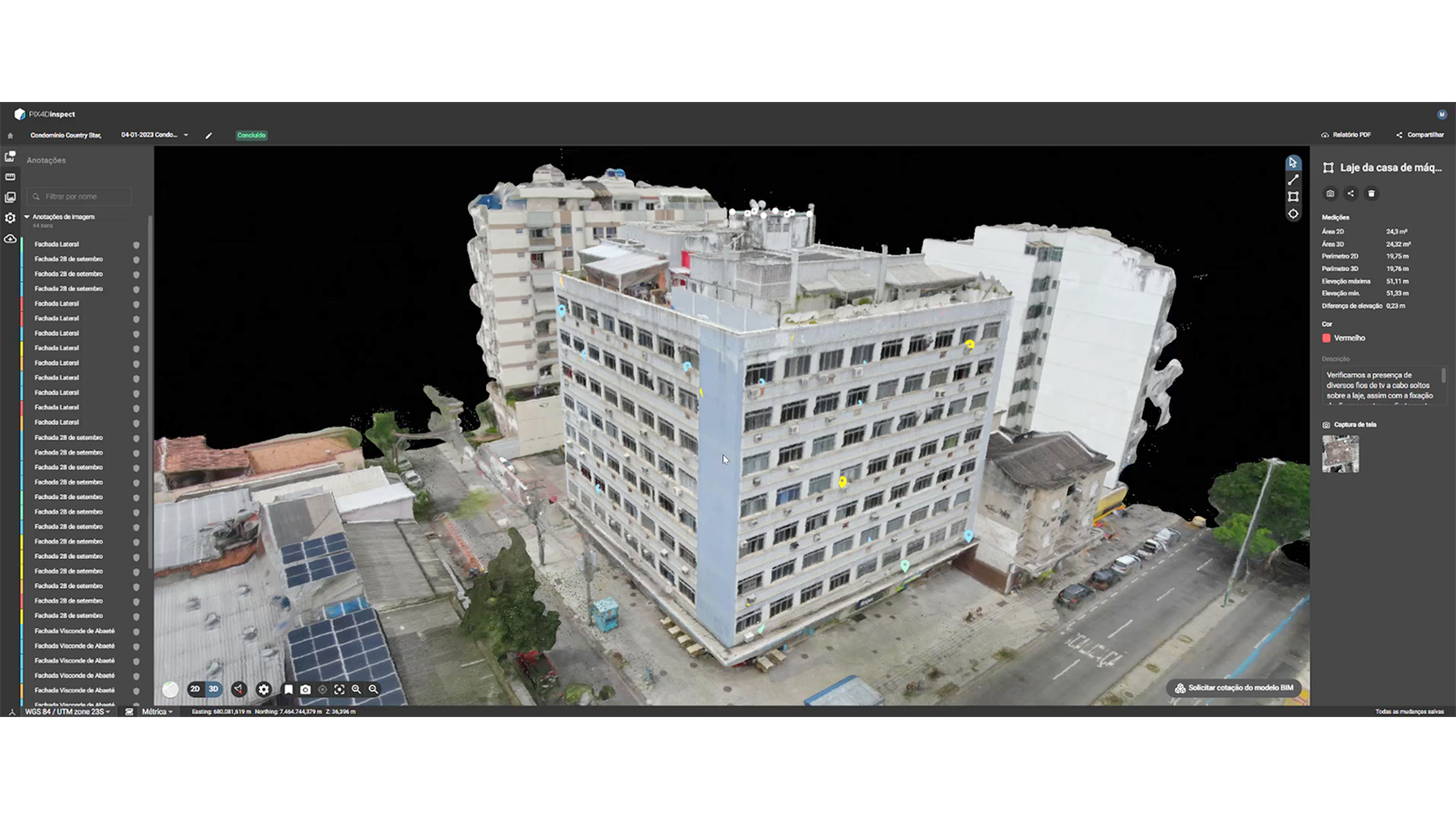
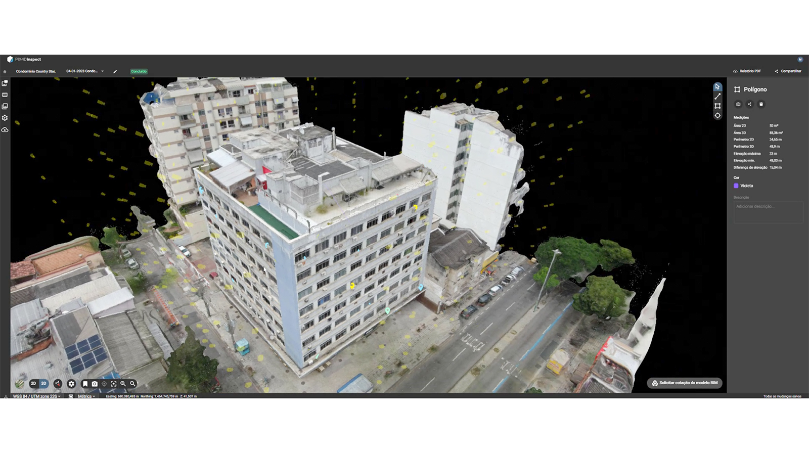
The team chose to use PIX4Dinspect, a specialized inspection platform designed to use AI and machine learning to automate and streamline inspection workflows. It has already been used to reduce the time required to inspect transmission towers by 60%, with more drone inspection success stories being replicated around the world. With this solution, Drone Visual would be able to share a 3D model with their client that the client could share and analyze with other colleagues easily.
Project details
| Location | Rio de Janeiro |
| Company | Drone Visual |
| Software | PIX4Dinspect |
| Area of building surveyed | 2500 meters2 |
| Images collected | 504 |
| Hardware used | DJI Mavic 2 Zoom |
| GSD | 2 cm |
Setting up a drone inspection for a building
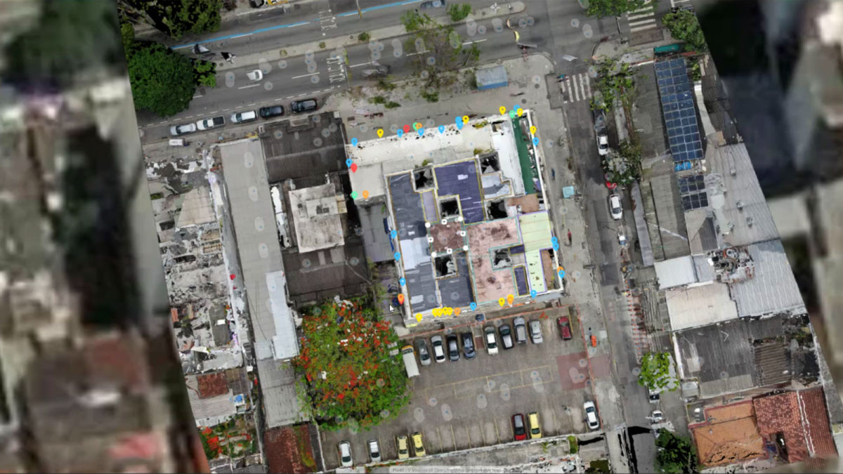
The team from Drone Visual set out with a DJI Mavic 2 Zoom, which they flew around the building in several individual flights to gather data. A total of 504 images were captured, which covered a total area of 2,500 square meters. The flight time took a total of 1 hour and 30 minutes, which is far faster than any manual climb around the entirety of a building could take.
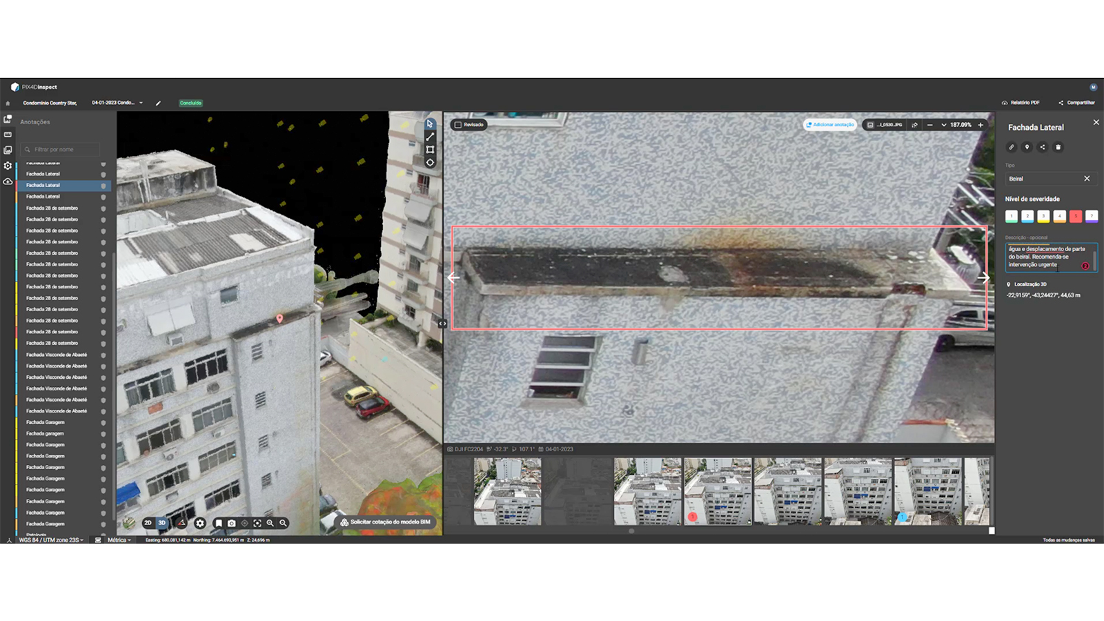
The imagery was then uploaded to PIX4Dinspect where processing began immediately. Once the results were completed, the team received an email notification that their project was ready for inspection. The analysis of the 3D model took place over 8 hours, with a range of faults detected that include: wear on paint, air conditioning unit maintenance requirements, loose cables, cracks in the walls, and more.
All 4 facades of the building were analyzed - which could take 40 hours to complete with a team of two people using traditional methods. This project's total turnaround time, including data collection, processing, and analysis, was just 12 hours - meaning 70% of the usual work time has been saved!
Rolling out aerial building inspections
This project was the first of its kind for Drone Visual and taught them how to perform data capture flights for building facade inspections. Thanks to the smooth workflow and intuitive feel of the technology, they had results ready in a record-breaking turnaround which impressed their clients. This project has also been added to Drone Visual's portfolio, demonstrating to potential new clients that this technology has been successfully replicated in a range of business assignments.
“The didactic and intuitive way of using all the Pix4D software is without a doubt one of the points that I like most about the platform, in addition to the processing time that, compared to other software on the market, has the best algorithms to speed up processing” - Jonas Vidal, system analyst.
As aerial inspections with drones roll out across industries, they are cutting down risks and data collection time. This project simultaneously proved the merit of investing in drone technology through the immediate time and cost savings it provided.