
PIX4Dfields 2.1: NDVI satellite preview and new PDF reports!
Improved PDF reports
Do you want to be able to quickly and easily spot problematic areas in your fields and keep a detailed record of any field or crop damage for insurance claims? PIX4Dfields 2.1 is here to simplify the process. With the new PDF report features, you are now able to customize your PDF report, classify your annotations, and categorize damaged areas by color, as well as keep a record of individual annotations and notes.
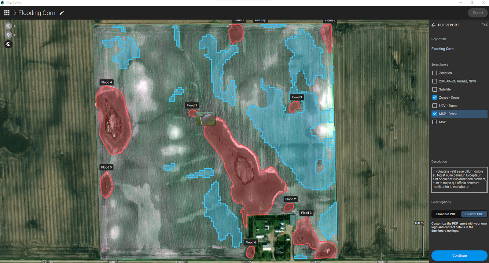
Check out our support article about the Customized PDF report and summary page for annotations.
Satellite NDVI index preview
It is now possible to preview the NDVI index from satellite images. This means you can get insight into your crops’ health and nitrogen levels even faster than before.
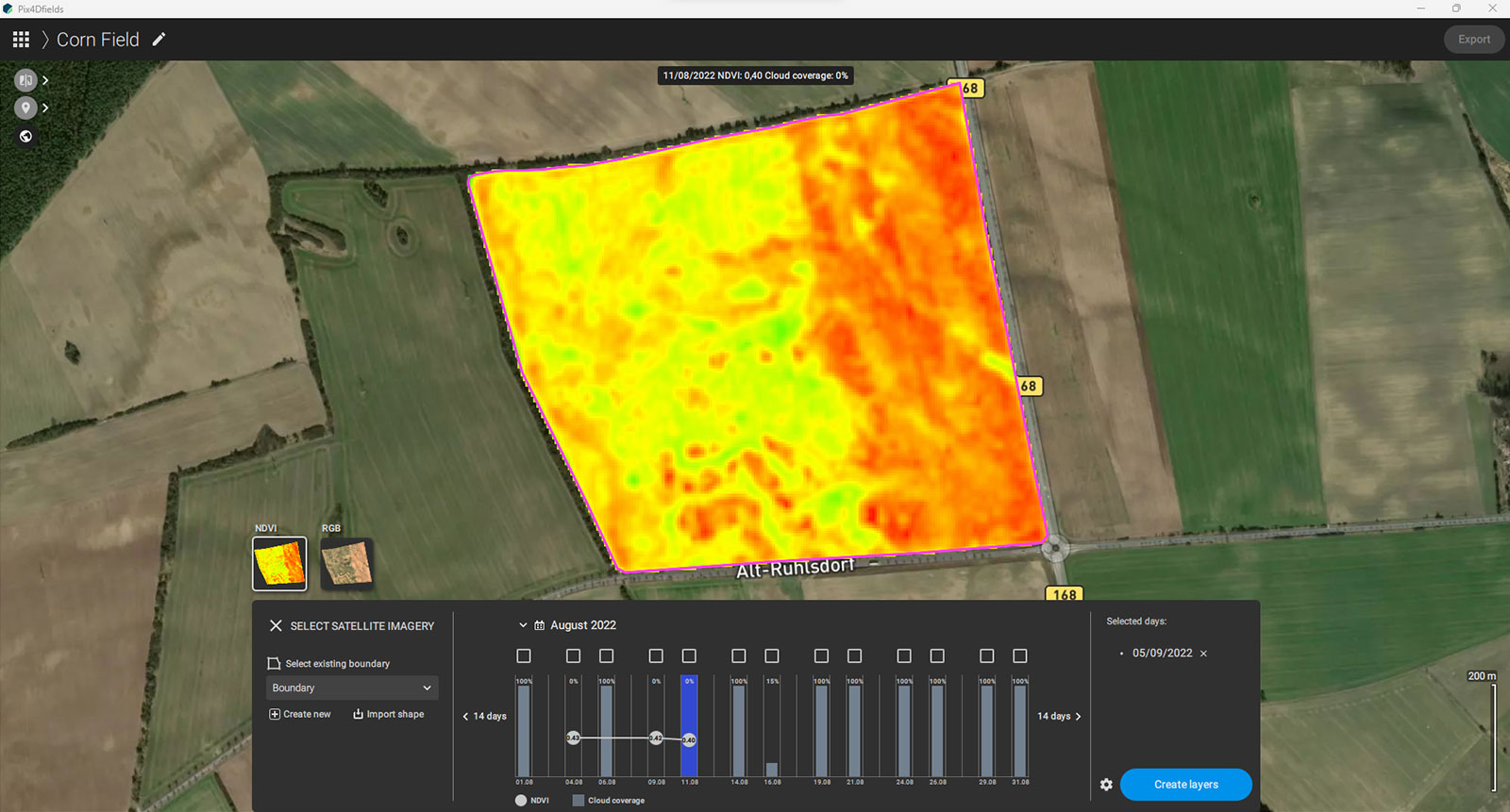
The addition of satellite data and access was introduced with PIX4Dfields 2.0 with the intention of providing growers and farmers with access to more crop insights and data than ever before. The satellite data can be used as a preview prior to more detailed drone data collection, or to check on the progress of a field without a drone flight.
New language added
We have added one new language to PIX4Dfields: Polish. The software is already available in English, French, Italian, Chinese, German, Russian, Japanese, Spanish, Portuguese, and Ukrainian. Work in the language that best suits you to improve your workflow.
PIX4Dfields 2.1 builds on the ongoing improvement of a unique hybrid solution for drone and satellite mapping in agriculture. With enhanced PDF report features and a vegetation indices satellite preview, you can now have valuable information that is even easier to acquire to inform your decision making whether you are in an office or in the field.


