
Will it fly? Students building their own agriculture drones
Yamhill Carlton is a secondary school of around 300 students in Yamhill, Oregon, surrounded by agricultural land. Around 20-30 students have worked on different agriculture based projects in total since the school was started, and are positioned to promote giving back to the community by students. The school works with local businesses, farm owners, and technology experts to provide UAV services as needed to their local community.
Building a custom drone for a precision agriculture workflow
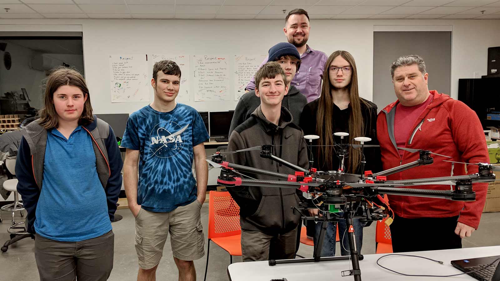
This project began in the spring of 2016 when Yamhill Carlton were approached by a local farmer. He offered to fund the initial investment if the school was interested in flying his crops and provide a prescription for growth inhibitors. Over the next three years the school team worked with local experts, hobbyists, and professionals to construct a one-of-a-kind, completely customized UAV with hover times in the 45 minute range. The custom drone was equipped with a MicaSense RedEdge camera on a custom gimbal that was designed and manufactured by the students. Tools like this can make agricultural land use more efficient, as the students discovered.
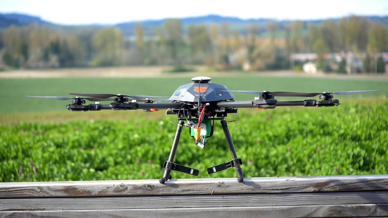
Unfortunately, the project hit a snag when their system lost power mid-flight to three out of the six rotors. They had nicked a wire when rebuilding an arm without realizing it, and the aircraft was a total loss and crashed. The payload (RedEdge), however, survived and the next year the team came back with a new commercial DJI S1000+ airframe, and with the addition of PIX4Dfields to their software suite.
This year, the school finally had a software solution that worked out of the box in PIX4Dfields and a UAV that was rock solid and reliable in the air (the DJI S1000). When they took it all out to the field for the first all-up test, they found that in making their purchasing decision based on a large, robust airframe they had lost a lot of capability in terms of duration. As a result, while they could cover the smaller jobs they were working on, they did not have the battery life to cover some of the larger fields.
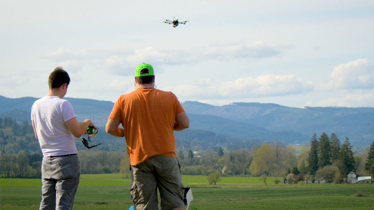
In the end, a simple Phantom 4 ended up being their workhorse. With a little ingenuity and custom design work, the team was able to mount their entire rig to the Phantom, and in the second week of April, the team successfully flew, processed, and delivered a map for both the 100 and 170 acre grass fields they originally promised.
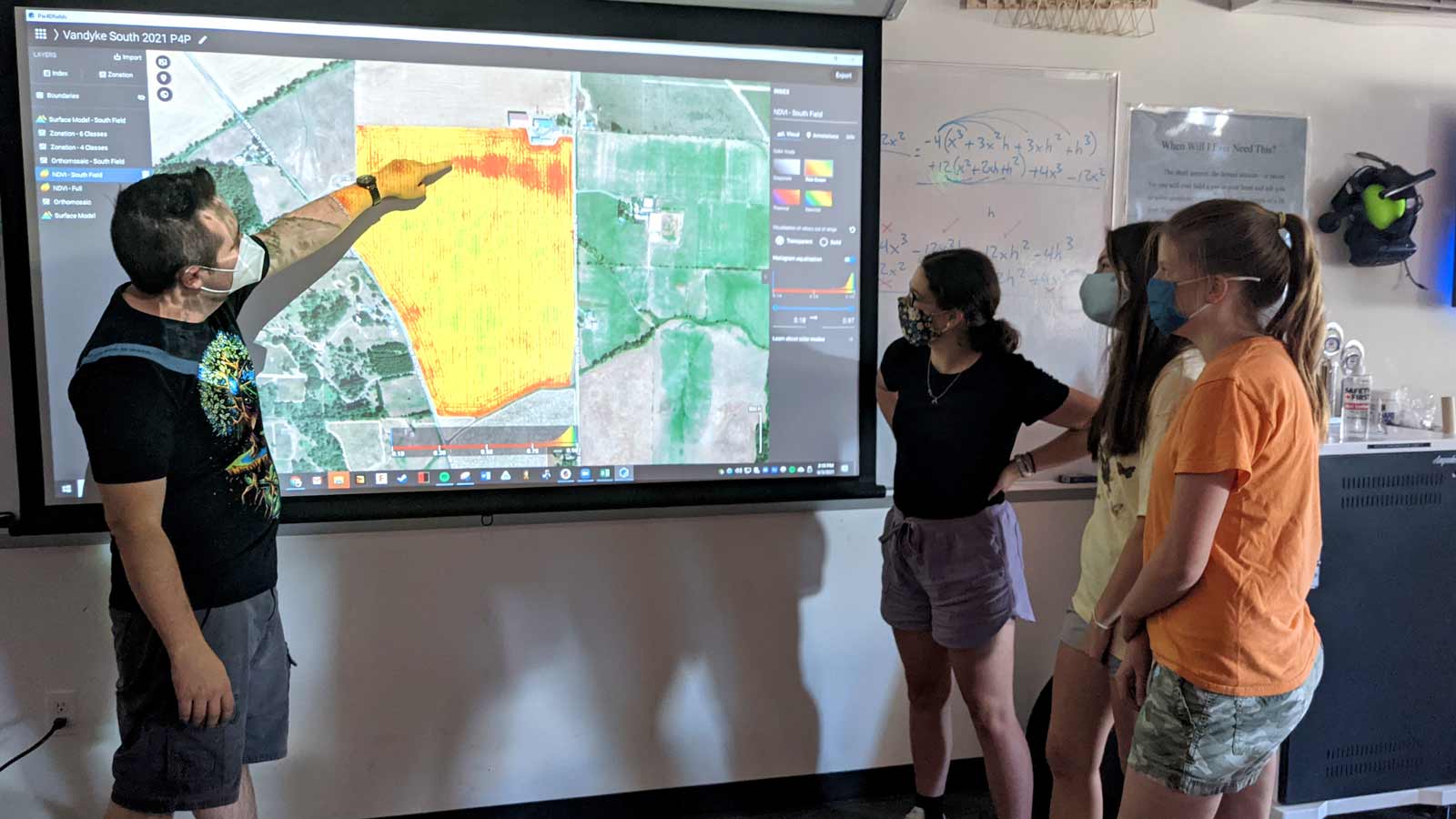
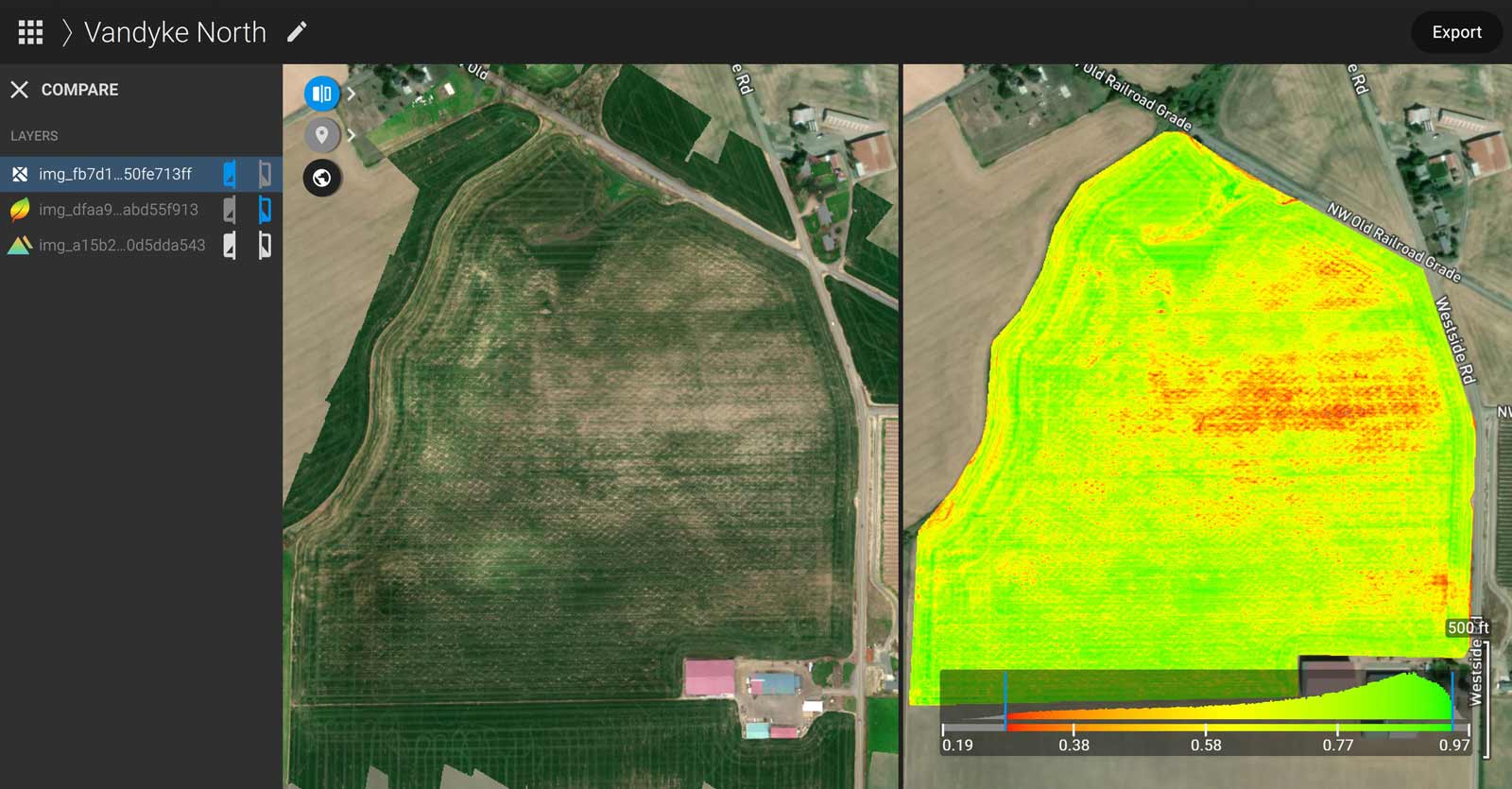
Bringing the 21st century into the classroom with PIX4Dfields
Because this field has been flown and imaged multiple times via manned aircraft, in addition to providing data the team has a benchmark with which they can compare the results. In the future, the students are looking forward to getting into the field on foot and analyzing the specific patterns and trends seen in their dataset in order to make further recommendations to the land-owner.
| Area covered: | 100 acres at 75% side overlap, and 170 acres at 65% |
| Number of images: | 1640x5 bands, 8200 total |
| Image resolution: | 1280x960 |
| Camera: | MicaSense RedEdge on custom gimbal |
| Drone: | DJI S1000+ UAV, Phantom 4 Pro UAV, DLS. |
| Software | PIX4Dfields |
“PIX4Dfields has been instrumental in the process at every step of the way, and really brought 21st century learning to life in the hands and minds of our students - the pilots, the engineers, and the agronomists”, shares Jordan Slavish, Engineering Teacher at Yamhill Carlton. “This software provided us with an accessible entry point to a technically complex problem. It breaks down the process into clearly understandable and easy to explain steps, and allows my students to grasp something that is truly cutting-edge technology. Pix4D has given our students a sense of pride by giving them the language and tools to engage in high level, real world discussions with boots-on-the-ground working people.“
“Initially we had played with other free apps, but found pretty quickly they simply didn’t have the reliability and reputation for accuracy that Pix4D had. After spending some time learning about PIX4Dmapper, we stumbled across the release of PIX4Dfields and it was a lightbulb moment.”, shares Jordan.
"We went from struggling through point clouds and GCPs to point and click spray maps in under 20 minutes, and for the first time in the project we could visualize a path to completion."
Yamhill Carlton School
The school collaborated with other local schools to make UAVs more common in their area. They worked with an expert Intel engineer to design and optimize their aircraft, and MicaSense to get the RedEdge camera. The school team reached out to local farmers and co-ops to understand what they needed and how they could add value to their product.
Solving real-world problems for real people
Yamhill Carlton school has programs that strive to integrate their students into the community with 21st-century skills. This project builds an enduring bridge between multiple aspects of Yamhill Carlton school and community. It ties strong academic students in with strong hands-on learners and brings them together with local businesses to demonstrate concrete skills to their larger community. It provides a high-level experiential education for small-town students, and has a lasting impact on what learning looks like.
At Yamhill Carlton School, they like to say they’re blurring the lines between the academic and professional worlds. This project was the impetus for that motto – by putting professional tools in the hands of students to solve real-world problems for real people, they revolutionized what learning looked like and meant for our students.
“Pix4D was instrumental in this process, because it is the key professional tool that made this possible. This project has spawned countless others in the same mindset at YCHS – from drones, to rockets, to CNC job shops – Pix4D was the professional world sticking its foot in the door, and without it, our district would be a very different place today.”, concludes Jordan.


