WEBINAR
How to have a successful season with a complete agricultural drone mapping solution
About the webinar
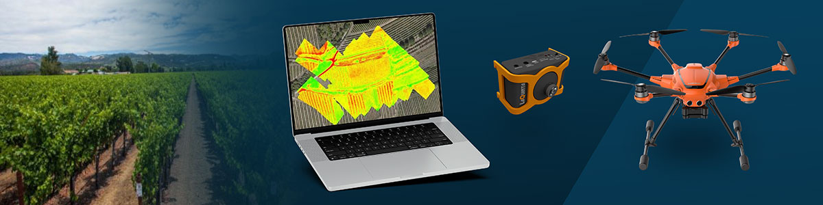
Do you want to hear about a smart agriculture solution? In this webinar you will discover how PIX4Dfields software, a YuneeC H520E drone and a LaQuinta multispectral sensor were used for precision agriculture and smart farming during the last growing season of De Databoerin.
Crop monitoring with drone imagery provides accurate and quality data that help farmers plan better with faster planning and economic savings for agricultural resources.The growing global demand for food and better resource management calls for the use of such technologies and agricultural solutions.
Join Pix4D’s Julius Petri, DB2 Vision co-founder Igno Breuker, and De Databoerin founder Nicole Bartelds for an insightful discussion about how the LaQuinta multispectral sensor and YuneeC H520E drone were used in combination with the advanced agriculture mapping software PIX4Dfields throughout growing season to derive actionable crop data.
Topics discussed:
- Introduction to PIX4Dfields, more than just a map, an agricultural solutions software. How PIX4D’s fast, offline edge processing algorithms and satellite data access help farmers with field Scouting, variable rate crop management, and site-specific weed control.
- Introducing the LaQuinta multispectral sensor for crop health analysis integrated in the YuneeC H520E drone
- Nicole Bartelds, a smart farming consultant at De Databoerin, will be presenting a use case on how the full solution was used for crop scouting throughout the last growing season on her farm.
- Your questions in our Q&A session
Panelists: