The latest Pix4Dbim updates
Important update: Pix4Dbim is now Pix4Dcloud Advanced
Today we’re excited to share the latest updates to Pix4Dbim. Read on to learn more about the new interface, the 2D Comparison tool, plus significant improvements to the Overlay tool.
New workspace for a smoother workflow
Improved organization and tools
The Pix4Dbim Cloud workspace has a new look for a smoother workflow.
Projects have been rearranged, with your own sites, demo datasets and uncategorized data grouped in the left menu. You can also create folders to arrange your dashboard your way.
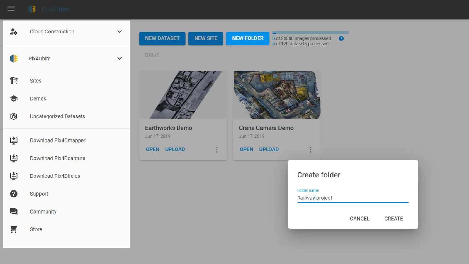
Open up a project and you’ll see the left menu is organized into layers, overlays and annotations. Annotations can contain more information and can be grouped together.
Clearer visualization
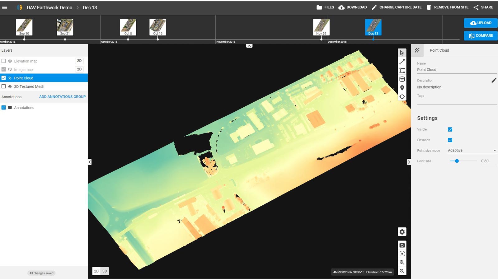
The 2D/3D toggle has moved - you’ll find it at the bottom left of the viewer.
Annotations are now synchronized in 2D and 3D. Annotations and measurements added in the 2D view will be shown in the 3D view - and vice versa.

When you add a marker, its information is now displayed in the project’s coordinate system as well as WGS84.
Hover over the project to see the position display at the bottom right corner of the screen
More advanced point cloud settings
Choose an adaptive or fixed point cloud size - the latter option may help areas with low point density display better. You can also color the points according to their elevation.
Easier reporting with the new screenshot tool
The new screenshot tool is useful for reporting and simple to use: just find the view you want to capture (in either 2D or 3D) and click the button at the bottom-right of the viewer.
Annotations and their labels will be included in the exported image to keep all the information together.
Support for GeoJSON and shapefiles
GeoJSON and zipped shapefiles can now be imported with one click, allowing you to add rich information to your projects.
Export annotations and measurements from one project as GeoJSON and import them into a new project. Or import files from third-party applications - just be sure they use the WGS84 (EPSG:4326) coordinate system.
Track site progress with the 2D Comparison tool
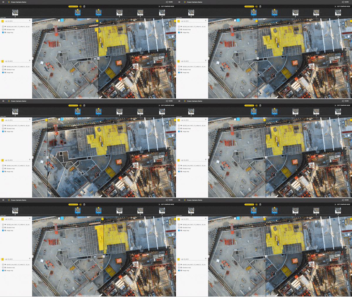
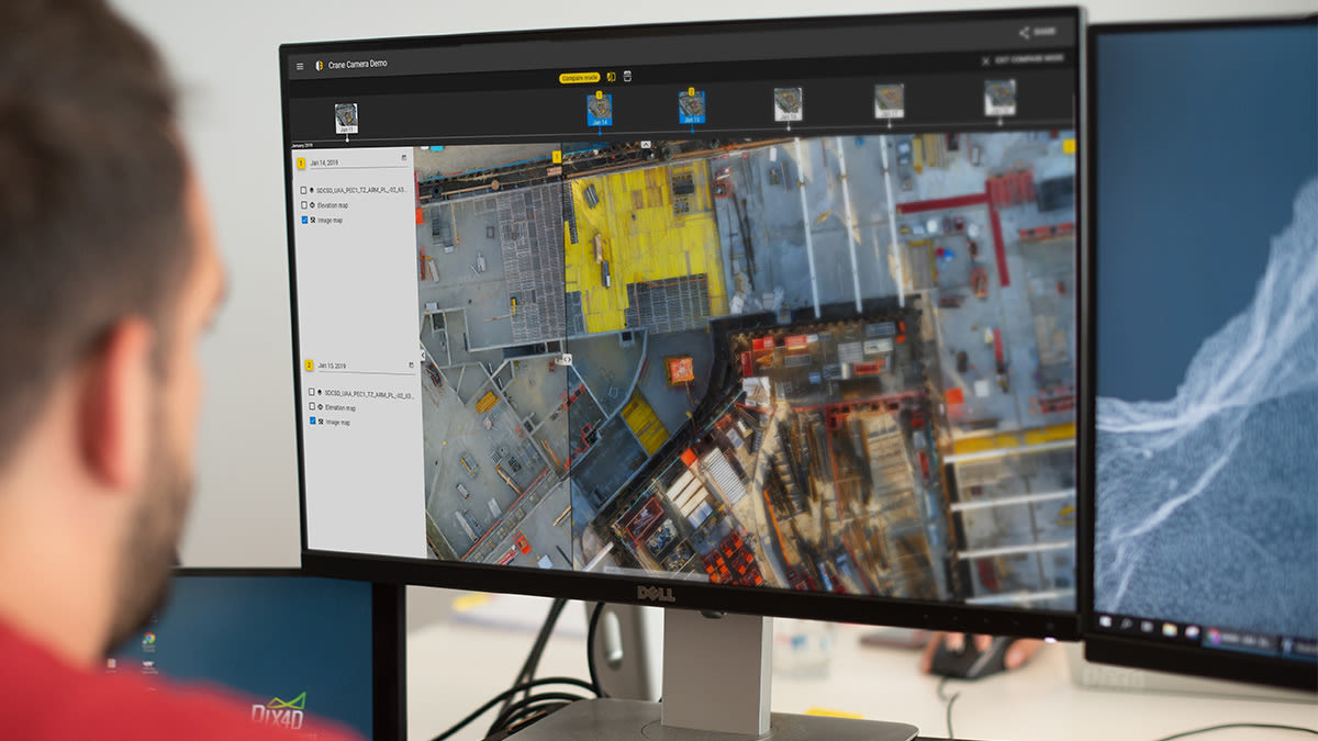
You can compare all 2D outputs: orthomosaics, DSM, and the imported CAD files, design plans or maps, either separately or together.
Share the comparison with team members onsite or remotely to make sure all project stakeholders have the same information.
Learn more on the Pix4D support site.
Check as-built vs as-designed with the improved Overlay tool
The updated Overlay tool makes it easier to import and overlay multiple data layers on your image map. The new marker system improves accuracy when positioning your design plans or maps on the orthomosaic. Georeference your overlays by editing the marker coordinates, or upload georeferenced PDFs.
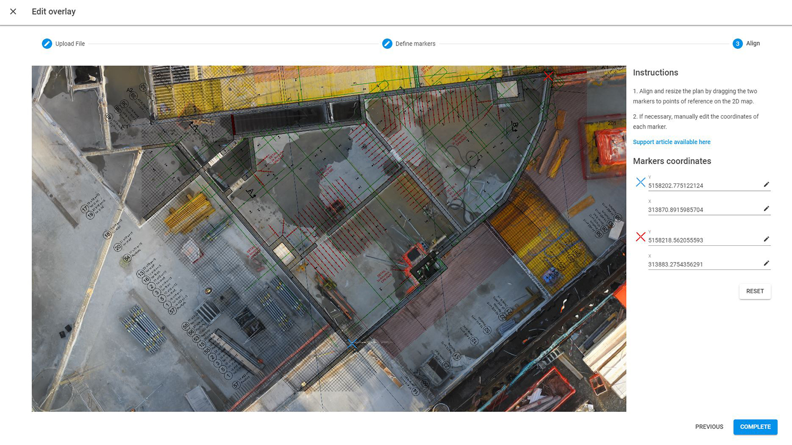
Once your overlay is imported, its position is applied across all datasets in the entire project. And to make sure you’re able to fully track the progress of the site at any stage of the build, you can add multiple files to the same map and choose to show or hide the different layers as needed.
The changes allow you to track progress more accurately, flag potential areas for rework faster, and smooth communication between subcontractors and stakeholders.
Learn more about the Pix4Dbim Overlay tool.
What’s next?
Sign up for our construction newsletter to be the first to hear about the next software updates.
