Water rescues thanks to drone mapping
Every 90 seconds, a person is reported missing in the UK.
At least once a day, Essex police see a missing person case which requires further investigation. While around 80% of missing persons are found within a day, as many as 5% of cases remain unsolved.
The missing are diverse: they are elderly and children; happily and unhappily married; alone in the world and with a wide support network.
The missing are diverse, but the found often have something in common: water.
Perran Bonner, Drone Manager and Operations Lead in Essex police explains: “Many people are drawn to water. That’s irrespective of their mental health, their age, anything like that - it’s just a natural pull. Quite often people fall in and then get into difficulties - or perhaps they have deliberately fallen in. Either way, we need to go and get them out.”
Essex has one of the longest coastlines in the country. Its green fields are crossed with canals and rivers, and dotted with lakes and ponds.
“In Essex in particular there’s an awful lot of mud here,” continues Bonner. “People are regularly stuck in the mud.”
One tool used to find and rescue the missing is drone mapping with Pix4D.
Preparing for success
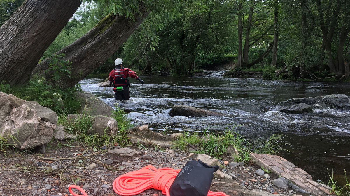
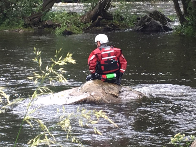
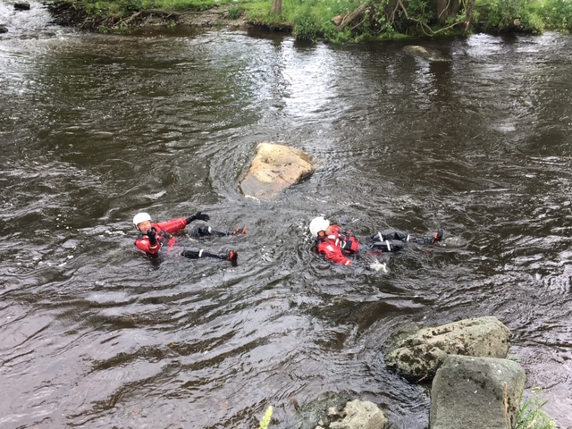
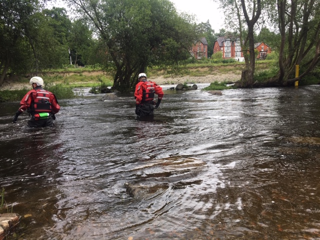
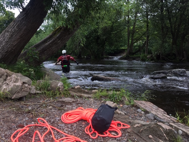
No training exercise can prepare a team for every eventuality, but as part of the force’s continued professional education, Perran and the Special Operations team headed to Wales. Their mission sounded simple: cross a river.
Project details
| Location | Wales, United Kingdom |
| Hardware | DJI Mavic |
| Software | PIX4Dcapture PIX4Dmapper |
| Images captured | 30 |
| Output | Orthomosaic |
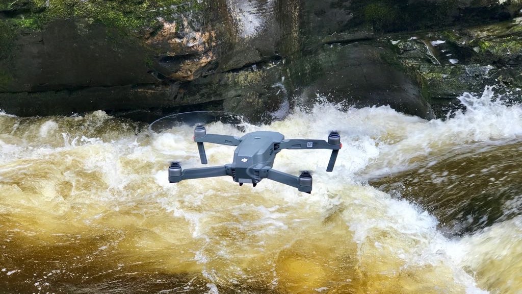
The team pulled up to the river and followed real-world proceedings. First, a flight path was plotted in the free flight planning app, PIX4Dcapture, then the DJI Mavic drone was launched.
The drone followed the flight path autonomously and within ten minutes had automatically landed. The images were loaded into the team’s operational laptops for field processing. The Essex police’s HQ is equipped with dedicated desktop computers for data analytics, but in this exercise speed was of the essence.
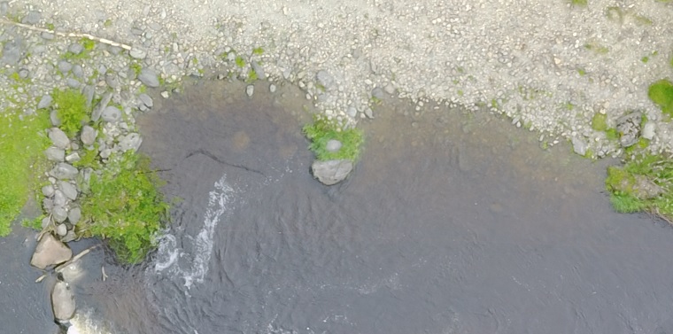
In less than half an hour Bonner and the Unmanned Special Operations team had processed an orthomosaic and inspected individual images for hazards.
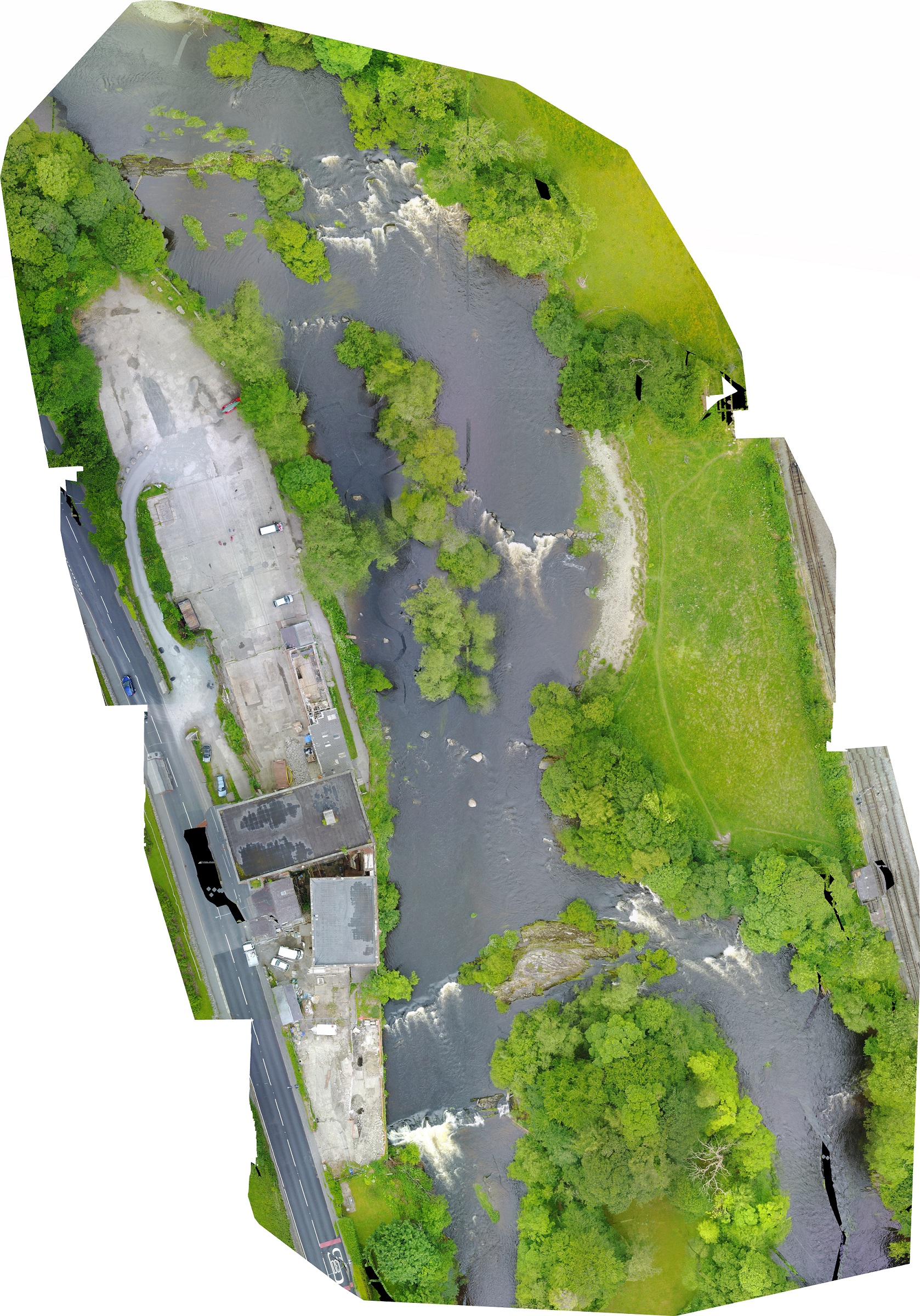
The output wasn’t perfect: the orthomosaic contained a number of artifacts. Moving water is especially difficult to map, although it is possible to get better results depending on the image acquisition. However, it didn’t affect the exercise. “We could clearly see good entry and exit points, where the rocks were, and the height of the water,” explained Bonner.
Obstacles and hazards were also highlighted in the orthomosaic, including a fallen tree. Just as importantly, it allowed the team to see the water currents, essential for the safe crossing of the river.
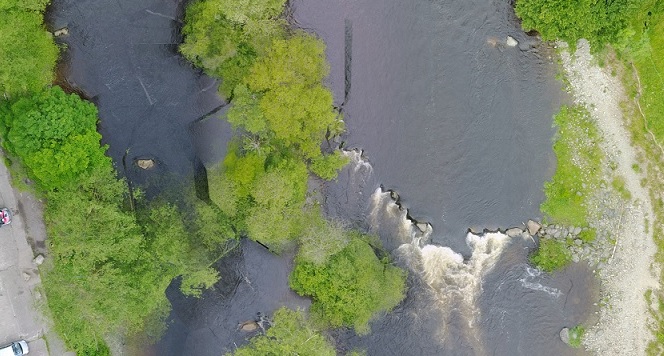
Bonner explains: “Very fast water can push you over as you’re wading. But if you can get into the lee of a rock, suddenly the water is very calm as you’re shielded by that rock. Using aerial imagery allows us to see those patterns and work out the best route across the river.”
Risk mitigation is an important principle for any emergency response team. While no situation can ever be 100% safe, policies are put in place to ensure the team don’t endanger their own lives to save others.
Despite the artifacts on the orthomosaic, Bonner believes orthomosaics are more valuable than aerial imagery. “We can map a whole area which can then be analysed and zoom into in great detail. It’s also helpful to be able to provide a wide mapped area to our partner agencies, such as Her Majesty's Coastguard.”
Real world applications
“There’s a surprising amount of deployments with this technology,” says Bonner. “Just a couple of weeks ago we recovered a body from the water with the help of drone imagery.”
“We’ve used the drone data analytics program to confirm - or not - if someone’s in a waterway. We’ve used it very recently to fly over an island in the middle of a lake to see if a person was on it.”
As well as looking for people, Bonner and the Unmanned Special Operations team use it to look for evidence that a person has been in an area. “We’ve used drone images and PIX4Dmapper software to look at a disturbance in shallow water, looking for footprints, and patterns which have been disturbed underwater.” Bonner added that, similar to lifesavers in Australia, they have also trialled using drones to fly out a rescue rope to a person in trouble. “We haven't done that in a real life situation yet, but if we had to, that’s how we’d do it,” he added.
Risk mitigation with drone mapping
Every body recovered from a waterway represents closure for a family and community - and danger to the recovery team. Entering waterways is inherently dangerous, and without good reason to enter, policy dictates the team stay on dry land.
Drone mapping with Pix4D is used as a first step before sending in personel. “Obviously everything the emergency services do is risk assessed and one of the best ways of doing that is using a drone,” explains Bonner, “We’ve used it for looking at some areas of riverbank which we can’t access as it’s too dangerous, or where we don’t want to put anyone in the water until we’ve looked at the aerial imagery. That’s a huge benefit to the technology.”