
Cheers to precision farming: drone mapping a hop field
When talking about Nelson, New Zealand, you inevitably end up talking about the weather. Sunny Nelson, or the top of the South, boasts the best weather in the tiny Pacific nation, with mild winters, warm summers and more sunlight than any other area in the country.
It’s an ideal location for growing crops, including hops. Rather than relying solely on the abundant sun, growers in Nelson are turning to precision farming with aerial photogrammetry.
Project details
| Location | Nelson, New Zealand |
| Company | DroneMate |
| Hardware | DJI drone Sentera single NIR sensor |
| Software | Pix4Dmapper photogrammetry software |
| Images | Around 200 NIR (Near-infrared) images |
| Project period | Results delivered within 24 hours |
| Output | NIR reflectance maps shared in farm management software and Pix4D Cloud |
| GSD | 11cm |
Charge your glasses
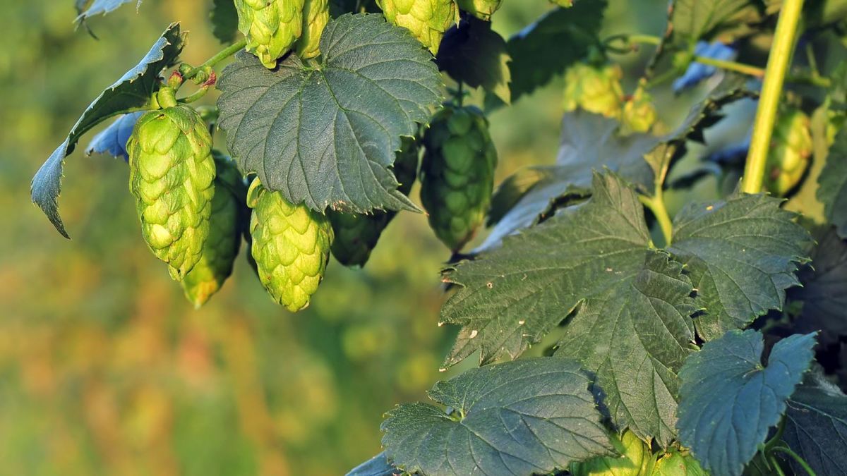
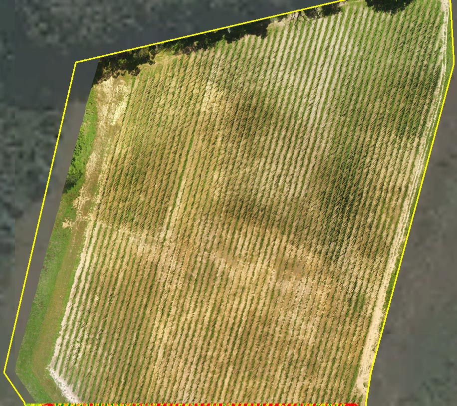
The hops which form the basis of your favourite beverage grow on a dense, twisting vine which is difficult to inspect over large areas. Crop monitoring is tricky, and any issues with the field can be hidden by its abundant foliage, making it difficult to diagnose and treat issues before they affect the plants.
That’s where drone mapping can help.
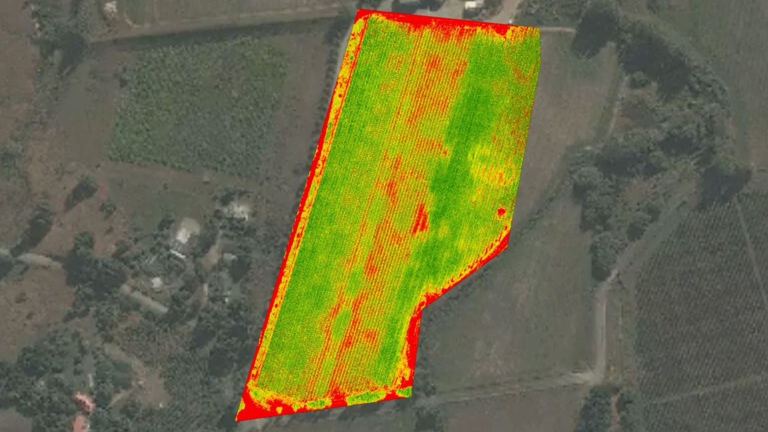
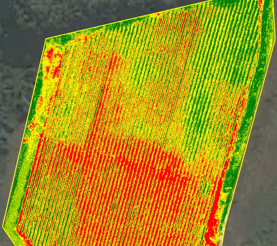
While aerial mapping offers a birds-eye-view, an NDVI (Normalized Difference Vegetation Index) map can offer more accurate data.
“An RGB camera and generic processing in other software doesn’t capture the information our clients are looking for,” explains Jonathan Lopardo, Chief Pilot and Operations Manager of DroneMate.
“With the wrong set-up, healthy grass can display the same way as healthy hops - if you make decisions based on that information, you are going to be disappointed. But if you use the right sensors, you can tell what part of your field is healthy hops, struggling hops, weeds, and dirt. You can see all of that if you zoom in on the project in Pix4D Cloud.”
Capturing the data
DroneMate flew aerial survey grids over several hop gardens with a DJI drone carrying a Sentera single NIR sensor. The near-infrared aerial images were processed in Pix4Dmapper photogrammetry software, and exported into the client's farm management tool.
“The key to getting a great reflectance map is flying on a day with uniform light,” adds Lopardo. “Not in bright sun, or on a day with clouds passing over the fields. You can also lay reflectance map targets, but in this case it wasn’t necessary.”
Initial insights and the plant health maps were delivered to the client in less than 24 hours. Typically, DroneMate share projects through Pix4D Cloud, which clients can access from anywhere.
Processing time is related to image size and ground sampling distance. In this case, the client was working with zones of high-performing and underperforming crops: precise accuracy was not as important as a quick turnaround time.
Crafting a beer
DroneMate’s preliminary analysis showed one area of the field was significantly underperforming.
The farmers were aware that the field contained dense, clay-heavy soil, but it had a greater effect on the crop than they had hoped. Further inspection prompted by the drone survey revealed a previously-unknown problem with the irrigation system.
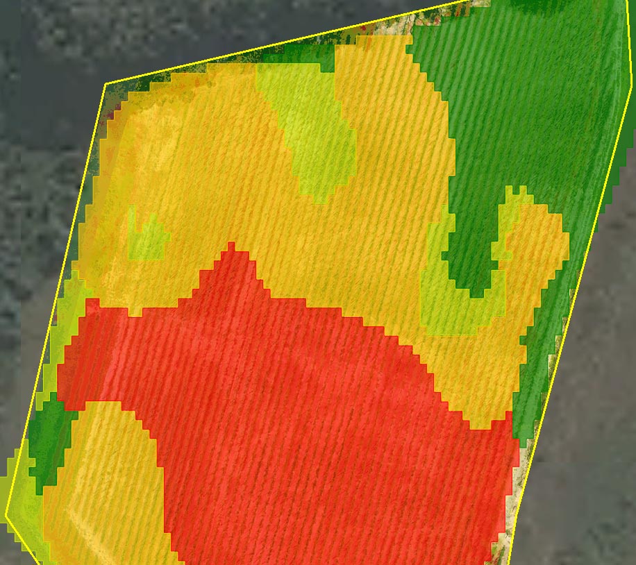
As a result of the drone mapping, the farmers made the decision not to harvest the underperforming area of the field. The fruit would be allowed to wither, causing less stress to the vine and improving the chances of a better performance the following season.
Balancing this loss was the discovery that another part of the field was over-performing and could be harvested early.
Hop to it
The rapid results allowed the grower to make critical decisions about the short-term and long-term health of their field, including an early harvest and investigating irrigation issues.
Precision agriculture? We’ll toast to that.


