PIX4Dsurvey 1.18: measure volumes and new Pix4D workflows
PIX4Dsurvey 1.18 is here! The latest software update brings exciting new developments to enhance the workflow of professional surveyors as they combine their point clouds ready for CAD. This release now includes the option to make volume measurements, to import all your PIX4Dcatch outputs from PIX4Dmatic, as well as the ability to edit how points are selected in the point cloud. Besides all that, we have a new language and new licensing options, plus a sale!
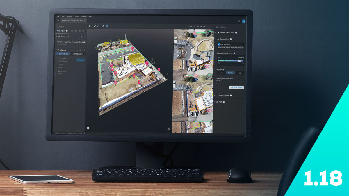
Accurate volume measurements
When it comes to surveying and vectorizing a space, PIX4Dsurvey is providing users with more and more options on how to manage their data. Now, PIX4Dsurvey can complete volume measurements of stockpiles and pits. The software can handle billions of points, meaning even large point clouds can be analyzed and gives the option for users to measure the elements of a scene, and accurately determine how much material has been moved. Results can be exported to a CSV report or LandXML.

This new feature adds to the other capabilities of PIX4Dsurvey including road marking and extracting terrain layers to get full analysis of a scene. PIX4Dsurvey is the ideal tool for professional surveyors to take their point clouds and get them ready for use in CAD or AutoCAD.
Import PIX4Dcatch projects from PIX4Dmatic
With the combined abilities of PIX4Dsurvey 1.18 and PIX4Dmatic 1.19, the products now support the use of both LiDAR and photogrammetry datasets. PIX4Dsurvey already had the capability to merge photogrammetry and LiDAR point clouds. Now that PIX4Dmatic can use both the LiDAR and RGB image data from PIX4Dcatch, there are three separate point clouds coming from PIX4Dmatic: depth, dense, and the fusion of the two. PIX4Dsurvey now natively reads all three of those point clouds, giving users the ability to merge or work separately with the three outputs in the same project. This gives users better control over their results and the flexibility to adapt their data collection and extraction methods without compromising on the completeness of the scene they create.
Edit selections of points in point clouds
Further technical details include the ability to add to or remove from the point cloud selection set, allowing the user to quickly and accurately modify the point cloud. This helps narrow down the data in a point cloud to just have the critical data needed rather than unnecessary points. The selected points can then be assigned to terrain classes or categorized by color to organize layers and control how the data works.
In addition, users can import GeoJSON and SHP files in any coordinate system now, even if it does not match the one currently in a project. This means collaboration is more straightforward and surveyors have more options when analyzing and preparing their data for CAD.
New photogrammetry licensing options and a new language
To celebrate the launch of PIX4Dsurvey 1.18 and PIX4Dmatic 1.19, new promotional offers are available for users. Both of these products now have a perpetual or one-time charge license for sale as well as the monthly and annual subscriptions. There are also discounts available on both products until the end of the year, with bundle options to buy them together.
Finally, we have added Spanish to PIX4Dsurvey! This means the software is available in English, Spanish, and Japanese.
More features will be coming to PIX4Dsurvey before long, and to hear what else we have in store for users, don’t miss the Pix4D Virtual User Conference on October 6th - registration is free with a Pix4D account! Sign up using our webpage and your account to get the latest from experts across the globe as well as Pix4D’s own development teams.