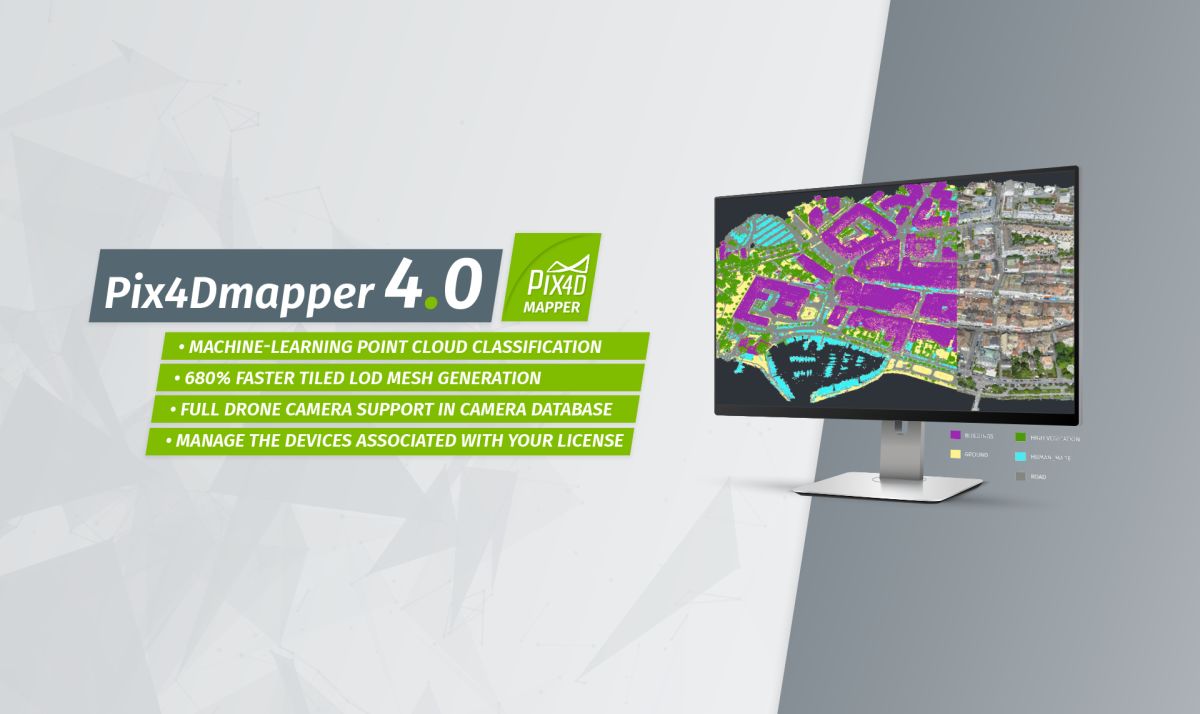
Machine learning technology and Pix4Dmapper 4.0
Revolutionary features in Pix4Dmapper 4.0
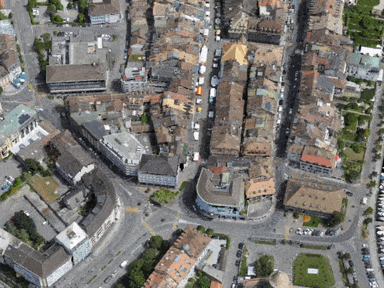
Machine-learning point cloud classification
Automatically classify your dense point cloud into five groups: ground, road surfaces, buildings, high vegetation and human-made objects.
Interested to help train the classifier?
Send an email to train-the-classifier@pix4d.com with the processed project or the .las file in which the five groups have been well-classified. The classifier parameters will be modified considering the geometry and color of your point classes.
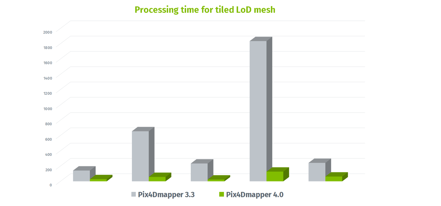
680% faster tiled LoD mesh generation
Always trying to improve our user experience, Pix4D development team has improved the processing speed of generating 3D textured mesh, especially the tiled level-of detail (LoD) mesh.
According to the 24 projects we tested, generating a tiled LoD mesh is now 680% faster and saves you 89% of the processing time.
Full drone camera support in camera database
In Pix4Dmapper 4.0, we support all the latest drone cameras pre-calibrated, including the DJI Spark. As a drone pilot, you can enjoy an automatic processing for your mapping mission. Simply drag the images into Pix4Dmapper and use the camera settings automatically detected by the software.
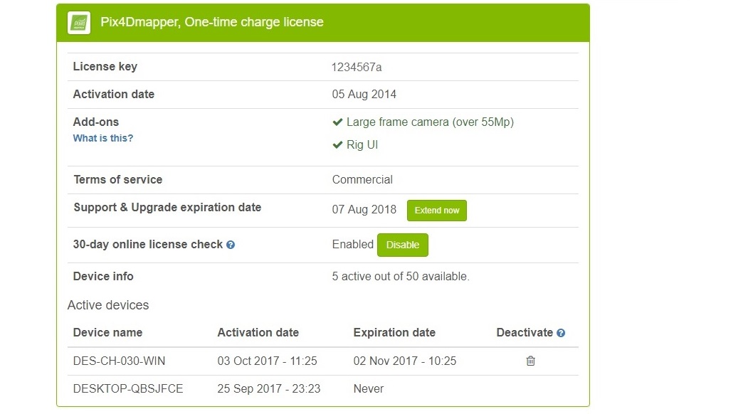
Manage the devices associated with your license
Easily deactivate the license tied to certain inaccessible computers and keep the full control of your floating Pix4Dmapper license at all times.