
Pix4Dfields 1.8: advanced layer visualization
The latest Pix4Dfields update brings multiple functions to help you focus on the data that is important to you, including histogram equalization and dynamic range to get more control over the data values of interest.
Histogram equalization
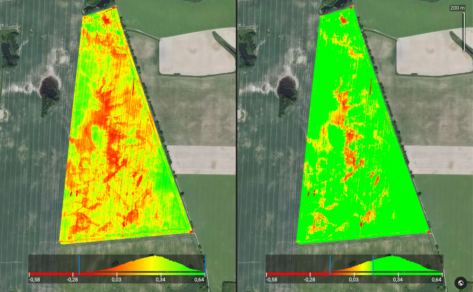
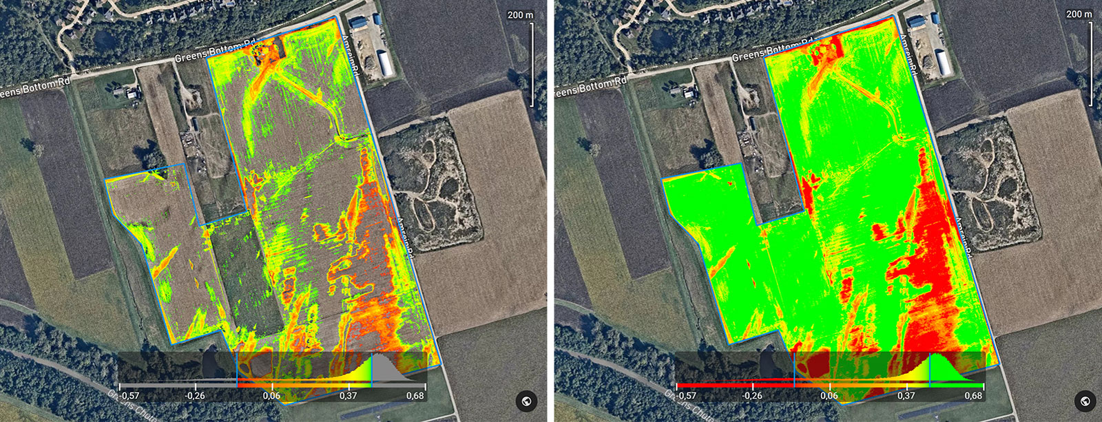
Histogram equalization is an image processing technique that enhances contrast by distributing the most frequent values in the histogram. This technique changes the probability density function of a given image into a uniform function that spreads out from the lowest pixel value, e.g., 0 to the highest pixel value, e.g., 1.
Dynamic range
You can set up the minimum and maximum value of the histogram to adjust the dynamic range. By changing the range of the histogram’s x-axis you can draw attention to certain values, which gives you more insights into the condition of your fields.
Display modes
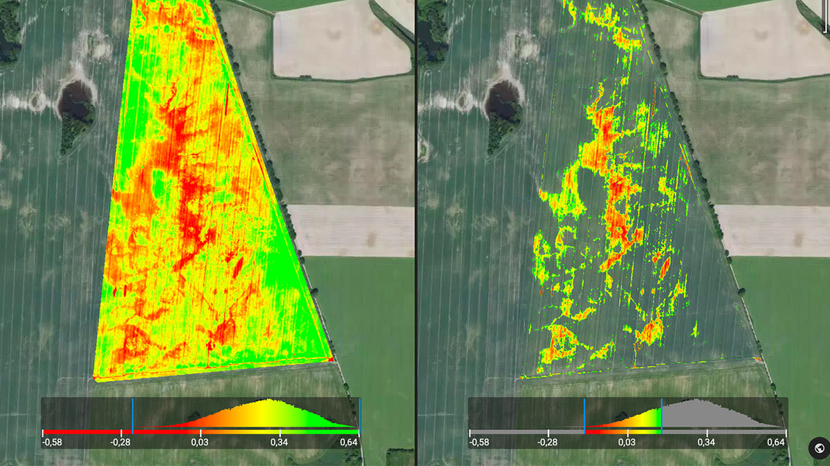
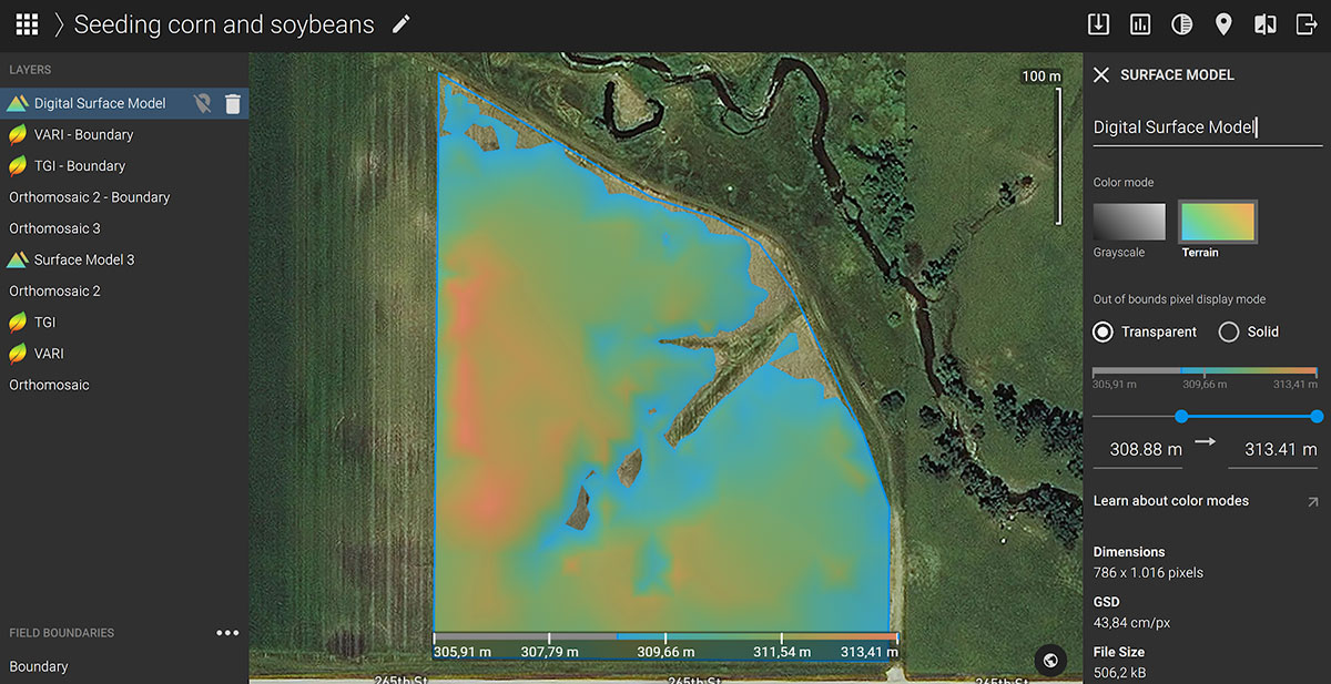
Pix4Dfields offers two display modes of the pixels with data values below and above the specified color range: transparent and solid.
Transparent mode displays all areas with pixel values outside the given range as transparent. Solid mode displays areas below the given range with one color and the values above the selected range with another color.
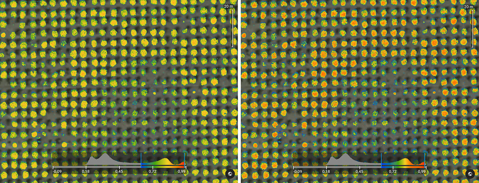
Color modes
With the new Pix4Dfields update you can select between different color modes for index maps (grayscale, red-green, thermal and spectral) and digital surface models (grayscale and terrain).
We added even more languages
Pix4Dfields 1.8, on top of English, Spanish, German and Japanese is now also available in Portuguese and Chinese.To work in your own language, update to the latest version of Pix4Dfields, and change the language in the Settings menu.
Getting started with Pix4Dfields
Try Pix4Dfields for yourself. Claim your free trial of Pix4Dfields, explore the demo datasets or reach out to our team.
| More information about the latest version of Pix4Dfields can be found in the release notes. For more details about all Pix4Dfields features, check out the product feature list. |


