PIX4Dcloud August 2022 release: meet the new features
Summer means sunny days, lemonade, and perfect blue skies. Now we’re adding the latest PIX4Dcloud release to make your summer better! The new updates include integration with Trimble Connect, a new Comparison mode, IFC file support, and more. Continue reading to see what’s changed and what is new.
Easily integrate your data into Trimble Connect
PIX4Dcloud and PIX4Dcloud Advanced users can now transfer outputs and reports to the Trimble Connect data-sharing platform directly from the Pix4D interface. Users are able to select their preferred files for transfer and export to Trimble Connect with just a few clicks. This integration facilitates smooth operations by streamlining user workflows and results in improved team and stakeholders collaboration.
To learn more about the Trimble Connect Integration,
check our dedicated blog post.
Support of IFC file format
You can now import IFC files into PIX4Dcloud Advanced. Import your IFC files to get a better understanding of the as-is vs as-built and plan ahead of time.
Trygve Almquist, Isachsen, said: “Having the IFC files on PIX4Dcloud Advanced is extremely helpful for our project managers, foremen, and supervisors as they can easily visualize the BIM models in the existing terrain. This helps us to understand how to dig, place elements, or where the pipelines would be, for example. Adding the IFC files opens the door to visualizing ahead of time, instead of seeing only the current project condition.”
What is the IFC data format?
The design and construction of a building involves various parties, each working in their own area of expertise. This requires a standardized file format for exchanging information to guarantee effective collaboration and avoid the loss of information and errors, which is the fundamental purpose of the IFC data format. This format is often used in BIM software.
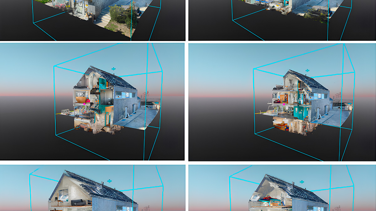
Better visualize site progress with the updated 2D/3D Comparison tool
In the past, you could use the Comparison tool of PIX4Dcloud Advanced to get detailed day-to-day comparisons of your 2D data (orthomosaics, DSMs) and any overlaid drawings. From now on you can also compare 3D outputs: point clouds, mesh models, and on top of that you can overlay IFC files.
“The 2D/3D Comparison tool brings a new level of site awareness. Compared to drawings, you get fewer misunderstandings and can plan better ahead of time. In our daily work, we work more and more with 3D models, so being able to visualize them via IFC files is of great value to us.”, says Trygve Almquist, Isachsen.
Easily share the comparison with your team and stakeholders to keep everyone on the same page
To learn more about how the 3D Comparison works, please check our technical support documentation.
Please note that this feature is only available to PIX4Dcloud Advanced users.
We have a new processing cluster in Montreal, Canada which adds another option for your data processing and storage preferences. To select your preferred cluster location, go to the User Information panel, and choose “Cluster location” under Preferences. Learn more about how your data is processed and stored here.
CSV file can be imported and exported in the project coordinate system
You can now import and/or export CSV files in your project coordinate system. To find out how to do it, read our technical documentation. To learn which coordinates systems are supported from PIX4Dcloud, refer to our support documentation.
Downloading multiple outputs
No need to download each output one by one - multiple outputs can now be downloaded simultaneously in project folders. Read our technical support documentation to find out how to download outputs from PIX4Dcloud.
What’s coming
Subscribe to our newsletter to not miss out.