

The secret to measuring material piles: the right tools
Timber is the original renewable resource. New, efficient production processes use 100% of every tree, from lumber for building to wood pulp for paper or fuel.
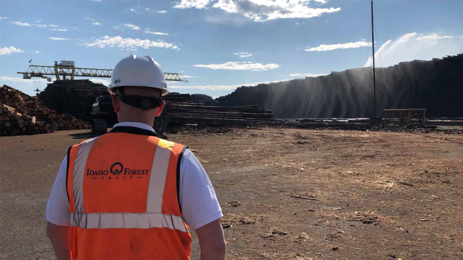
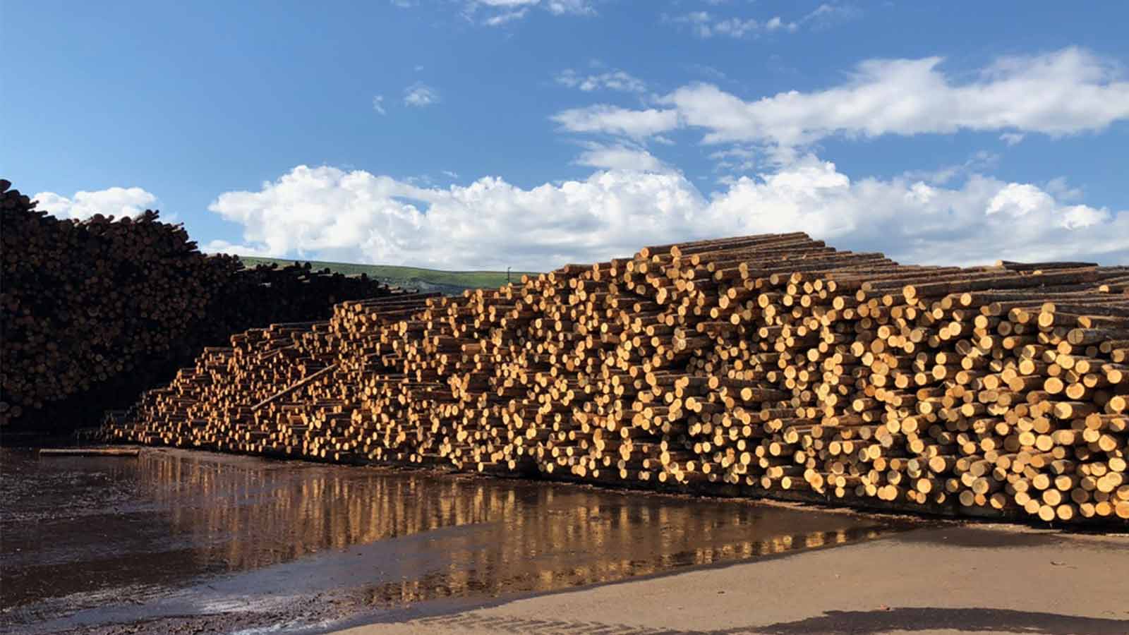
Before, during and after processing, the wood waits in stockpiles. “We have a lot of logs sitting under our cranes. And that’s millions of dollars of inventory,” says Aaron Fisher, Technology Project Manager at Idaho Forest Group.
Knowing the precise volumes of the wood and byproducts helps the company estimate the value of their lumber and pulp stock. It also helps smooth the production process, as the team can estimate how much fuel is available to power their boilers and dry the lumber with steam.
Traditional methods of stockpile measurement involved walking the site with a measuring tape. By contrast, flying a drone over the entire site takes the team just 17 minutes.
Project details
| Location | North Idaho and Montana, USA |
| Company | Idaho Forest Group |
| Area covered | ~80 acres per day |
| Flight time | 17 minutes |
| Images per flight | 400-500 |
| Processing time | ~2 hours |
| GSD | 1-1.5 inches (2.5-2.7 cm) |
| Hardware | WingtraOne |
| Software | Pix4Dmapper |
Finding efficiencies
With a history dating back to 1934, Idaho Forest Group has seen a lot of changes in the industry. Embracing new technologies has helped the company grow to one of America’s largest lumber producers, processing over one billion board feet every year - plus raw materials for paper, landscaping, and wood pellets.
Six sawmills across North Idaho and Montana have ongoing photogrammetry projects. Their yards are surveyed once or twice a week with a WingtraOne drone, and the data is processed onsite with Pix4Dmapper.
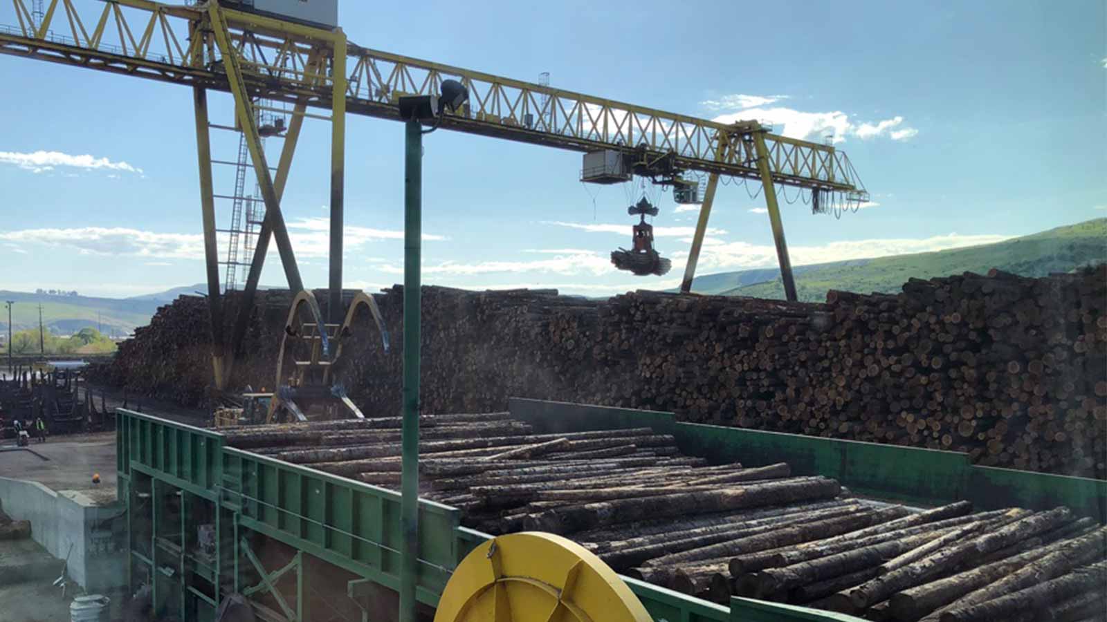
The management team ‘wears many hats’. They keep track of lumber as it comes in, processed through the sawmill , all the while producing wood byproduct as bark, chips and sawdust. Often, just one person is overlooking this complex process on inventory transparency within the mill.
Smoothing the workflow and finding efficiencies makes a real difference to the team at Idaho Forest Group. A single 20 minute drone flights is enough to survey the entire 80 acre site.
Fisher adds: “A lot of the time we don’t stop operations for a drone flight, so when that Wingtra is in the air we want to take as fast a snapshot as possible. Not needing battery changes and being able to complete your whole flight in one mission is a big deal.”
The results are processed in Pix4Dmapper onsite as management works on other tasks. In a couple of hours, reliable stockpile measurements are available.
Ready for takeoff
A lumber yard is a dynamic workplace, filled with complex machinery as well as stock.
The Idaho Forest Group team found that fixed-wing drones needed more room to take off and land safely than was available. The team trialed multicopter drones, but found the battery life was insufficient for their needs. The WingtraOne drone was chosen because of its vertical take off and landing (VTOL) capabilities which allow it to be launched from anywhere on the site.
Fisher jokes that both the Wingtra drone and Pix4D software can be run just by pushing a button and letting the process happen.
“It’s a time saver that Ryan Jones [Idaho Forest Group Logyard Lead] can go fly his Wingtra and throw it into Pix4D and it just runs in the background. He can come and just check on progress intermittently, which is a really big time saver for us as well,” Fisher continues.
Running on dedicated servers, projects are processed in Pix4Dmapper in around two hours.
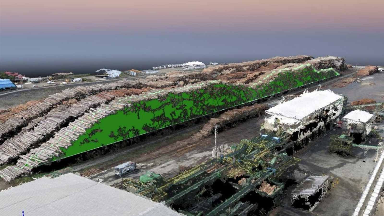
Measuring a digital twin of a stockpile
Stockpile measurement with drones has been a common workflow in the mining industry for years. But it can be easily applied to other fields - or in this case, lumber yards.
Lumber isn’t the only thing Idaho Forest Group produces. The residuals are also valuable, both economically and environmentally as the team ensures 100% of the tree is put to good use.
Woodchips are collected and used to fuel the boilers which steams the lumber to the desired moisture content. Being able to itemize and quantify the amount of fuel available to run the boiler allows mill personnel to predict and plan workflows and shipments with residuals. The team can accurately measure the volume of a stockpile and calculate how much of the valuable residual is needed to run the boiler.
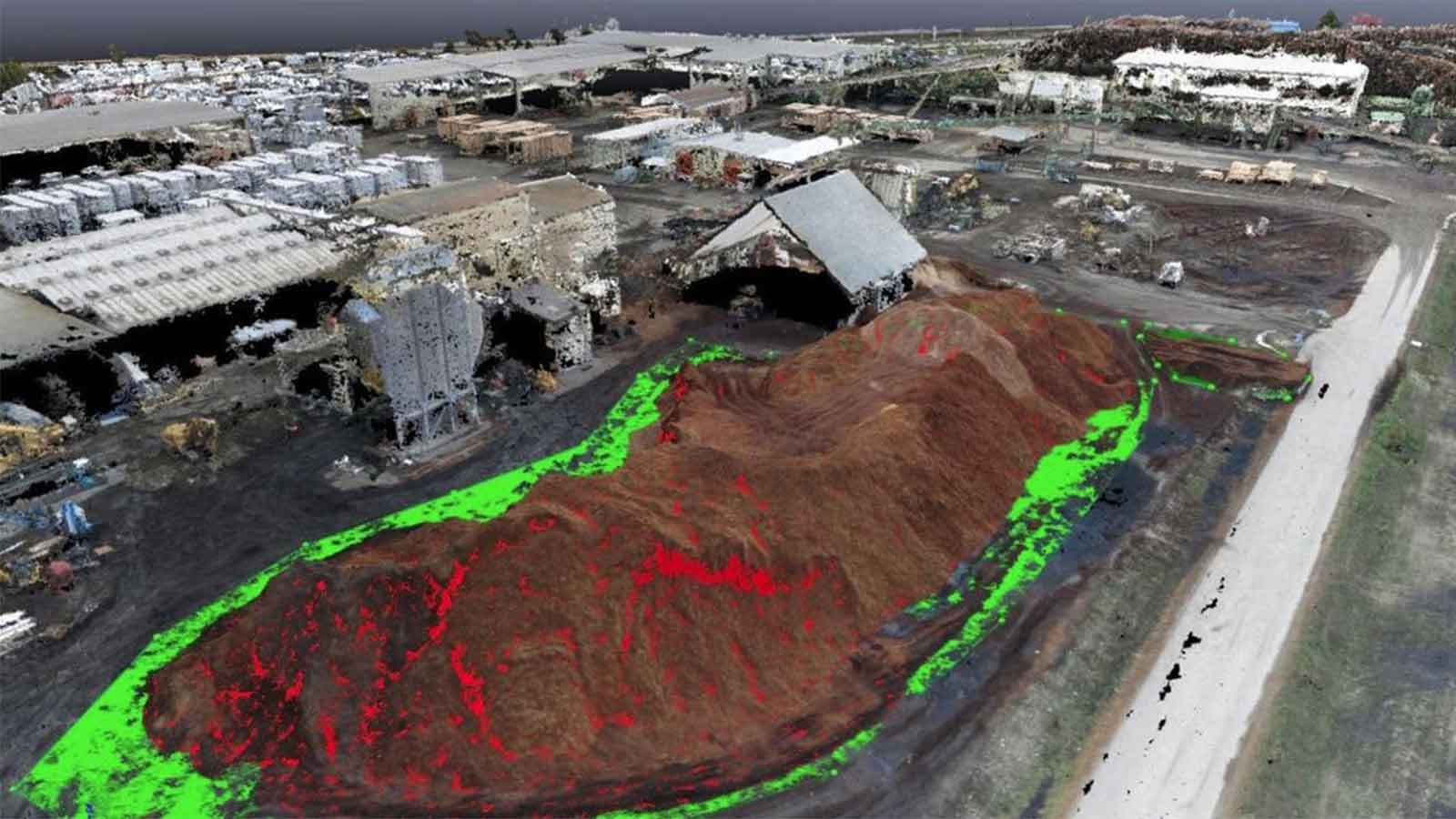
As well as being fast, the results are accurate. Jones comments: “We’ve measured a stockpile with the drone and compared it to traditional style measurements. [Pix4Dmapper] has been very accurate as far as measuring those volumes. It does a very good job of reading the elevation and understanding what is ground and what is fill.”
Fisher explains that when measuring a log deck: “If the elevation measurements in Pix4D are off by six inches, the calculations and conversions could be off by one or two million board feet. This is when you have a full log deck that is close to a quarter mile long. Accuracy within the point cloud is essential to achieving the best inventory measurements.”To verify accuracy, the team use established ground control points (GCPs). Fisher adds that he they did look at other photogrammetry providers as well as Pix4D. “Some of our mills are at remote locations so it might be difficult for us to upload data to the cloud efficiently. Pix4D giving us an on-premise option is a big benefit for Idaho Forest Group,” he says.
Elevating photogrammetry
As well as processing timber, the resource department at Idaho Forest Group offers forestry assessment, surveying the health and value of lumber.
With the success of the drone-based photogrammetry surveys of their lumber yards they are now in the process of expanding the forestry sector of their company with this new technology.
This will mean bigger survey areas and different kinds of imagery — all of which can be captured by WingtraOne and processed by Pix4D.


