
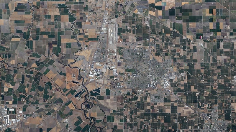
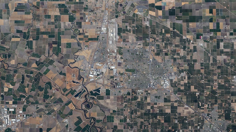
Large scale mapping in Manteca
West Coast Aerial Photography, Inc. is a father-son, family-owned aerial photography business based in Los Angeles. The project aims to provide up-to-date mapping results of Manteca, California.
| Company | West Coast Aerial Photography, Inc |
| Country | The United States |
| Industry | Aerial Photogrammtery |
| Project date | June 2013 |
| Project members | Steven Holtzman |
| Project size | 566.6 square kilometers |
| Number of images | 2,532 |
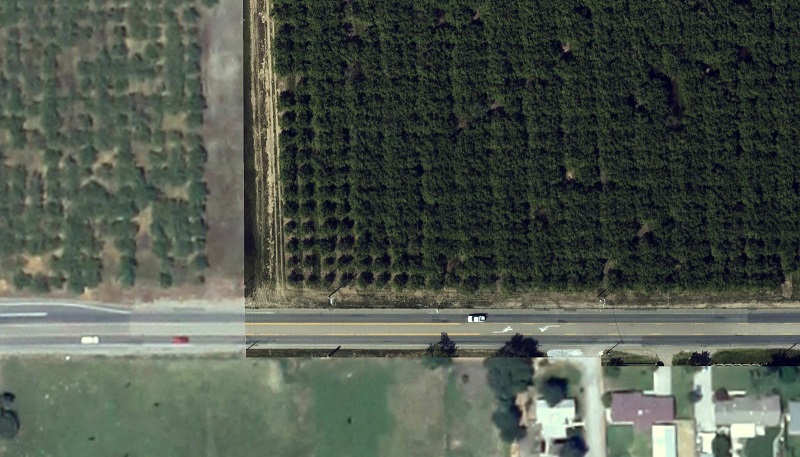
| GSD | 48.8 cm |
Capturing the images
All images were acquired with a 21.1 megapixel Canon 5D Mark II camera with a 50mm focal-length lens, from a Cessna 206 aircraft.
A grid flight plan was flown with 50% of side overlap between adjacent flight lines. Images were taken at nadir view in order to create an undistorted final map.
A map of the area within two days
Pix4D software’s automation allowed for the entire project to be processed and orthomosaic generated within a 24-hour period.
Additional modification in the Mosaic Editor was necessary to correct for minor artifacts, but corrections were completed within a business day.
Within two business days, a completed map of the full region of Manteca was generated.
"Significantly increased efficiency"
Previous solutions for this type of work would have required days or weeks to mosaic, correct artifacts and georectify the imagery. The final product would not have been as accurate as the Pix4D solution and would have required substantially more work and time.
Pix4D software offers numerous advantages, including significantly increased efficiency, allowing for large projects to be delivered within a few days of acquisition. Without this technology, this is not possible within this time period.


