
How are drones making a difference in precision viticulture
DroneBee is a precision farming company based in Florence, Italy offering highly technological services in precision farming and agronomic consultancy to farms, agricultural consortiums, research institutions, and agronomists.
The company recently worked on two projects using RGB/multispectral/thermal sensors mounted on drones to analyze crop health and identify stressed or ill areas in vineyards.
In this article
- Project details
- Chianti project: precision irrigation system to recover from grape yield losses
- Bolgheri project: selective harvesting to produce high-quality wines
- Drone mapping for better vineyard management
Projects details
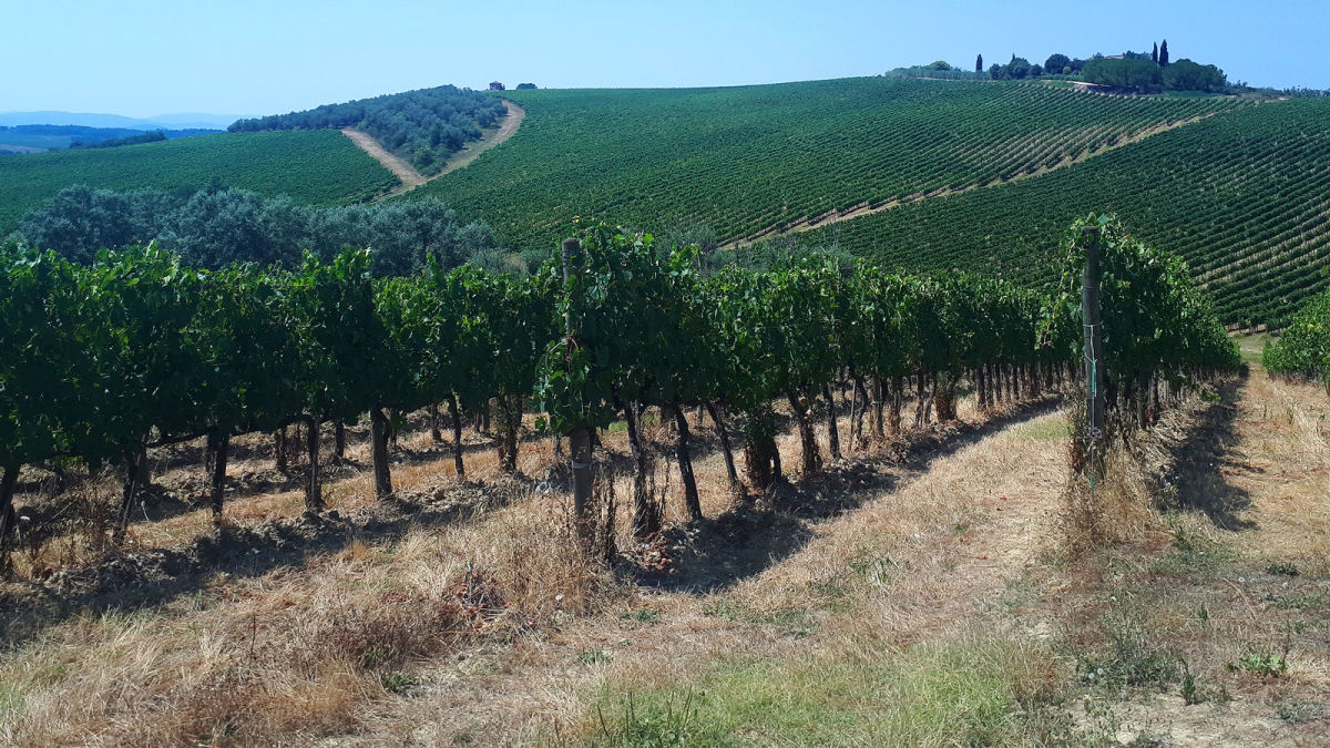
The first of these projects was done in July 2020 on the big and well-known Chianti Classico winery, near Siena, and the second in September 2020 on a family business winery in Bolgheri. Both Chianti and Bolgheri are two of the most important Italian vineyard production regions, characterized by high-quality wines.
| Area covered | Chianti project: 15 hectares Bolgheri project: 3 hectares |
| Number of images: | Chianti project: 1228 (RGB), 4908 (multispectral), 2392 (thermal) Bolgheri project: 767 (RGB), 3068 (multispectral) |
| Drone & cameras | Parrot Sequoia multispectral camera FLIR Vue Pro R 13mm thermal camera Zephyr EXOS hexacopter |
| Software | Pix4Dmapper QGIS |
| GSD (ground sampling distance) | 1.76 cm/pixel (RGB), 6.9 cm/pixel (multispectral), 8.6 cm/pixel (thermal) |
Chianti project: precision irrigation system to recover from grape yield losses
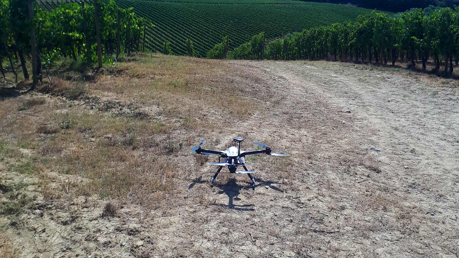
The Chianti project aimed to properly build up a precision irrigation system over 15 hectares of vineyards to recover from grape yield losses. To assess vineyard vigor and water stress, the DroneBee team flew a drone to acquire thermal and multispectral images. The images were then processed with Pix4Dmapper to get the visible (RGB) orthomosaic, the thermal map, and the reflectance maps.
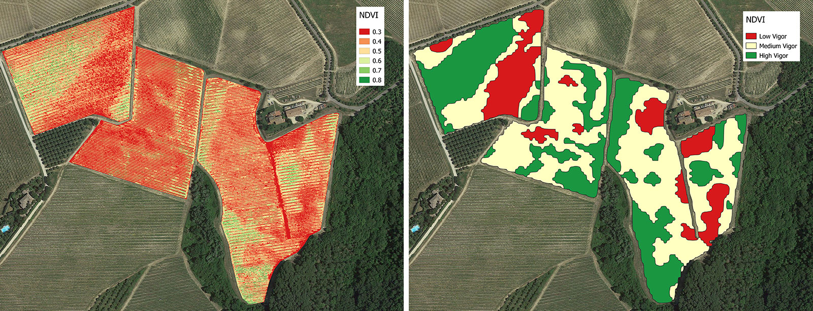
The vigor and thermal maps of the vine rows were analyzed in QGIS by using the NDVI (Normalized Difference Vegetation Index) and the CWSI (Crop Water Stress Index) respectively, after removing the inter-row and soil pixels. Vine rows pixel aggregation in classes have been done in QGIS to highlight three vigor zones (high, medium, low) and four water stress zones (high stress, moderate stress, low stress, no stress), corresponding to four different temperatures zones.
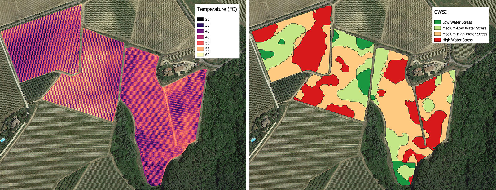
The final NDVI and CWSI maps have been used to correctly identify stressed areas that will receive more water than the healthy areas. Additionally, missing vines were detected as well.
Bolgheri project: selective harvesting to produce high-quality wines
The Bolgheri project aimed to analyze 3 hectares of vineyards, with more than 10 different varieties, to get a two-classes vigor map for grape selective harvesting, which have been then done manually using a smartphone by following the map imported in Google Maps. The selective harvest allowed for collecting grapes coming from different vigor zones to be vinified separately to produce wines of higher quality. This is possible by vinifying the grapes coming from low vigor zones which have more sugar content, as it has been also confirmed by ground sampling on grapes.

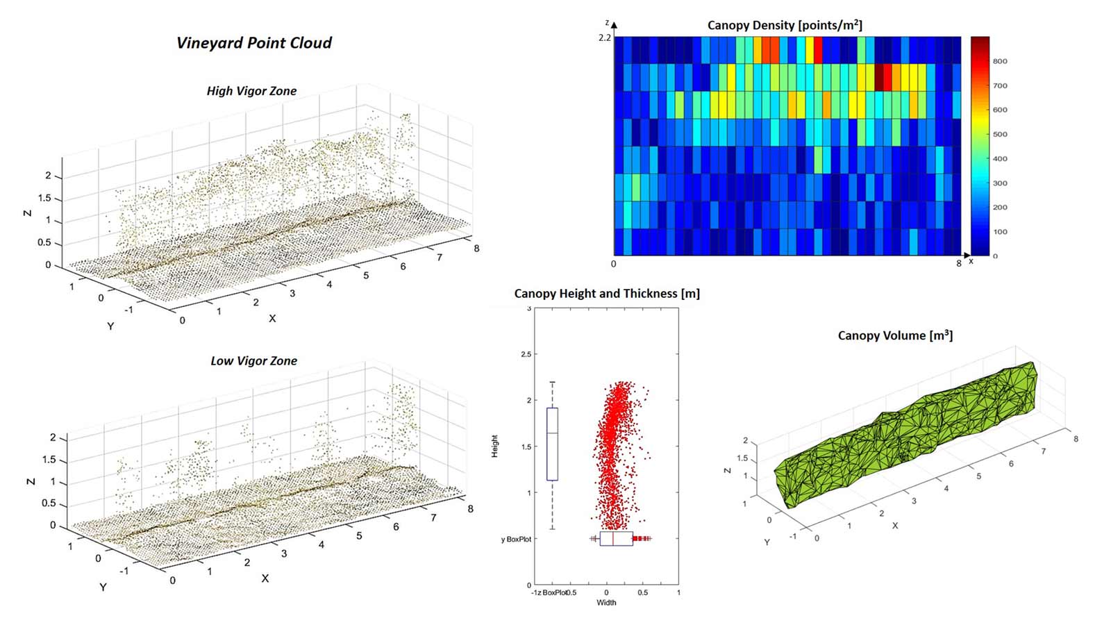
During this project, an innovative and specific algorithm to process the vineyard point cloud was tested to assess for vines canopy geometry (density, height, thickness, volume), which was useful for evaluating the optimal pesticide dose.
Drone mapping for better vineyard management
During these two projects, different data analytics were used to resolve various issues which demonstrated the potential of using drones in precision agriculture. Important and innovative wineries can have a positive environmental impact in producing better quality wines with an optimized use of resources.
This type of technology is easily accessible for all farmers, from family-run businesses to big companies, thus the advantages (money savings, better product quality, increased yields) overcome the investments. Also, different levels of innovation can be brought by drones to farmers, which can have variable rate (VRT) machines to fully automate field operations by using drone maps.


