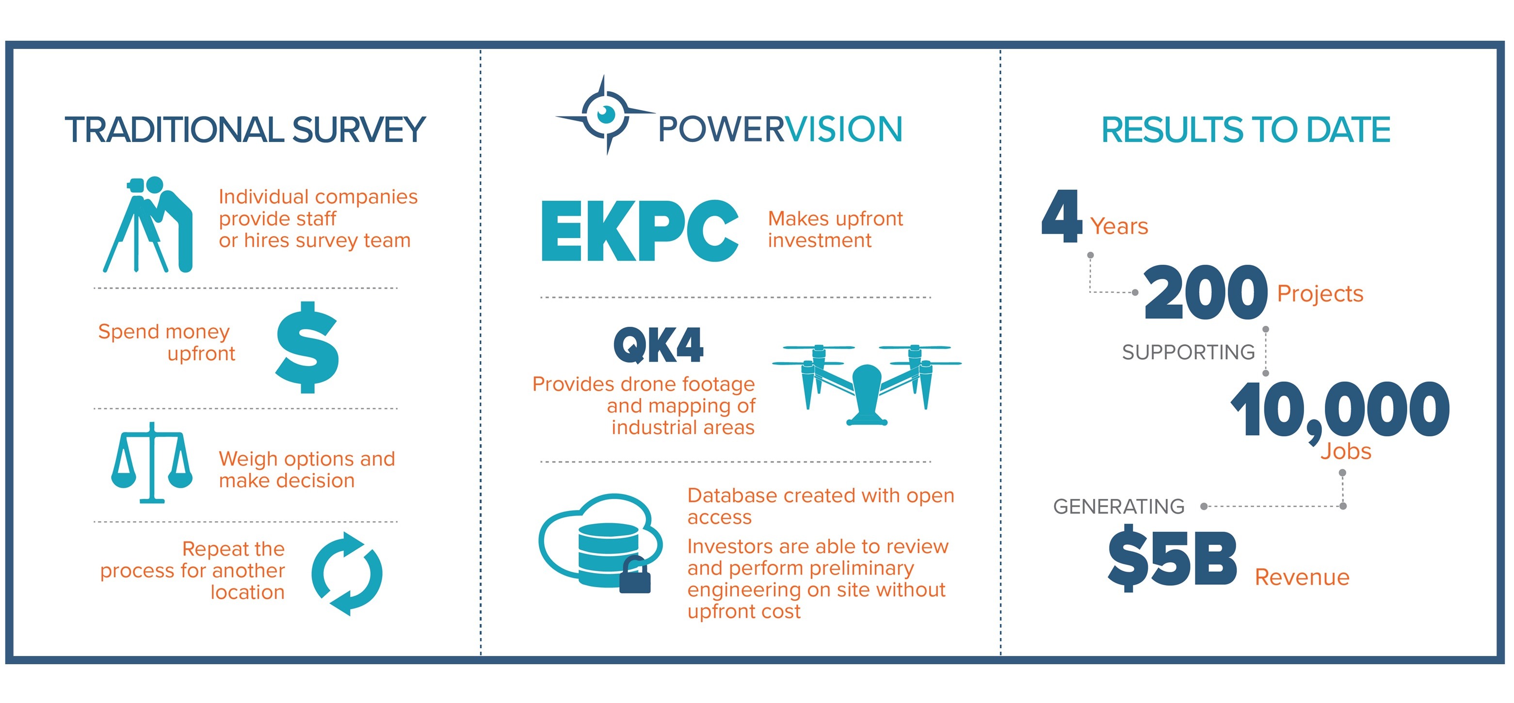
Drone surveys bring 5 billion dollars to rural Kentucky
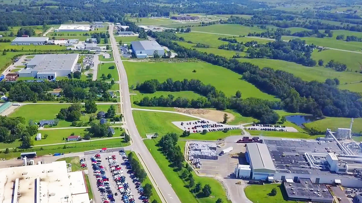
With its abundance of land and relatively low wages, rural Kentucky is the ideal place to launch industrial and manufacturing ventures. But in the decade following the ‘Great Recession’ the area was languishing. To attract investment from global companies, the economic development arm of Kentucky Touchstone Energy Cooperative (KTEC) turned to new technology - drones.
Beginning in 2016, Qk4 Engineering mapped over 40 industrial sites with Pix4Dmapper. The drone maps, models, surveys and projects created with Pix4D helped market new industrial sites in Kentucky bringing more than 200 projects, creating almost 10,000 jobs and more than five billion dollars in investment.
Project details
| Location | Kentucky, USA |
| Engineering firm | Qk4 Inc. |
| Client | Kentucky Touchstone Energy Cooperative (KTEC) |
| Hardware |
|
| Software | |
| Outputs |
|
| GSD | ½ - 3 inches |
Hightech solutions for rural communities
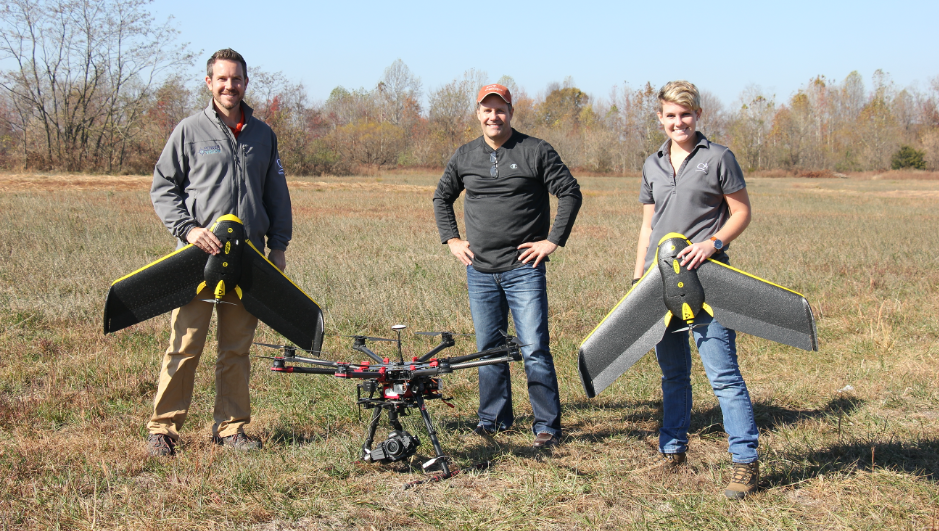
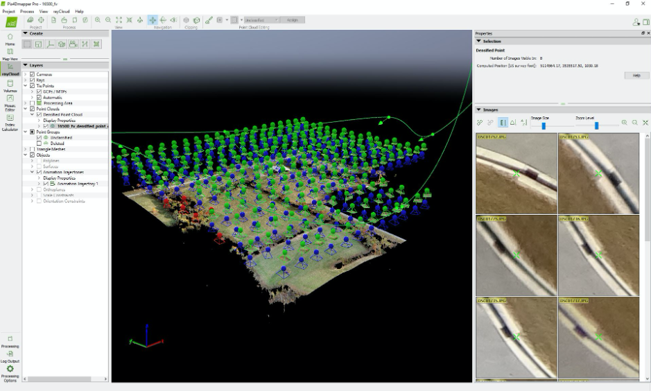
After receiving the site information from the client, Qk4 UAS teams head into the field.
“We run video and mapping separately because of the expertise of each drone operator,” explains Ben Shinabery, Qk4 Survey Manager. “The data serves different functions, so it makes sense to us to have different teams capture them.”
First, surveyors mark ground control points (GCPs). As many as 15 GCPs are used on larger sites. The next team to arrive is the video team. Finally, the mapping team will map the area.
Occasionally, data will be collected on different days, although the teams find it helpful if they overlap as there are more spotters to watch the drones.
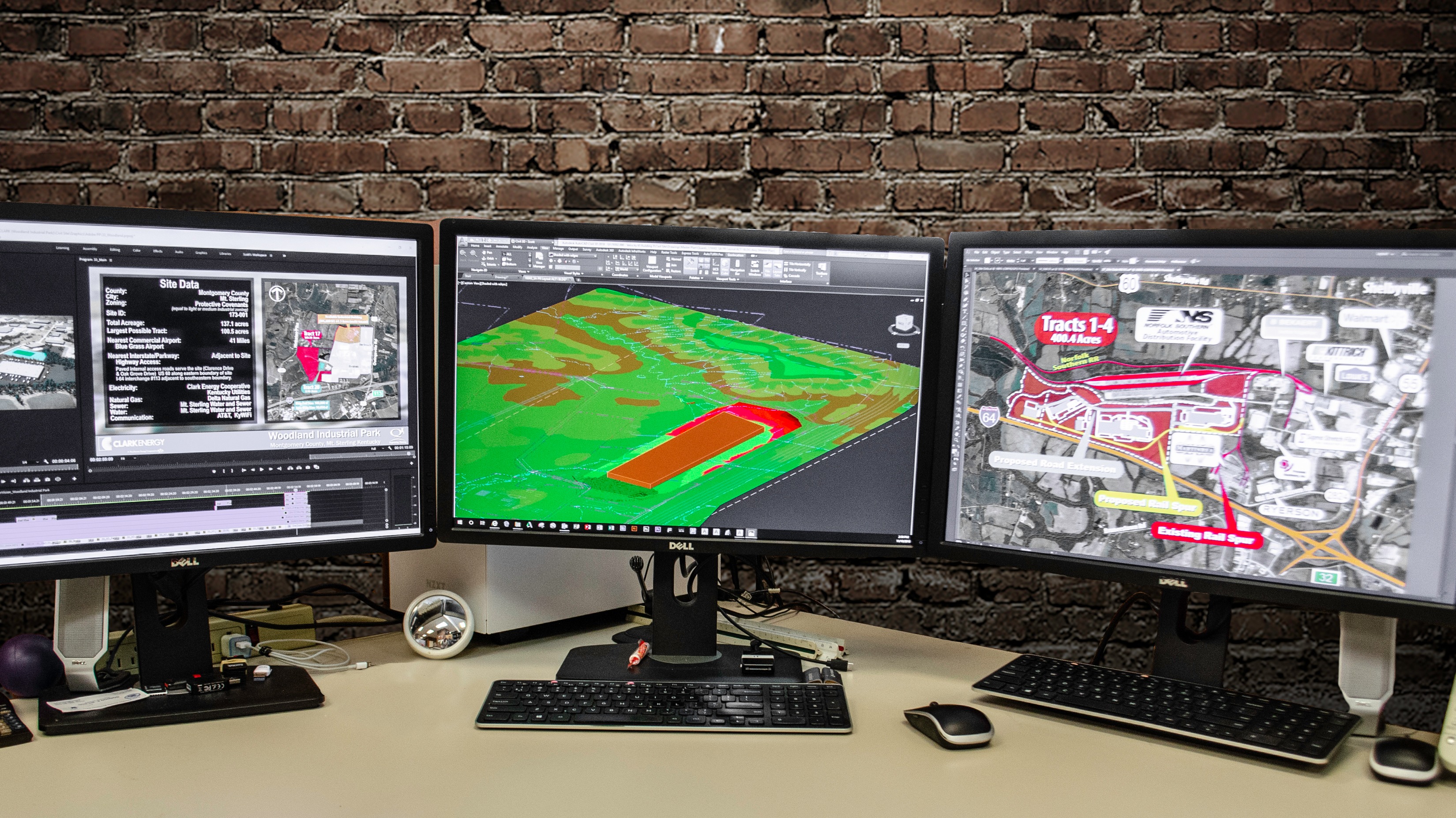
Back at the office, the video and mapping teams process their images separately: Qk4 rely on photogrammetry and high resolution video rendering, only occasionally using videogrammetry.
PowerVision to the people
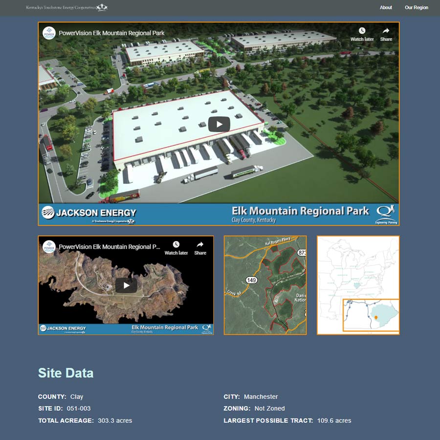
Outputs vary depending on the client’s needs. They all have one thing in common: they’re publically available on the PowerVision website.
PowerVision is the secret weapon the KTEC used to bring investment to Kentucky.
Traditionally, the most digital part of industrial real estate marketing was a phone call. Millions of dollars’ worth of investment was leveraged off the back of brochures and a handshake. But in today’s digital world, the system wasn’t working anymore. So KTEC reinvented it.
The PowerVision website features every site available for purchase in rural Kentucky. Users can:
- Search for sites of a particular size, or in a particular area
- View site data at a glance, including proximity to freeways and more
- Take a virtual flythrough of the site
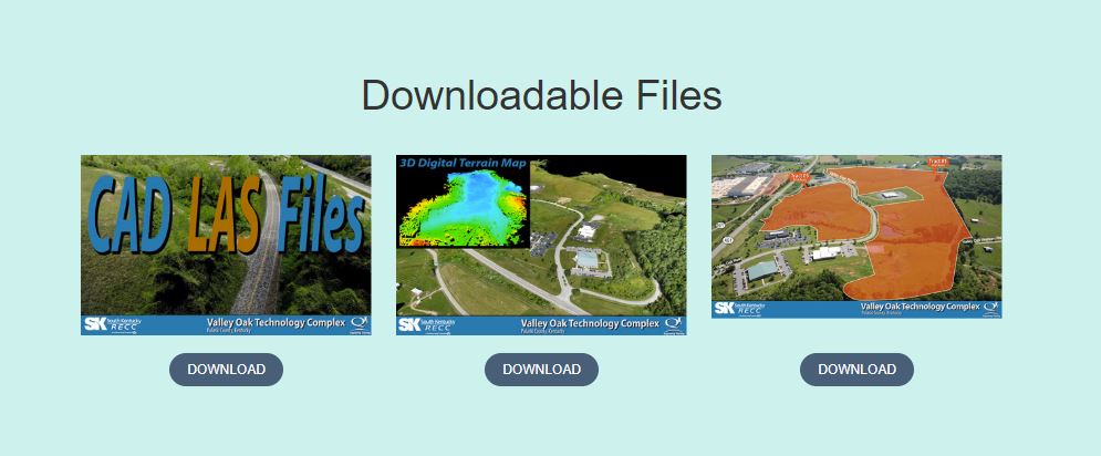
- Download CAD files to do their own initial engineering work
Shinabery explains: “In the past, foreign investors interested in a site would have to hire independent contractors to capture mapping information for their feasibility and preliminary engineering use. Kentucky Touchstone wanted to provide usable data to potential investors so they could run actual calculations before ever making a decision on the site.”
This allows work to start before the site is purchased as conceptual layouts of potential buildings can be digitally constructed.

“The standard Pix4D file outputs can be used in multiple software applications,” Shinabery adds. “That allows us the flexibility to supply survey data that integrates with software that our clients already use - the Pix4D files fit right in.”
Videos featured on the website are a combination of drone footage, DSMs, conceptual site renderings and fly-throughs rendered in Pix4D. Shinabery says: “Clients think you’re actually flying the drone on the trajectory instead of showing a digitally rendered point cloud environment! In my experience, Pix4D video trajectories are more smoothly rendered than other laser-scan walk through video outputs.”
Transformative results in days
Traditional surveying methods of sites up to several thousand acres would have taken months and hundreds of work hours per site to survey. Using drones and Pix4D photogrammetry software, each site was surveyed and individual project outputs were generated in under two weeks.
Three recent examples of investment which can be attributed to the PowerVision website include Wal-Mart’s Jet.com (e-commerce), Diageo (a Kentucky bourbon distillery) and Thai Summit (automotive parts). These three investments brought in a total investment of 301 million dollars and created 830 jobs.
Shinabery clarifies that drone mapping alone can’t solve an area’s economic woes: “All the investment is not directly based on the drone collection and mapping. The videos and access to the engineering data for clients formed a large part of KTEC’s marketing strategy to sell the sites. The total estimated impact on the Kentucky economy exceeds five billion.”
Award winning drone maps
For their efforts, Qk4 was awarded the prestigious Engineering Excellence Award from The American Council of Engineering (ACEC).
“Having a reliable post-processing software to produce the survey maps and DSM models has been great for us,” says Shinabery.