Drone mapping for analyzing animal feed crops
Azulda, a Mexican company located in the northern state of Coahuila provides high-value drone data solutions to local growers using RTK drones and multispectral sensors. The La Comarca Lagunera region is the leader in milk and dairy products, being the largest producer in Mexico. In addition, Lala (the biggest Mexican dairy company) has its HQ here.
Green revolution for dairy farming
Cotton growing, once the chief agricultural activity, was abandoned due to low prices in favor of dairy farming. Green Revolution scientific and technical advances and capital-including public and foreign funds-enabled Lagunera to develop the infrastructure required to become Mexico's leading dairy farming region1.There is a clear need to offer the growers solutions to make a more efficient way to produce the large amounts of livestock feed the industry needs. According to a recent study, there were around 35,290 thousand hectares harvested in La Laguna in the last year. This is why Azulda is making efforts to reach everyday agriculture 4.0 methods and are the first to implement precision agriculture techniques in this area.
Agriculture 4.0 is a term usually associated with the next big trends facing the agriculture industry. This includes a bigger focus on precision agriculture, the IoT (internet of things), as well as the use of big data to make efficient decisions2. These new technologies and trends are focused on developing ways of sustainably feeding the world in the face of climate change and the human population reaching 11 billion by 2100.
Project details: drone mapping for animal feed
| Area covered: | 26.5 ha (17. 9 ha first mission + 8.6 ha second mission) |
| Number of images: | 3691 images |
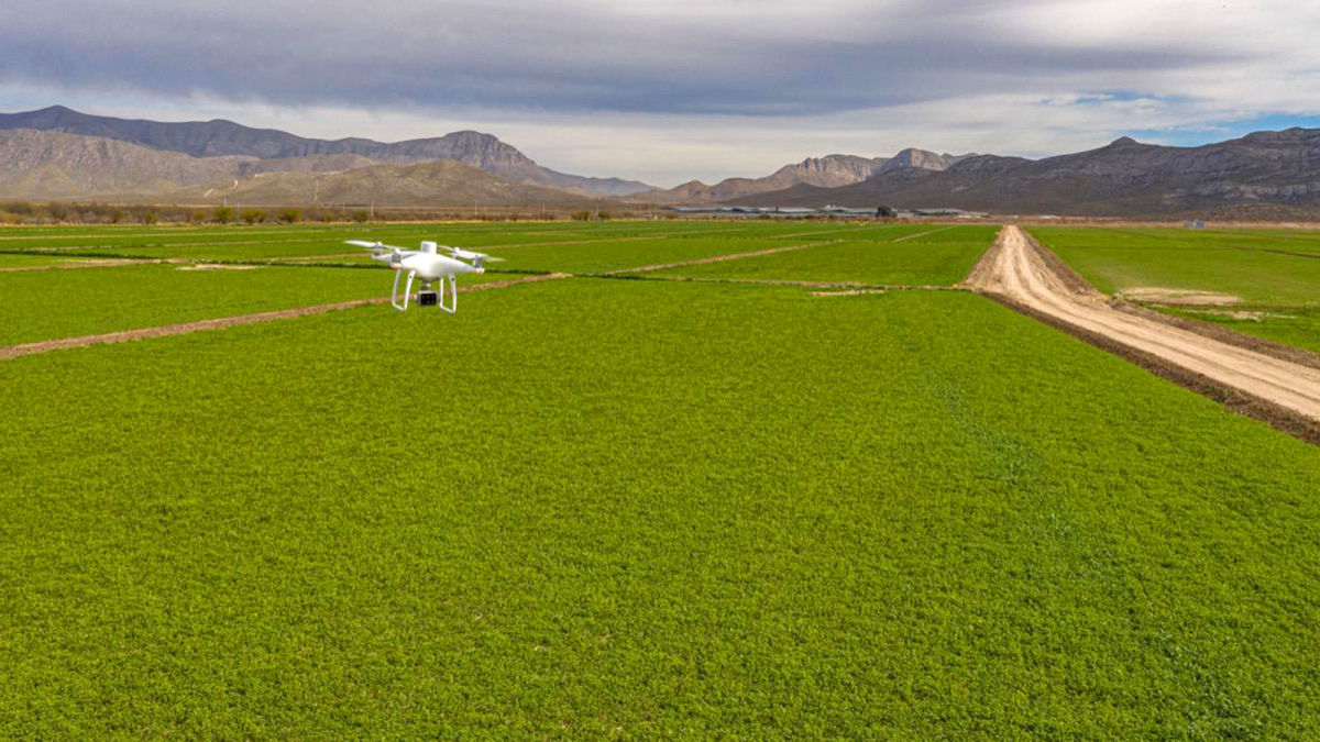
| Drone: | DJI P4 Multispectral + D-RTK 2 |
| Software: | PIX4Dfields |
| Computer specs: | CPU: AMD Ryzen 7 3700X 8-Core Processor GPU: NVIDIA GeForce GTX 1660 RAM: 32 GB |
| Processing time | <10 minutes |
Verifying the quality of crops
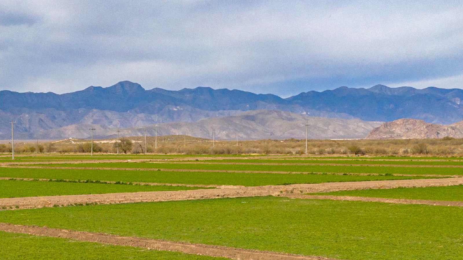
Azulda works with a dairy farm Establo Santa María, located in Francisco I. Madero. They have around 400 hectares and produce their own livestock feed: oats in the winter and corn in the spring and summer. Because feed is one the most important and critical elements on a dairy farm, it is crucial for growers to know the quantity and quality of animal feed.
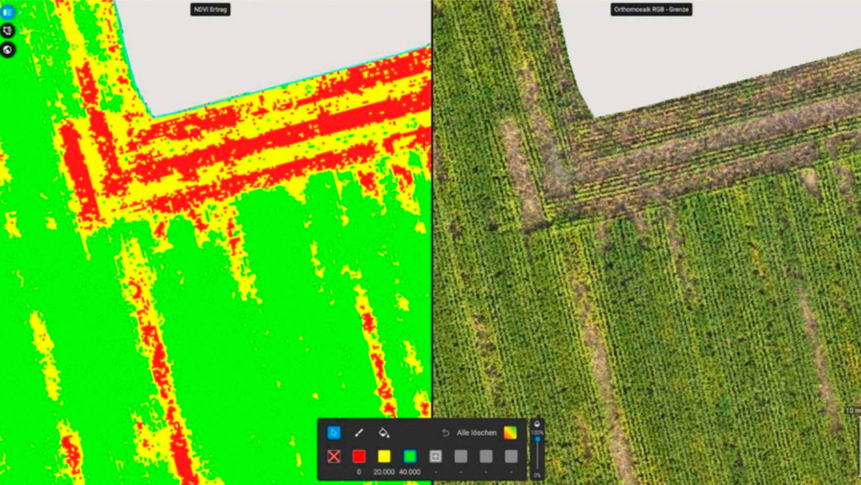
This project aimed to verify the quality of the same variety of oat crop in two different types of soil with two different treatments at late-stage. This was very important information for the grower and their team because they were trying different types of treatments on the crops to see which one would perform better.
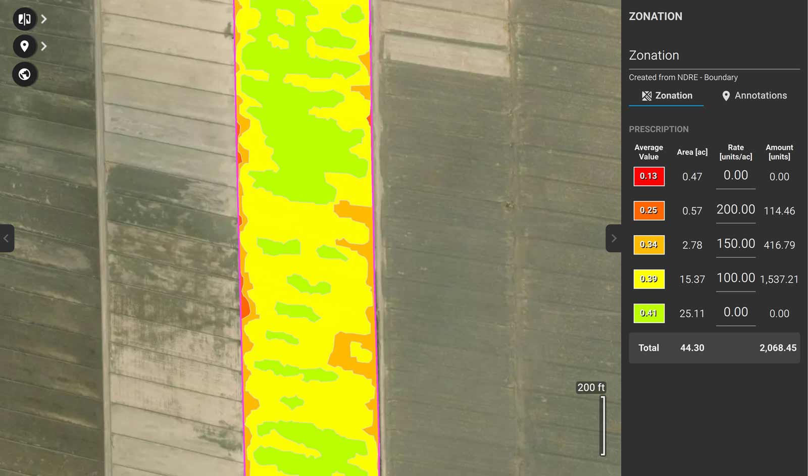
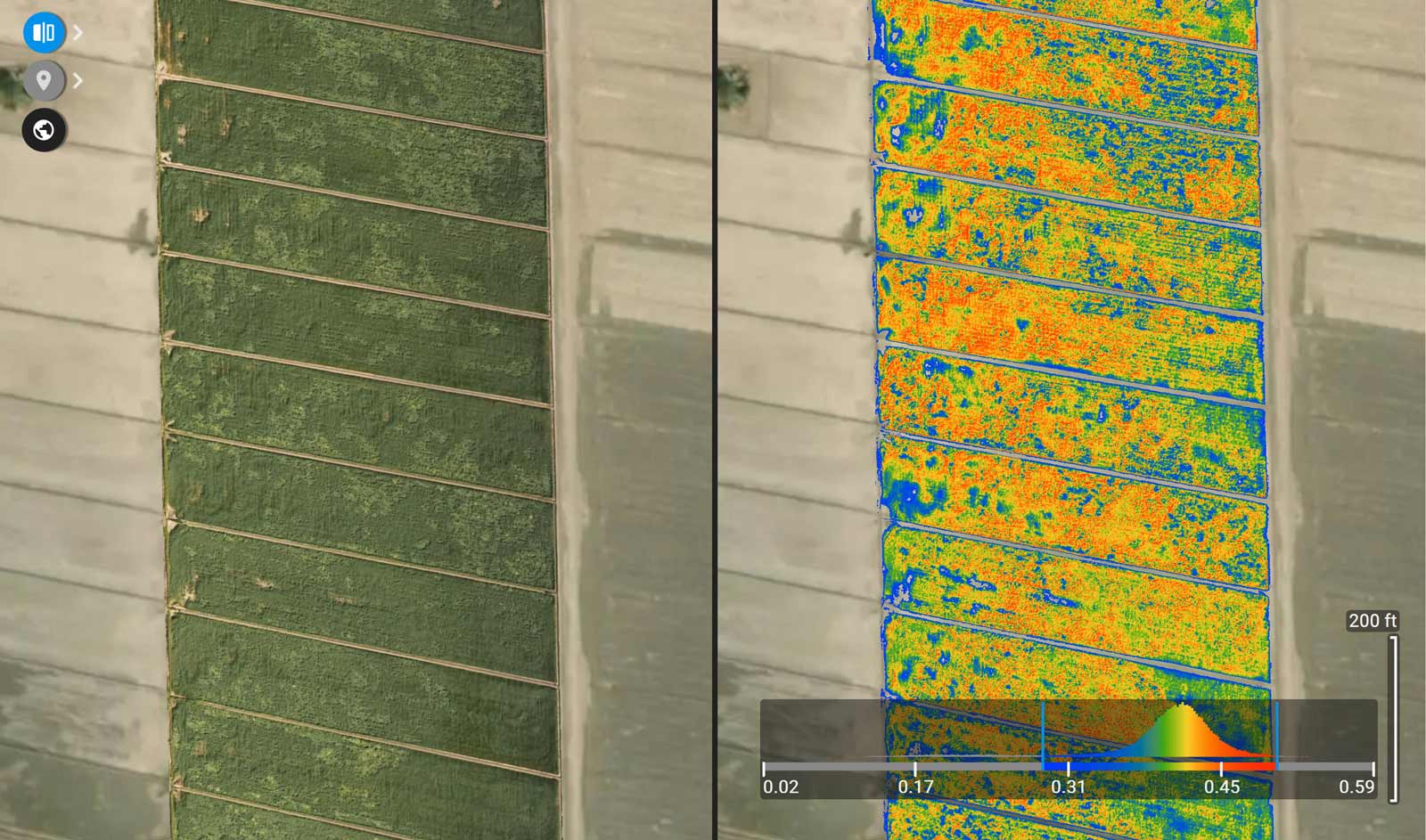
The map was used to indicate the average values of vegetation indexes correlated with biomass and chlorophyll content such as NDVI and NDRE across the plot and how it changes between the treatments. “Our work wouldn't have been possible without PIX4Dfields. The fast processing and tools such as the zonification by the arithmetic mean of vegetation indexes allowed us to deliver a high-quality zonation map”, pointed out José Alfredo, Manager at Azulda.
Advantages of using PIX4Dfields
“For us what differentiates Pix4D from other providers is the processing speed, data output quality, the index library, and the capability to get radiometric and sun corrections of input with the DJI P4 Multispectral. We don't consider using other Ag software, because in terms of precision agriculture PIX4Dfields is the best of the best”. - José Alfredo Dávila González, Azulda
The grower was very satisfied with the achieved project results. With the acquired data and image analysis the grower could compare which treatment and plot were the most productive and make the right decisions in the next spring growing season in order to make their production more efficient.
References
| ¹ "History of Grupo Industrial Lala, S.A. de C.V.", Back to top 2"Agriculture 4.0: Making it work for people, production, and the planet", Back to article |