
Reducing risk: mapping the world’s largest refugee camp
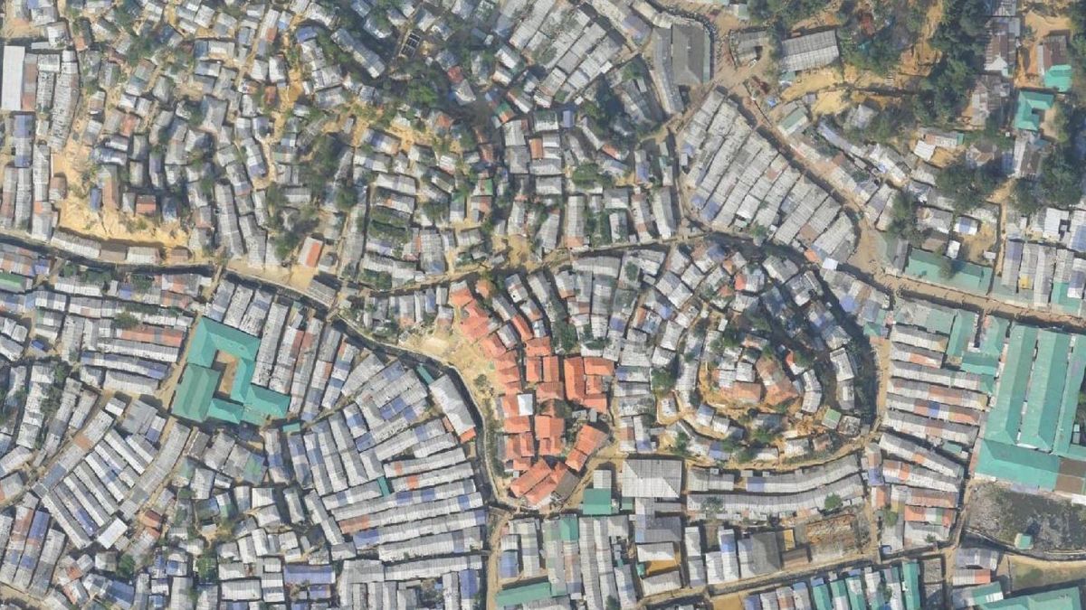
Kutupalong refugee camp in Cox’s Bazar, Bangladesh, has existed since 1991, but an influx of refugees fleeing persecution put pressure on the area’s resources. The International Organization for Migration (IOM) use drone mapping and Pix4D to help ease some of these logistical issues.
“There were no maps here before,” explains Sebastian Ancavil, IOM GIS Officer. “Before the August 2017 influx of refugees, it was a rural area and no detailed maps were made. The camp has grown from a few thousand to more than a hundred thousand shelters.”
As of January 2019, the OpenStreetMap database lists around 150,000 shelters.
Project details
| Location | Kutupalong refugee camp, Bangladesh |
| Project dates | Ongoing: September 2017 - present |
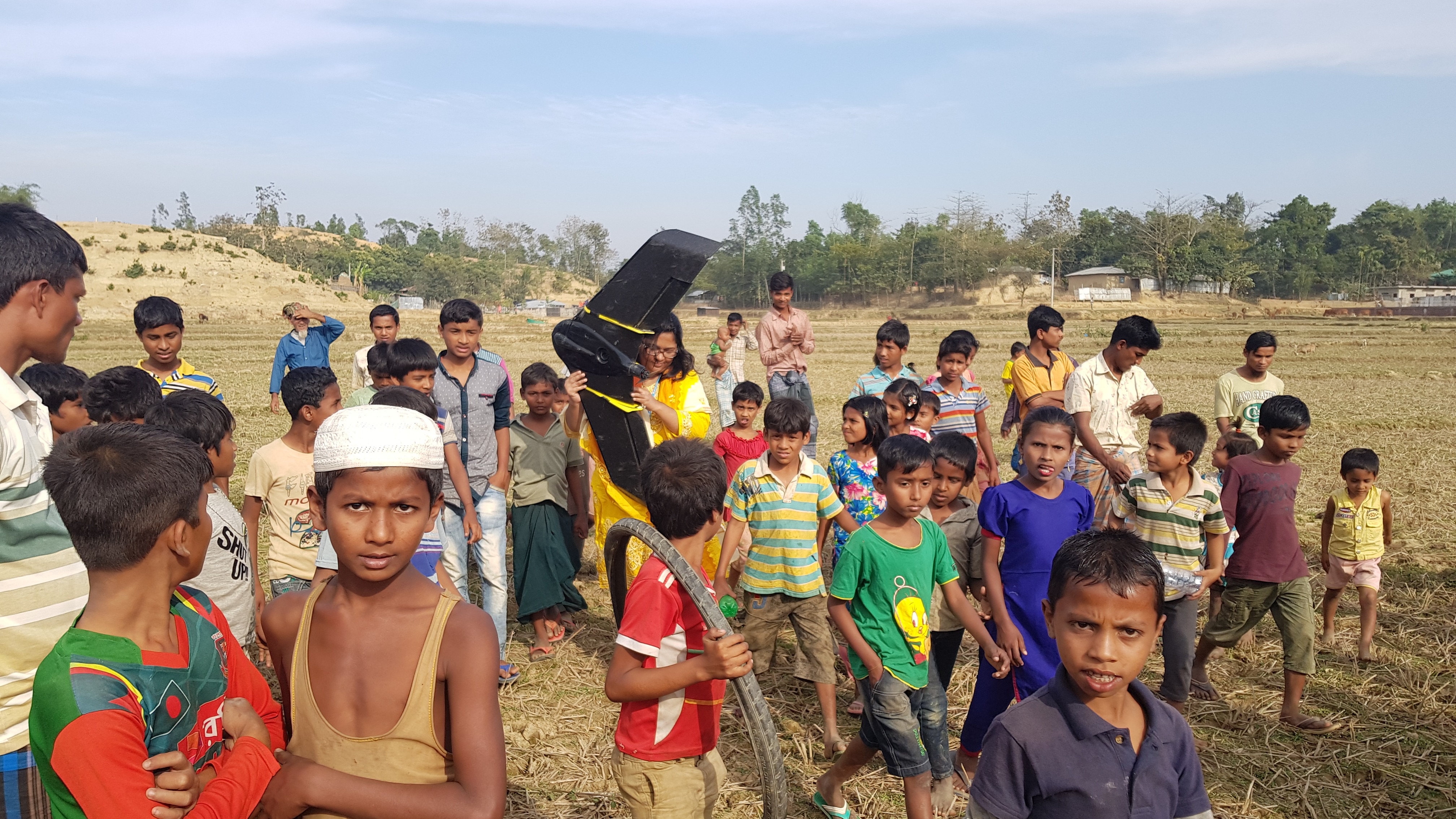
| Hardware | Sensefly eBee Plus DJI Mavic Pro |
| Software | Pix4Dcapture Pix4Dmapper photogrammetry software Pix4D Cloud |
| GSD | Between 5 and 15cm |
| Outputs | Orthomosaics Elevation model Lightweight downloadable PDFs Lightweight imagery for mobile apps Maps shared on humanitarian response platforms |
Giving a voice to the community
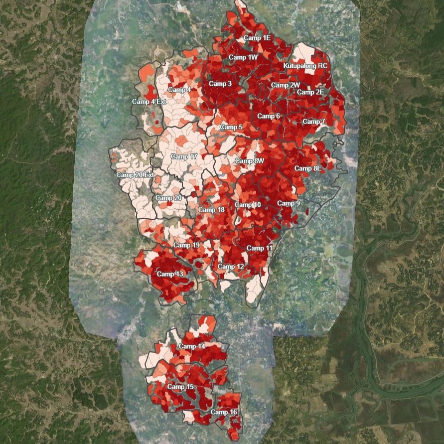
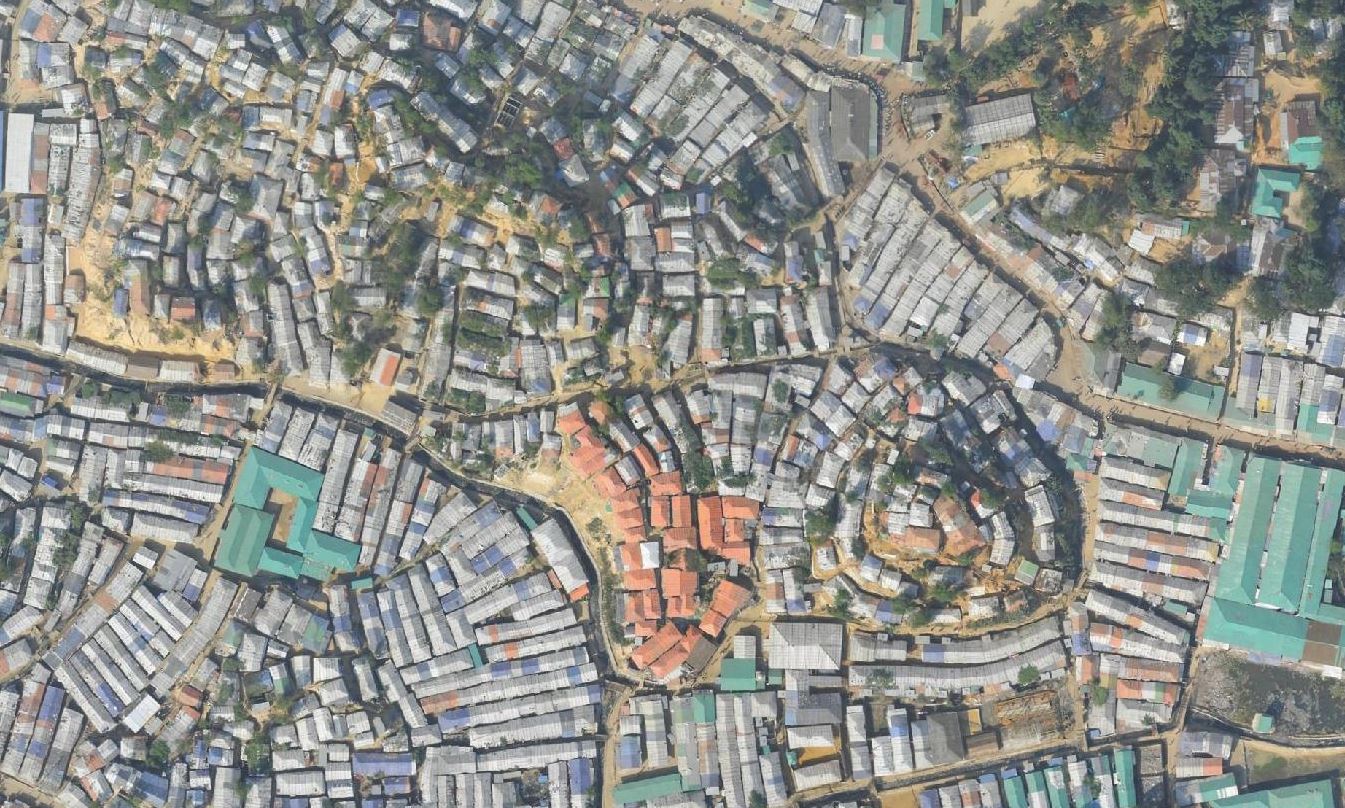
The Kutupalong refugee camp is divided into around twenty smaller camps for better management. The sub-camps are divided again into some 1,600 blocks, each led by a key informant, or Mahjee, and housing around a hundred families.
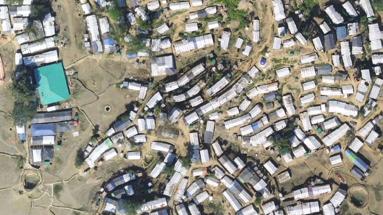
Drone maps help define these boundaries, and help staff on the ground navigate within them. IOM, humanitarian partners and other support personnel can mark key points such as sanitation, water points and rivers on the maps.
Updated maps can be downloaded by anyone from OpenAerialMap and HDX, or in lightweight georeferenced imagery package and in PDF format, which can be accessed on most phones and in mobile app as SW Maps or MapTiler. To keep the project accessible to as many people as possible, the team ensure the maps package is around 40mb.
In collaboration with authorities, the IOM team use the drone maps for enumerators combined with data collection on tablets to create regular estimates of the camp’s population. These dynamic estimates are used by relief organizations to distribute food, water, and medical supplies.
“It’s not a headcount,” clarifies Ancavil, “With the help of the Mahjee we define the Mahjee blocks perimeters and the shelters in their charge, and estimate the population and monitor population needs. The population was growing so fast - our methodology allowed us to have an updated population figure and a better understanding of their needs every two weeks.”
Reality-based reality capture
In any dynamic situation, teams have to be flexible.
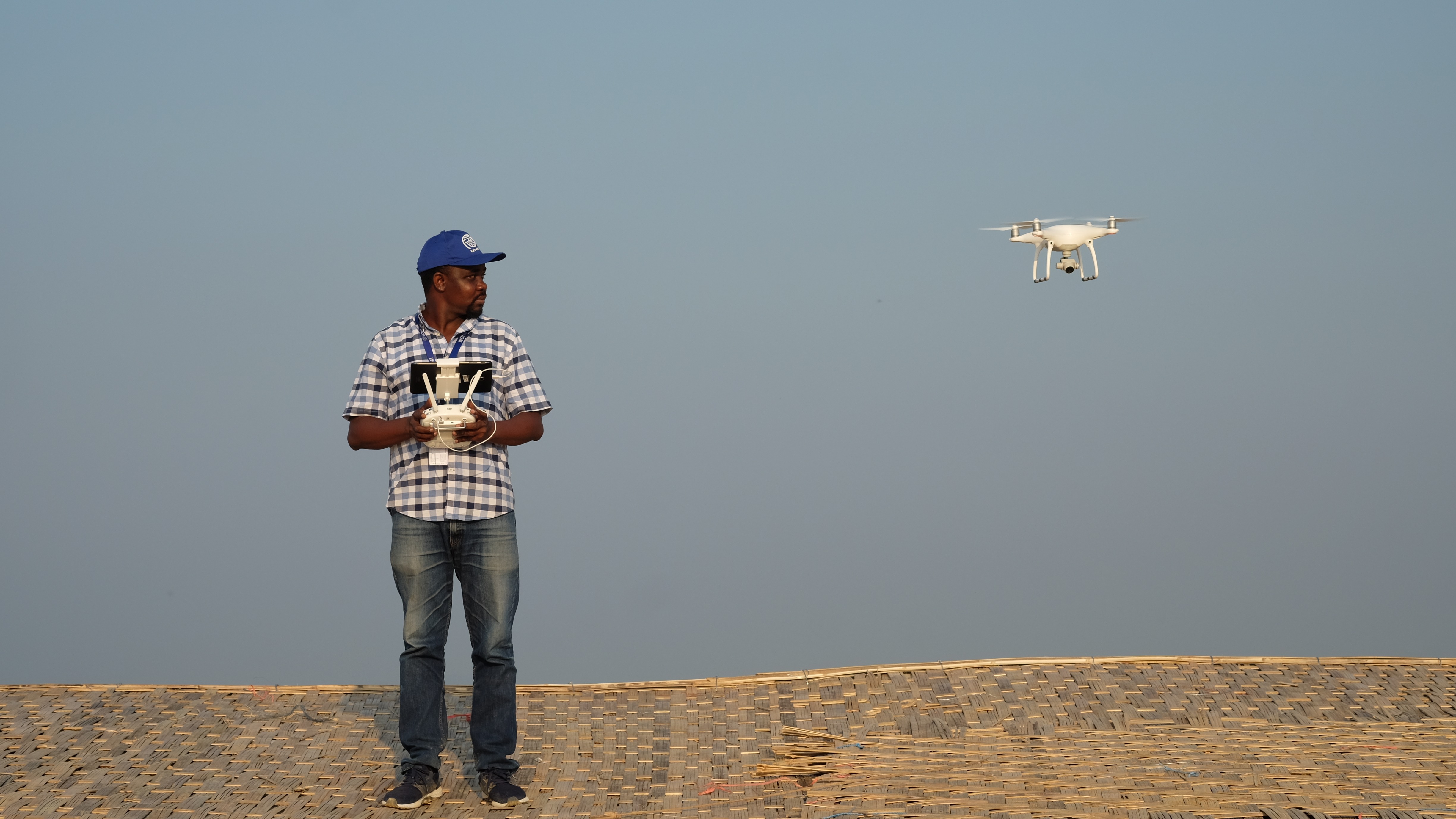
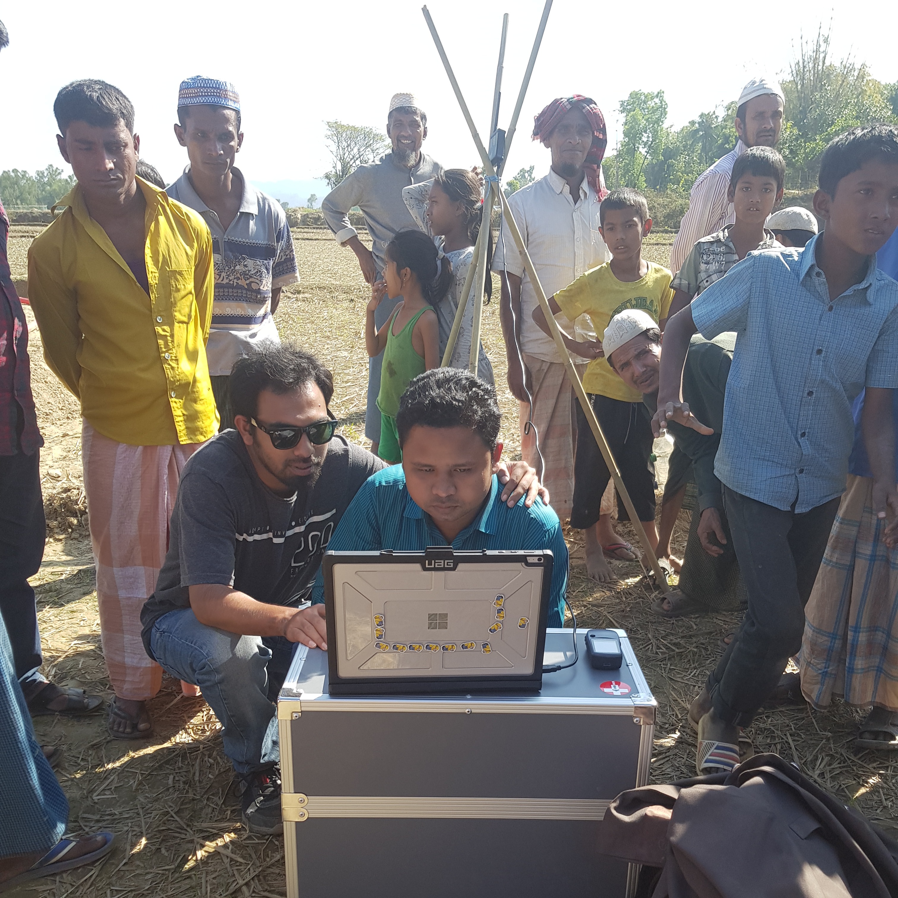
For the IOM, ensuring staff on the ground are trained as drone pilots and are able to process imagery and produce different mapping outputs is essential. Deploying drone pilots such as Ancavil from Geneva on temporary duty assignment is not sustainable for the long term. Instead, the IOM invested in training personnel on the ground, including Presler Jean who was trained by Ancavil and has worked with UAVs and the IOM since the Haiti earthquake. Jean is now based in Bangladesh and works with the Kutupalong refugee camp full time.
The IOM has developed a workflow which works even in the challenging conditions of Kutupalong camp. A new orthomosaic map is created once or twice a month - more if the situation demands it.
As the terrain and situation is so dynamic, the team have had to add new ground control points as the project has evolved. “Since I did the first drone survey in October 2017, more than half the camp was empty - now it is full of shelters,” says Ancavil.
“Typically, we complete ten flights over two days,” says Ancavil. “In the past - if the situation or a sudden emergency requires it - we have used very rapid mapping, flying in the morning and getting rapid mapping results by the same afternoon.”
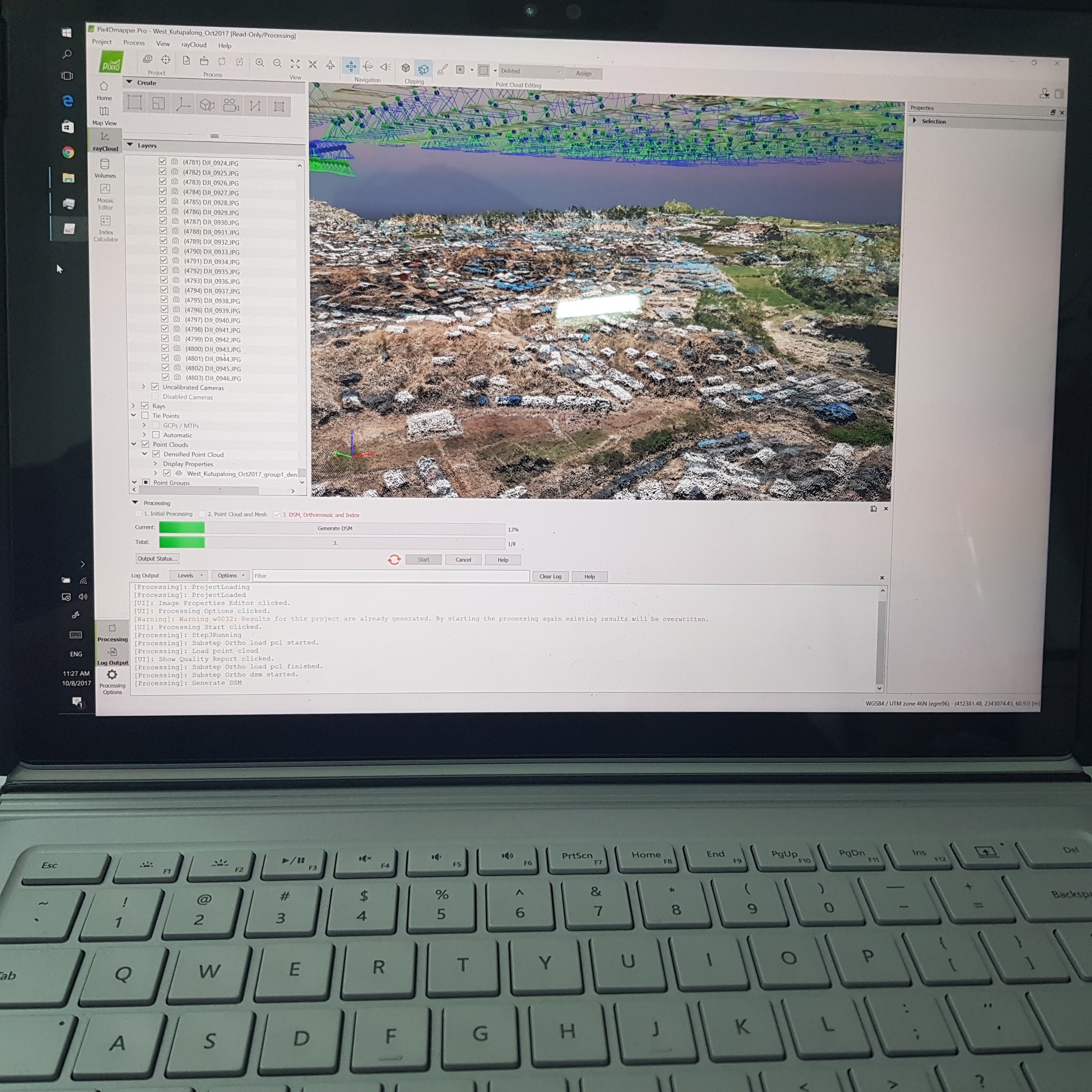
A single dataset may be as much as 9GB or 1,200 photos. Instead of attempting to work with the data in the field, the images are uploaded to Pix4D Cloud.
The images are processed in the Pix4D Cloud platform and on a dedicated server in Geneva, either by Ancavil in IOM HQ or by the team in Bangladesh.
“The team in Bangladesh can access the server remotely, even if they have very low bandwidth,” explains Ancavil. “They can access the high-capacity CPU, the RAM which Pix4Dmapper uses a lot of, so even with a small computer, they can process big datasets.”
The team achieves a ground sampling distance of between five and 15 centimeters.
Once processed, the orthomosaics, GIS imagery package and aerial photos are shared to OpenAerialMap and HDX. The results are also compressed to PDFs and small images to share with partners, camp managers and IOM personnel in the field.
Safety plans
As the camp expands, terrain mapping is used to ensure new shelters are erected safely. Surveying and mapping the camp’s landscape help identify areas at risk of weather events in the rainy season, allowing residents to move to higher ground ahead of the monsoon.
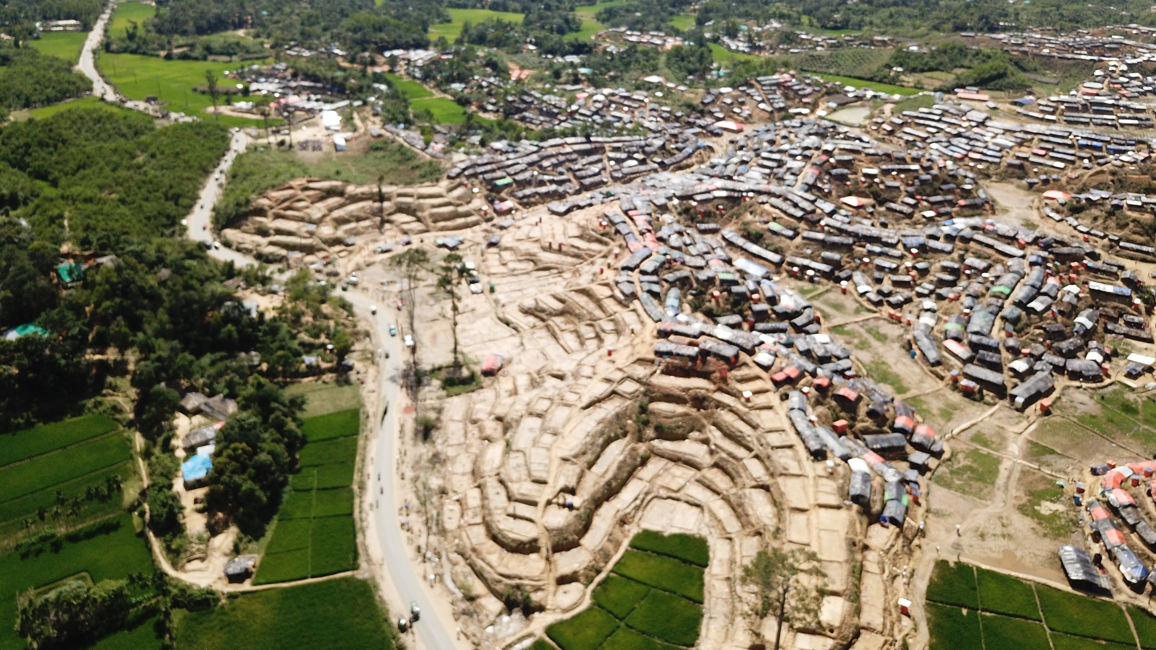
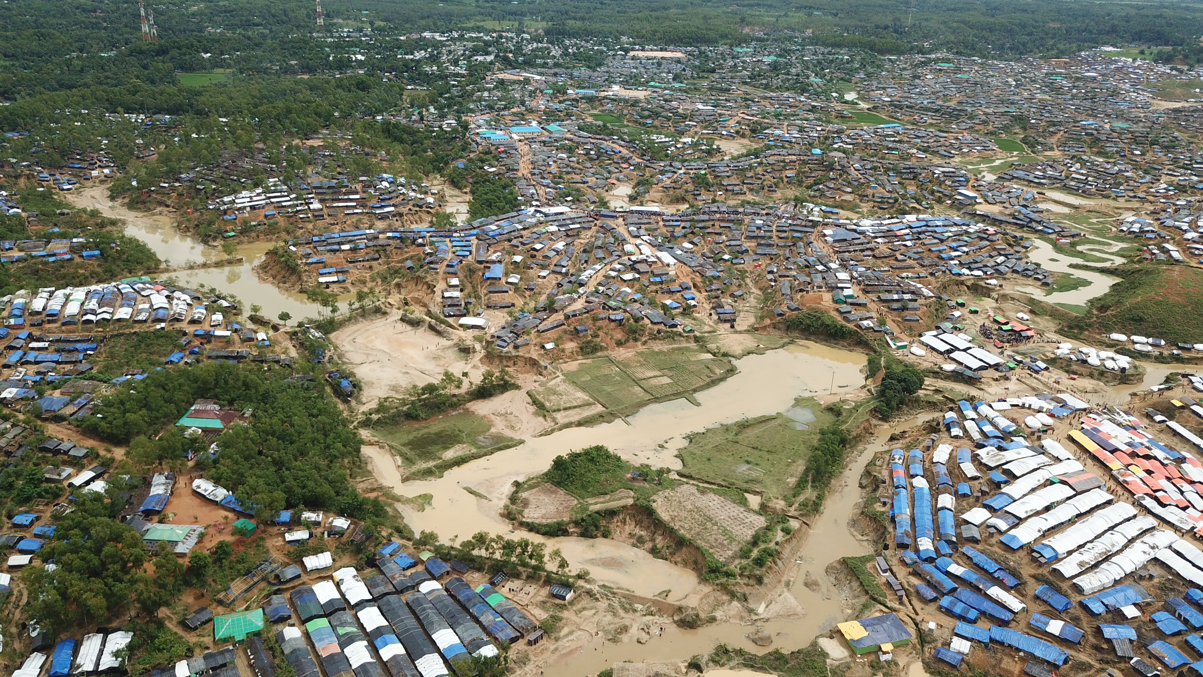
“Before we started this project there was nothing, not even up-to-date satellite imagery - the satellite images we received in September were very cloudy,” says Ancavil. “Now we have 150,000, 160,000 shelters digitized, plus the river, the water points, the latrines, the roads, all the infrastructure of the camp is available for everyone to see in an open-source platform.”
The unmanned aerial solution
“Drones are a solution I feel more organisations should access,” says Ancavil. “The project is handled on the ground with support from HQ. With good training in the unmanned aerial system, someone on the ground can launch the drone, and upload the image to Pix4D Cloud. That gives them the first output, and from HQ we can work with the point cloud, elevation model or imagery and provide other outputs as needed.”
“People working with drones don’t all need to be GIS or mapping experts, with just a small investment in the equipment we can have the maps we need quite easily and very quickly.”


