[Webinar] Collision reconstruction with Pix4Dmapper
Two experts in the field covered collision reconstruction in a recent round table discussion. Andrew Klane from Forensic Mapping Solutions Inc. and Brian Leventhal North Carolina State Highway Patrol spoke about the best hardware for mapping, Pix4D workflow solutions and overall advice on drone mapping for collision reconstruction.
Watch the webinar for free
Watch nowWhy use drone mapping and photogrammetry for collision reconstruction?
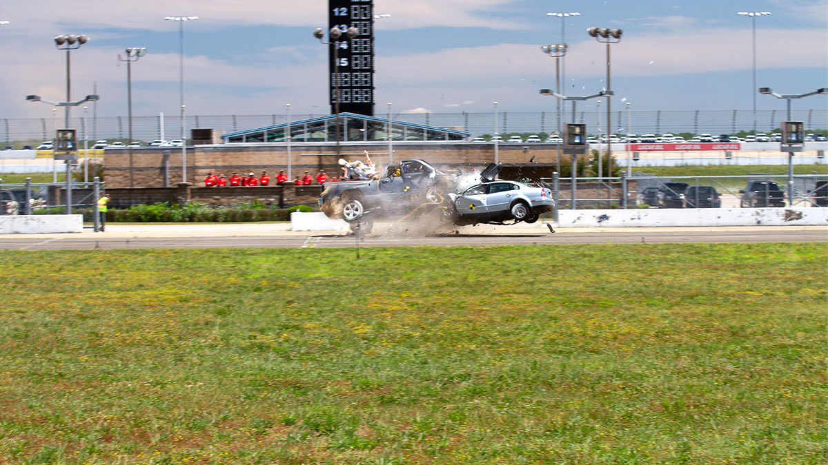
“It helps to think in terms of good, better and best,” says Brian Leventhal, North Carolina Highway Patrol Trooper with 20 years expereince in law enforcement. “If I take a single photograph from a crash scene and show it to a judge or a jury and talk about it, that’s good. It can give them an idea of what’s going on. If I can take a drone and fly over it and take several different images, and then stitch all those together and create an orthomosaic that’s better. Because now I can give them an overall picture of what the whole scene looked like and they can start to get a better idea of what happened in that crash. The best solution is if I can get a 3D environment. It’s almost like going back to the crash scene itself. It’s a magnifier of what that crash scene looked like. It’s much more realistic.”Police departments around the world rely on Pix4Dmapper to recreate courtroom-ready 3D environments.
The ideal collision reconstruction workflow with drones and Pix4Dmapper
Host Angad Singh from Pix4D discussed an ideal collision reconstruction workflow.
> Register to watch the webinar, then jump to 4:07 for the full discussion
First, the scene is plotted in Pix4Dcapture. Flying in a “lawnmower” or grid pattern will give good coverage.
Next, the dataset is retrieved from the SD card or drone.
Finally, the dataset is processed and explored using Pix4Dmapper desktop software.
Adding ground control points (GCPs) is an optional step - which can add an incredible amount of value. The panel discussed when GCPs are necessary.
Andrew Klane, CEO of Forensic Mapping Solutions and with 29 years experience with the Massachusetts State Police commented: “Anyone that tells you you don’t need a scale constraint or ground control points in one of these isn’t doing you a favor.”
He continues: “If you were to say to me, even 5 years ago that we could be talking about hundredths of a foot in crash reconstruction - that wasn’t something anyone would have thought about.”
Secondary benefits of drone mapping
The advantages of drone mapping for collision reconstruction are well-established. The panel listed some secondary benefits.
Internal tests from the North Carolina Department of transportation indicate that a drone map of an accident scene can be created in 25 minutes - compared to 1 hour and 51 minutes by traditional methods. That’s 344% more efficient.With the roads cleared faster, officiers can stay out of harm’s way. Klane notes that “An added benefit to clearing the road faster is reducing secondary collisions.”
And, as Singh commented: “Police officers have told me again and again that collision reconstruction is a gateway to a wider drone program.”