Drawing boundaries with UAV mapping in Namibia
An efficient and up-to-date solution for high resolution mapping in Namibia was developed by a research group from University of Twente (Netherlands), using a Bateleur fixed-wing UAV from Aeromapix with a SONY NEX 5 camera.
Project description
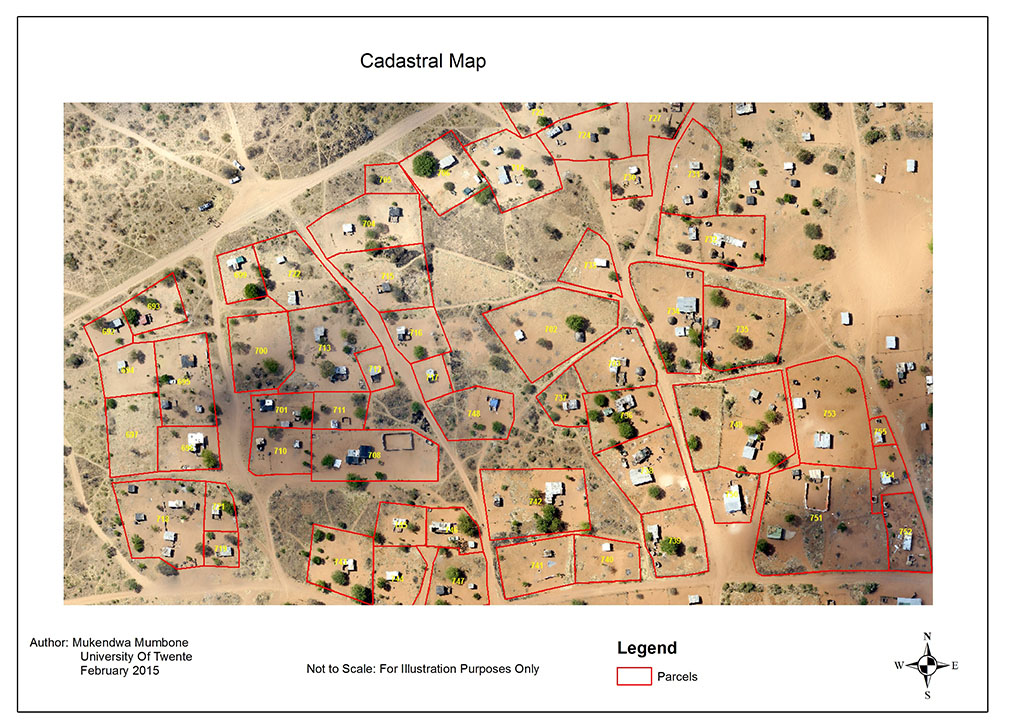
It was revealed that UAV-enabled mapping approach allows to capture high resolution images, and out of which a good quality orthomosaic can be generated. Due to the high resolution and timeliness of the Pix4Dmapper processed results, such outcome can be easily used for mapping customary land parcels.
This can now be done in a fast and relatively cheap fashion of digitizing parcels straight on-screen, without having to print out the orthomosaic. The final product is a high-resolution cadastral map which provides much more details than any previous maps of the region.
Project Details
| Institution | University of Twente, Faculty ITC |
| Country | The Netherlands |
| Industry | Aerial Photogrammetry |
| Project Date | September 2014 |
| Project Members | Markus Gerke, Rohan Bennett, Walter Volmann |
| Project Size | 160 Hectares |
| Number of Images | 330 |
| GSD | 5 cm |
Mapping land boundaries
In Namibia, the registration of customary land rights requires for a 2D polygon footprint of the land parcel to be mapped.
Aerial imagery and hand held GPS have been used in the past. However the physically demanding nature of the processes and poor resolution of the imagery make it difficult to work with these methods.
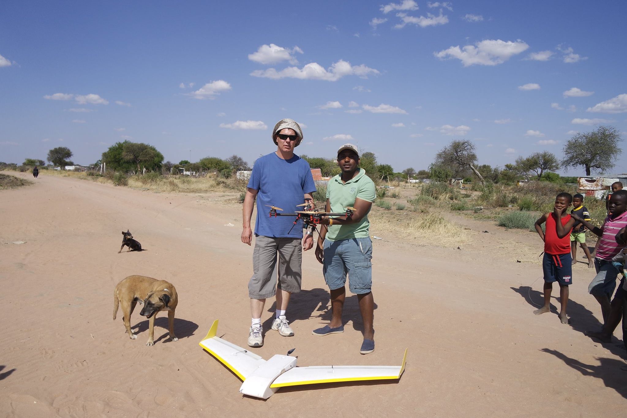
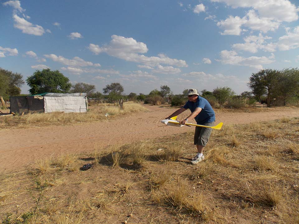
UAV technology has been said to be able to arrest these obstacles, for that reason UAV aerial surveying was considered and trialed in a pilot project in Namibia.
A fixed-wing drone “Bateleur” with a 16 megapixel camera - Sony NEX 5 was used for the image acquisition. 7 flight lines and a total of 330 images were captured over the study area in Gobabis Namibia.
Digitizing parcels
It was revealed that UAV-enabled mapping approach allows to capture high resolution images, and out of which a good quality orthomosaic can be generated. Due to the high resolution and timeliness of the Pix4Dmapper processed results, such outcome can be easily used for mapping customary land parcels.
This can now be done in a fast and relatively cheap fashion of digitizing parcels straight on-screen, without having to print out the orthomosaic. The final product is a cadastral map with a resolution of less than 5 cm. This is by far better than that of the current methods used in mapping customary land parcels in Namibia.