Accurate volume estimation with non-ideal flight plan
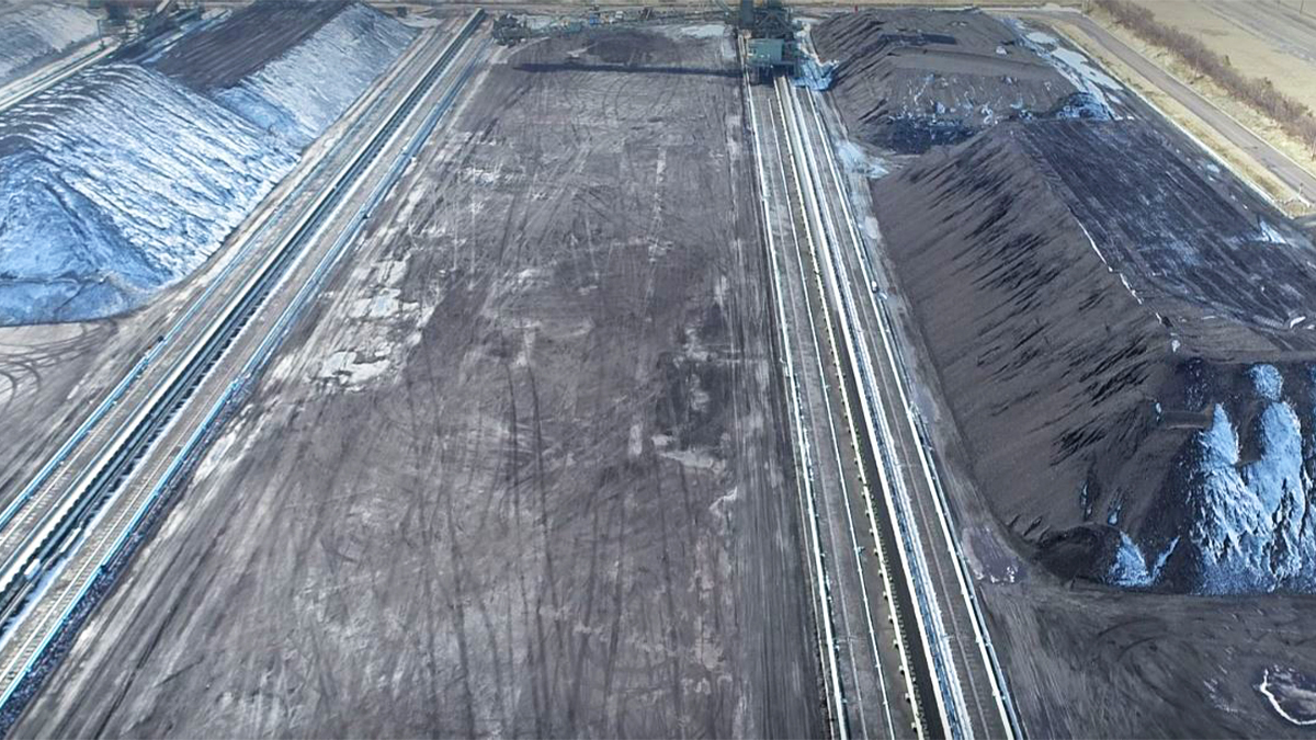
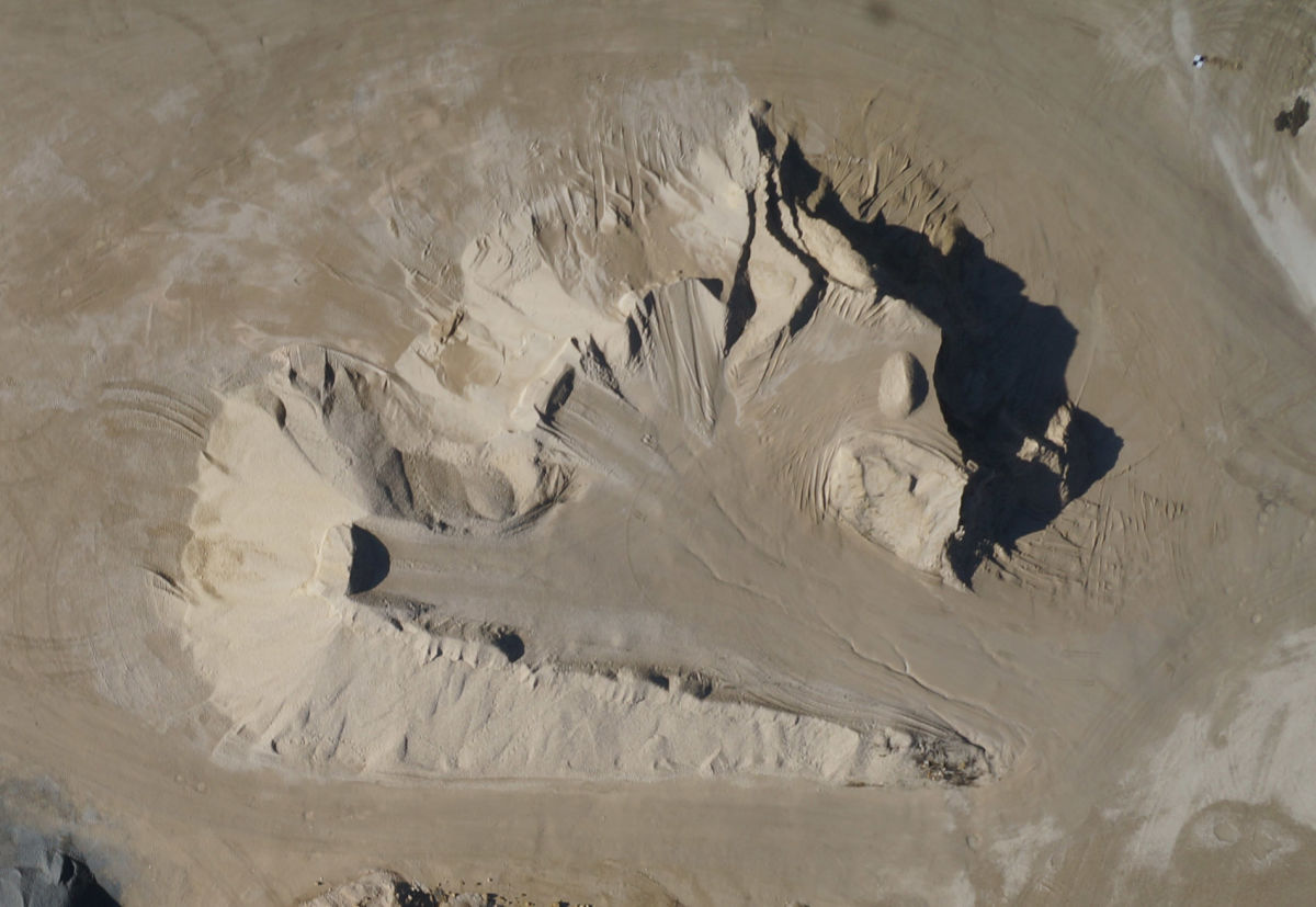
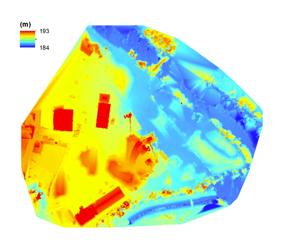
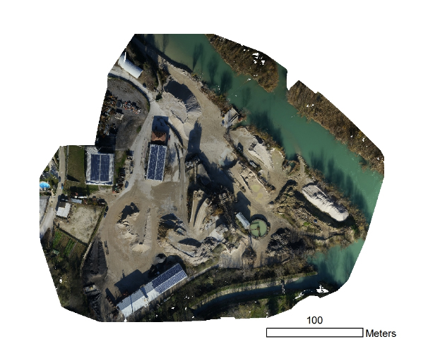
This project needed to obtain a centimeter grade DSM and orthomosaic to calculate volume of sand/gravel stockpiles within the quarry area. The goal was to estimate volumes of sand/gravel stockpiles with around 10 percent of error, based on the high-resolution and accurate DSM and orthomosaic generated.
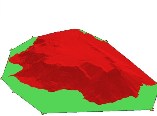
GCPs and the merging method were used in order to solve the issues of missing image geotags and the multiple flights. When separating into subprojects, care was taken that each subdivision contained at least 4 GCPs and shared a portion of images with the adjacent subdivision. When merging the subprojects, manual tie points were added in Pix4Dmapper rayCloud editor in order to better coincide the subdivisions.

Project information
| Company | Servizi Aerofotogrammetrici di Prossimità Srls (SAPR) |
| Country | Italy |
| Industry | Construction |
| Software | Pix4Dmapper photogrammetry software |
| Project date | March 2015 |
| Project members | Gaetano Di Achille (SAPR) |
| Project size | 15.8 acres |
| Number of images | 101 |
| GSD | 3cm |
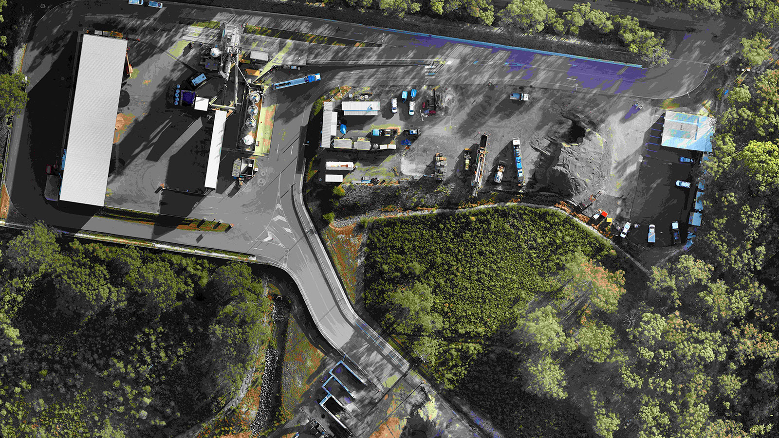
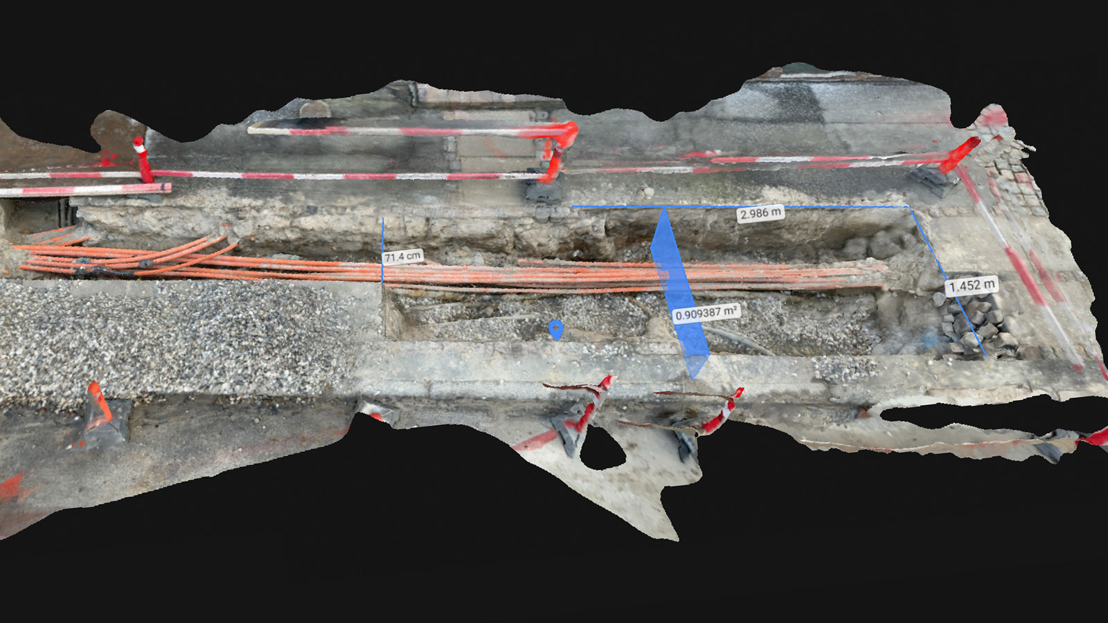
Due to the presence of several complex objects at low altitude such as trees, poles, tanks, container, buildings, trucks and several “difficult” surfaces to match such as water and photo-voltaic panels, the rayCloud editor and mosaic editor were used to do final polishing of the DSM and the orthomosaic.
Taking off
Images were acquired by an AirVision NT4-Contras. The on-board GPS had some problems and so the autonomous flight plan was not used. Therefore, both the UAV flight and the image acquisition were done manually.
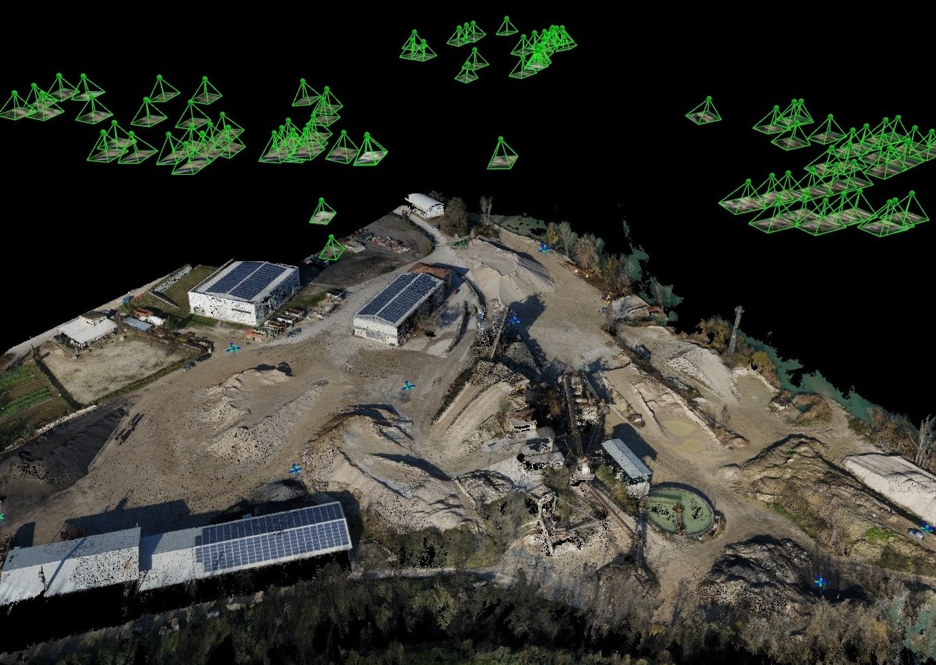
This resulted in the missing of image geolocation and inhomogeneous image coverage which may lead to insufficient overlap and difficulties in feature points matching. Also, without the automatic execution, there were three different flights (instead of one) that need to be merged in Pix4Dmapper photogrammetry software.
For acquiring accurate global geo-position without the geotags of images, 8 ground control points were placed and measured with RTK in the survey area.
"Extremely accurate results"
Despite the above mentioned acquisition issues, the thorough use of Pix4Dmapper photogrammetry software allowed the achievement of high-resolution (less than 3 cm GSD) and extremely accurate results over the studied area. The derived DSM was successfully used to calculate the volume of the sand/gravel stockpiles with an accuracy requested by the customer, who was very happy with the work and wanted further surveys in order to constantly monitor the evolution of the stockpiles through time.
For this reason, we decided to take full advantage of the high resolution and accuracy of georeferencing, and are going to plan multi-temporal surveys with associated differential calculations of the stockpiles’ volume through time with the use of Pix4Dmapper photogrammetry software.
"A quantum leap"
Volume calculation made with drones and Pix4Dmapper photogrammetry software represents a quantum leap with respect to the traditional topographic approach (i.e. using theodolite etc). The advantage is clear – this new method is Accurate, Fast, Repeatable, Cost Effective, and Efficient. Moreover, the results are of high impact, easy to publish or share, and are compatible with other applications.