What is accuracy in an aerial mapping project?
We’ve come a long way since the first aerial photographs. Now, drone images and even camera phones capture enough detail to create accurate digital twins.
Accuracy in an aerial mapping project is essential to getting professional results. In this article, we’ll explore what we mean by accuracy, what exactly is ground sampling distance, and how the Pix4D rayCloud can be used to improve the accuracy of your aerial mapping project.
In this article
What is absolute accuracy and relative accuracy?
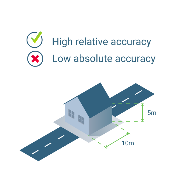
When discussing accuracy, it’s important to distinguish between relative and absolute accuracy.
Relative accuracy is accuracy comparing features within a reconstruction. For example, if a model of a building shows windows two meters apart, and this is the same distance as on the actual building, the model has high relative accuracy.
Absolute accuracy is the accuracy of the reconstruction in relation to its true position on the planet. If the same model of the building is not in the correct place on the basemap, it has low absolute accuracy, even if it has high relative accuracy.
This article goes into more detail on the difference between relative and absolute accuracy.
Does it matter if your model is accurate? That depends.
With a relatively accurate reconstruction, you can still measure distances, volumes and height. This may be more than enough for your project. However, if you want to combine it with GIS data, then absolute accuracy is very important.
What is the expected accuracy of an aerial mapping project?
Are your reconstructions as accurate as possible? The accuracy depends on the quality of the project which depends on a lot of different things - such as the overlap between images, the visual content of the images and more.
Generally, in a project which has been correctly reconstructed, you can expect the relative accuracy to be within one to three times the ground sampling distance (GSD). The absolute accuracy of a correctly reconstructed project is one to two GSD horizontally (X and Y) and one to three GSD vertically (Z).
What is ground sampling distance?
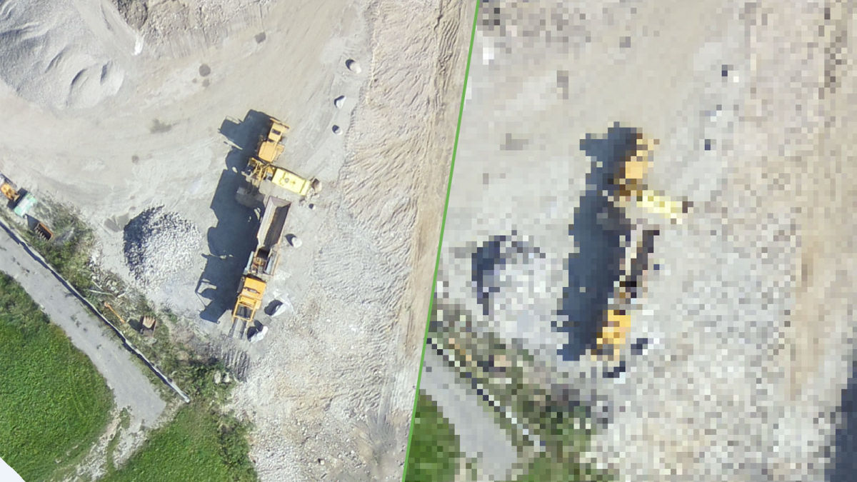
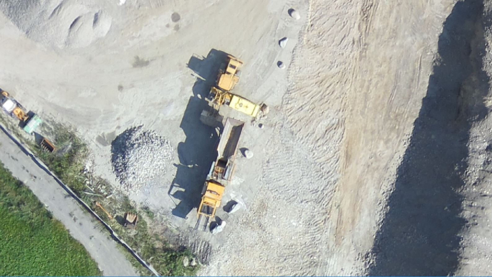
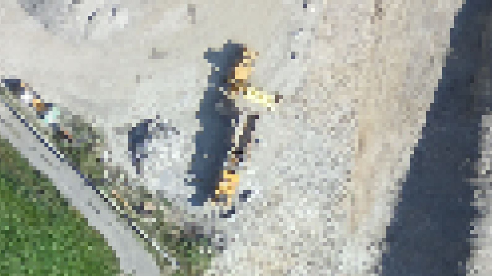
Ground sampling distance (GSD) is the distance between the center of two consecutive pixels measured on the ground.
Projects with a high GSD will have fewer visible details. In extreme cases, your project may look like an old video game.
Ground sampling distance is affected by the height you fly at and the camera specifications. A lower height, with the same camera, means lower ground sample distance and more detailed outputs.
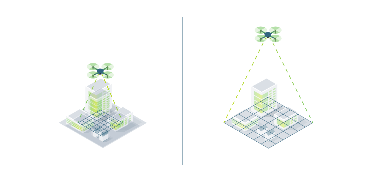
However, flying lower means taking more time (and batteries) to capture the same area.
Differences in terrain and changes in the camera angle mean that images in the same project may have different GSDs.
How to calculate the right flight height for the right GSD
What ground sampling distance you need depends on the requirements of your project.
If you are creating a 3D model of a complex structure, you need a low GSD to capture as many details as possible.
Before taking off, decide the right GSD and define the flight height.
The required height that is needed to obtain a given GSD depends on the camera focal length, sensor width and image width.
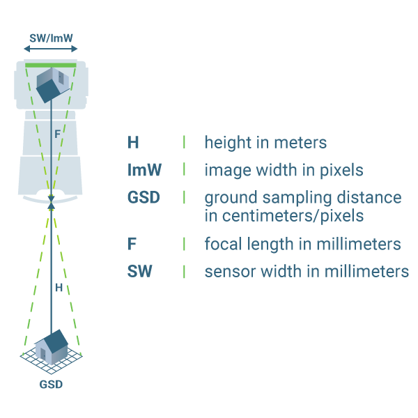
H [m] = (ImW * GSD * F) / (SW * 100)
Fortunately, we’ve created a tool to do this for you.
You can download the Pix4D GSD calculator for either Excel or Open Office.
To use it, plug in some variables such as sensor width and and focal length, and the GSD will be calculated automatically.
Or, with a drone flight planning app such as Pix4Dcapture, you can plan and fly missions with many different drones - and it automatically calculates the GSD.
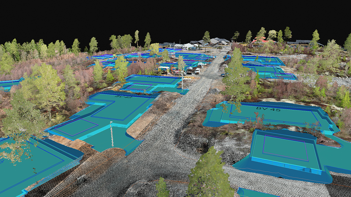
Assessing and improving accuracy with the Pix4D rayCloud
The 3D interface of Pix4D’s rayCloud allows you to interact with both the original 2D images and the reconstructed 3D scene.
Just click on a 3D point to see all of the images which were used to reconstruct that point.
As well as being great for virtually inspecting a project, you can use the rayCloud to better assess and improve accuracy.
A Theoretical Error can be visualized with the Error Ellipsoid for every single point of the reconstruction by clicking on it. Learn more in our support article.
Adding manual tie points (MTPs) improves the relative accuracy of the project. This way you add additional information that is used for the reconstruction of the project.
Adding ground control points (GCPs) improves both the relative and absolute accuracy of the project. In addition to MTPs, GCPs also include the real world coordinates which are used for georeferencing the project.
Checkpoints work similarly to GCPs, but while GCPs build the reconstruction, checkpoints verify that it is correct. You can review checkpoints in the Quality Report.
What you can’t do is create data which isn’t in your original images. In further posts in this series, we’ll help you plan the best possible flight for your project.
Do you have any questions or comments about this article? Join the discussion on our community! We're looking forward to hearing from you.