High-Resolution satellite insights. Precision results in minutes
Access premium satellite data directly within PIX4Dfields. No drones required. Create variable rate maps, monitor crop health, and save thousands on input costs—all from your office.
Access high-resolution satellite imagery directly in PIX4Dfields.All-in-one integration
Don't switch between platforms. Order, download, and analyze satellite data directly inside PIX4Dfields.
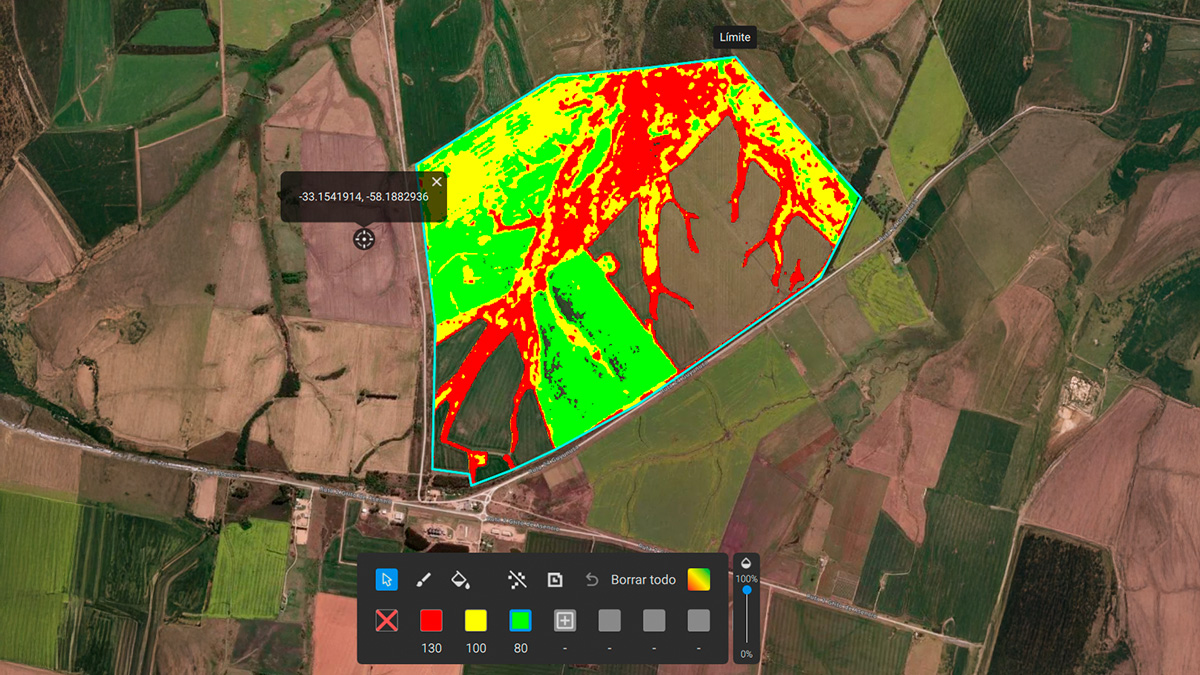
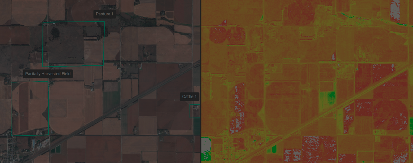
Plant health insights
Generate vegetation indices in seconds and track crop and field health.
Prescription maps
Get ready-to-use prescription maps in minutes for hundreds of hectares.
Tailored solution
Choose between standard (10m) for broad monitoring or high-resolution data for targeted applications.
Direct export to machinery for in-field applications
Seamlessly export maps to your tractor, spray drone, or field sprayer to save thousands on agricultural inputs.
Looking for specific dates or higher resolution? Task a satellite here
Inspect, analyze and visualize your crop changes all year round
Inspect, analyze and visualize your crop changes all year round
 Download satellite imagery
 Generate indices
 Zonate and prescribe
 Targeted Operations/Prescription maps