
PIX4DFIELDS OUTPUTS
Use what you need when you need all year round
Learn more about a specific output type


Digital maps
Visualize and analyze your crop data with different digital maps
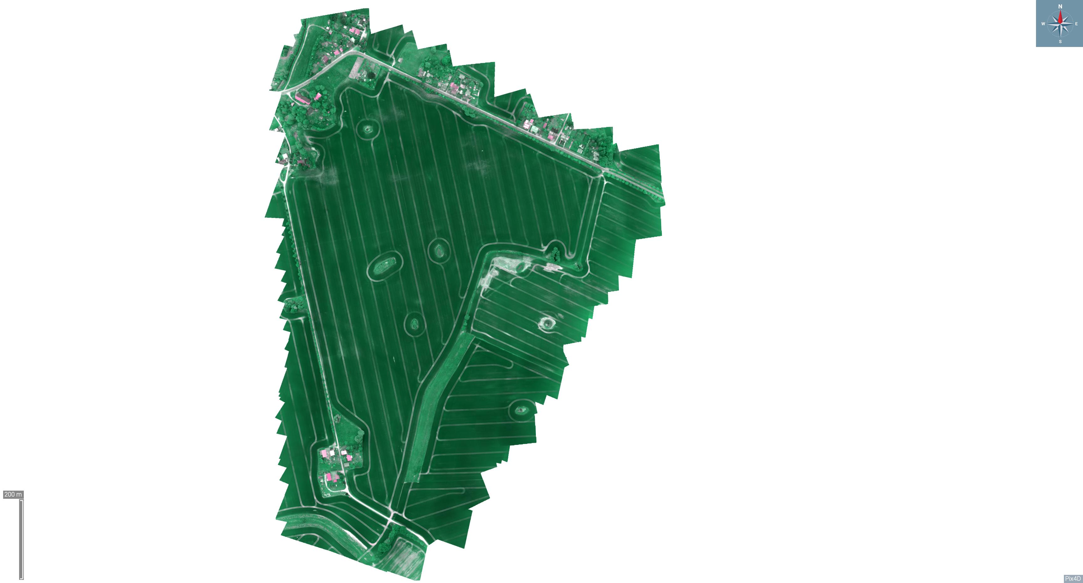
Orthomosaic
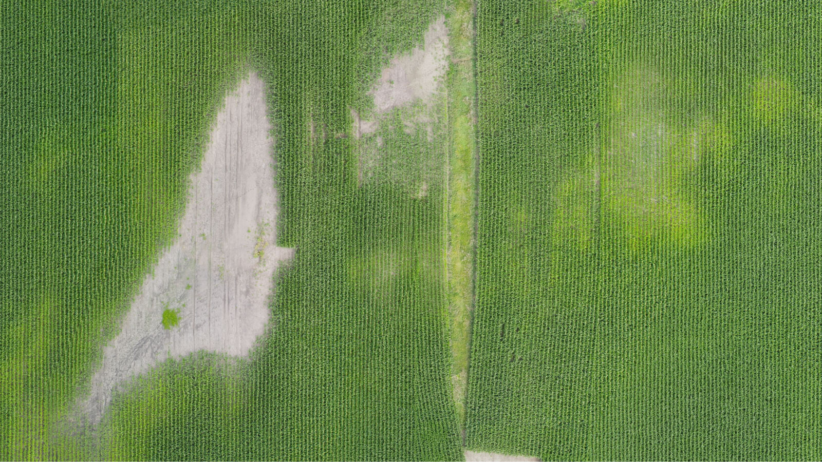
An intuitive representation of your field that helps you scout and identify issues faster. Specify the desired Ground Sample Distance (GSD) for a more, or a less, detailed output.
Fields of application:
Digital scouting, crop protection, insurance
Export formats: GeoTIFF, High-Resolution JPG
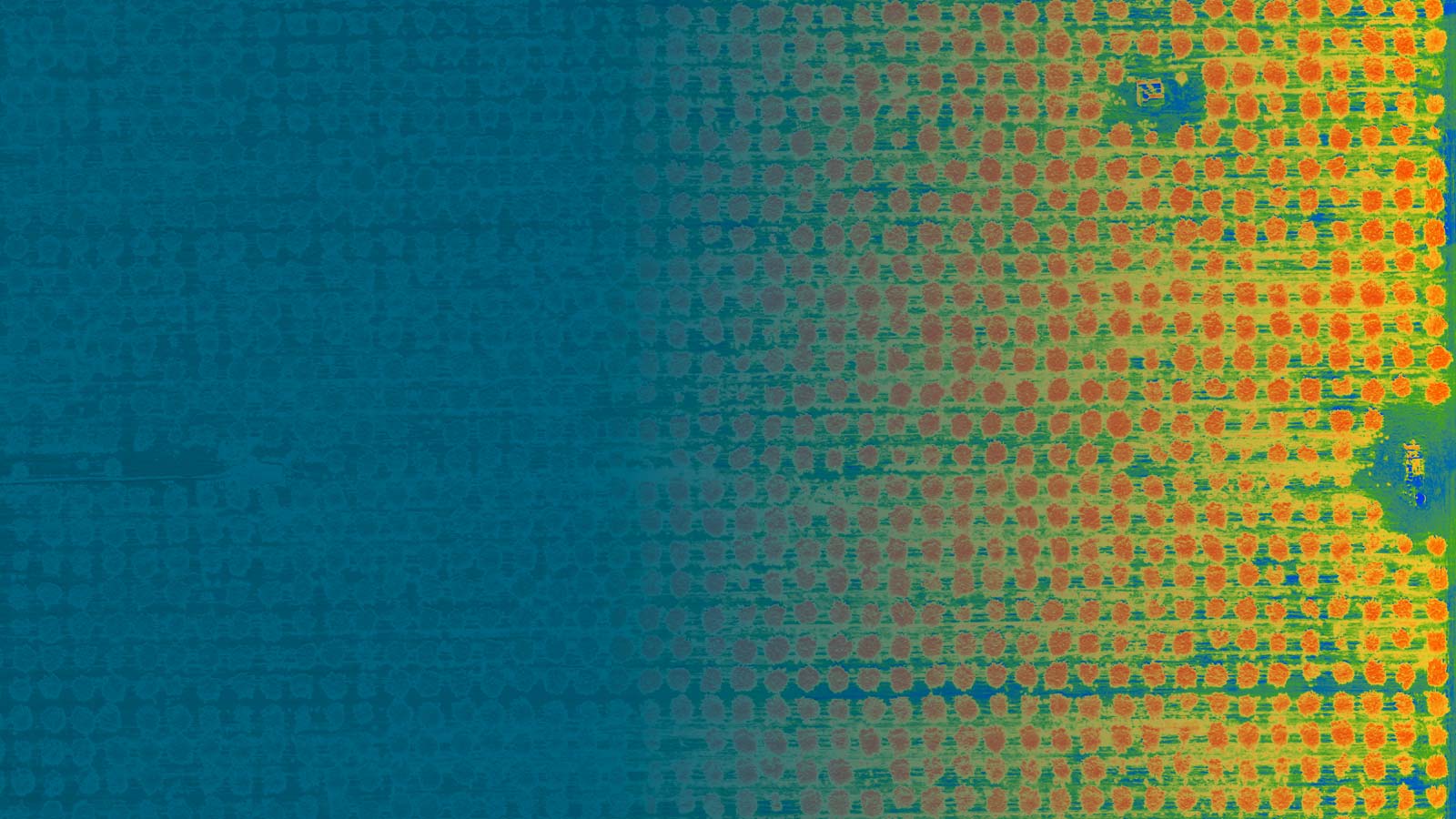
Vegetation index maps
Use a predefined list of vegetation indices like NDVI or use custom index formulas for a more comprehensive understanding of your crops.
Fields of application:
Crop protection, crop production, breeding
Export formats: GeoTIFF, High-Resolution JPG
Zonation maps
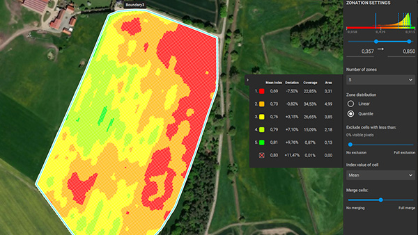
Create custom crop health zones based on vegetation index maps.
Fields of application:
Crop production, Scouting, Insurance
Export formats: Shapefile, KML, GeoJSON, GeoTiff, High-Resolution JPG
Annotations
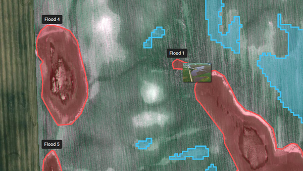
Convey valuable and actionable information by adding annotations (text and photos) to your maps.
Fields of application:
Digital scouting, crop production, crop protection, insurance
Export formats: Shapefile, KML, GeoJSON
Digital surface model (DSM)
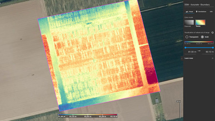
Get more detail about your irrigation variability and pinpoint erosion-prone areas with an elevation model of your field.
Fields of application:
Irrigation and erosion control
Export formats: GeoTIFF
Start saving today!
Customizable prescription maps for your spray drone, tractor, or field sprayer!
Targeted Operations: export maps for different brands (DJI, John Deere, XAG, and more!)
Spot Spraying - Prescription maps
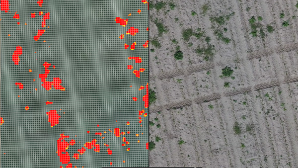
Identify weeds, areas of low emergence, or crop damages and create a targeted spot application prescription map to save inputs.
DJI Example (Spot), XAG Example, Shapefile Example (Spot), ISOXML Example (Spot)
Fields of application:
Crop production
Export formats: Shapefile, KML, GeoJSON, ISOXML
Variable Rate - Prescription maps
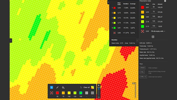
Assign application rates based on crop health to use in Variable Rate Application Maps for a more efficient use of inputs.
DJI Example (VRA), XAG Example, Shapefile Example (VRA), ISOXML Example (Spot)
Fields of application:
Crop production
Export formats: Shapefile, KML, GeoJSON, ISOXML
Field boundaries & obstacles
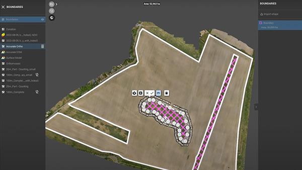
Create highly precise field boundaries & obstacles from your RTK drone flights, for application accuracy and safety
Fields of application:
Digital scouting, crop production, crop protection, insurance
Export formats: Shapefile, KML, GeoJSON
User-friendly exports
Enhance your business services
PDF report
Aggregate all the project information you need in a PDF report for easy sharing and collaborating.
Explore a PDF report
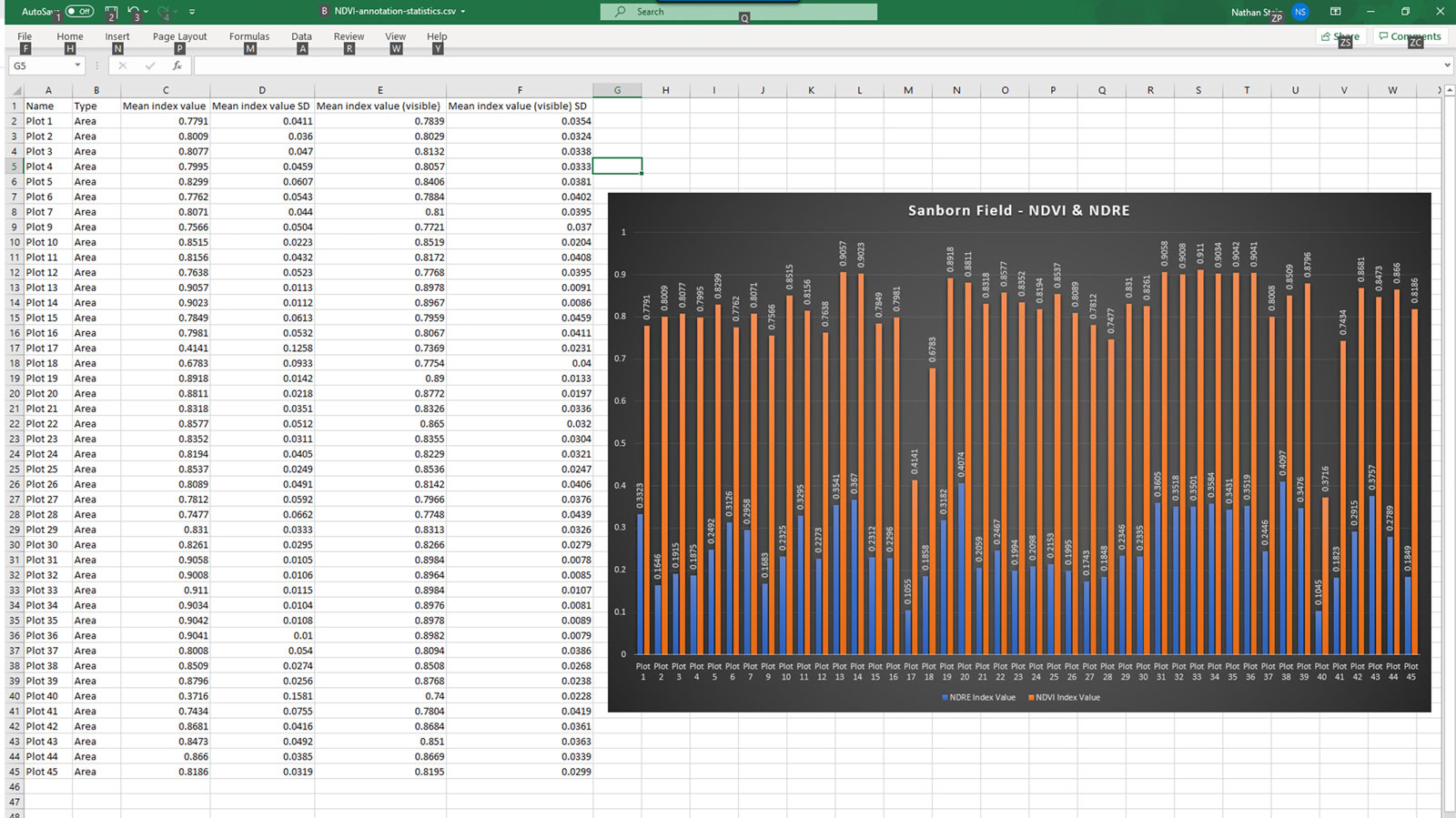
CSV export
Aggregate all the statistical information you need in a .csv export for easier trial plot management.
Download a CSV export
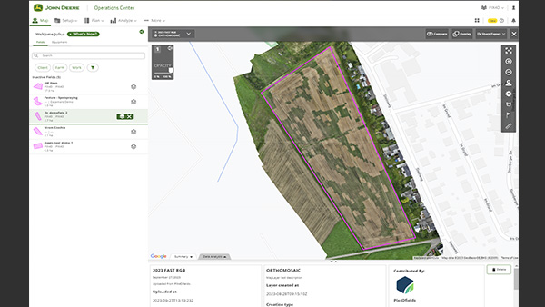
John Deere Operation Center
Connect to your Operation center account and share high-resolution drone and satellite images! Upload boundaries, aerial maps, crop health maps, maps for variable rate and spot spraying applications.
Pix4D Share-to-Cloud
Share to PIX4Dcloud is a feature of PIX4Dfields which makes it easy to share 2D layers over the internet with just a web link. It enables the connection of a PIX4Dfields desktop project to PIX4Dcloud.
Demo Project
High-Resolution snapshot
Export your layers as high-resolution JPG or PNG with customizable resolution, for social media, mail, or print
Get exporting today