
ビッグになる準備はできているか?
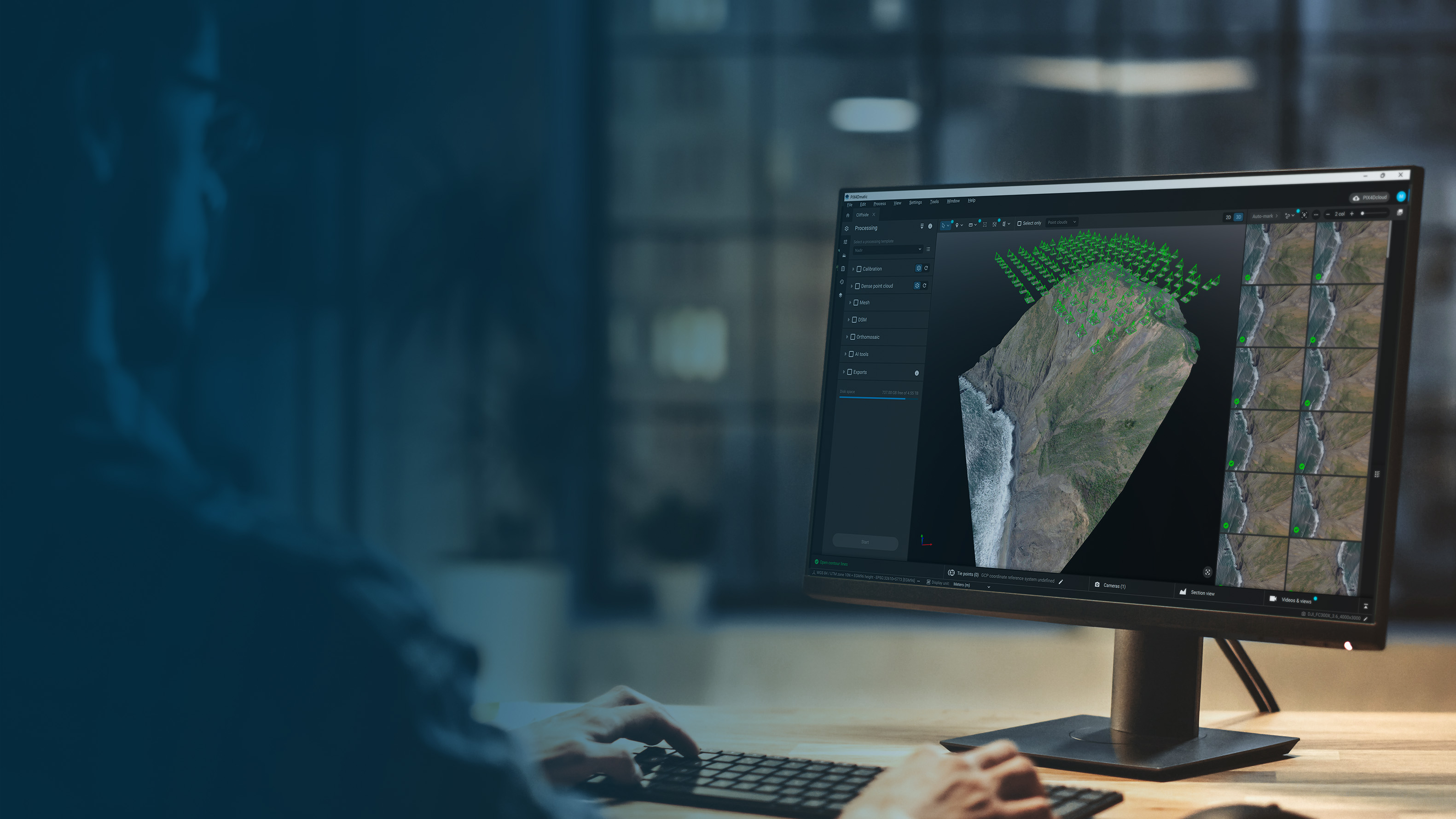
生のキャプチャからCADやGISに対応した成果物まで、大規模な処理と調査グレードの抽出を1つのワークフローで組み合わせます。
CAD/GISへのシームレスなパス
すべて 1つのワークフロー。データを処理し、同じワークスペースで調査作業を完了します。ツールを切り替えることなく、コンテキストを崩すことなく、キャプチャから成果物までスムーズに行えます。
スピードを落とさずに大きなプロジェクトを処理
精度のレベルを維持しながら、 大規模なデータセット を扱うことができます。プロジェクトの分割や手抜きをすることなく、より多くのデータをより短時間で処理することができます。
信頼できる測定
地形モデル、ベクトル、 および 体積計算 を、処理されたデータ上で直接作成できます。複雑な現場でも、一貫した信頼性の高い結果が得られます。
CADやGISへの出力が可能
CAD または GIS ソフトウェアにそのままドロップできる、クリーンで構造化されたファイルをエクスポートします。手直しも、余分なフォーマットもなく、すぐに使えるファイルです。
Pix4D エコシステム用に構築
PIX4Dcatchでキャプチャし、 PIX4Dmaticで処理と抽出を行い、 PIX4Dcloud にエクスポートして共有とコラボレーションを行います。現場からオフィス、さらにその先まで、一貫したデータを維持する接続されたワークフローです。
統合された加工と測量のワークフロー
必要不可欠なアウトプットをわずかな時間で
精度を損なうことなく
点群
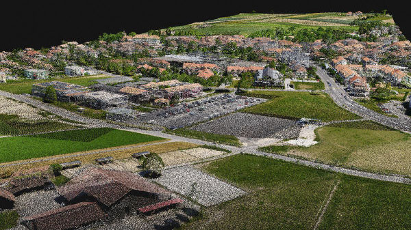
プロジェクトのニーズに応じて、高密度点群の生成、深度点群の作成、またはこれらの融合を行い、可能な限り最高の再構成を作成します。
エクスポート形式
.laz
.las .xyz
オルソモザイク
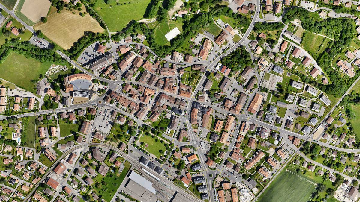
縮尺が均一になるように幾何学的に補正されたオルソモザイクを作成する。視覚的に美しくなるようにカラーバランスを整える。
エクスポートフォーマット .tiff(GeoTIFF) .jpg(.jgw で地理参照) .tfw .prj
デジタル・サーフェス・モデル(DSM)

マッピングされたエリア内のすべてのオブジェクトのデジタル表示を生成します。自然の特徴だけでなく、建物のような高台のオブジェクトも含まれます。
エクスポート形式 .tiff (GeoTIFF)
メッシュ
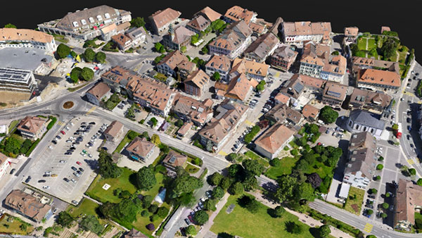
テクスチャサイズとデシメーション基準を定義して3Dテクスチャメッシュを生成し、テクスチャモードまたはシェーディングモードで表示します。
エクスポート形式: .obj .slpk Cesium 3D Tiles .laz .fbx
地形分類。
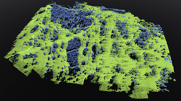
点群データを地上クラスと非地上クラスに分類し、正確な地形モデリングと測量分析をサポートします。
エクスポート形式: .LAS (.las) .LAZ (.laz)
デジタル地形モデル(DTM)
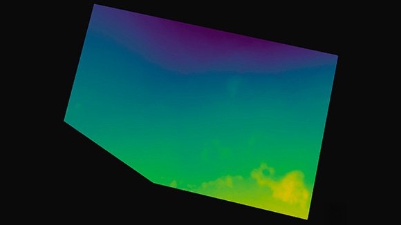
非地形ポイントをフィルタリングしてデジタル地形モデル(DTM)を生成し、エンジニアリング分析や測量ワークフローに適した裸地表面を表現します。
エクスポート形式 .tiff (GeoTIFF)
TIN
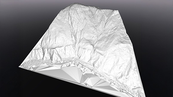
地形点の分類とサーフェス解像度の定義により地形TINを生成し、地形解析や計測のために構造化された三角サーフェスとして可視化します。
エクスポート形式: .LandXML .GeoTIFF 形式 (.tif)
等高線
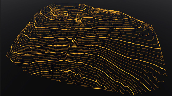
地形モデルから等高線を定義された間隔で直接生成し、マッピングや測量の成果物を作成します。
エクスポート形式 .dxf .shp

PIX4Dmaticユーザーの声
「PIX4Dmaticは精度、スピード、使いやすさを提供してくれます。1つのソフトウェアスイートで、観光、危機管理、都市計画のための貴重な情報を数時間で抽出することができます。"
オペレーション・マネージャー
JABビジュアル社
「Pix4Dとは設立当初からの付き合いですが、彼らのソフトウェアの成長は、私たちの成長を直接的に後押ししてくれました。PIX4Dmaticの処理速度は、一刻を争うこのようなプロジェクトにおいて、画期的なものでした。都市全体のデータセットを処理し、それを即座にPIX4Dcloudで共有し、共同作業を行うことができるのは、Pix4Dのソフトウェアがいかに進化したかの証です。Pix4Dのチームは、データだけでなく、一刻を争う重要なソリューションを提供できるツールを提供してくれます。
COO(最高執行責任者
ウエストコースト航空写真社
「PIX4Dmaticは常に正確で信頼性の高い結果を提供してくれるので、私たちはPIX4Dmaticでの作業が大好きです。PIX4Dmaticは私たちのあらゆる処理ニーズに対応しており、直感的なツールで環境プロジェクトやマッピングプロジェクトをサポートしてくれます。"
コスタリカ・フライング・ラボ・コーディネーター&ハンゼル・レオン
&
コスタリカ・フライング・ラボ リサーチ・アシスタント


