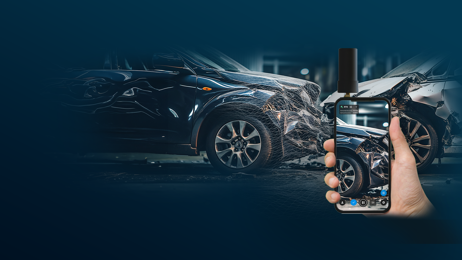
Forensics
The forensics solution
transforming 3D collision reconstruction with speed and precision
Contact us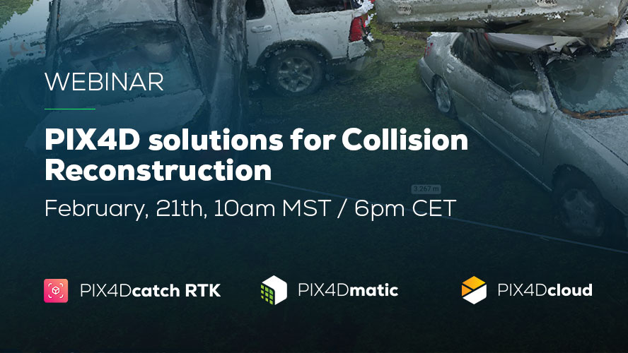
WEBINAR
Explore Pix4D’s solutions for Collision Reconstruction and Forensics
Explore capturing scenes using your phone and drone with subject matter experts. Learn how to process, merge, and utilize data, export videos for sharing in court.
Watch nowTransforming challenges into solutions in forensics
Discover how Pix4D solves the common problems for Forensics teams

Time
Every 10-minute delay in clearing a collision increases risk of secondary collision by 28%.
*According to the Federal Highway Administration
We provide the most time-efficient method that allows you to collect irrefutable evidence and accurately reconstruct 2D and 3D scenes.
We provide the most time-efficient method that allows you to collect irrefutable evidence and accurately reconstruct 2D and 3D scenes.

Cost
Traditional forensics tools are not only expensive, but also delicate, demanding meticulous handling.
PIX4Dcatch RTK and PIX4Dmatic form the most affordable and precise 3D capture and reconstruction solution, equipping police teams with top-tier tools at minimal cost.
PIX4Dcatch RTK and PIX4Dmatic form the most affordable and precise 3D capture and reconstruction solution, equipping police teams with top-tier tools at minimal cost.

Easy-to-use
Traditional tools have steep learning curves, complex setups, and need more personnel.
PIX4Dcatch RTK’s small size and intuitive usage help with the rapid clearance of collision scenes, whereas PIX4Dmatic enables you to deliver court-ready results with a minimal amount of training.
PIX4Dcatch RTK’s small size and intuitive usage help with the rapid clearance of collision scenes, whereas PIX4Dmatic enables you to deliver court-ready results with a minimal amount of training.
Merge data
Drones face limits against adverse weather and overhanging objects.
With PIX4Dmatic and PIX4Dcatch RTK, you can seamlessly merge ground-level 3D reconstructions with drone data to create a comprehensive reconstruction.
With PIX4Dmatic and PIX4Dcatch RTK, you can seamlessly merge ground-level 3D reconstructions with drone data to create a comprehensive reconstruction.
Analyze the scene
Understand the surroundings, highlight collision markings and place GCPs.
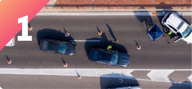
Drone survey
Capture the area of the collision to build a map of the surrounding area.
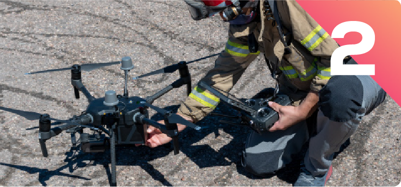
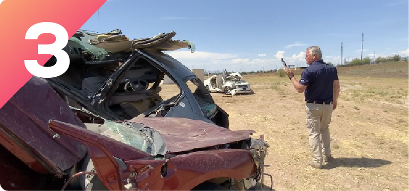
Phone survey
Capture the collision scene and vehicles using PIX4Dcatch RTK for a highly detailed collision reconstruction including a detailed damage analysis.
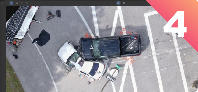
Merge and Export
Merge the drone and phone surveys, deliver a 2D map with annotations, a court-ready video of the collision or export the dataset to any 3rd party software like Virtual Crash, PC Crash, Map360, Faro Zone 3D.
Trusted by professionals