Preserving colonial era church ruins with drone mapping
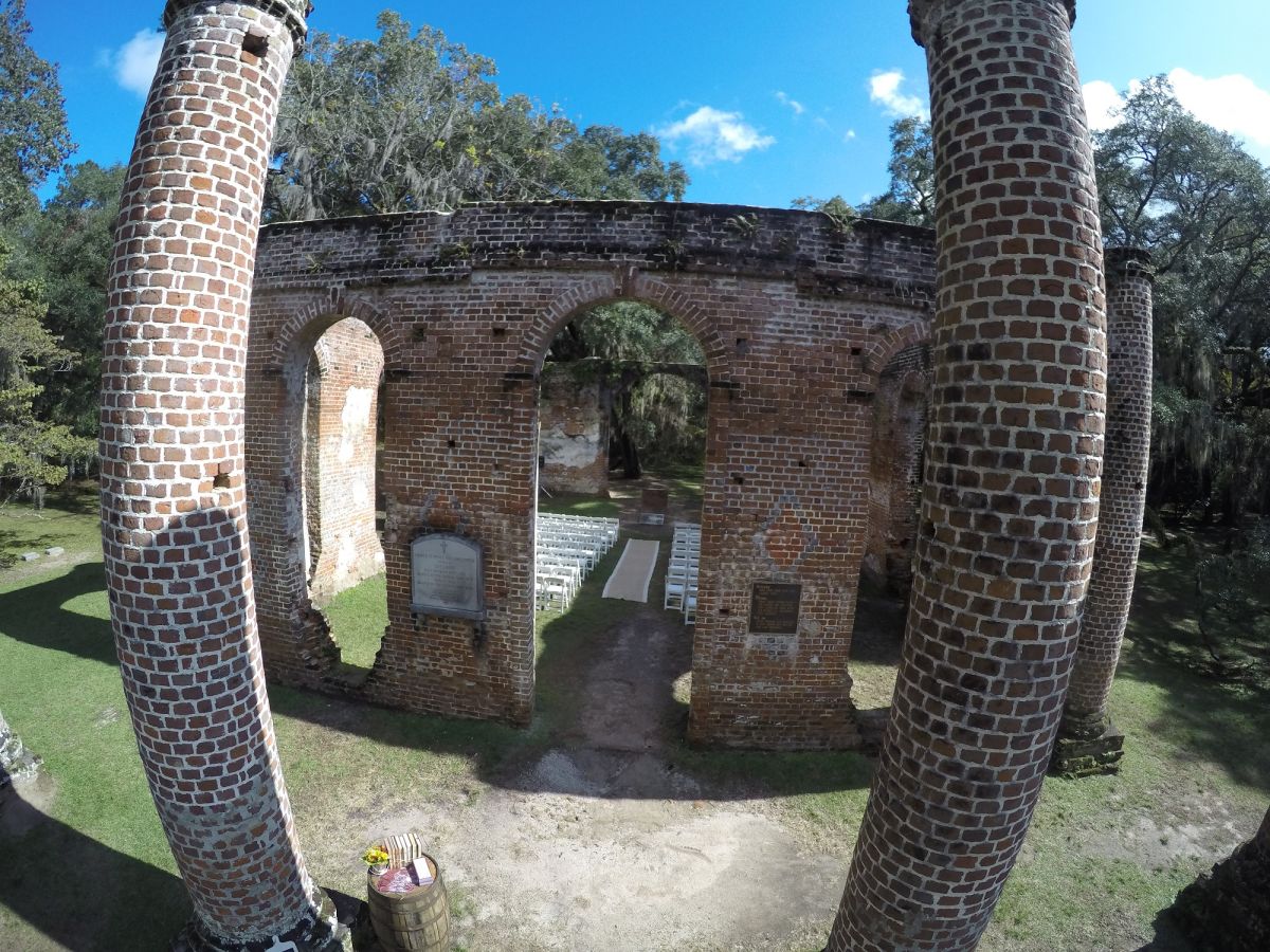
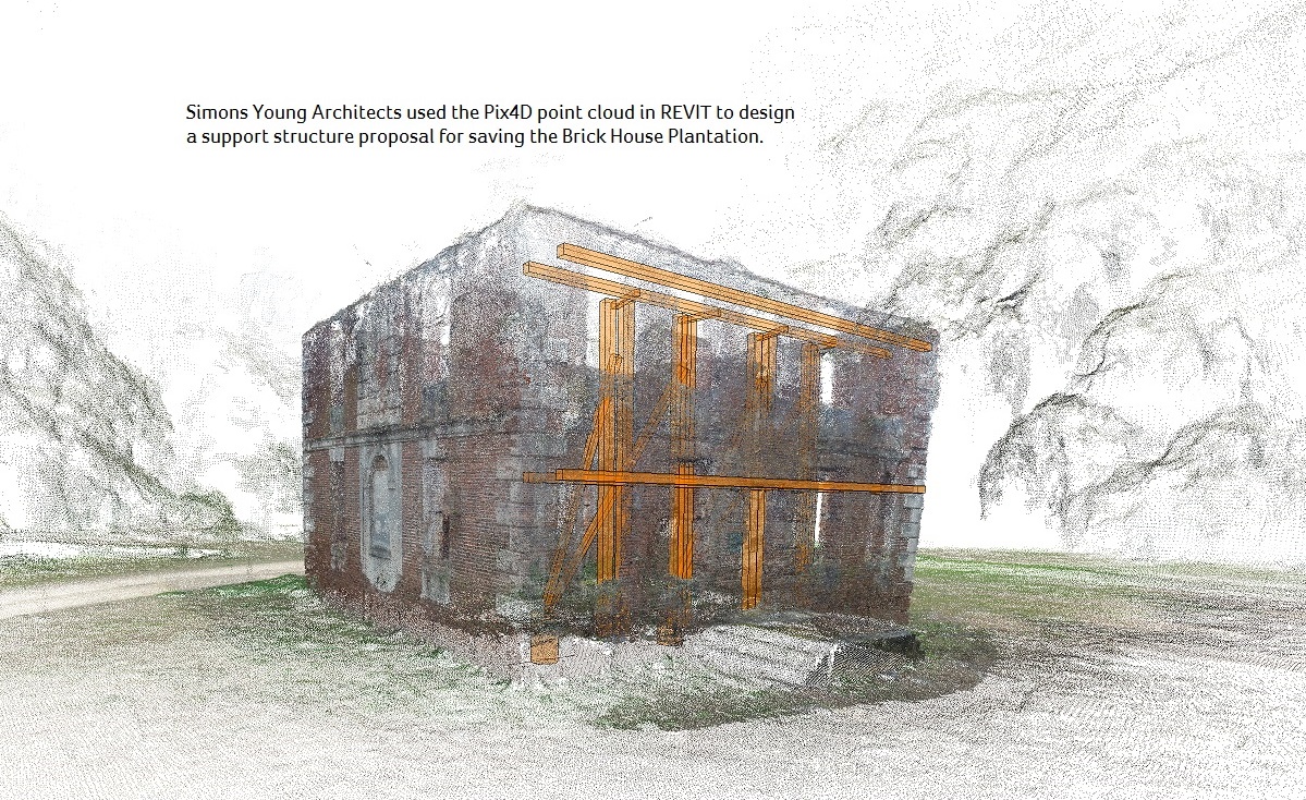
In order to help save these National Historic Landmarks, the Sheldon Church Ruins and Brick House Ruins, photography company Abovit Aerialography used Pix4Dmapper to digitally preserve the American colonial era-structures and assist in the design of potential support structures.
| Organization | Abovit Aerialography |
| Country | The United States |
| Industry | Cultural Heritage |
| Project Date | March 2015 |
| Project Members | The Preservation Society of Charleston, The Historic Charleston Foundation |
| Number of Images | 847 |
| GSD | 6 cm |
Preserving an architectural treasure
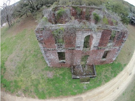
Recognizing the potential loss of this architectural treasure, the Preservation Society of Charleston listed the Brick House ruins as one of the “seven-to-save” sites in 2013, committing to help support efforts to save the building.
Capturing the images
Both data sets were composed of nadir, oblique, and terrestrial images:
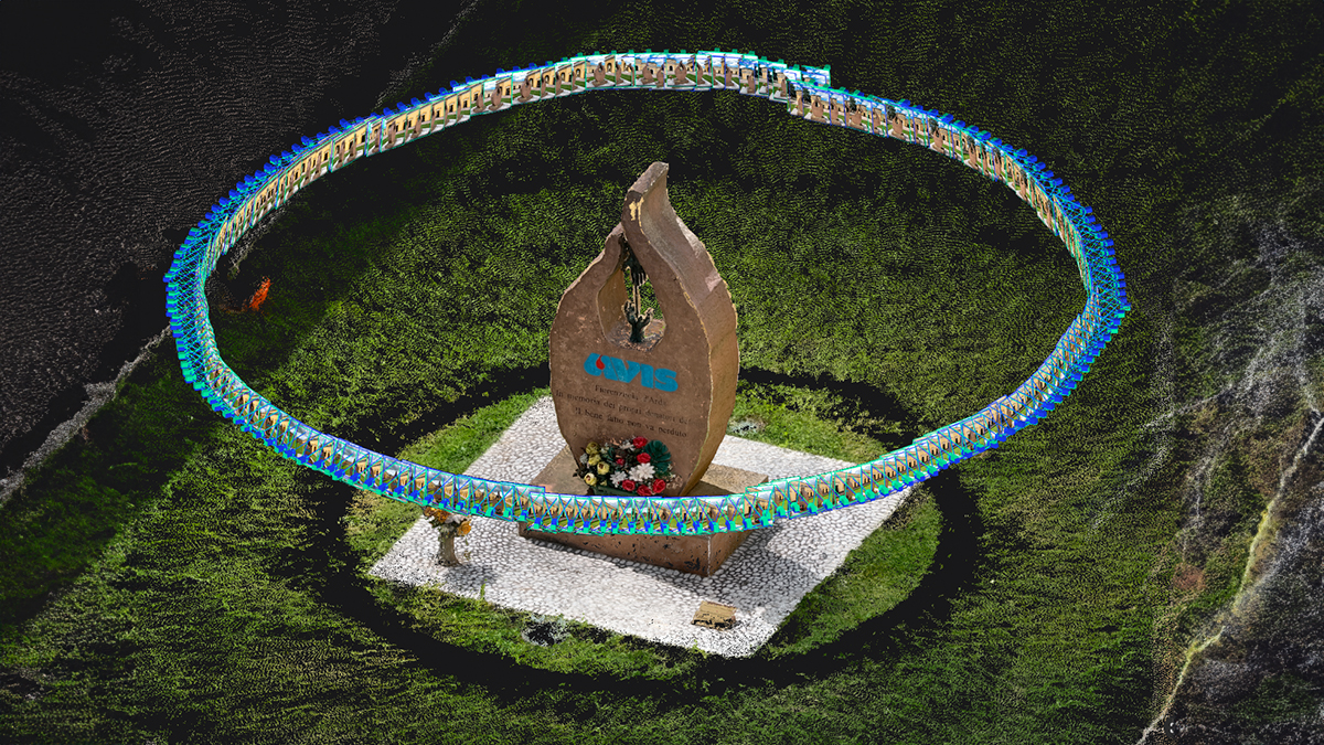
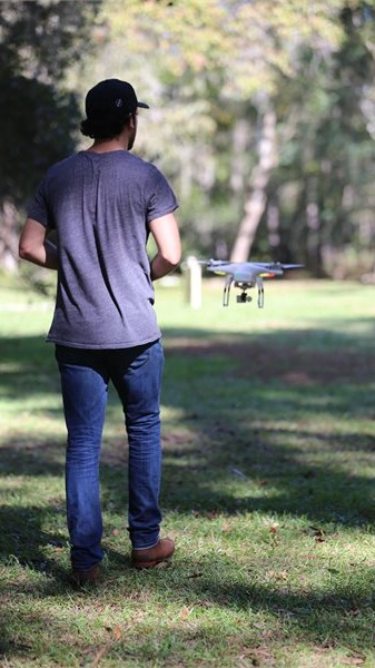
Nadir images were acquired with a DJI Phantom from two different flights using Pix4Dcapture (a mobile flight planning and execution application from Pix4D).
Oblique images were taken by manually controlling the drone, ensuring at least 60% of image overlap.
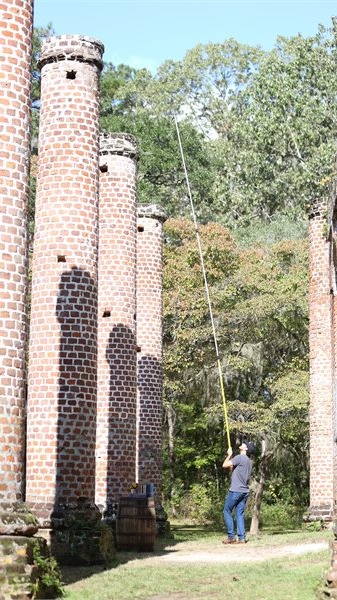
Terrestrial images were shot from a GoPro camera, held by hand or mounted on a tripod, giving close-up details for the 3D model texture.
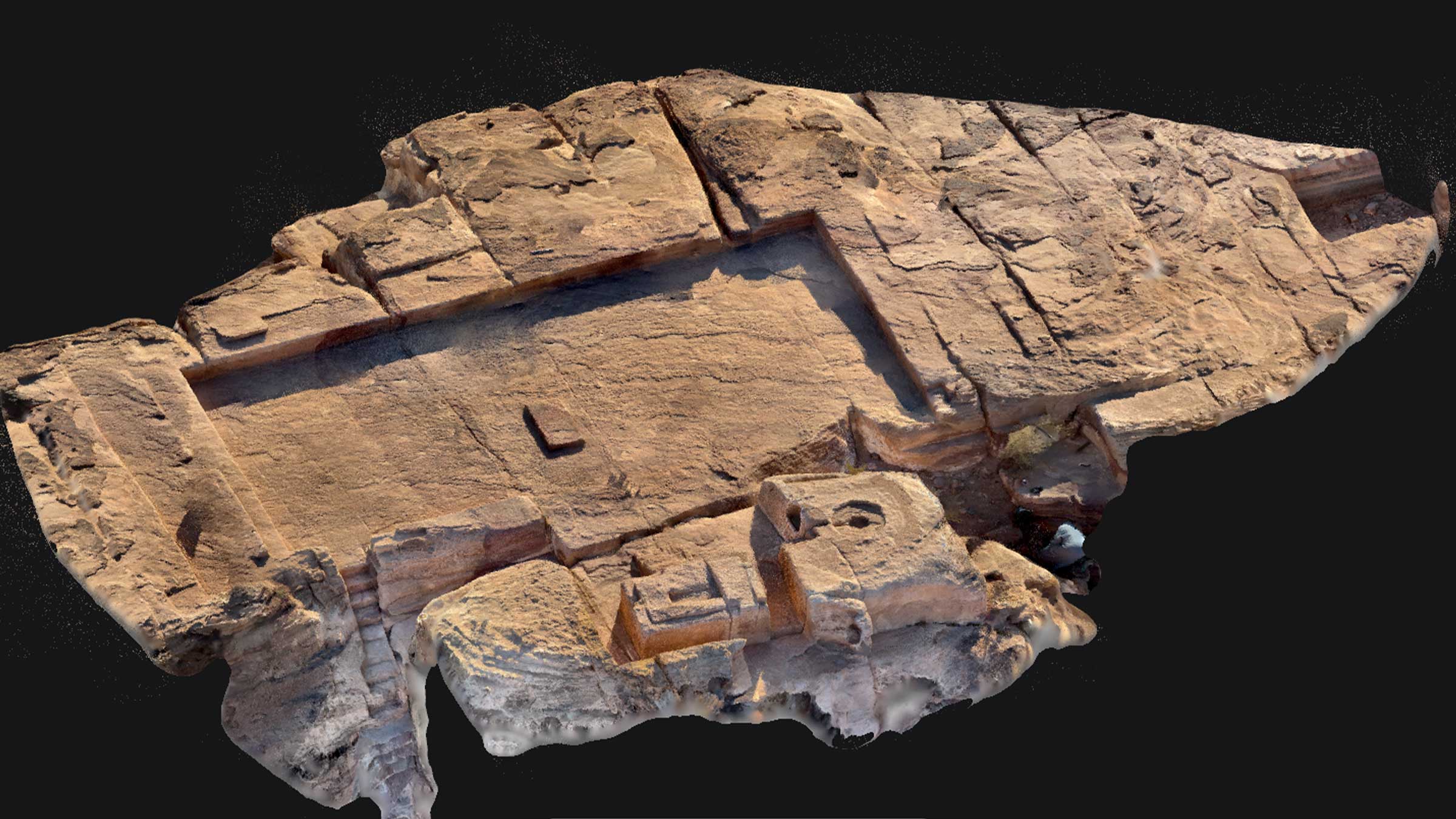
A 3D model of the past
Images from various shooting angles – nadir, oblique, and terrestrial, were processed together in Pix4Dmapper. With some clean-up of sky points, a clear 3D model was generated.
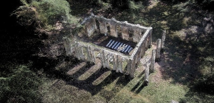
From the reconstructed point cloud, the 3D models were then completed for the Preservation Society of Charleston and Historic Charleston Foundation.

New opportunities in an historic city
“I am excited about the opportunities that Pix4D is providing me in such an historic city,” says Michael Damrich of Abovit Aerialography in Charleston, South Carolina. “I will be lecturing to both foundations, the Preservation Society of Charleston and Historic Charleston Foundation, in December on the methods I used and will be explaining photogrammetry and how Pix4D made the models possible.”