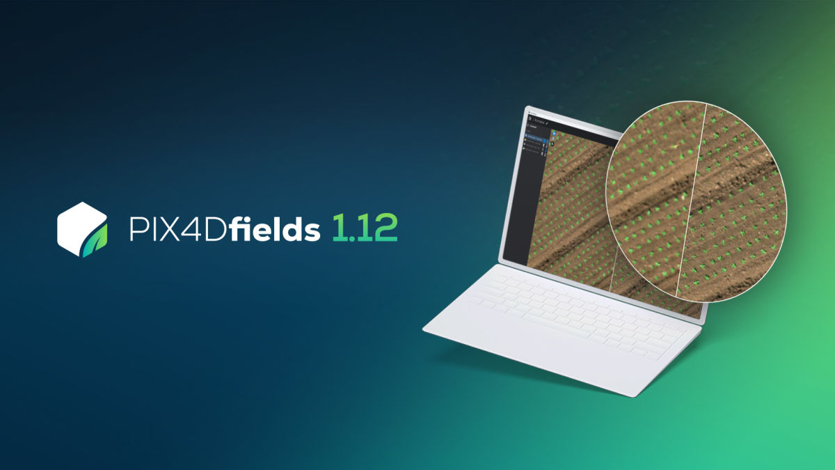
PIX4Dfields 1.12: Pan sharpening and more!
The latest update for PIX4Dfields offers the Pan sharpening option for Micasense RedEdge-P and Altum-PT cameras, annotation upload to PIX4Dcloud, and new fixes and options to keep making work easier for PIX4Dfields users
Pan sharpening
High resolution images help get better crop insights. Getting a clearer and more detailed view of your field from above opens the door to more accurate crop monitoring and seeing beneath the surface. Early detection of weed infestations or identifying plant stress helps prevent yield loss. You can now use Pan sharpening for RedEdge-P and Altum-PT cameras.
Here is a palm tree plantation captured with a Rededge-P camera carried on a fixed-wing WingtraOne drone. After processing and applying pan sharpening with PIX4Dfields, there is a clearer view of the overall crop as well as each individual plan. PIX4Dfields is constantly being developed to get more detailed crop insights. Whether you want to better track the phenological stage of your crop or detect spatial patterns of plant diseases, pan-sharpening gives users more data than ever.
Annotation upload for share to PIX4Dcloud
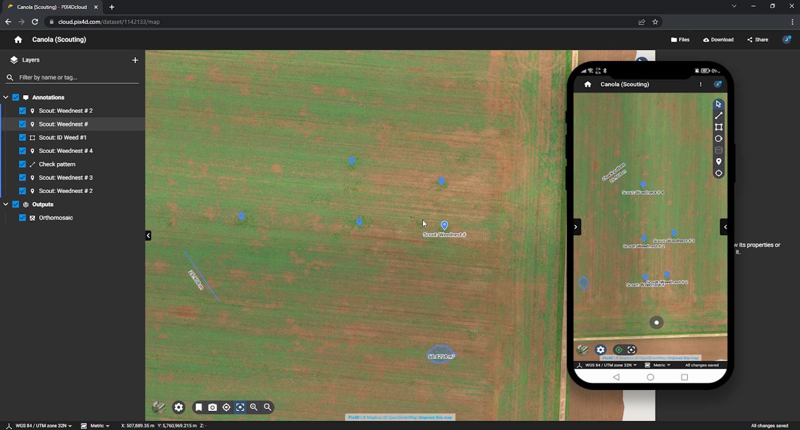
Here is a project from a canola field that was processed in PIX4Dfields. The annotations were used to indicate areas with weeds and plan a strategy for weed control.
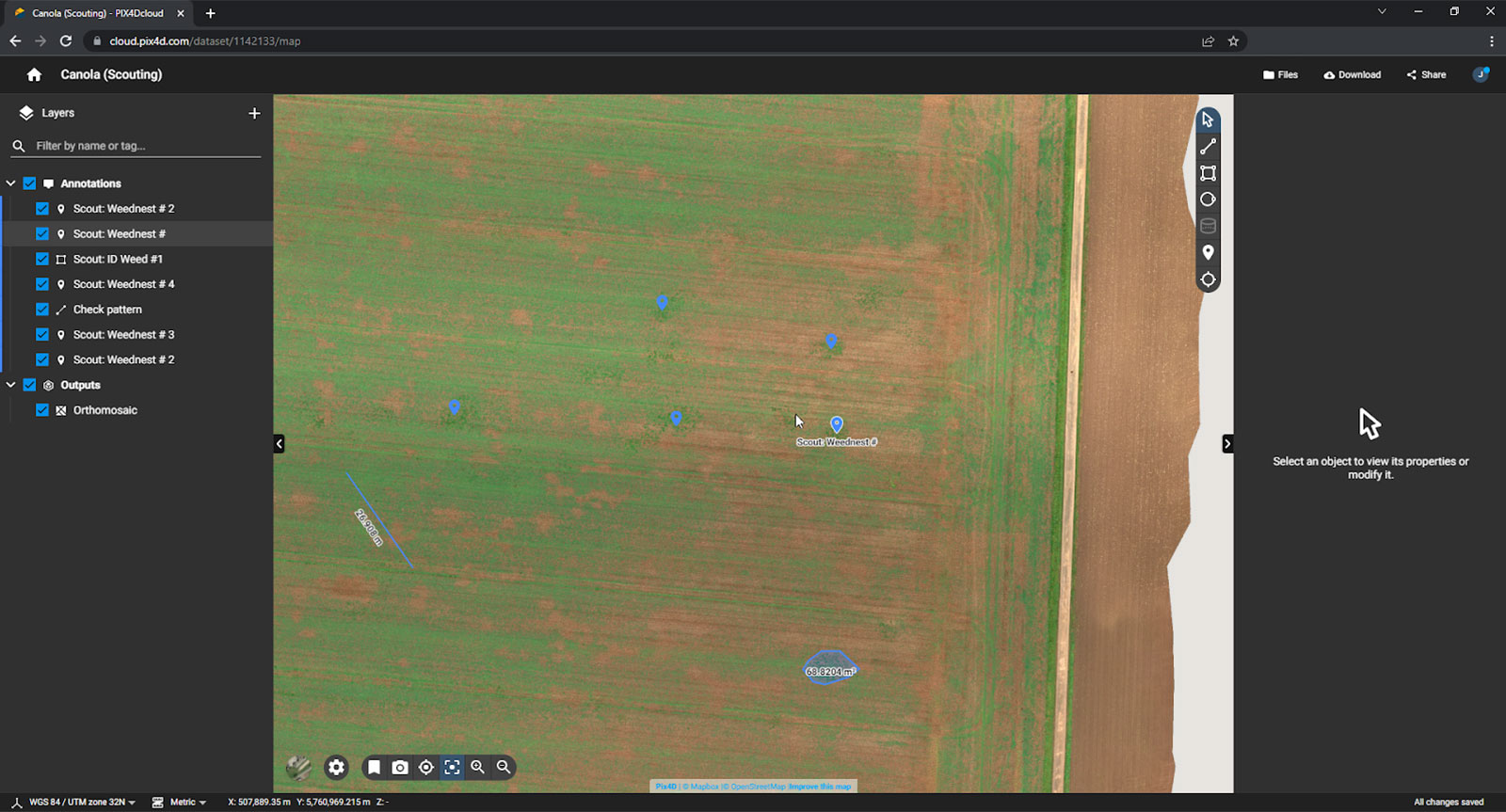
You can now upload annotations to PIX4Dcloud with the share to PIX4Dcloud functionality. When sharing your project’s link you can also choose your link’s viewing settings (distinguish between Private view, Public view, and editing rights). Sharing outputs with share to PIX4Dcloud allows multiple stakeholders to have access to a complete view of your field, highlighting exactly what you are interested in investigating further.
Check out our demo project on PIX4Dcloud
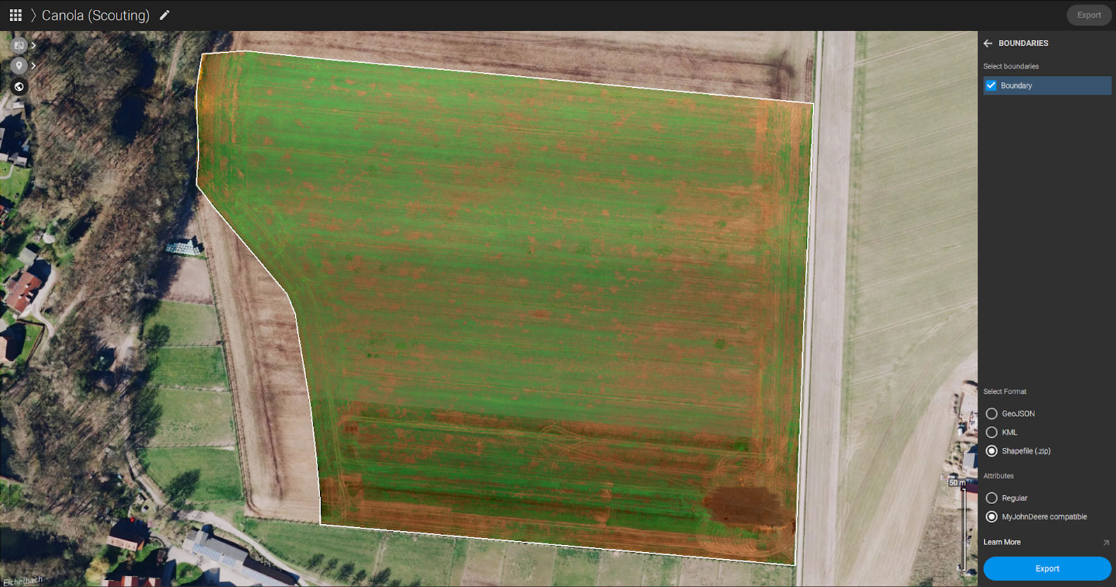
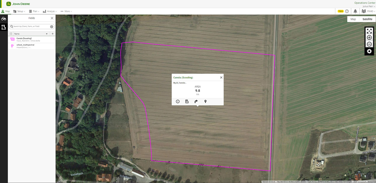
MyJohnDeere compatible boundary export
It is now possible to draw or import your field’s boundary and export it to MyJohnDeere. Integrate outputs from PIX4Dfields with the control center of John Deere products. This allows growers to optimize how they use their smart tractors and application machines in their fields. The compatible boundary export means that the precision of a drone survey can easily be relayed to MyJohnDeere.
PIX4Dfields is changing how smart agriculture can be used. It can make the difference between missing a crop affliction and catching it early. The new release brings more options and insights to farmers who want to use aerial maps to take their work to the next level.