
Pix4Dfields 1.6: high resolution measurements
Within minutes of flying a field users can obtain detailed information, in high resolution if necessary and take measurements to make decisions immediately. All done from edges of a field and without the need of an internet connection.
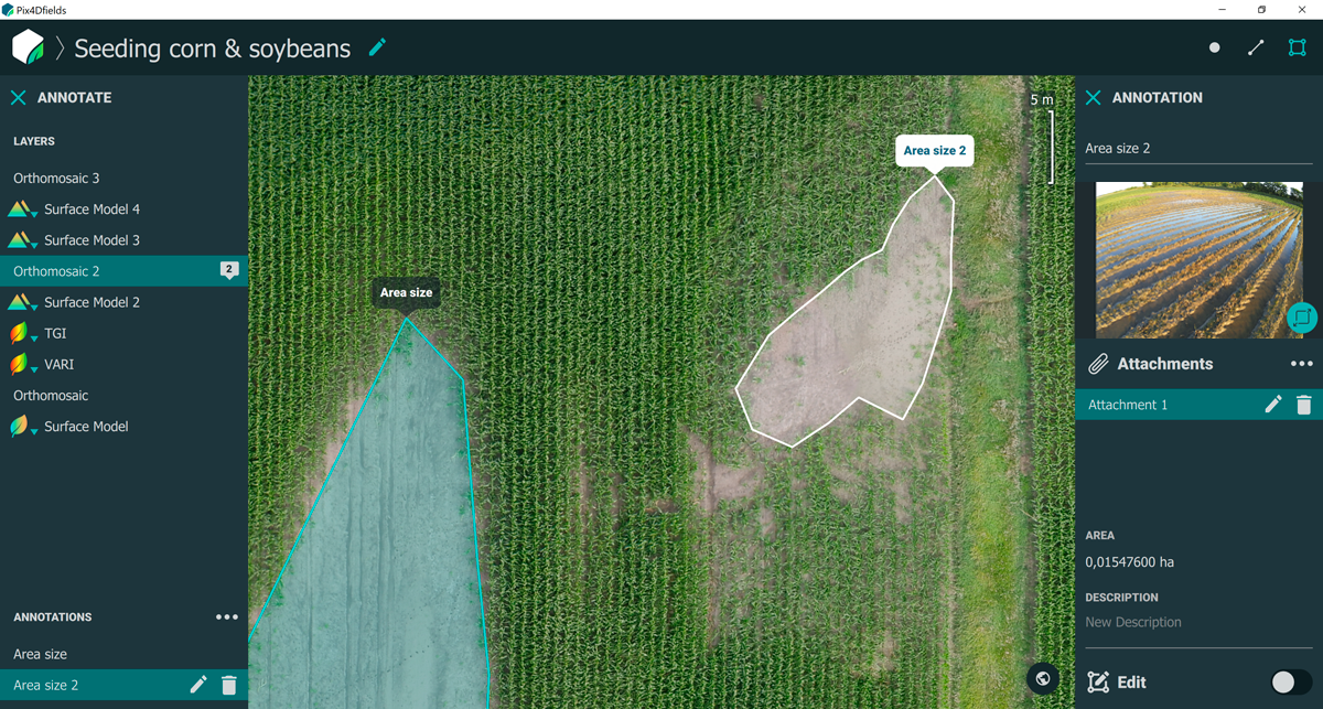
Remove the guesswork with new annotations/measurement tools
With the Pix4Dfields 1.6 release, we added a measurement tool that will allow our users to measure distances and areas, as well as continue adding annotations.
These new tools will allow users to measure an area or several areas at a time. It can also help calculate the length or distance of any mapped feature. These tools make replanting decisions, field navigation, planning and logistics as well as insurance claims (flood, hail, greensnap, herbicide drift, fire, drought, etc) fast and easy to measure.
How does the new tool work? Imagine a severe rainstorm occurs bringing high winds and several inches of rain. Suspecting a crop loss of several acres, one flight per field is performed a day after the storm to obtain the damage report. Back at the truck after the flight, the data is processed in Pix4Dfields.
The areas of damage are clearly visible and using the area measurement tool the total area of loss is measured. The map is exported to a PDF report and when the insurance adjuster shows up they receive the report to help them submit their claim. The farmer uses the report then to purchase the necessary seed to replant the areas lost to flooding.
Not only does the farmer know how much seed is needed but also where they need to drive to damage their crop least. When it finally dries up the replants are successfully planted without any guesswork.
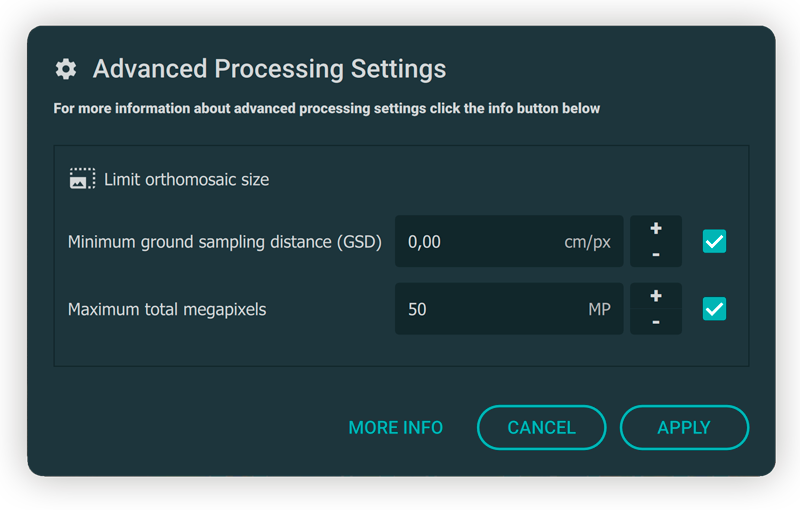
Full Ground Sampling Distance (GSD) control
Process data now with no limits! In Pix4Dfields 1.6 our customers can define the target GSD (or maximum orthomosaic size) of their maps. This tool is especially useful for customers flying very large farms or for agribusinesses who require very high resolution of their trial plots.
| To read more about GSD control visit our knowledge base. |
Many situations in agriculture don’t require high resolution data when plants are large but in the case of plant emergence or when performing - plant stand analysis, high resolution may be necessary. All user needs to do is select the high resolution option before processing.
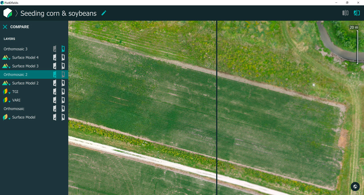
What does this look like on the ground? After five weeks of cold weather after planting, a service provider might want to check the crop stand of a field to see what the emergence looks like. After flying the field with a high resolution camera, they process the data. The high resolution orthomosaic is exported and the .tif is used in the service provider’s damage report analysis.
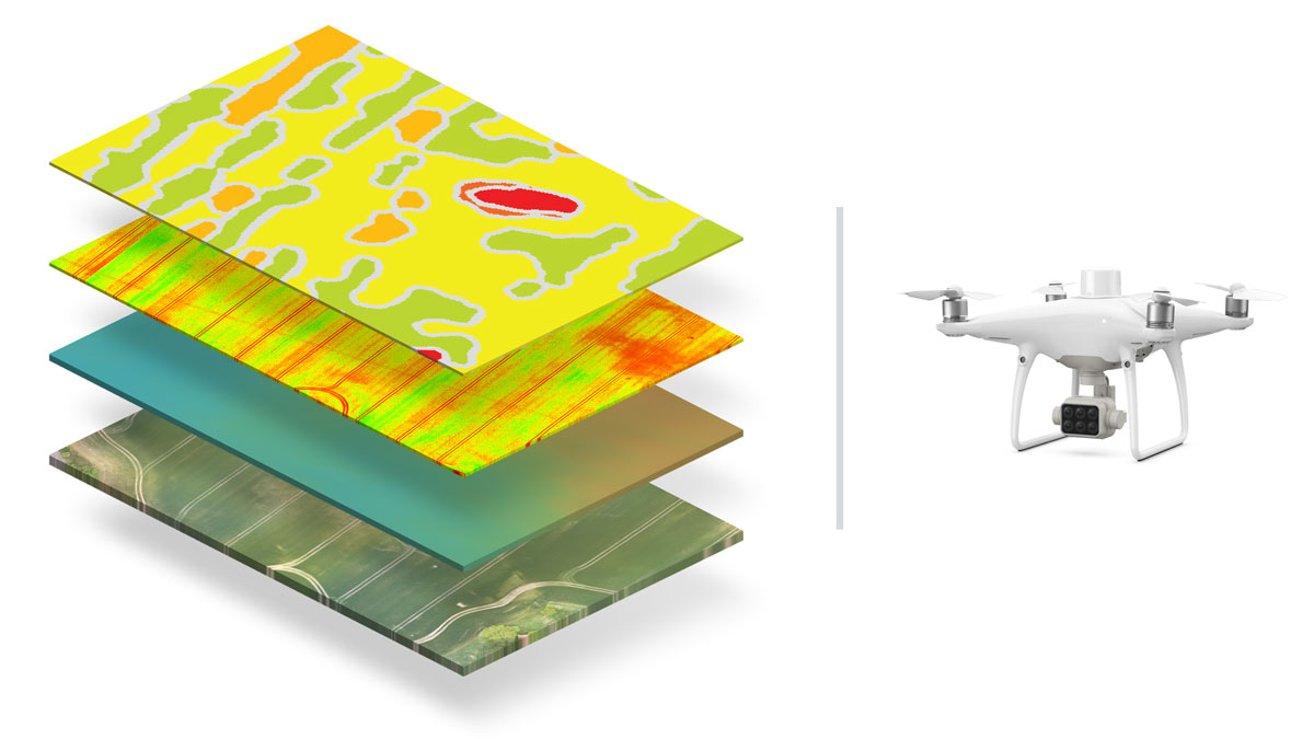
DJI Phantom 4 multispectral support
A new 6-band multispectral camera was recently released by DJI on the popular P4 RTK drone. We are excited to be the first company supporting the new DJI Phantom 4 multispectral sensor. In Pix4Dfields 1.6, images from the new agricultural drone from DJI will be converted into radiometrically correct maps.*
*Pix4D can only apply radiometry correction to the extent of the information provided by the camera manufacturer.
Getting started with Pix4Dfields
Try Pix4Dfields for yourself. Claim your free trial of Pix4Dfields (explore the demo datasets if you don’t have a drone), or reach out to our team. We’re happy to help.
| More information about the latest version of Pix4Dfields can be found in the release notes. For more details about all Pix4Dfields features check out the product feature list. |


