

PIX4Dfields 2.10: AI boundary & obstacle selection, & more!
AI object selection: streamlining aerial application!
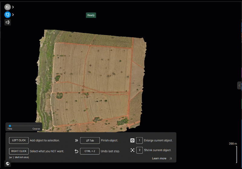
We're excited to announce AI Object Selection, our intuitive new interface that lets you select and refine your agricultural field boundaries, identify obstacles, and annotate areas with simple mouse clicks! Gone are the days of tedious manual drawing, freeing you from digital grunt work with more time focusing on what truly matters: your crops. AI Object Selection brings unparalleled precision and speed to mapping your targeted agricultural operations.
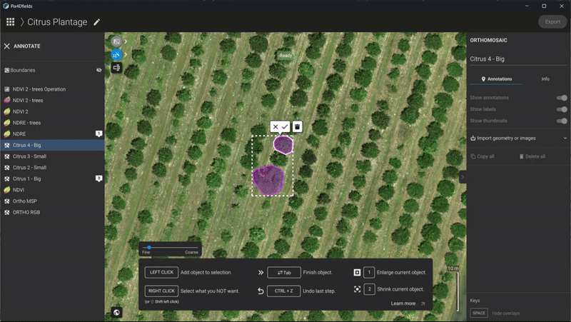
We’re introducing three new game-changing AI tools: AI Boundary, AI Obstacle and AI Area annotation:
AI Boundary detection: automatically detect and outline your field boundaries!
AI Obstacle detection: identify field obstacles like utility poles, waterways, or unplantable patches with AI-powered selections. This speeds up your mapping process by allowing for quick selection rather than manual drawing, improving the accuracy of your field maps.
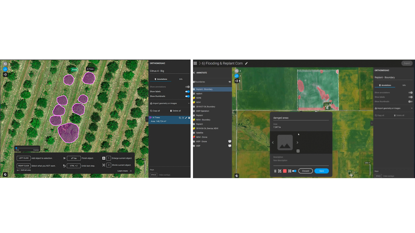
AI Area Mode: found in the annotation toolbar, this mode allows you to swiftly define specific areas within your fields. Whether you're marking zones for particular crop treatments, trees or damaged field/crop areas the AI Area Mode makes it incredibly simple to highlight and analyze.
Annotating complex objects, which once took painstaking effort, can now be done up to 10 times faster! This powerful capability frees up valuable time, reduces human error, and provides you with the accurate, actionable data you require, right when you need it.
With AI Object Selection, you'll experience a new level of precision and efficiency in managing your farm data, helping you make smarter decisions and optimize your operations like never before.
This isn't just an improvement; it's a leap forward, particularly for aerial applicators. By enabling you to create the necessary boundaries and obstacles quicker than before, AI Object Selection allows you to get in the air faster. This direct impact on workflow efficiency means more productive flight time and reduced ground delays.
Beyond speed, this feature significantly increases safety by making it more convenient to mark even the smallest of obstacles. A clearer, more precise map means safer operations for pilots.
Learn more from our support article.
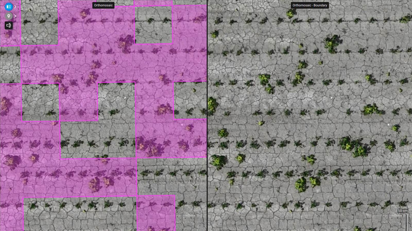
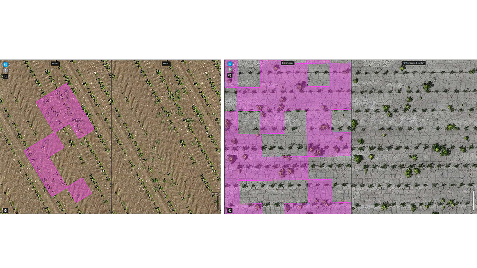
Improved Magic Tool: weed detection in row crops
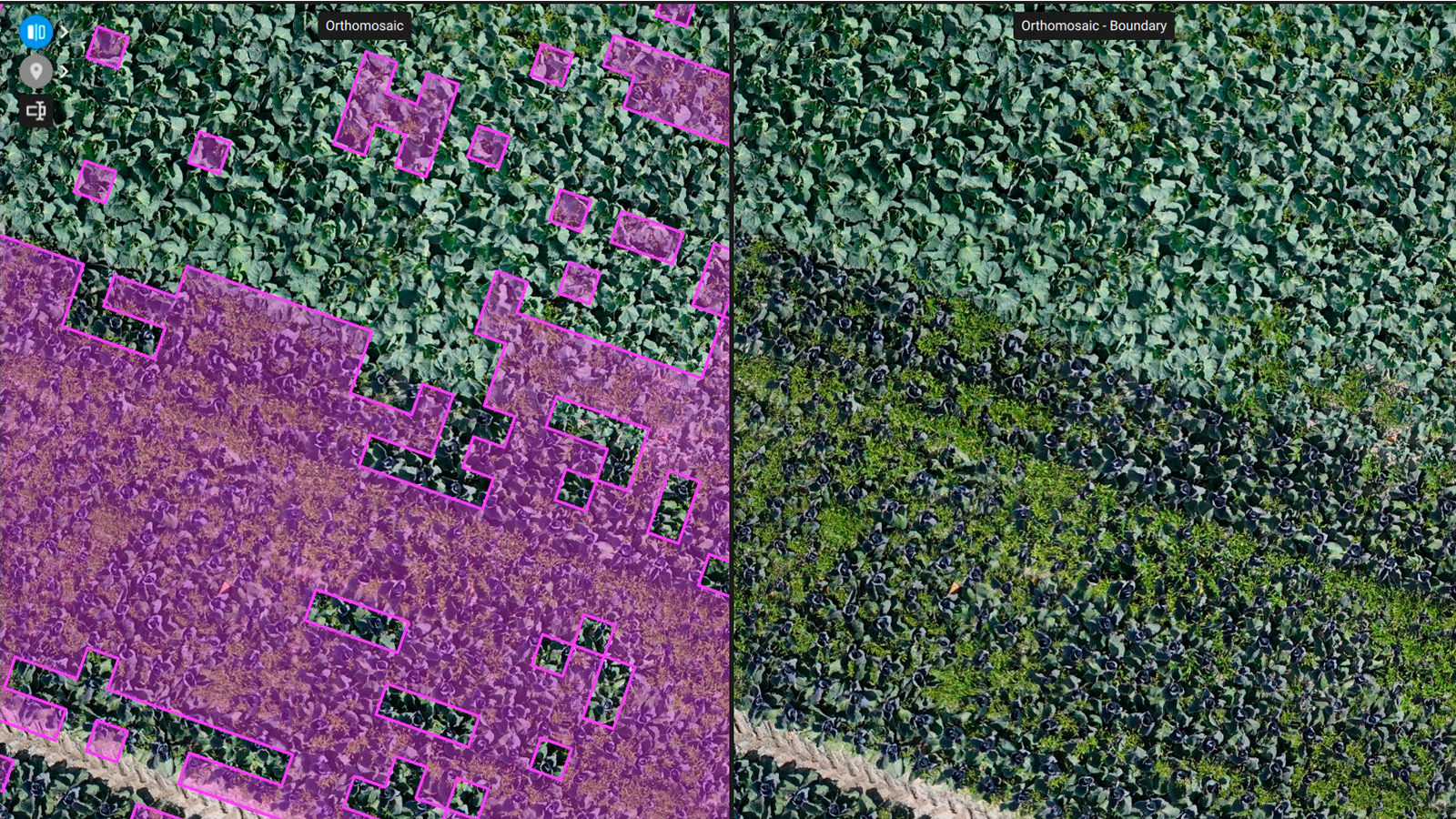
The Magic Tool is continuously becoming smarter! Wondering how you can quickly and accurately spot weeds at any crop stage? We have the solution for you - even for Green-on-Green complex scenarios! See below how accurately the Magic Tool can now detect weeds in row crops like cabbage, potato, onion and turnip, and these are just a few examples, it will perform better across the board in all scenarios!
TopXGun spray drone export
PIX4Dfields is compatible with a variety of agricultural machinery brands. What this means is that users can turn their machine into a smart spraying one - be it a spray drone, tractor, field sprayer or field robot. This update brings you prescription maps for variable rate and spot spraying applications that can be used directly with TopXGun spray drones!
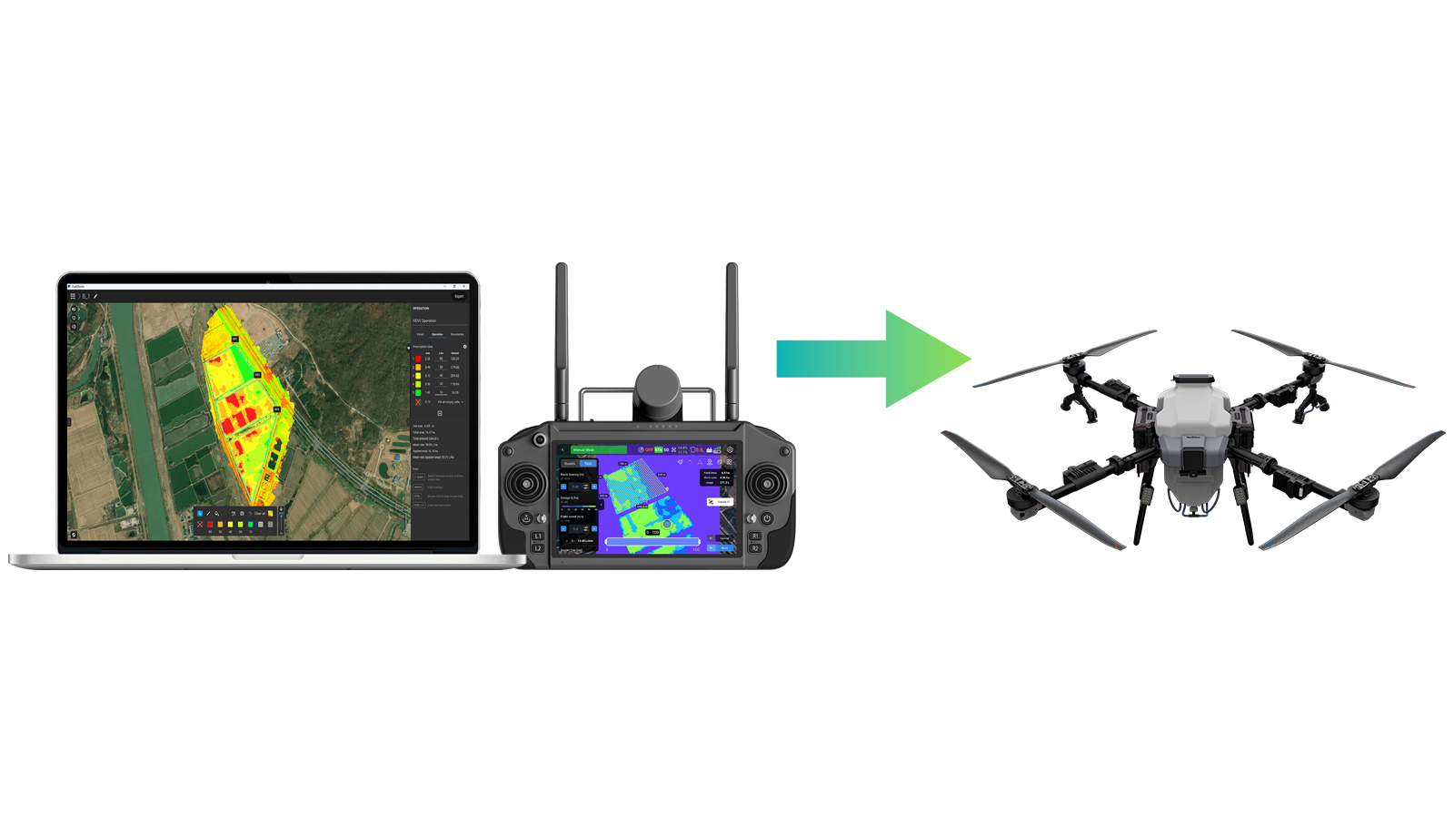
Learn more from our support article.
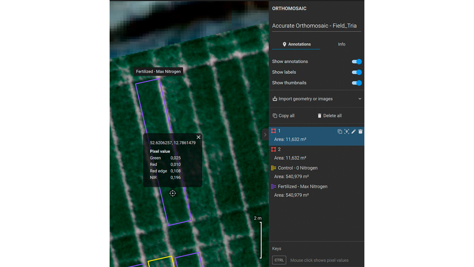
Reveal the unseen: deep dive into your crops with PIX4Dfields!
What if you could pinpoint exactly where and why your crops are struggling, even before it's visible to the naked eye? With the latest update to PIX4Dfields, you can! We're making it easier than ever to identify plant stress, pests, diseases, or variability across your fields.
Now, you can simply click on any point on your map to retrieve individual pixel values for RGB, DSM (Digital Surface Model), and all your Index layers. This allows you to:
Create highly specialized custom vegetation indices that respond precisely to your specific crop needs
Instantly find connections between your field observations and the rich, underlying data captured by your drone
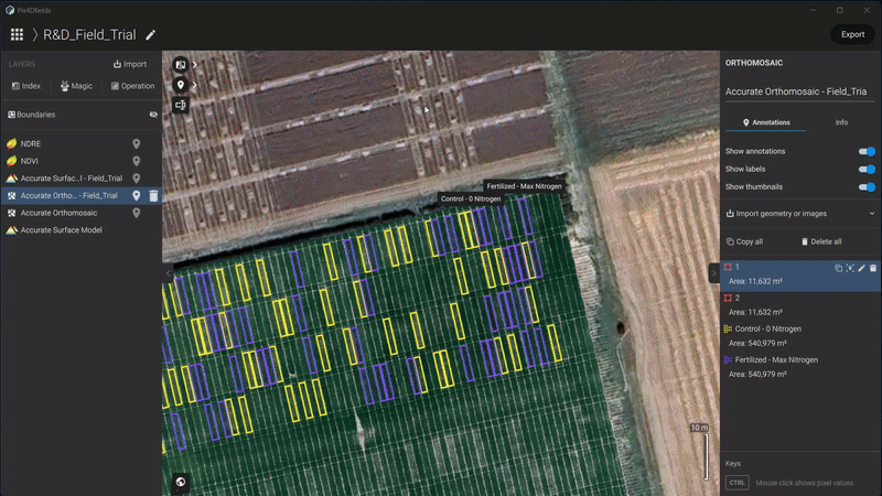
Stop guessing and start knowing. PIX4Dfields helps you reveal the unseeable, empowering you to optimize every inch of your operation for better yields and healthier crops.


