The Standing Stones of Petra: archaeology and Pix4D
Thanks to a unique collaboration between the French Institute of the Near East (IFPO), the Free University of Brussels, and the University of Lausanne, Pix4D provided crucial technological support for the “Cult of the Standing Stones” project in Petra, Jordan.
Standing Stones
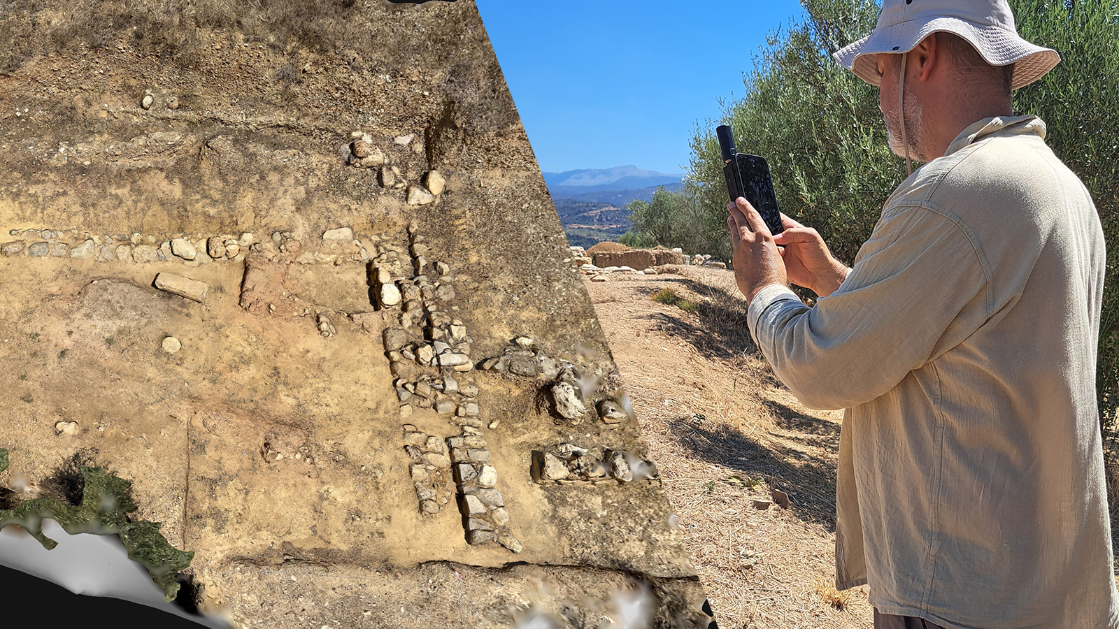
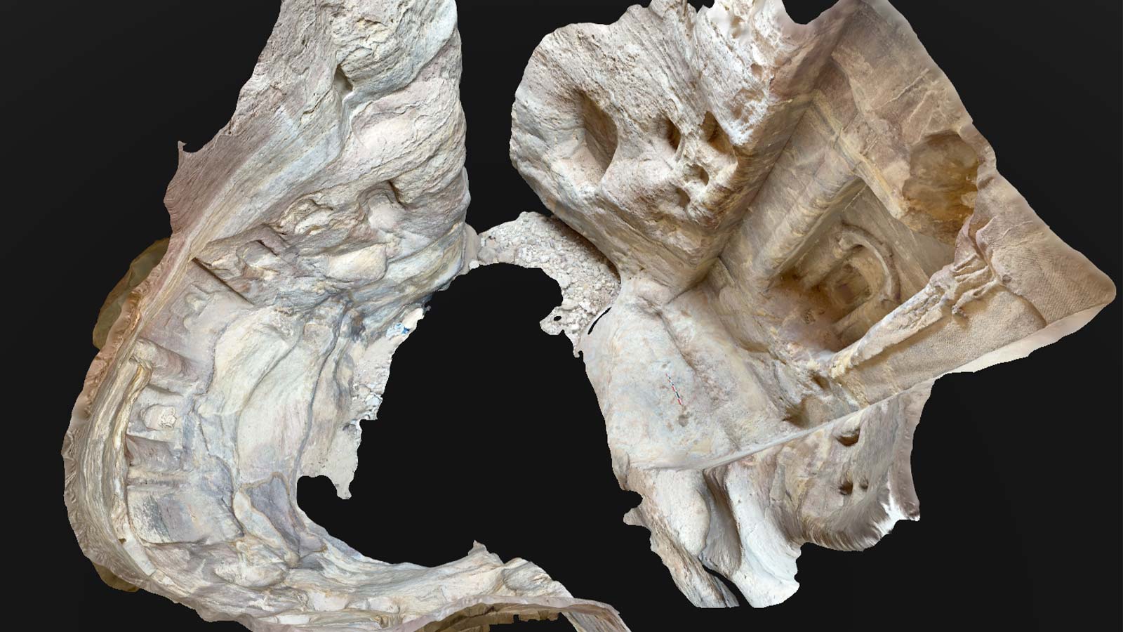
A standing stone, known as a “betyl,” was a symbol of great significance to the Nabataeans, representing the power of their gods and ancestors. This ancient culture constructed the historic city of Petra, renowned for its iconic rose-colored architecture. Among its notable structures is the well-preserved temple, Qasr Al-Bint, believed to have been built around 30 BC. Archaeologists working on the site used PIX4Dcatch to document the excavations and capture data to record and study ancient architecture and artifacts.
How it came about
The archaeological mission was a collaborative effort, combining the expertise of two teams led by Dr. Patrick Michel and Dr. Laurent Tholbecq. Within Tholbecq's team, Dr. Micheline Kurdy, an Architect-Researcher in Archeology at the IFPO, worked closely with Dr. Matthieu Deveau from Pix4D, who provided support from the project's inception to the post-processing of photogrammetry data.
Dr. Ryan Hughes from the Pix4D team also played a crucial role. Operating from Switzerland, he conducted a demo session for Michel, who transported the device to Jordan. The experiment to incorporate photogrammetry into the archaeological mission was underway!
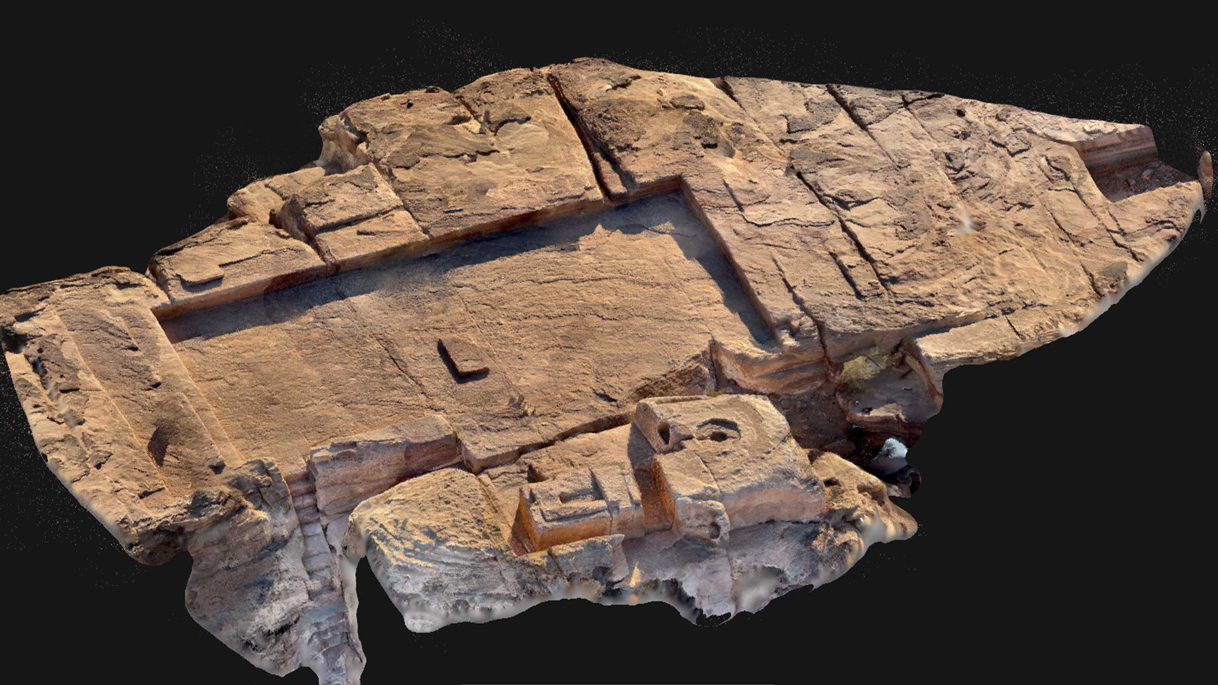
Terrestrial 3D scanning for archaeology
The PIX4Dcatch app transforms your mobile device into a 3D scanner that can capture intricate detail. When paired with a compatible RTK device, it offers a convenient, agile, and portable alternative for recording geolocation data compared to traditional methods, such as a total station. While traditional methods require heavy and delicate equipment to be carried in and out of the site daily, PIX4Dcatch only requires the smartphone or tablet already in your pack!
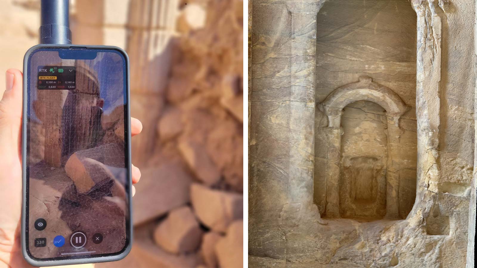
Due to the limited availability in the region, securing an NTRIP service provider in Jordan posed the biggest challenge. Accessing the NTRIP network is crucial for the RTK which facilitates precise data capture. After much searching they finally connected with Al-Mutaz Surveying Instruments, who went above and beyond to provide their services.
Another challenge they faced was the terrain, such as structures up in the mountains which were difficult to georeference and hard-to-capture niches in deep canyons.
Using a photogrammetry workflow for archaeology
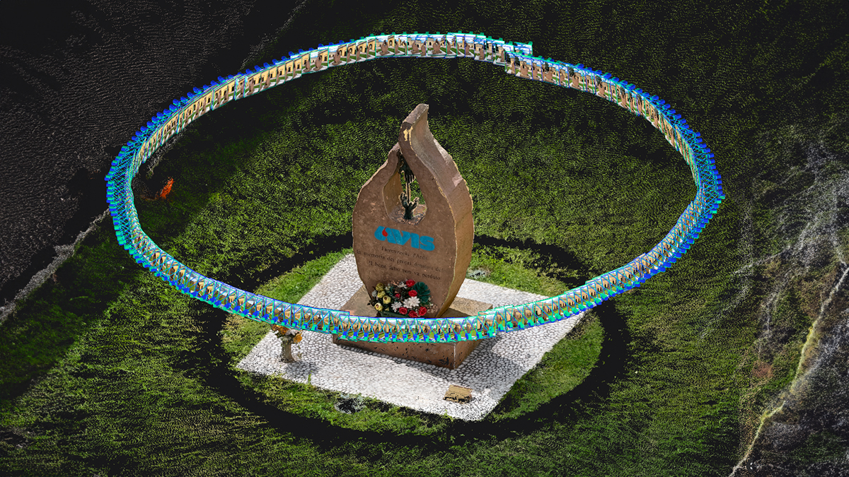
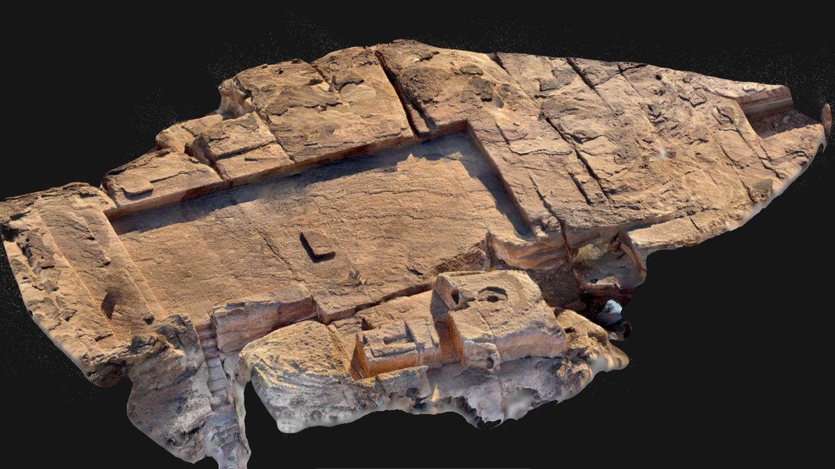
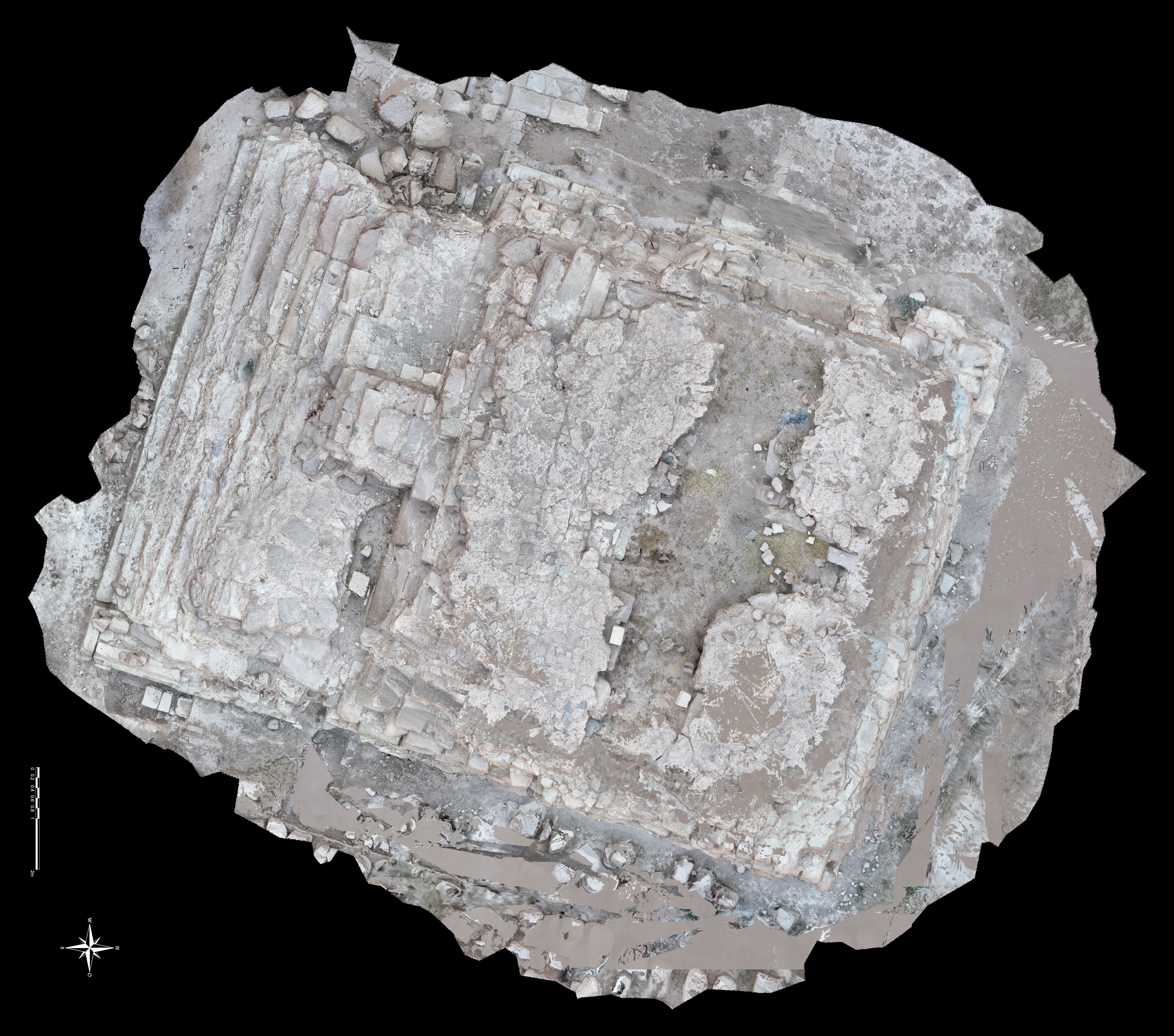
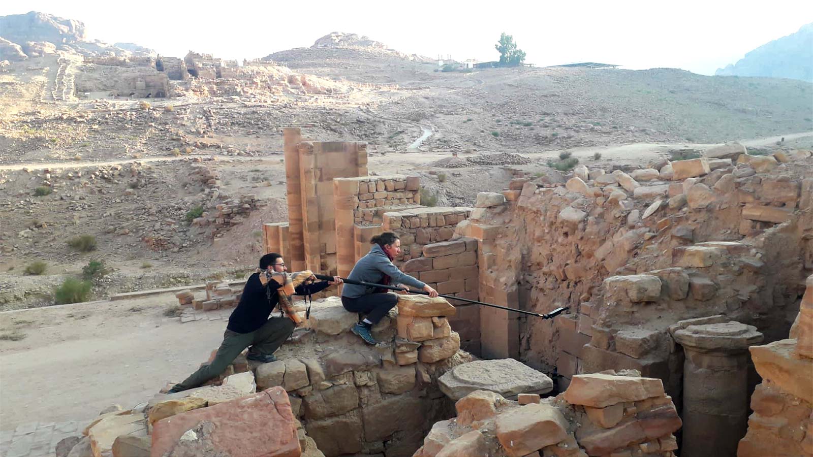
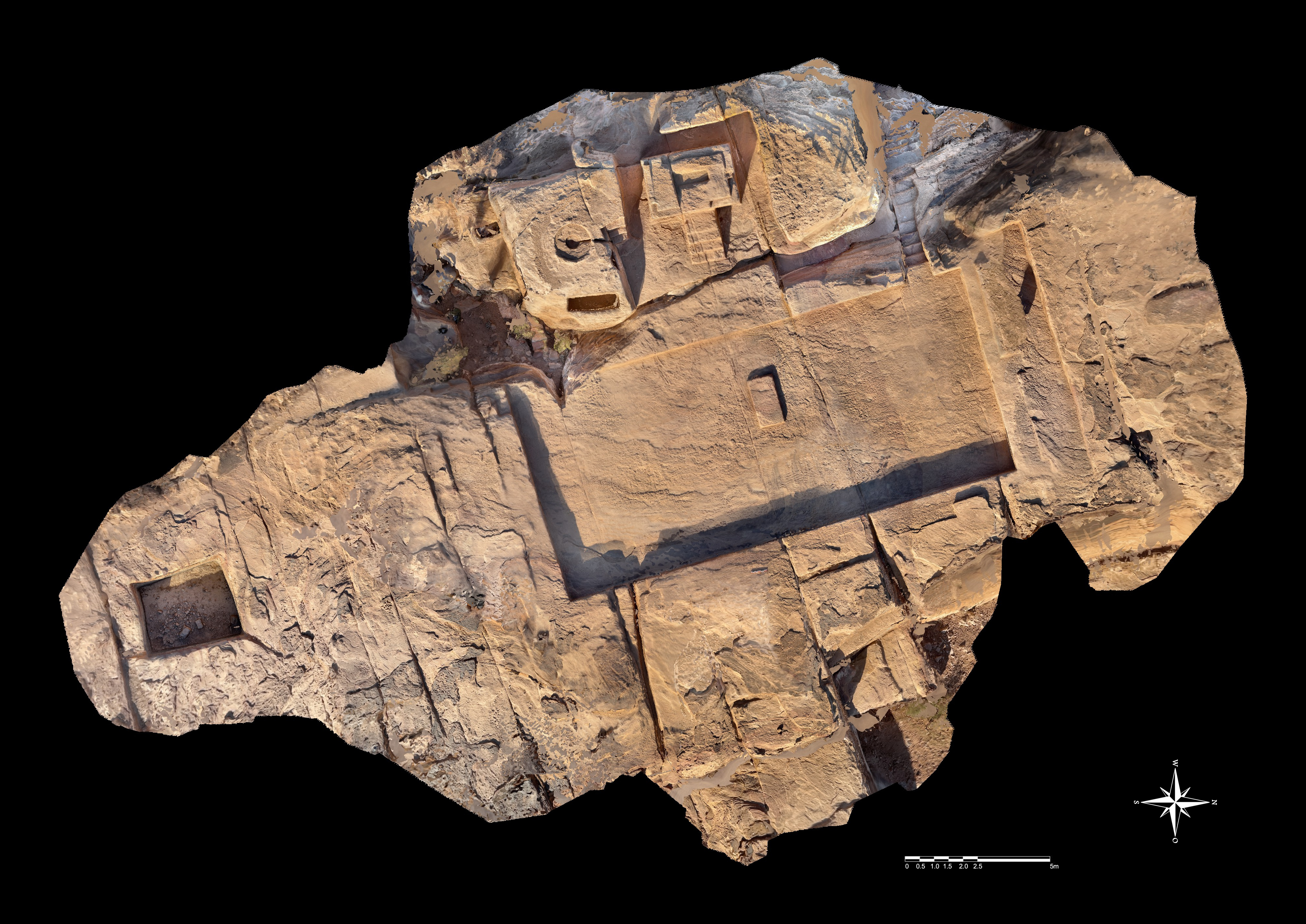
After Deveau spent two days on-site with a demonstration, the archaeologists began using PIX4Dcatch successfully in the field and collected over 50 datasets covering various subjects. These datasets produced a wide range of outputs, with orthomosaics being the main focus.
The team began by downloading the PIX4Dcatch app and attaching the compatible RTK device to achieve centimeter-level accuracy. Afterward, they simply used their phones to scan the archaeological data, which was uploaded to either PIX4Dcloud or PIX4Dmatic for processing, facilitating precise analysis, documentation, and cartographic reconstruction of the studied artifacts and sites with remarkable ease and accuracy.
Kurdy noted that the team found the PIX4Dcatch workflow immensely beneficial to their study, and they appreciated the responsiveness and assistance provided by the Pix4D team.
Digitizing archaeology
One of the goals of the project is to use digital tools to study the history of Petra through excavation, documentation, and analysis of the sacred courtyard of Qasr al-Bint. They wish to better understand the history and evolution of the site and to improve procedures for recording, studying, and digitally restoring religious artifacts such as stelae, rock niches, and betyl displays.
“PIX4Dcatch was a great help during the Oct 2023 campaign for our study of the cult of standing stones in the Nabataean environment. The lightness of the workflow and the connection with the RTK system enabled us to capture the religious structures at several locations in Petra in a short space of time.” - Micheline Kurdy, Architect-Researcher in Archeology at the French Institute for the Near East
The project concluded
Compared to traditional methods, the terrestrial mobile scanning approach of PIX4Dcatch paired with an RTK device holds significant appeal for its users, including archaeologists and topographers. Its advantages lie in its lightweight and agile nature, which is particularly beneficial in sites like Petra characterized by challenging terrain with steep steps and sudden elevation changes, and its RTK-assisted accuracy.