

From agriculture challenges to efficient workflows
Welcome to March! We know how busy and important this month is for the agriculture community in the northern hemisphere. So we wanted to breakdown the challenges we typically hear from our ag clients and what workflows they use to overcome those challenges.
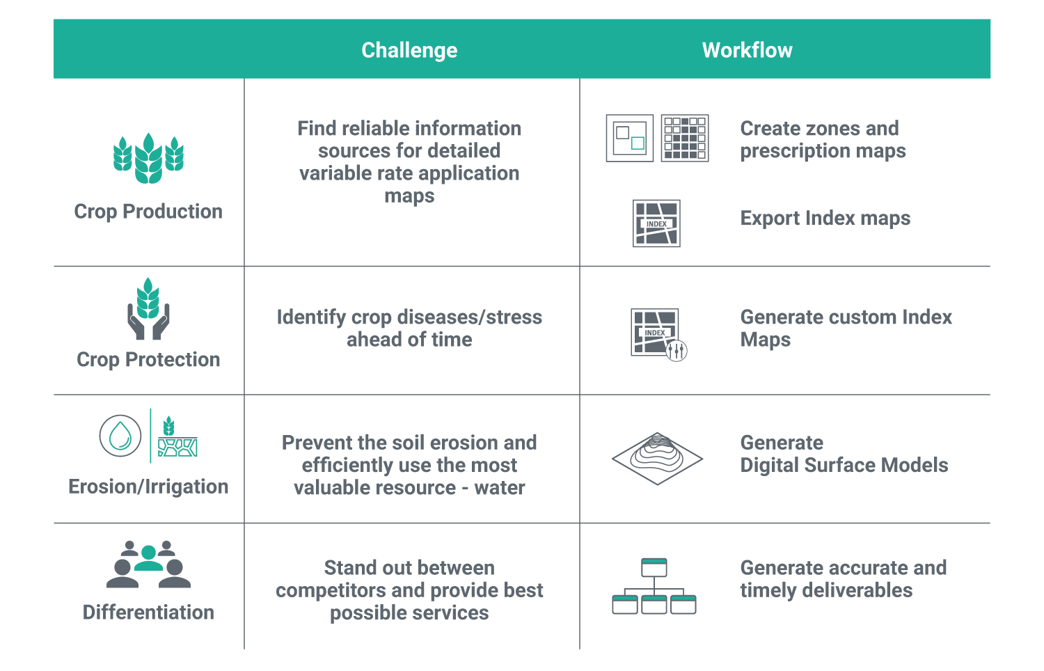
Crop production
Challenge: Find reliable information sources for detailed variable rate application maps
When preparing for this year’s season, you already have some guidelines from last year, right? Which combinations of fertilizers for what type of soil? What type of crops worked the best? How much water was really needed for different types of crops and during what period? What was the soil quality pre seeding and post harvest? These are just some of the questions that farmers are presented with every season. In order to optimize the crop production in a way that is more efficient yet less expensive, there are different workflows to help out with that challenge.
Workflow: Create zones, prescription maps and export into Farm Management Platforms.
Workflow compatible with Pix4Dfields
With the high level accuracy of reflectance maps generated with Pix4D software, you can create index maps, classify crops into different regions/zones, and derive prescription maps for your crops (which are important for both production and protection). As a step forward, you can export your maps in multiple formats (e.g. .shp, .KML) that are then ready for the ‘plug and play’ in a Farming Management Platform of your choice (e.g. SMS, Gatekeeper and more).
Crop protection
Challenge: Identify crop diseases/stress ahead of time
Crop protection goes hand in hand with crop production. To get the most out of your crops by increasing the yield and reducing the damage, everyone interacting at a farm needs to make fast and focused decisions. While traditional on ground inspection works, it is not always error free, and is generally time- and cost-sensitive. By introducing the component of invisible data acquired by drones, your crops start telling a whole different story.
Workflow: Generate Index maps (generic and custom).
Workflow compatible with Pix4Dmapper and Pix4Dfields
To leverage the invisible data in spectrums that our eyes can’t see, with the index calculator in Pix4D software you can create high accuracy Index Maps like NDVI, NDRE or any other custom index specific to your crops. Pix4D index maps are weather independent and combine information from the reflectance maps to highlight plant health differences that are directly or indirectly related to issues such as water stress, nutrient deficiencies, diseases and pests or more. Knowing where to put ‘more’ or ‘less’ pesticide and herbicide reduces cost, increases yield and improves the soil and crop quality overall.
Erosion / Irrigation
Challenge: Prevent the soil erosion and efficiently use the most valuable resource – water.
Erosion as well as the water management are becoming an increasing concern in agriculture. Whether that’s dealing with too much or too little water in your crops–or different types of erosion like wind, water or tillage, there are tools to help you overcome these challenges.
Workflow: Generate Digital Surface Models.
Workflow compatible with Pix4Dmapper and Pix4Dfields.
By calculating a Digital Surface Model (DSM) in Pix4D software you can get the answers to questions like: What is the degree of slope of this hill? What is the volume of material in it? Or what is the surface area of crops on this hill? These answers can then help with the decision making when addressing variability in irrigation of different crop zones, as well as pinpointing more dry areas prone to wind erosion. Once again, the accuracy of Pix4D software photogrammetry plays a crucial role in answering these questions with focused and precise calculations.
Differentiation
Challenge: Stand out between competitors and provide best possible services.
‘Standing out in the competitive landscape’ means you need tools that work and are not giving you empty promises. There is a variety of tools and software in the market so why choose Pix4D? What makes Pix4D the tool for you to use in your agriculture decision making workflow?
Workflow: Pix4D software for more accurate and timely deliverables.
Pix4D is a software that has a proven reputation of being ‘the photogrammetry tool’ in the market. It offers agriculture workflows that are fast, focused and above all accurate, which is ‘the game changer’ that matters in agriculture.
We offer you the answers to the challenges you face every day in the field and invite you to try our software for free and experience it yourself.


