3D mapping and drones target deforestation with PIX4Dmatic
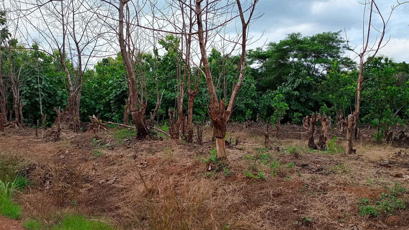
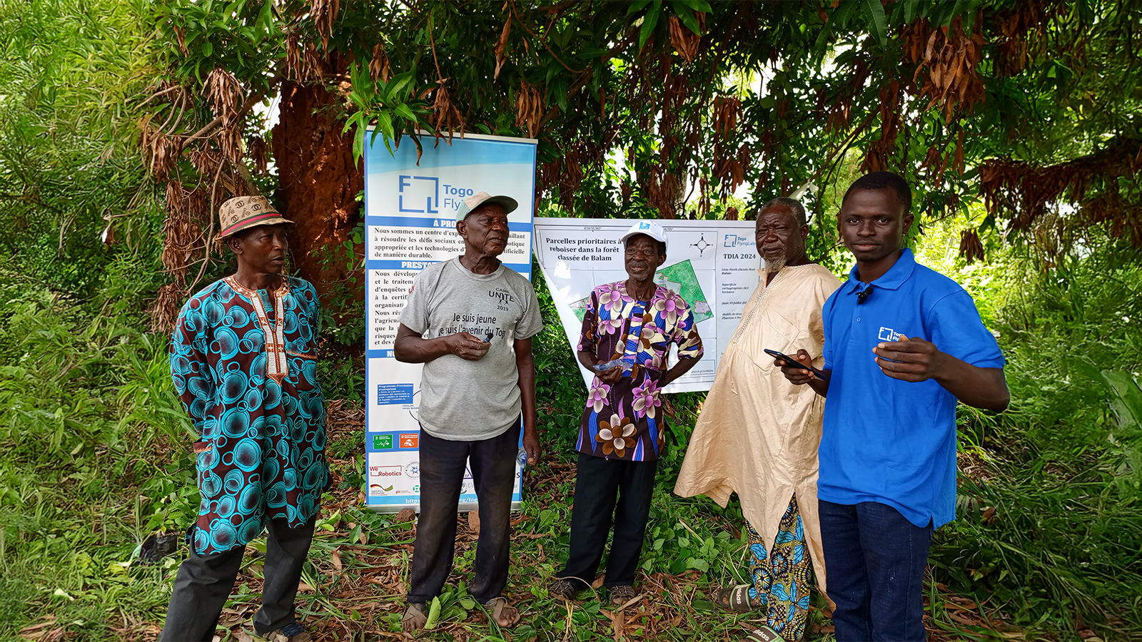
Once a thriving green space, the Mont Balam forest in Togo is now facing alarming deforestation, driven by human activities such as subsistence farming, charcoal production, and land clearing. As tree cover diminishes, the forest’s ability to support biodiversity and sustain local communities is rapidly declining. The need to address this growing crisis formed the foundation for a drone-mapping and reforestation initiative led by Togo Flying Labs.
Togo Flying Labs is a national center of expertise in drone and data technology. As part of the global Flying Labs Network, the organization focuses on solving social and environmental challenges through innovation. By integrating advanced mapping tools with community engagement, the project not only restored degraded ecosystems but also aims for long-term, inclusive forest management. Drone mapping helped identif the most at-risk areas, allowing for targeted reforestation using species adapted to local conditions.
Aerial mapping against deforestation
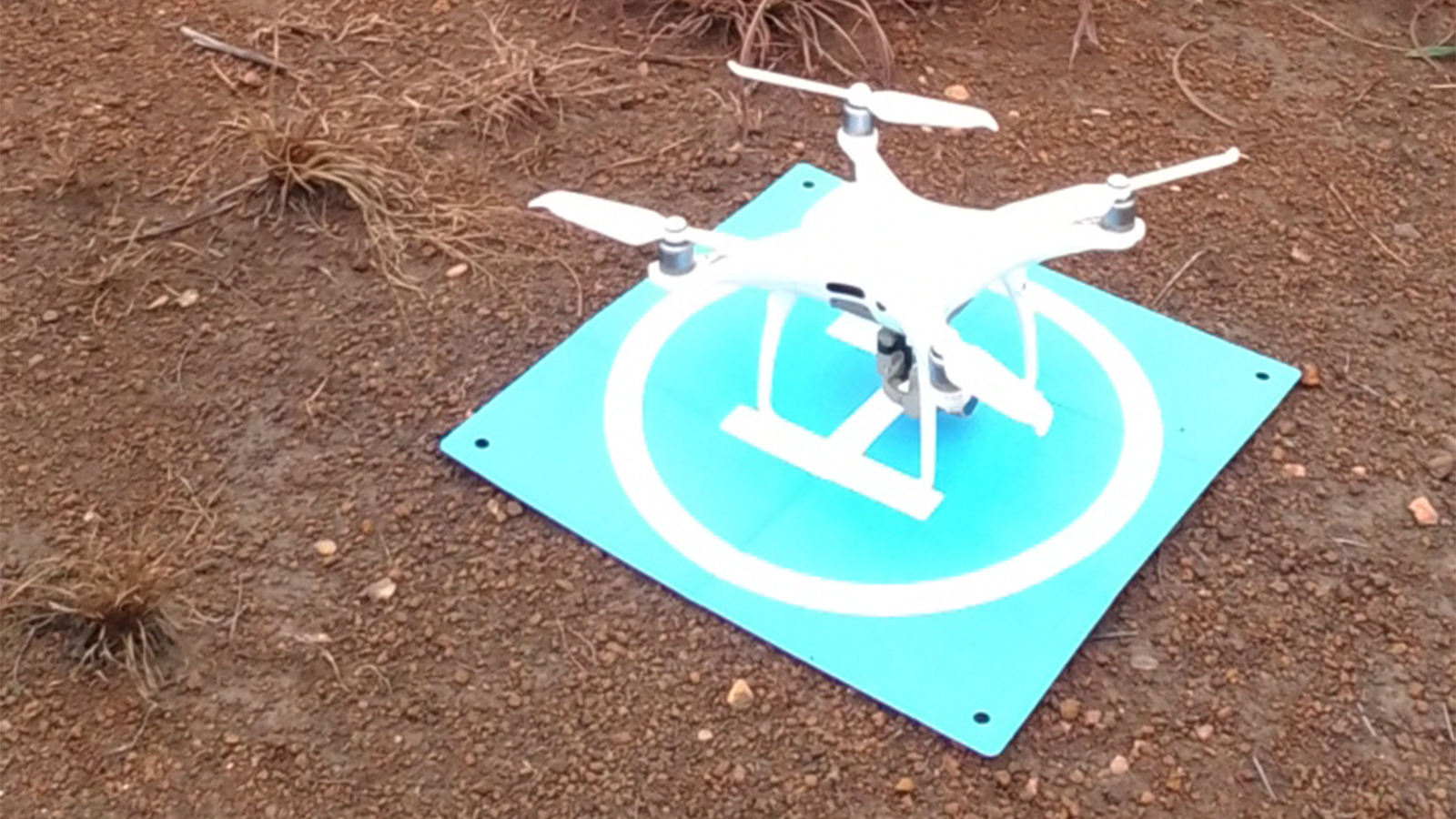
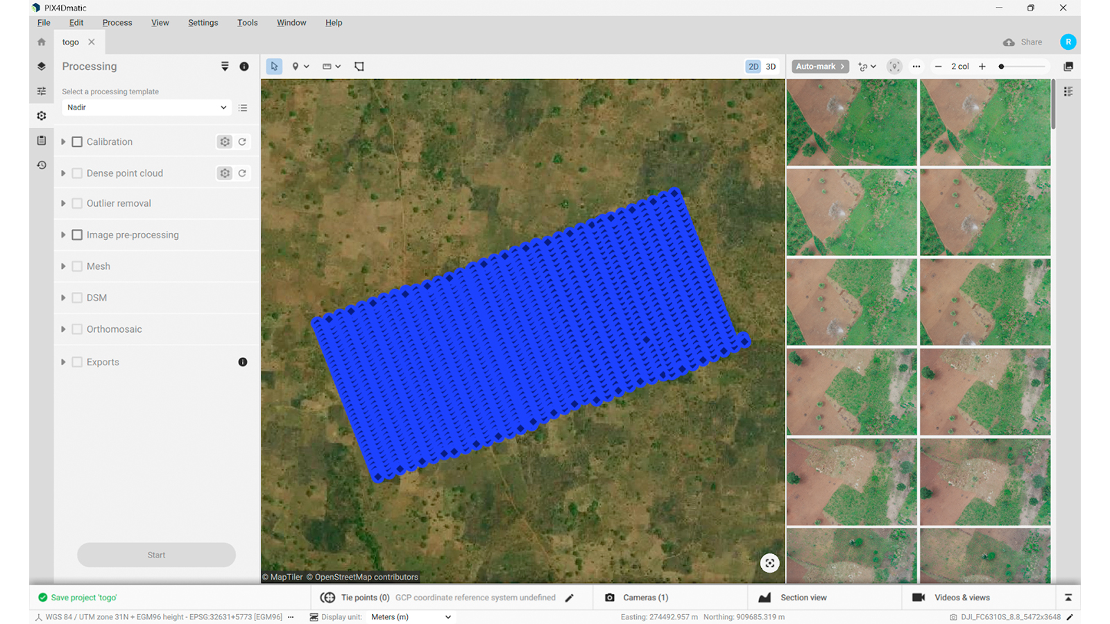
The mapping process began with defining the study area boundaries using Google Earth Pro to extract the necessary KML files. The drone flight data was captured with the DJI Phantom 4 Pro V2 drone and processed with PIX4Dmatic.
The software enabled the creation of detailed maps and supported in-depth analysis of critical zones. The team also used QGIS to digitize and refine key areas, ensuring precision in the planning of reforestation actions.
One of the early challenges in the project was mobilizing local communities and building awareness around the importance of forest restoration. To overcome this, Togo Flying Labs organized stakeholder meetings and launched targeted environmental education programs. These efforts helped increase community involvement and foster a strong sense of ownership.
Project details:
| Location | Mont Balam Forest, Togo |
| User | Togo Flying Labs |
| Software | PIX4Dmatic |
| Hardware | Phantom 4 Pro v2 with GPS, i7-9750H CPU @ 2.60GHz, cpus =1, threads=12, RAM: 31.82 GB, GPU: NVIDIA Quadro P620, OS: Windows 10 Version 22H2, SSD: 512 GB |
| Area surveyed | 44 hectares |
| Total number of images | 1289 |
| Number of datasets | 4 datasets |
| Time to process | 18 hours |
| Project duration | 6 months |
| GSD | 2.2 cm/pixel |
Project impact
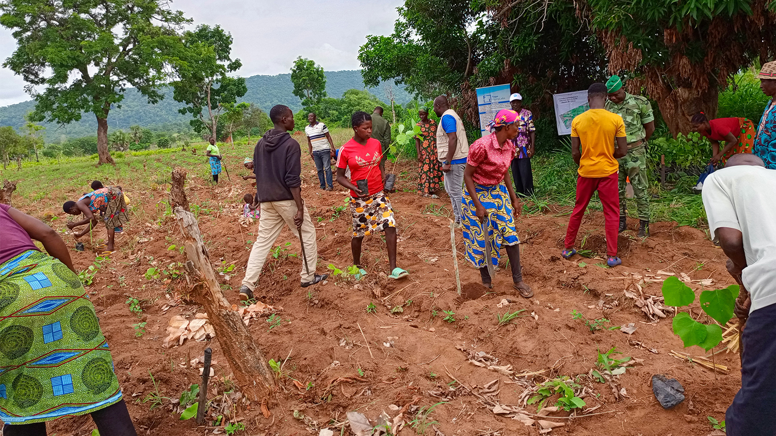
The project had a tangible impact on the Mont Balam area, with several degraded land plots successfully reforested. A total of 44 hectares were mapped, revealing 10 severely degraded hectares. Focused reforestation efforts led to the planting of approximately 1,622 seedlings across three of these hectares! In addition to the reforestation work, local farmers received training in sustainable techniques.
By using drone technology and PIX4Dmatic the team was able to precisely identify the areas most vulnerable to deforestation. This accuracy ensured that interventions were targeted and efficient.
A key factor in the project’s success was the use of Pix4D software, which provided a complete and reliable workflow from data collection to analysis. With tools like PIX4Dmatic, the team was able to efficiently process large datasets, generate high-quality maps, and extract actionable insights—all within a user-friendly and flexible environment.
“We particularly appreciated the flexibility and precision of Pix4D solutions, which allowed us to easily move from data collection to processing, while ensuring high-quality results tailored to our needs." - GNASSINGBE Tchoou Paul, Drone Pilot and GIS Analyst
The compatibility with GIS platforms also ensured that results could be seamlessly integrated into broader planning and conservation efforts. Pix4D’s accuracy, efficiency, and adaptability made it an essential part of this initiative, supporting informed decision-making and contributing to the long-term sustainability of reforestation activities in Mont Balam.