Drone mapping the structural geology of Boconó Fault
The Venezuelan Andes are characterized by the presence of a major strike-slip fault – the Boconó fault, which extends more than 300 km in the SW-NE direction and accommodates a dextral slip in the order of one centimeter per year.
This motion has displaced various landscape features that cross the fault, in particular the “Los Zerpa” moraine system, located a few kilometers north east of the locality “Apartaderos.”
The moraine formed during the last glaciation, which ended 10,000 years ago; its northern tip crosses the Boconó fault and is displaced 100 meters towards the north east - this corresponds to a rate of one centimeter per year, which is consistent with GPS measurements.
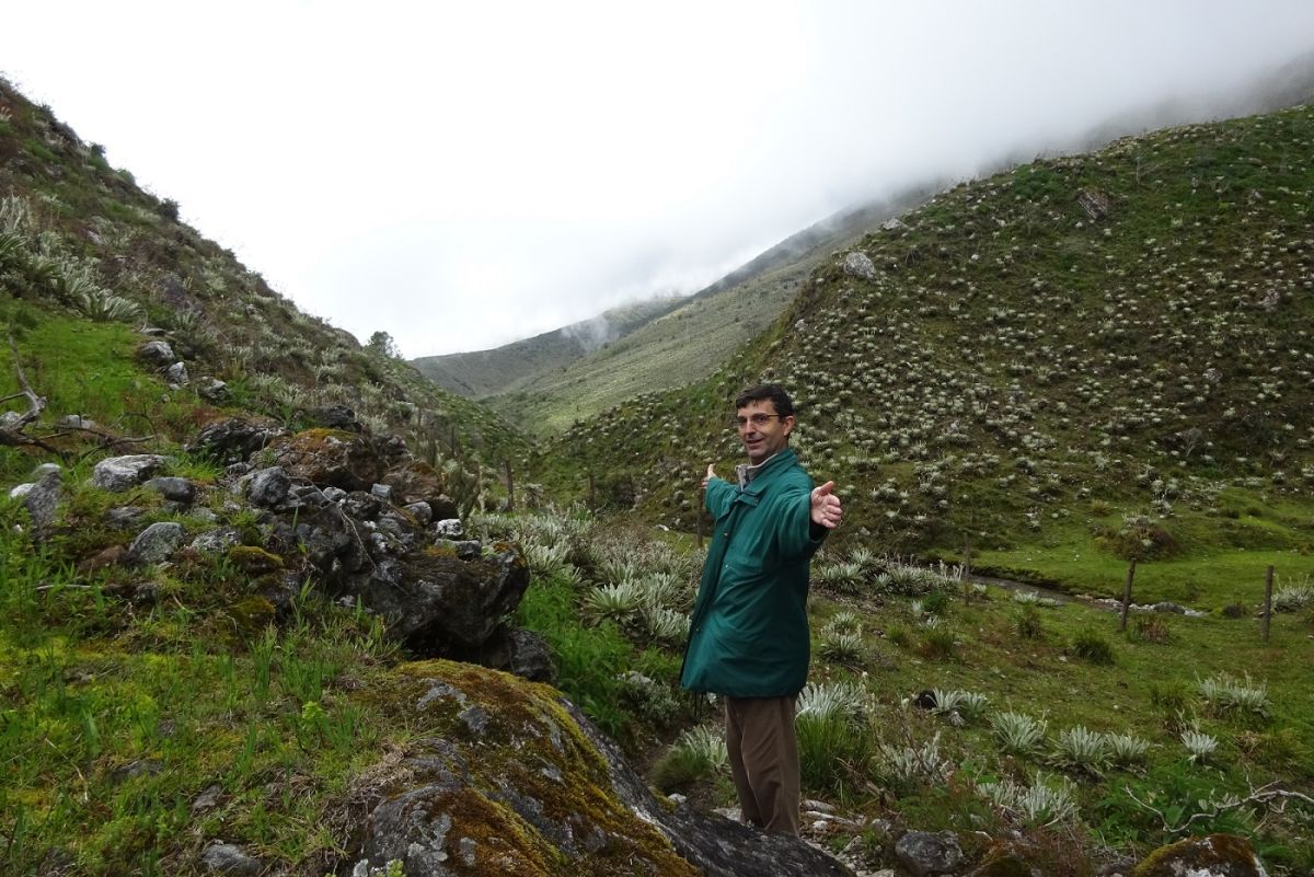
Using UAV and Pix4Dmapper technology in the Venezuela Andes, a geologist – Riccardo Rocca created the digital surface model of an area affected by the Boconó fault, to both identify geomorphic features and restore the original topography before the deformation.
Project details
| Company | Repsol Exploración |
| Country | Venezuela |
| Industry | Environmental monitoring |
| Project date | August 2015 |
| Project members | Riccardo Rocca |
| Project size | 59.3 acres |
| Number of images | 327 |
| GSD | 5.7 cm |
Mapping tectonic shifts
For the acquisition, two flights covered an area of 400 meters by 600 meters over the moraine system, capturing images at an initial altitude of 60 meters and with a 70% overlap and taking 20 minutes.

About 300 images were acquired and processed with Pix4Dmapper, generating a georeferenced map and a digital surface model.
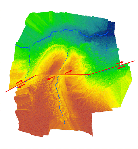
Analyzing the surface model permitted the clear identification of various geomorphic features related to the Boconó fault and moraine deposit interaction:
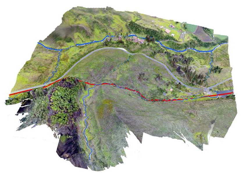
- Tectonic scarps identifying the fault trace
- 90º sharp bend of the stream running down the glacial valley, where it is captured and deviated along the fault strike
- 100-meter dextral displacement of the lateral moraines and glacial valley as they cross the fault
- fluvial escape through the right lateral moraine
- The abandoned fluvial valley that used to drain the moraine system before it was breached by the fault
Why use drones for geology?
In conclusion, this experience has proven that UAV technology can be a useful tool in geological field work:
- Acquisition can be made in remote impervious areas with difficult access
- Maps can be acquired at low cost and high resolution (typically a few centimeters per pixel)
- Surface models were generated at true scale and can be used for measuring distance, thickness and volumes
- Geological features can be observed from the most favorable point of view