Improving coffee yields in Uganda with PIX4Dfields
Uganda, also known as the pearl of Africa, is the 7th biggest producer of coffee in the world. Coffee farmers here grow both the Arabica and Robusta varieties, and it is the country’s biggest export crop. As we saw in a recent use case on coffee plantations in Costa Rica, coffee is vulnerable to climate change. Bringing new techniques and practices to farmers can help them to optimize yields and enhance their crop care to adapt to the changing environment.
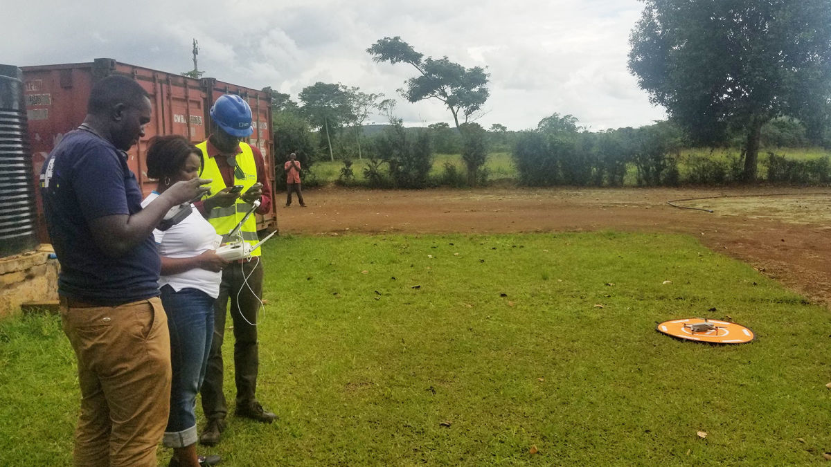
Uganda Flying Labs, as part of the Flying Labs Network consisting of highly skilled local drone experts, recently partnered with the Uganda Coffee Development Authority (UCDA) to assist smallholder farmers with drone mapping. They wanted to help growers identify pests, irrigation flaws, and soil erosion risks with a combination of terrain analysis and multispectral imagery. For this, the Uganda Flying Labs drone team captured aerial data and processed it with PIX4Dfields and PIX4Dsurvey.
Project details:
| Location | Mukono District, Uganda |
| User | Uganda Flying Labs |
| Software used | PIX4Dfields PIX4Dsurvey |
| Hardware used | DJI Phantom 4 Multispectral |
| Flight height | 75 meters |
| Images captured | 10722 |
| GSD | 4 cm |
| Outputs | NDVI, Orthomosaic, DSM |
Mapping smallholder farms with drones
The Uganda Flying Labs team set out with a multispectral drone to gather data at a farm. The farmer had been involved in the process and informed that the team would carry out an analysis of his crops and help him to identify problem areas as well as recommend strategies to improve the yield.
Once on the farm, the drone pilots took off and carried out four different flights across the area, capturing a total of 10,722 images. They were capturing both RGB and multispectral imagery, which would be analyzed with the agricultural drone mapping software PIX4Dfields.
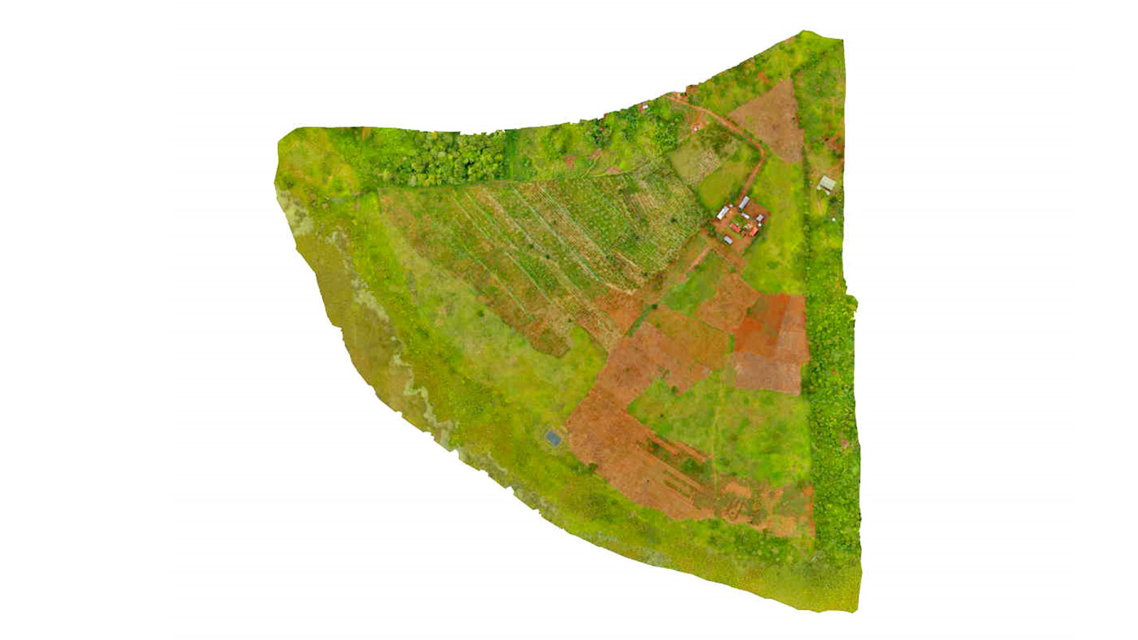
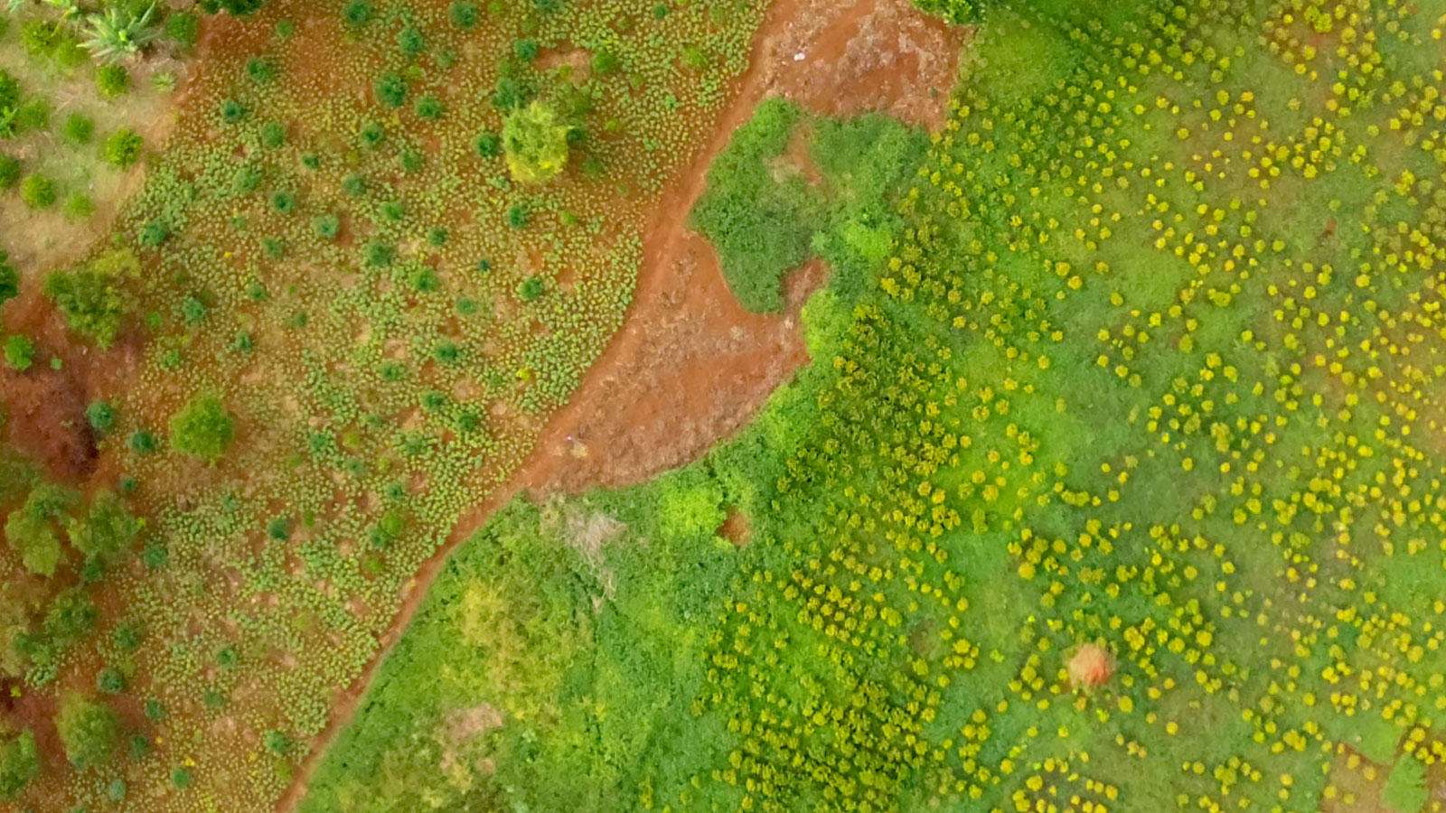
Using PIX4Dfields, the Uganda Flying Labs team generated a 2D orthomosaic of the farm to get a general overview of the area. Using this, they identified areas where the crop was not growing or there was space to plant more. Then, they used the multispectral aerial imagery to create the NDVI vegetation index. This was used to analyze the health of the coffee crops and the results were to share with the farmer to help him plan treatment methods.
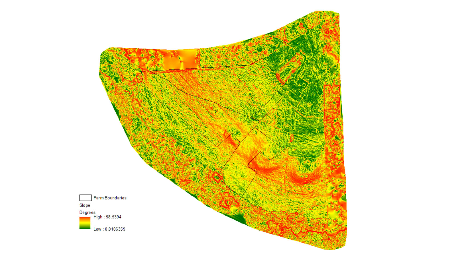
Finally, the Uganda Flying Labs team took their results a step further by importing the outputs from PIX4Dfields to the digital surveying program PIX4Dsurvey, where they generated a topographic analysis map with a digital terrain model (DTM). This helped them to analyze the slopes to identify areas at high risk of soil erosion.
Taking action with drone photogrammetry data
Based on the results from the Uganda Flying Labs team, the farmer took several steps to improve his yield and crop tactics:
- He added organic manure to areas where crops were struggling due to the infertile rocky soils. This would help encourage vigor and growth in the coffee
- In the gaps identified with the orthomosaic, the farmer replanted to encourage more growth across his fields and avoid any wasted space
- Thanks to the identification of risk zones for soil erosion, the farmer dug trenches and planted elephant grass to help hold the ground together and prevent soil loss
Thanks to the aerial mapping by Uganda Flying Labs, the farmer was able to implement techniques to improve his farm’s yields and operations. This project’s success has resulted in the UCDA agreeing to work with Flying Labs on similar projects at more farms, as well as this farmer requesting periodic reviews to check on his farm and help him continue to improve his yields and save time. Seeing more information about the crop with aerial imagery and multispectral analysis had an immediate impact which will hopefully be rolled out to more coffee farms in Uganda!