Mapping clifftop hazards and coastal erosion using drones
The sandy beaches of Planguenoual in Brittany, Northwest France are boarded by cliffs and headlands which divide the coast into a series of natural harbours. The tourists who gather to enjoy the mild weather and stunning landscape, make Brittany one of the most-visited regions in France.
But the famous coastline is eroding.
Climate change means that more storms of a higher intensity¹ have been pounding the coast, washing away the beaches and causing the cliffs to crumble into the sea.
To draw attention to coastal erosion and offer vital information to the authorities, Dijon-based company Geocapture carried out a series of surveys of the coastline between 2016 and 2017.
Project details
| Company | Geocapture |
| Location | Planguenoual, Brittany, France |
| Hardware | Sensefly eBee drone DJI Phantom 3 Pro |
| Software | Pix4Dmapper photogrammetry software QGIS Cloud Compare |
| Images captured | 427 - 177 (first site) 250 (second site) |
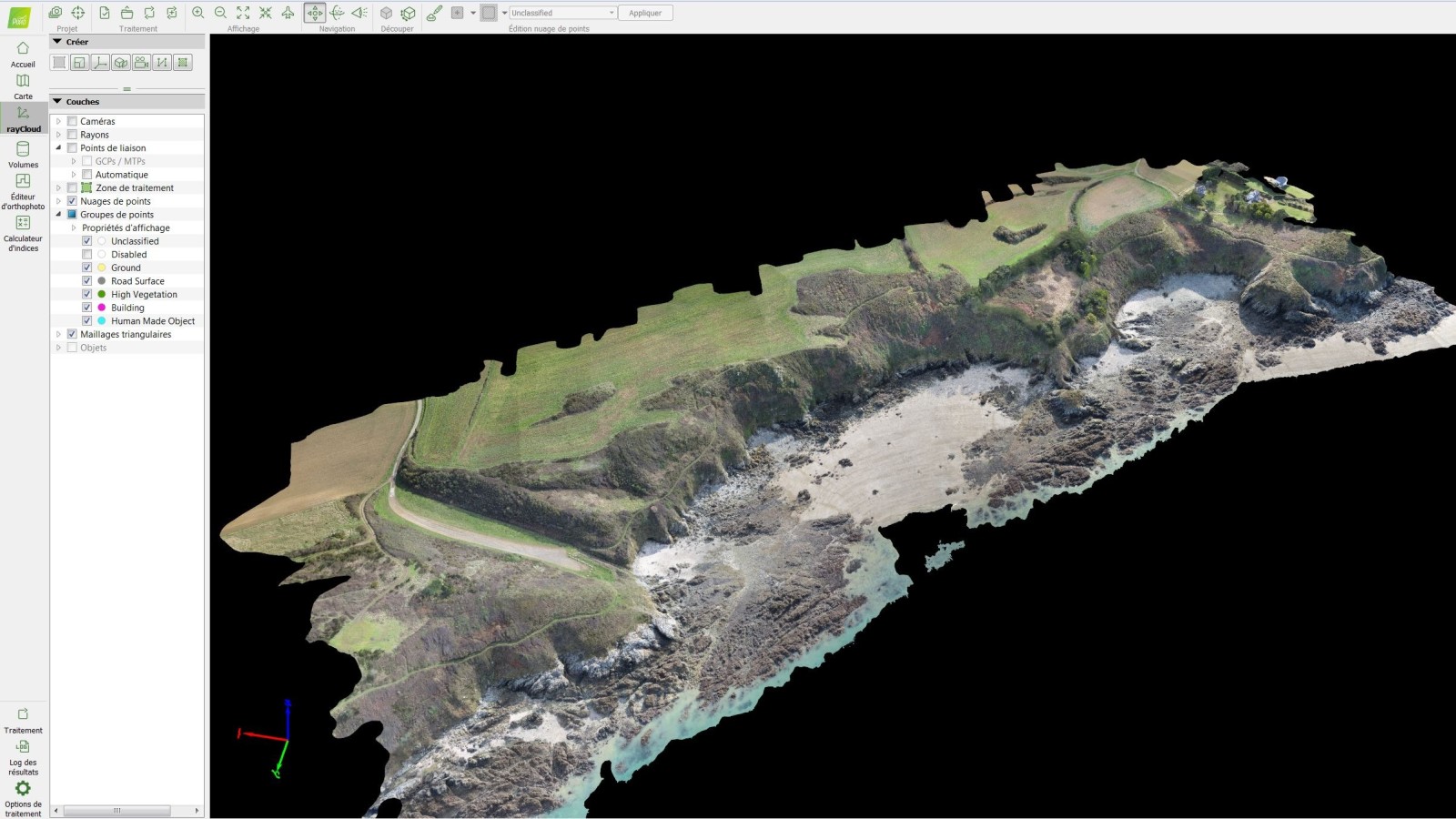
| Outputs | Orthomosaic, DSM and point clouds |
| GSD | 3.6 cm (first site) 0.7cm (second site) |
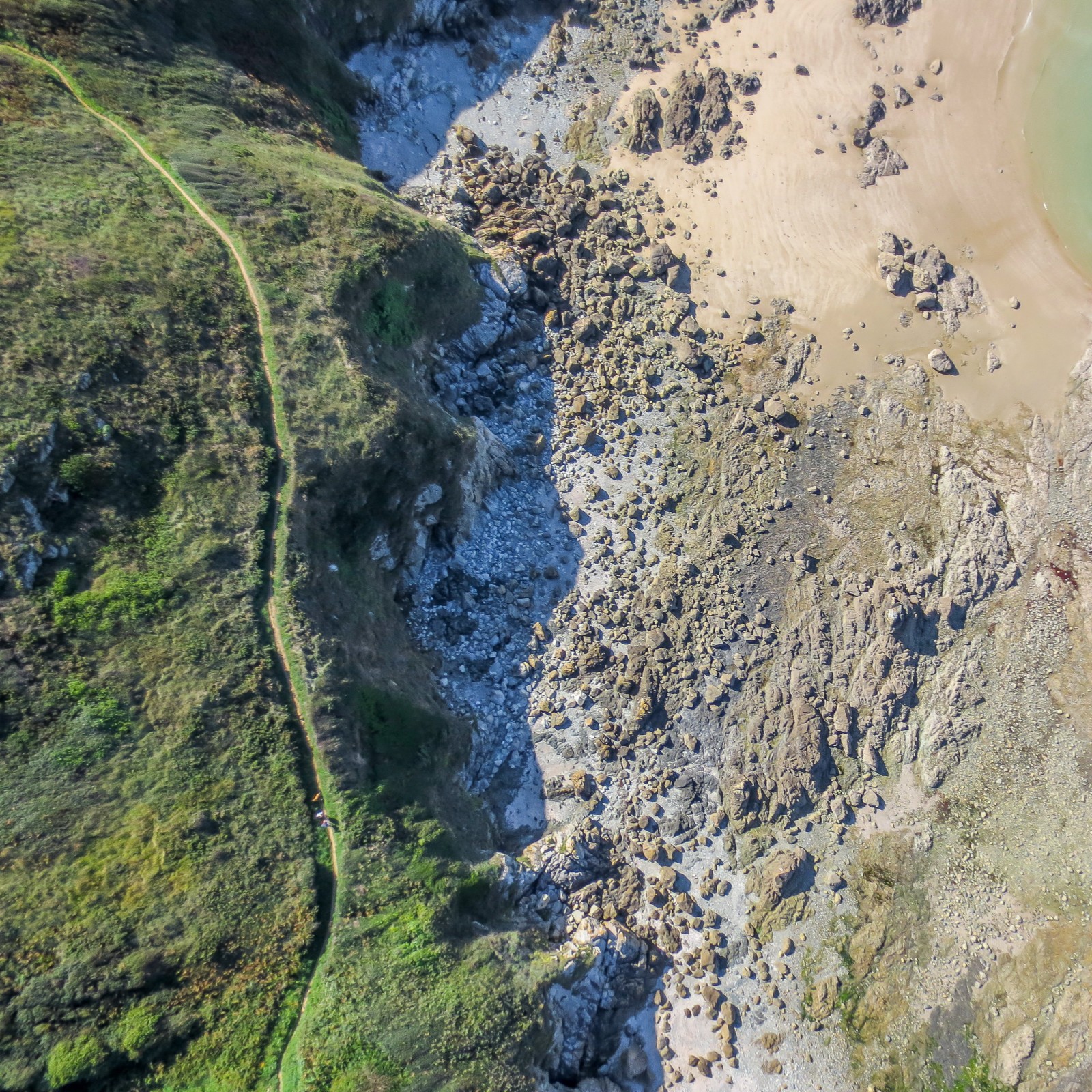
The survey of the coastline was divided into two distinct phases. First, the company surveyed a site to take a baseline measurement of the coastline. The second phase was a close examination of a tourist walking trail, which was at risk of landslides.
Planning drone surveys
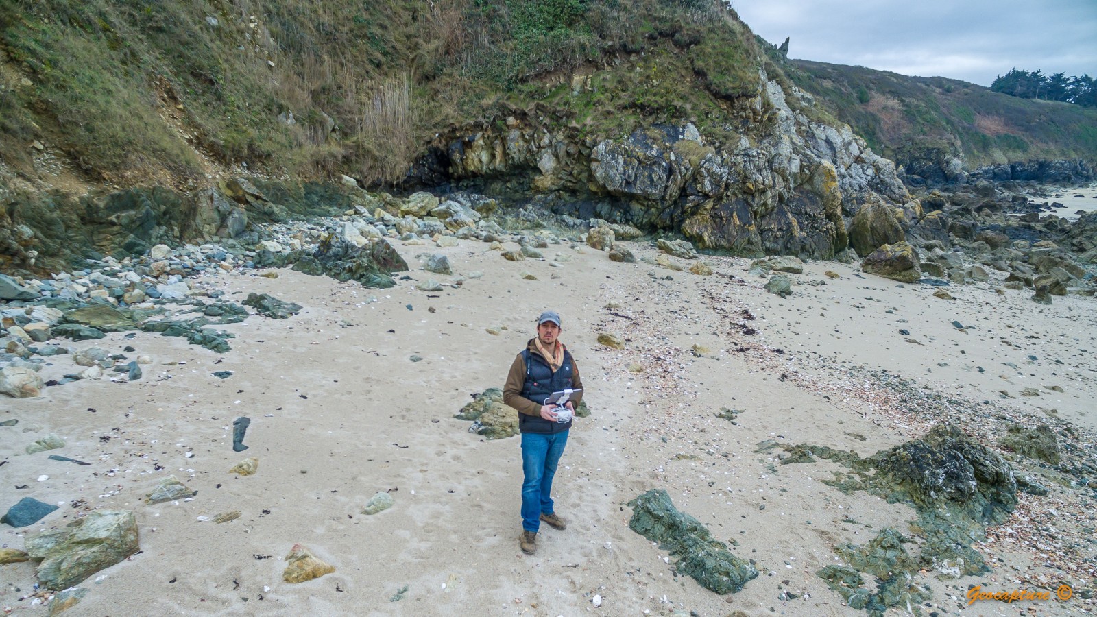
“The Brittany coastline was my office!” says Geocapture founder and drone pilot, Hugues Calderero.
A beautiful office, but one without road access: to reach the protected site, he had to hike while carrying up to 20kg of gear, including UAVs, cameras and a laptop.
Launching the drone from the road wasn’t an option: regulations artificially limited the range of the eBee to just a kilometer. Flying was only possible at low tide, allow the maximum amount of time to capture images.

As storms are more frequent in Autumn and Winter, causing more of the erosion Geocapture was interested in tracking, he only flew during these months. This had an extra bonus of fewer tourists.
“France has very strict regulations around drone flight,” explains Hugues Calderero. “I informed the military and administrative authorities before flying, and posted signs in the area so the public was also aware.”
Accurate outputs
A total of 177 images were captured from the first site with the Sensefly eBee.
“I didn’t use RTK at the time - or even ground control points,” says Hugues Calderero. “I did add manual tie points to all my projects, and found that Pix4Dmapper gave very accurate outputs.”
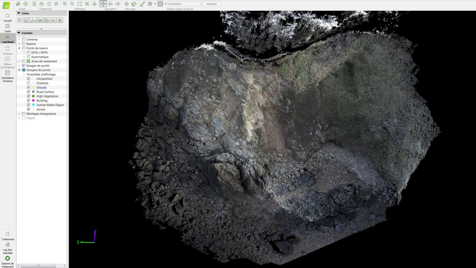
While processing the images, Hugues Calderero noticed that the cliffs supporting a tourist walkway were dangerously eroded, and decided he needed to take a closer look.
For this second mission, he chose a multirotor drone, which allowed for a closer examination of the cliff. In this second mission, 250 images were captured, with a GSD of just 0.7cm.

Tracking coastal erosion
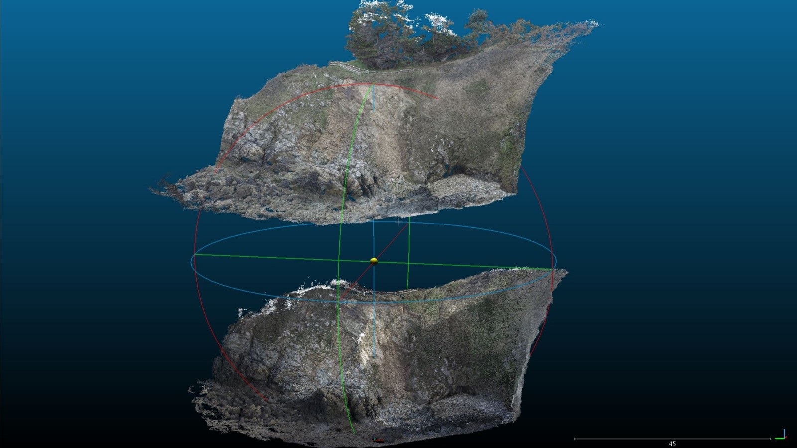
Hugues Calderero was able to use open source Cloud Compare to compare point clouds of the landscape over time, accurately tracking the coastal erosion.
Because Pix4Dmapper allows users to export a number of different outputs, Hugues Calderero had the option of working in a completely different program.
This information was provided to the local authorities, including the DDTM (Direction Départementale des Territoires et de la Mer) and Conservatoire du Littoral.
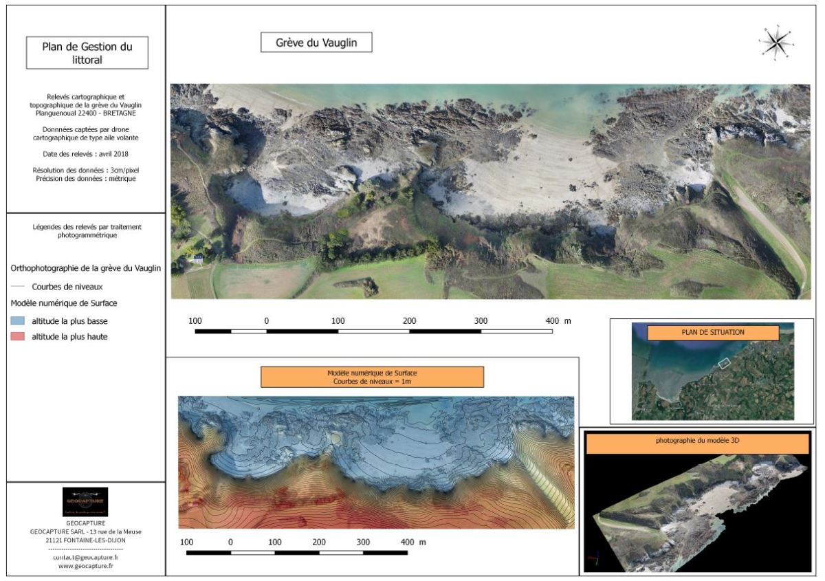
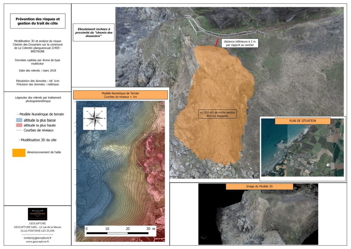
“The aim of the project was to track the coastline’s erosion,” says Hugues Calderero. Providing data to the local authorities empowered them to make better decisions about the future of the area.